Alone with Escalante
The Escalante Route, Grand Canyon National Park, March 22-24, 2005
March 21, 2005
Rain, snow, and more rain had blasted me for the last two days as I made my way down some of the smaller roads that lead from Washington to Arizona. Fifty, eighty, a hundred miles between gas stations, or even a house. Occasionally I might see a car or some cattle in the distance, but the weather usually prevented me from seeing anything much beyond the steering wheel as I drove south through the foul weather at a sedate 55 miles per hour. I had left Lakewood two days ago and had finally reached Canyon County, Abbey's Country, as I pulled into the town of Page and, ironically enough (you have to have been to Page to understand), crossed Lake Foul, the weather cleared and the land showed itself. The sun shone and I rolled down the windows to take advantage of the change to smell the air.
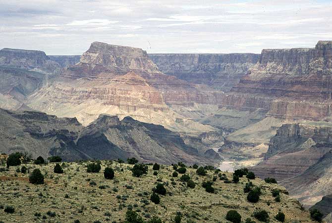
The plateau holding the south rim came into view as I pushed my car harder and harder, passing slow moving trucks and RVs, as I raced for the Grand Canyon. I could see the signs of the big ditch in the distance, along with the gorge of the Little Colorado hiding near the base of some cliffs. Occasionally I'd take my eyes off the land to verify that I wasn't over 90 yet. Occasionally I'd have to slow down. I stopped briefly in Cameron, a tired town that doesn't sell beer, to buy some food for the night and another cup of bad coffee. I didn't want to miss any time out here.
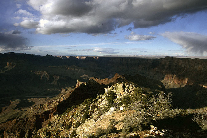
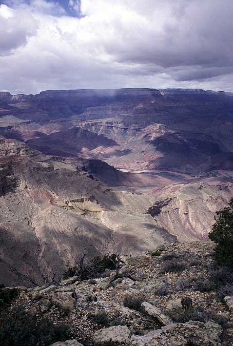
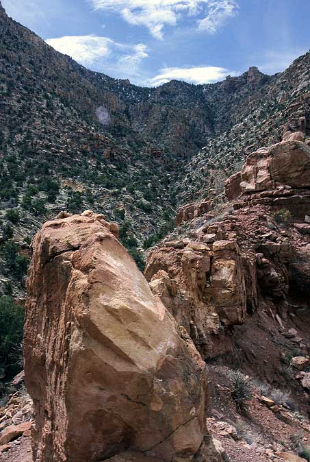
After sitting, frustrated, in a line behind four SUVs at the park entrance station, I raced to Lippan point, where my hike last March started and ended and where I would begin again this year. Only not today, nor tomorrow. The Canyon was still here. It would always be here, even after the human race extinguishes itself. Tourists, as expected, were also here. Children ran about, trying to play in the parking lot or along the edge of the rim, and were chased by their parents or atleast by the voices of their parents. People took photos and smiled and tried to be happy. I smiled and was happy knowing that in a couple of days I would climb down to the river and be, once again, in the most beautiful place in the world.
Almost the entire route from last year was visible. Sandy and I had hiked down the Tanner and along the Beamer trail to the junction of the Little Colorado and the Colorado. It looked easy from here, but looks were deceiving. Our route for this year looked easy also, and I knew that it wouldn't be. The Escalante Route had some difficult sections where you had to be a little careful, even if you couldn't see them from here. I wasn't worried that we wouldn't get through, but I was a bit nervous that Sandy might not enjoy herself.
Satisfied that the world hadn't changed, I drove, slowly now, to Mather Campground to get a room for the night. My room would be a tent on a patch of muddy ground, but it was good enough. In front of me, two German tourists were trying to get a campsite as well, but having difficulties with the park ranger.
GTs: "We'd like a campsite for the night, but don't know if we want a cabin or a tent."
PR: "There are no cabins here, only tent sites."
GTs: "There are no cabins?"
PR: "No, only places to put a tent. Do you have a tent?"
GTs: "Will there be any cabins tomorrow?"
PRs: "There are no cabins here. Only tent sites. If you have an RV, you'll need to go to the other site."
GTs: "We don't have an RV. Can we have a tent?"
The conversation would have been comical, but it was cold out and I wanted to get a site and get my tent put up and warmer clothes on. A few minutes later the ranger sold them a campsite for their car, which would also be their home for the night. I paid for two nights and left a note for Sandy, who would be joining me tomorrow, and quickly drove to the campsite to get warm. I just enough clothes to stay out in the open air until dark, but had to huddle inside my sleeping bag after that. The South Rim is not a balmy place in March.
Sandy was coming down from Salt Lake today, which meant that I had a day to spend out along the South Rim dayhiking. I picked up some coffee from the Rim Village and then sat around the backcountry office for 90 minutes waiting to see a ranger about adding Sandy's car to my permit. A lot of disappointed faces could be seen in the fancy new office as group after group either didn't get a permit, or were issued a permit for some place they didn't want to go and several days after they wanted to start. I had gotten a permit by making a reservation a month in advance and had not gotten what I wanted or when. It didn't matter much to me as I had no intention of keeping to the permit. Because the areas I was planning to move through were zoned as Primitive, only three permits were allowed in per night. It didn't matter how many people were on the permit. There could be as few as three people, or as many as 24 people. Two more people didn't matter much, and I suspected that, even though the area was theoretically filled, we wouldn't see anyone, least of all a ranger. But, I didn't want Sandy to get a parking ticket and so made sure her plates were on my permit.
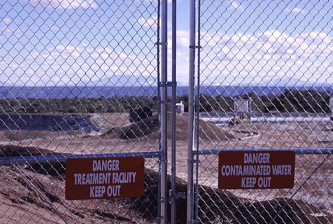
I drove out to Desert View, at the east end of the park, and geared up for a day hike. I didn't expect to see many people as I wasn't heading to anything that had a name. I walked out along a gravel road for a few hundred yards, passing the new motel-like buildings that housed park employees and eventuallly the sewage treatment area for Desert View.
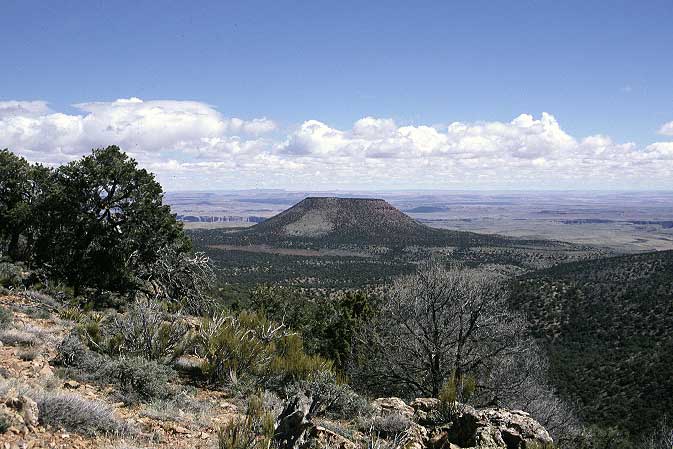
The gravel road turned to a rough jeep track and began leading me down to the plateau below. Cedar Mountain, which looked like the core of some long dead volcano, came into view, the only bump on the plateau south of the river.
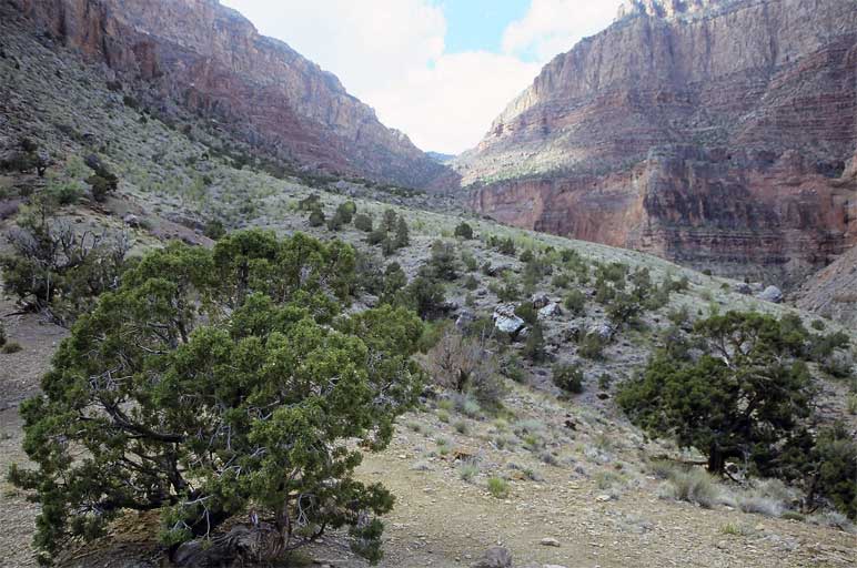
The jeep track switch backed down, steeply at times, until it bottomed out shortly before reaching a split where a faint trail led off toward the river. I paused and looked at my map and decided to take the faint track as the road simply led toward Cedar Mountain and I wanted to take a look, four thousand feet down, to the not-so-mighty-anymore Colorado. The faint trail led into a small wash, which I followed downhill for a bit before cutting cross country. Cross country hiking at this elevation, in this (relatively) arid environment, was easy. The lack of rain meant that land was open enough that getting lost was hard and motion was free and easy. But, because it was high enough, there were not too many desert plants to stick and scrape you. I climbed over one hill and down to the next drainage, and then went up and over another hill and down into another, larger, wash complete with green grass. Water was about somewhere.
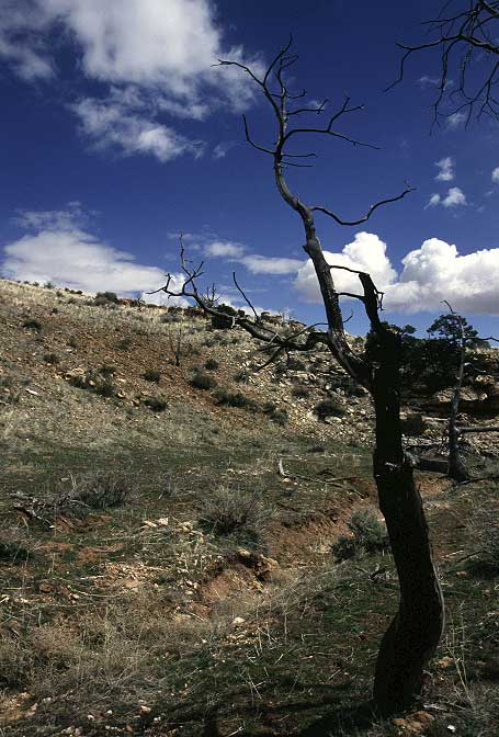
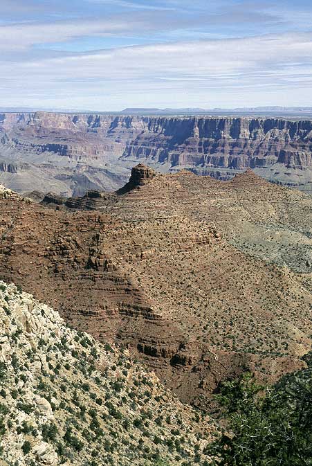
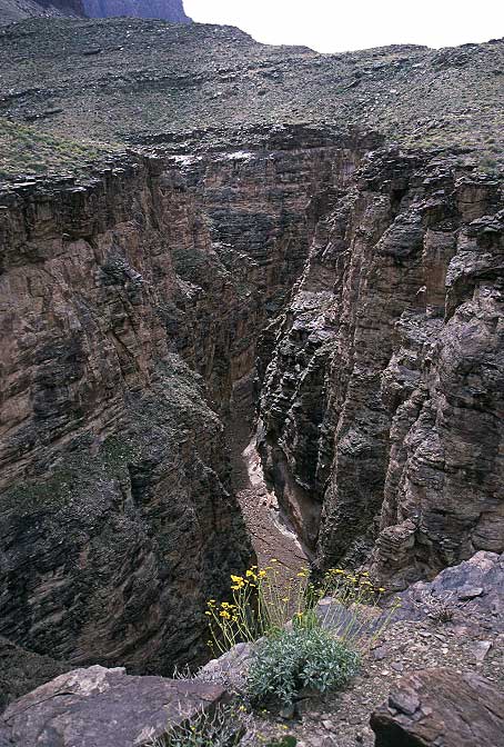
I rested near a burned up tree for a while and watched the weather begin to turn. Clouds were coming in at a frightening rate from the north, where the storm system I drove through was lodged. I sat about for thirty minutes, which was about as long as it took for the hail to start falling. For the first few minutes the storm brought only light snow, but it quickly degenerated into wind and hail. I stayed in the wash even after to began to narrow down and become choked with vegetation, preferring bushwhacking over being thrashed by the wind. The storm lasted mere twenty minutes, after which it was again safe to hike on the open ridges. Another twenty minutes brought me up to the top of a cliff overlooking the Canyon and a viewpoint even better than Lippan Point. Scenically the same things were there. However, this one was all mine.

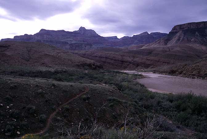
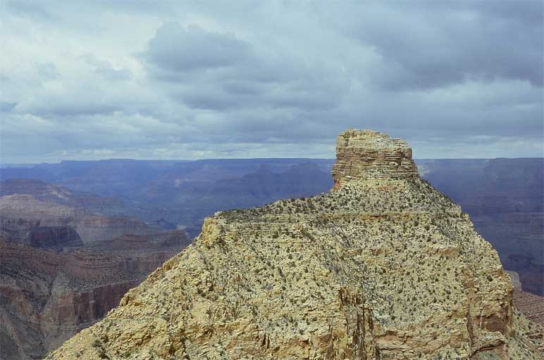
Looking to the east I could see, once again, the route from last year but also part of the Tanner trail, including the steep drop off where Sandy and I got briefly lost last year. The trail dipped down, a faint scar on the land, and plummeted into Tanner Wash before running straight to the river. Looking northwest, I could see where the Escalante had to go, at least for the first few miles of its route.
Satisfied, I had a sit and was determined not to leave until a storm forced me out. I put on some more clothes and had lunch, feeling sorry for all the tourists at Desert View, whose lookout tower I could faintly spot in the distance. Desert View had rope and chains and concrete walkways and a bathroom complex several times the size of my apartment. It had a gift shop and a snack shop and (coming soon) a gas station, along with a Wal-mart sized parking lot for all the cars that would visit the national park. I'd rather the cars have been kept outside the park and visitors be forced to walk or ride in, but I was in the minority on this. I would have been happy to park at the boundary of the park and walk in, but this would have been highly unpleasant given the amount of traffic inside the park. To paraphrase Abbey, the too young to walk will get their chance, the too old to walk had their chance, and the infirm, well, they have my sympathy. For now, though, everyone and their machines are allowed in.

I sat for an hour and realized that another storm wasn't coming in, but that I was getting a bit cold when the sun wasn't shining. I packed up and headed back down to the wash I had hidden in during the wind and hail. As I wasn't in much of a rush, I followed the wash down hill, assuming that it would spit me out somewhere close to the jeep track. The wash bent around the hills I had come over and had only a few minor falls to jump down. A half hour later another wash came in from the direction I wanted to go, prompting a direction change and a bit of uphill walking. After a rest, I began to see my old footsteps from a few hours ago, including where they went off cross country. I regained the jeep track and was soon on my way back up to the inhabited part of the park, rather pleased with myself. I rested once again near the top of the climb and spent some time picking out the cliff that I had hiked up to. It wasn't a long hike or a hard hike, yet no one was out there. I didn't even see human tracks in the wash, although some horse dung did appear. My little cliff sat out there stoically and I almost had the hubris to give it a name. Not for other people, you see, but rather to give it some personality. I thought better of it and simply left it alone.
I returned to my car, already feeling the effects of the backcountry. I didn't bother to change clothes before walking to the snack shop for a cup of coffee and didn't bother to avoid cars driving around looking for a parking spot. Although there were plenty of spots in the back end, where I parked this morning, the mini vans and SUVs seemed to want to walk as little as possible. I felt crowded in by the tourists milling about and even scowled at a young boy who walked too close to me. I was surprised by this as I had only been out for about five hours and it usually takes a few days or a week for me to become that antisocial.
I bought some coffee and was heading back to my car when a voice called out my name. Sandy was standing there waiting and probably had been when I was out at my cliff feeling sorry for the inhabitants of Desert View. We stood there and talked for a while before returning to the cars and making the drive back to the campground. I was riding a high, having been out for an excellent walk, now with good coffee, Steve Miller coming through on the radio, and a friend trailing behind me. I didn't even mind driving slowly behind a wobbling SUV.
Back at the campground I put on some warmer clothes and popped open a can Budweiser, tossing one to Sandy with the other hand. We talked for a while over beers and then made the stroll to the Rim Village, with cans of Bud in our hands, for dinner. We got a few looks from people as we walked along, but I was in thruhiker mode and couldn't have cared less. This was my land (and your land) and I wasn't causing any trouble that could diminish someone else's enjoyment of their land (and mine). However, as I didn't think the cafeteria would let us in with open containers, we sat on some garbage cans to finish our beers before going inside.
Four hours later we emmerged after having eaten some not-good food and drunk several more (overpriced) beers. There was a lot to catch up on and talk about and it was warm inside, cold outside. The air temperature was in the thirties, which made drinking more Budweiser not so enjoyable. After identifying some stars using two star charts that Sandy had brought along, we crawled inside the tent to go to sleep. The air was even colder than the night before and I went to sleep hoping that Sandy would not be too cold overnight.
In the middle of the night I heard Sandy moving out of the tent, muttering "I can't take it anymore." It was rather cold outside and I figured she was heading to the bathroom (which is heated) to sleep for the rest of the night. I snoozed away until a little after 7. I found Sandy sleeping in her car and left her alone for the few minutes that it took to get the tent down and my gear packed up. She had not had a good night. Not wanting to inconvenience anyone who might choose to go to the bathroom in the middle of the night, she had slept in the car, which was slightly warmer than the tent. However, even with that she hadn't really slept the entire night and was chilled throughout and wasn't feeling much like hiking. We walked over to the Village to get some breakfast and talk for a bit. She was wiped out from the night before and, eventually, decided to go back to Salt Lake and rest instead of coming on the trip. I could certainly understand, as I have spent some cold nights before and know the feeling of waking up in the morning, facing a 20 mile day, and not having slept much. We talked for a bit longer and then set out on foot back to the campsite.

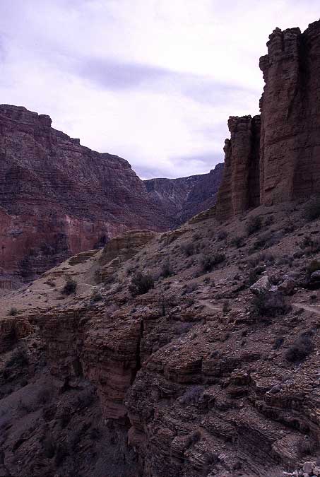
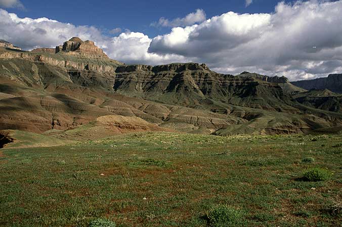
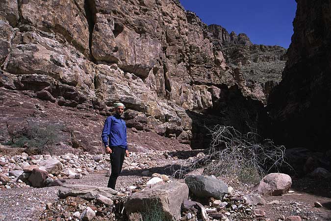
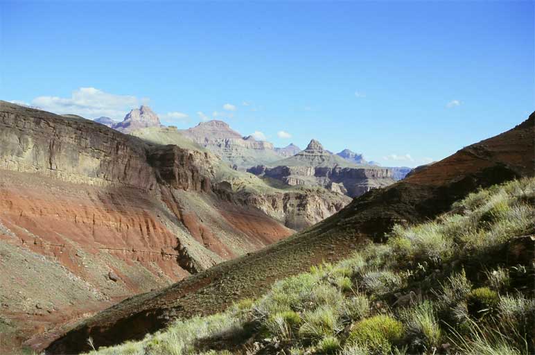
I dropped my car at Moran Point, near where the New Hance trail starts. I had originally planned to come out on the Grandview trail, but there were notices in the Backcountry Office that told of several slides on the trail that had forced its closure. Sandy drove me over to Lippan Point, where the Tanner starts, and, after a few pictures, I set out down the trail under clear, but cold skies, leaving Sandy to drive back to Salt Lake City. There was less snow on the upper reaches of the trail than last March, but it was much more compact and icy and I had some difficulty moving down the steep trail at times. However, after a hundred vertical feet, the trail came out of the shadows and the snow disappeared. The first task was to get down toward Cardenas and Escalante buttes, which were where we cached water last March and form prominent landmarks.
I ran into a few hikers on the climb down as they were heading up, looking very tired. The Canyon is tough that way: You descend first, then you have to climb out. It seemed that a few slides had occured in the past year as the trail was much rockier and a little trickier on its upper reaches than I remembered. However, with a little time everything can be accomplished and I soon found myself dropping down toward Tanner Wash on good trail.
Pausing near our cache point from last March to admire the view, I thought about how empty this place really is. With others in sight, it just feels like a big place. However, if no one can be seen in the area, and you can see for vast distances, the feeling of solitude comes quickly. I knew, in my head, that other hikers were in the area, but I felt very, very alone.
The Tanner rumbled along, bending around various ditches and ravines, until it made a climb up to a viewpoint where I found a group of four hikers carrying massive packs. I stopped for a picture and said hello, but wanted to get back to the canyon itself and so moved on quickly, knowing that there was a fine rest area just ahead.
A few minutes later I came to the spot where Sandy and I had gotten temporarily lost last March and had a seat near the trail turn off for a little lunch and water. Not long after I had polished off some cheese and a King Size Snickers bar, the four hikers came down the trail, a bit strung out, laughing and having a good time. I watched as they passed by the trail turn off, doing exactly what Sandy and I had the year before. When the last one went by me, I asked quietly if they were heading to the river and then showed the last one where the trail turn off happened. The fourth hiker told the others and they had a good laugh at it before beginning the steep drop into Tanner Wash.
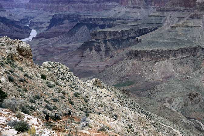
Fully rested, I shouldered my pack and began the plunge myself, quickly passing the four hikers who were struggling with the steep grade and loose footing and their heavy packs. They were out for seven days and were heading along the Escalante as well, and then the Tonto trail all the way back to the main south Rim area of Bright Angel - South Kaibab. I slowed my pace a bit on the decline so that we might have a chance to talk for a bit (people who laugh at themselves are generally good people to be around). When we reached the end of the steep stuff they high fived each other and joked about how out of shape they were before having a seat for a nice rest. The river wasn't very far anyways and it was only the early afternoon. I said my goodbyes and headed out, enjoying the quite of the place once again.
I dropped down to where the Tanner made an end run around a ravine that was bounded on one side by some very strange cliffs that I distinctly remembered from last year. The topography of the canyon made for interesting trail building and a lot of exposure. This didn't bother me much as the trail was a couple of feet wide and was mostly solid. No chance of falling, unless I did something stupid. However, it was very understandable that people got spooked by the Rim-to-River trails in the canyon: If you didn't do a lot of hiking, you might worry about falling even without doing something stupid.
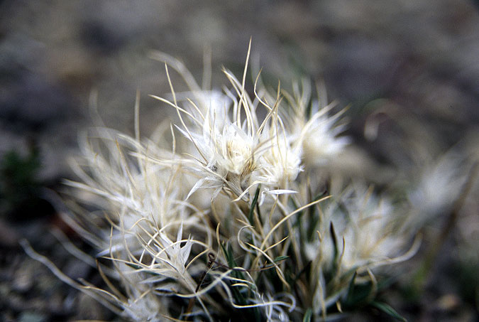
After leaving the hoodoo-like cliffs I found a nice flat area to rest on and noticed, to my surprised, that it held some interesting little plants. The canyon flora was beginning to bloom and the scent of flowers was increasing as I dropped elevation and started nearing the river. Some plants were small, with flowers the size of tack-heads, or were nothing more than fancy tufts of grass. There were cacti on the very of blooming and creepers that seemed to engulf whole patches of rock.
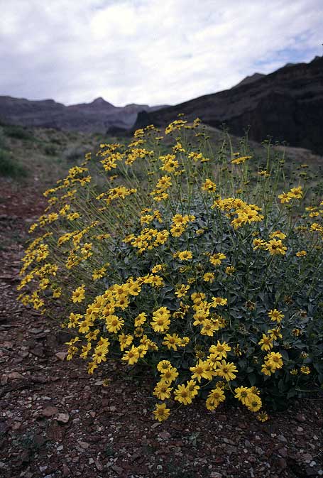
One of my favorites was a green bush that shot long yellow flowers into the air and had an almost undetectable scent. However, after smelling the flowers for a while, I decided that there must be a lot of them further up as it was their scent that I was following toward the river. Collectively they could make an impression on the nose, even though individually they barely caused a twitch.
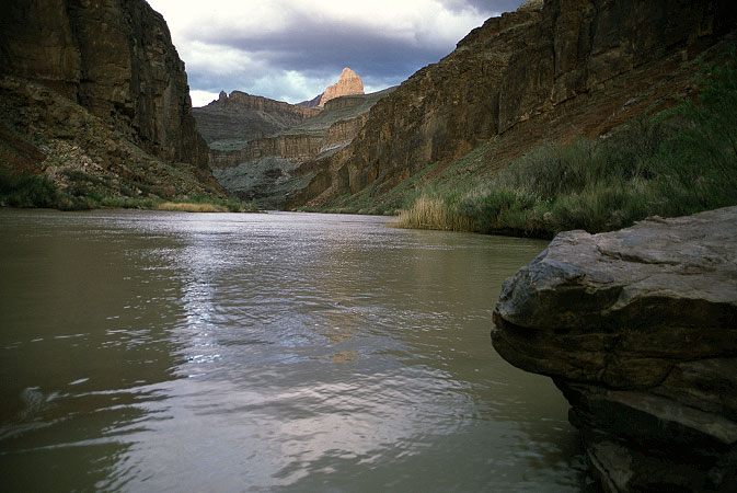
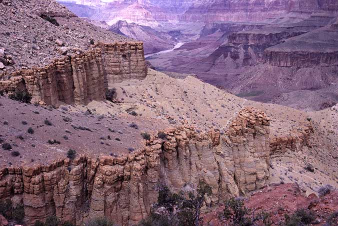
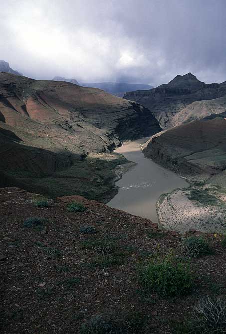
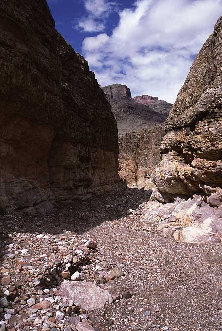
The Tanner dumped me into Tanner Wash and I was once again on flat ground. A short walk down the wash brought me to the sandy river side where the Escalante would run to the west, the Beamer to the east. I sat and ate some salami and looked at my map and watch, and then ate some more. I had a lot of time on my hands and only a couple of miles to make it to Cardenas beach, which seemed like a reasonable place to spend the night. I didn't see any tents up at Tanner beach, but didn't expect to either. I held one of the three permits for the night, the four hikers above me held another, and the third holder might not be down yet. I watched the clouds for signs of rain for a bit, but found this a little boring and so set out down the sandy beach for my home.
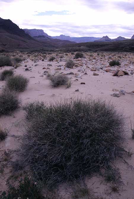
One of the trail descriptions I had with me had promised a flat walk all the way to Cardenas Beach. While not strictly true, the hiking wasn't hard enough for me to really call the author a liar. However, given the fact that I dropped some sweat along the way, I can honestly assert that the trail is not flat. I passed three hikers coming back from Cardenas Beach to the Tanner, out for a dayhike only. They were the third permit holders (I was in a new zone now). The open trail rumbled along, dropping up and down as it traversed two major drainages and then spit me out on Cardenas Beach. No one. Not a soul. And, moreover, it was unlikely that anyone else would be showing up for the night. The zone was theoretically full (three permits), and this was about the best camping in the area. It was possible to camp along the Escalante route in a few spots, but I thought it unlikely that anyone would. I would have to find out tomorrow.
I wandered around the beach area until I found an excellent cave formed by a dense growth of mesquite trees. While it didn't have a view, it was well protected against the wind and rain that I was sure would be around for most of the night. The area was flat and clear and the mesquite gave me plenty of places to hang stuff to dry out and was only a thirty foot walk to the river bank.
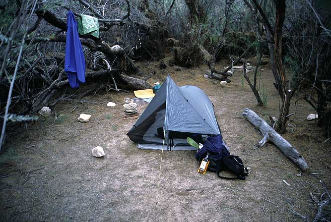
After pitching my tarp and getting camp set, I walked over to the beach where I took off my shoes and socks and soaked my feet in the icy cold Colorado for a while as I wrote for a bit in my journal. Occasionally I thought I heard the sound of someone approaching on foot, but in the end it turned out just to the be the sound of the river on the rocks that formed the local rapids. As the night wore on and the sun went down I ate and drank and read some Edward Abbey and thought about how fine everything was. Here and now I had eveything I needed. Plenty of food and water, shelter, something good to read, and a bottle of overproof rum which went very well with mint tea. The few things that I needed I had either carried down with me on my back or the land provided for me. I had a small pack, barely more than twenty pounds. I just didn't need much to be happy, it seemed. That was a comforting thought that stayed with me for the whole of the quiet night, spent completely alone in a zone that was full according to Park Service standards.
It rained over night and the wind blew, but I was safe in my mesquite cave from the worst effects of the storm. The silnylon tarp sagged a bit as humidity increased and a bit of rainwater ran down the mosquito netting and onto my groundcloth, but not enough to worry much about. The sky was partly clear, but white puffy clouds were moving overhead at a tremendous rate and I didn't want to sit around drinking tea while a storm might be brewing. Being more than 6000 feet below the North Rim, I couldn't see what was coming my way, which bothered me only slightly.

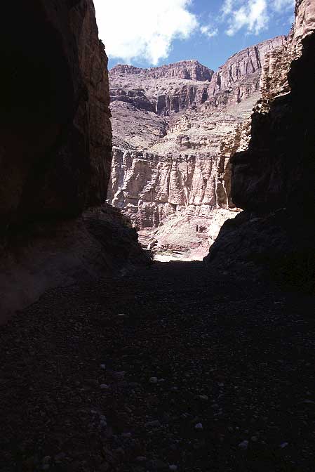
The Escalante Route is supposed to be a cairned, barely maintained track along the cliffs above the river, but I found instead a large, strapping trail that made hiking easy. The route climbed up onto the hillsides above the river as it skirted some cliffs that made beachside walking impossible. Being on the open, exposed hillside was a delight for the first thirty minutes, despite the high winds, but then the rain came and I was ensconced in a veritable tempest of windblown precipitation. The wind pushed me around enough than it made taking pictures extremely difficult, especially when I tried to stand near landsend, with a drop of several hundred feet only a few inches in front of me. And then the wind and rain stopped. And it cleared. And the hillside was pleasant once again.
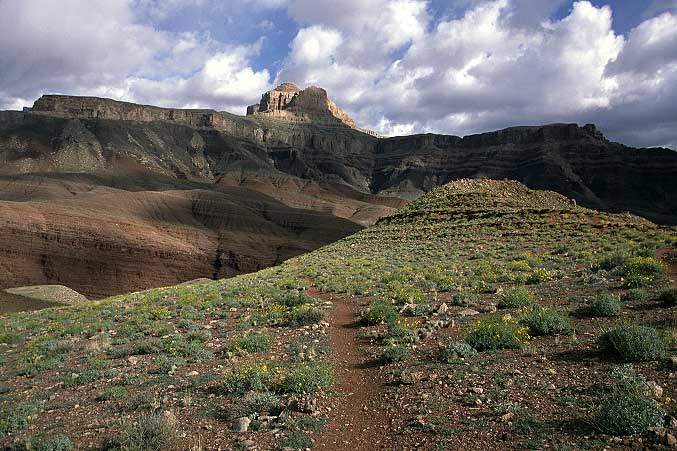
The route wandered along an excellent plateau for a while before dodging around a drainage and climbing sharply up and along another hillside, exposed as before.
And, as before, the wind and the rain returned. I put my rainjacket and pack cover on this time as the squall seemed likely to remain on top of me for quite some time. Negotiating the route was not especially difficult, but when you are trying to balance on rocks and the wind is blowing at a sustained 30 miles per hour a bit of care becomes necessary.
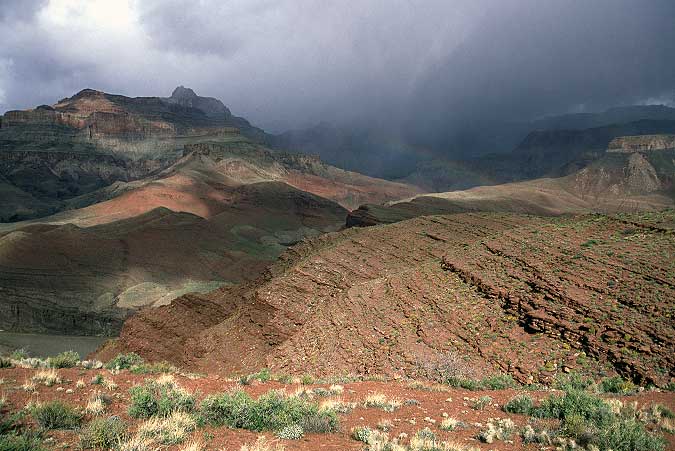
The trail bobbed in and out of small drainages before making a concerted push up and around one final obstacle and Escalante Creek became visible. From my studies of the map the night before, I knew that I would eventually reach the dry creek bed and then move down it back to the river. The main question in my mind was what the dry falls would be like during the route down the wash. But, given that people hike the Escalante on a regular occasion, they couldn't be that daunting. As powerful as the storm was, it wasn't surprising that it blew itself out after thirty minutes and was replaced by simple iron grey skies, and even a faint rainbow that sprung up out of the river when the sun poked its nose through the cloud cover for a few minutes.
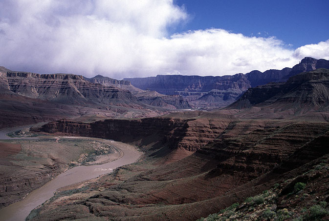
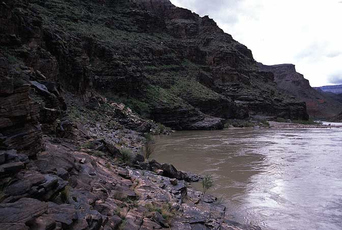
The iron grey was replaced by blue and once again I found myself in sunshine and warmth. When the sun was out it was comfortable to sit around and I took advantage of the break in the weather to sun myself on a rock overlooking the river. The river was redder than I remembered it from the previous two trips, and this may have had something to do with the recent release of water from Glen Canyon Damn to help the endangered humpback chub. Sandy and I had met some of the research team that were studying the chub last March and apparently their findings had convinced the federal government to release some water from the damn. Unfortunately, as I read in the paper a few weeks ago, after the release scientists had counted far fewer chub in the Colorado than before. Something like 80% fewer. They were still not sure if the chub were dead or simply misplaced.
My thirty minute break in the sun was ended by encroaching clouds that seemed to be heralding the return of the storm and so I quickly packed up and was rumbling for Escalante wash, where I would at least be safe from the punishing winds.

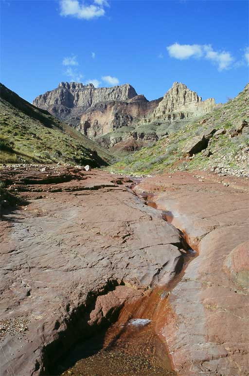
I dropped into the wash as the storm hit and rain began to fall once again. The wash provided the anticipated safety from the winds, and even some of the rain, but the dry falls in the wash slowed my progress and the wet rock meant I had to jump down most of them. A thin trickle of water appeared in the wash and I tasted it hoping for something sweet and without all the silt of the Colorado. Unfortunately, there was a noticeable amount of dissolved minerals and salt and the silty Colorado was a better drink.
The rain stopped once again, although the sun did not come back and I suspected that the weather system was trying to lure me back onto the exposed cliffs after Escalante Creek before opening up once again. Being no fool (only a fool leaves a dry place for a wet one), I found a large, overhanging cliff near the banks of the Colorado and sat under its protection, waiting for the rain to come back. Like clockwork, the squall resumed after ten minutes and fell even harder than it had before. Unfortunately, now that I was not moving I was starting to get a bit cold sitting under the cliff eating cheese and salami. Another half hour passed and I was starting to reach the bottom end of my comfort level when the rain slowed noticeably and I detected the (temporary) end to the storm. I packed up and hit the trail, moving forcefully toward Seventy Five Mile Canyon. A crow could get to the mouth of the canyon in about fifteen seconds. However, as I couldn't fly, I had to climb up and along a cliffside, paralleling the deep canyon.
The sun came out and I was warm once again and enjoying the prospect of going back down the Canyon that I was watching from above. I passed one possible, precarious, down climbing route but continued on amidst a profusion of the greenbusheswithlongyellowflowers that I had found so appealing the day before on the Tanner. After a half mile or so of parallel walking, I reached a spot where there was an easy 12 foot down climb into Seventyfive Mile canyon, which forced me to leave the wonderful smelling bushes.
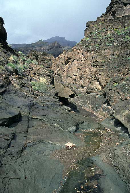
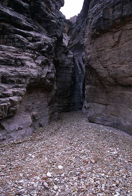
The canyon was broad enough that I couldn't call it a slot, but narrow enough that it was fun to walk in, especially after a hundred feet when the walls sprung up to a considerable height.
There were twists and turns and strangely textured rocks, along with a few dry falls that I hopped down. There were a few pocket caves along the base of the walls and other, more artistically inclined, hikers had used them to build small cairn shrines, much as some hikers make beer-can art along roadwalks.
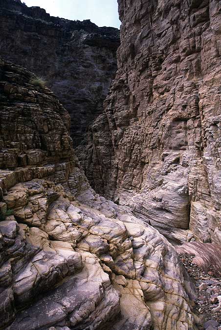
The walls became high enough and the path narrow enough that the sun was blocked out completely and I, all too quickly, came to the shore of the Colorado to find myself blinded by the bright sun and blue skies overhead.
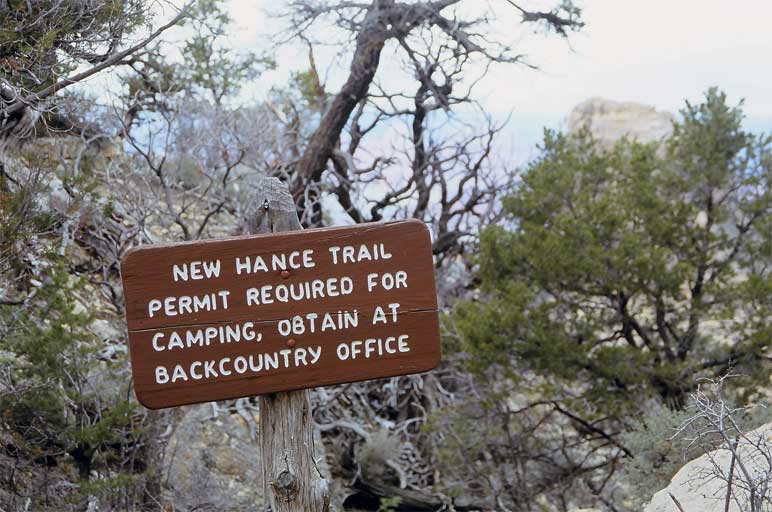
I dropped my pack near the mouth of the canyon and decided to have a nice long sit in the sun to warm up a bit and rest before making my way to the last, and most difficult, obstacle on the Escalante: The Papago Wall and Slide. Those, however, could wait for a while. I had a lot of time to kill as I didn't particularly want to start up the New Hance trail today, given that it was a short ways out to the rim and camping, according to the park service, was non-existent for the most part along the route. The New Hance was billed as the most challenging established trail on the South Rim and I thought it best to wait until tomorrow to tackle it. I was only a little over two miles from the junction with the New Hance and it was still the early afternoon. And so I did the only sensible thing: Sit in the sun with feet up.
I rode the wave of sunshine for almost a full hour before the clouds came back and urged me to move on and deal with the Papago obstacles before another squall hit. Although the Escalante route climbs up onto the cliffs above the river, it seemed like the river was low enough simply to walk along the bank to Papago. This was mostly the case, however I found myself scrambling about on small boulders to get along the river when the sandy beach gave out. I could spot sand not very far off and figured, quite correctly, that that marked the mouth of Papago canyon and the two obstacles. I carefully threaded my way along the boulders for another hundred, or two, yards and reached the beach, glad that the rain was holding off.
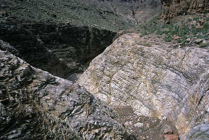
At the beach I found the mouth of Papago wash quite solidly blocked by a fifteen foot, rather vertical, dry fall. Although I probably could have climbed up it, it seemed foolish to risk it when there was an easier way to get up high.
Next to the dry fall was a sequence of ledges, with a cairn at the top, that seemed considerably easier. I hopped up onto the first ledge and then found a twenty or twenty five foot climb was required to get up. There were plenty of nice, big footholds to step on, but little in the way of big, secure handholds. This meant that I actually had to pay attention to my balance and not just hoist myself up. Still, the way was easy enough for me and I found myself at the top after a few minutes of being careful. I was pretty sure Sandy would have made it to the top, but I was also pretty sure she would not have liked doing so.
Once on top, however, there was still some moderate scrambling to do to get around a few cliffs and to gain elevation, including a narrow shoot where I had to take off my pack and slither through. None of this would have been a big deal, but as I was a hundred feet above the rocks below me, I had to remain in be-careful mode until I finally topped out. However, now that I was up I had to get back down to the river, and this meant the Papago Slide. The slide looked fairly well impossible, but knowing that people get around it on a regular basis cheered me. The slide was a steep screen field dropping down fifty feet to a point where I could see the trail once again leading toward the river. A few micro cairns showed me a reasonable way to get down the slide, although not without a couple of heart-pounders, where I watched rocks tumble ferociously down the slide and impact on the ground below. This would definitely have spooked Sandy a bit as we would have had to go down it in turns, the rockfall danger to me (going down first) would have been too great otherwise. When I reached the base of the slide, I was happy to be able to turn off the safety and return to carefree strolling once again.

The junction with the New Hance was not far beyond the slide. With plenty of time on my hands, I made several circuits of the area looking for the best possible campsite and trying to find the permit holders that had sealed the Escalante, and this, zone. No one was about, but I did find an excellent campsite close to the river with good protection from the wind and rain that I was sure would be coming soon. I set camp and then went for a stroll to kill time before dinner and rum-mint tea and the rest of The Journey Home.

I walked up the start of the New Hance trail, which runs straight up Red Canyon for as long as it can before taking to the cliffs around it and making the climb to the South Rim. I wondered where the other permitees happened to be hiding, given that this was supposed to be the only reasonable camping between here and the south rim. West of here, on the Tonto, there was camping in five or so miles at Horseshoe Mesa, but that was a dry cam and surely anyone with sense would try to camp near the Colorado and its plentiful water. I found it unlikely that there would be three parties, all of whom knew that it was quite possible to haul water to camp.
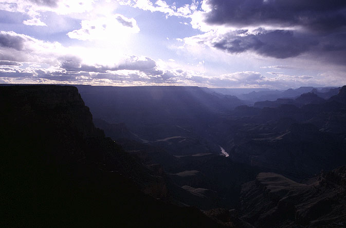
I returned to camp and spent some time writing next to a rock, scurrying off to my tarp when rain came down (occasionally, and only softly). I ate dinner when it seemed like it was the right time and then went out to take some pictures with the fading light. Because of the steepness of the walls in the canyon, there is an extended twilight period where interesting things tend to happen. The absence of the desert sunset was missed, but at least it was replaced by something more intriguing than the re-runs of old sitcoms that follow the nightly news.
I returned from my photo jaunt and made some mint tea, which I mixed with an Abbey-sized portion of rum (thus making a sort of grog) and settled in against a sand dune with Abbey for a few hours. When I am at home, and settled, Abbey always seems to have something of an elitist-idiot vein to his writings that gives the words an artificial, plastic feeling. However, when there is no roof over my head and I am sitting on the bare ground, far from anyone, Abbey makes perfect sense and even seems like reasonable.

The land grew dark as I turned the pages in the book and sipped on my funny grog, munching on generic mint Oreo cookies. Occasonally I'd turn out my head lamp and look up for stars, delighted that even a few were out. I was hoping for good weather in the morning for the climb out, but didn't expect that it would actually occur. Being here on the river seemed so much simpler and more desireable than being in a settled society in which there were rules of etiquette and things and worries. My greatest worry, right now, was that some rain might fall tomorrow. I had everything I needed with me and I could carry on like this for several thousand miles if I wanted to, and had the time. There was a luxury of freedom about living with few possessions and without a fixed abode that is becoming more and more important to me as I age. Having "stuff" means that you have responsibilities to manage it. The more I acquire, the more I lose. An odd relationship.
Wind came and wind went, and the morning dawned with blue above and a lot of muted sunshine. The depth of the canyon prevents the desert sunrise just as it bars the desert sunset. With the good weather, I declined to make tea and lay about in favor of getting going on the 4200 foot, 8 mile hike up to the South Rim. The New Hance trail ran up Red Canyon, which is something of a wash. Several spots required a little nimble climbing, but nothing that even my poor abilities could not match. The wash ran out onto solid rock and I began to hear voices. After coming upon the signs of water, the trail climbed out of the wash and along side it. Looking down, I spotted the permit holders. Two groups of hikers had set their tents up on a nice flat area next to the stream that was filtering through Red Canyon. Although directly on rock, their campsite looked very scenic. I waved, but as the sun was at my back I doubted they could pick me up as I traversed above them. The traverse over, the trail ran back onto the rock and gave me a chance to sample the waters, which were rather unsweet. Even the Colorado was better.
The trail began to grunt, forcing me to sweat more than I wanted to. Although it was warm here in the sun, relatively low down, once I started on the upper reaches of the trail the temperature would become an enemy rather than a friend. Breaks wouldn't be possible without going for the down jacket in the bottom of my pack, which meant that I really did need to conserve strength and keep my clothes dry.
As Red Canyon began to choke down, I started wondering where in the world the trail might be headed. In front of me, following the canyon, there sat only a rather imposing looking dry fall, a hundred or more feet in height. The approaches along the sides looked steep and dangerous, and surely the park service wouldn't build a trail like that? Then I remembered that the Park Service had not built this trail. A private citizen, John Hance, did. And, sure enough, the trail was running straight for the obstacle, which was still mired in shade. I took a seat in the sun and wondered about the clouds overhead. My blue sky was rapidly filling with white things, which meant that this might be my last break before reaching the top. I just didn't want to have to take a break in the cold shade.
I could no longer see the Colorado, but that feature was hardly the most impressive thing about the area. The river was the action by which this land was created, but it was certainly not the object that drew people from far and away. Indeed, the cause was much less than the effect. I mused over this principle for a while, as it seemed to violate some sort of conservation law, but soon grew cold and the thought of Stephanie and Moab drew me to my feet once again. The trail bounced and bounced and became somewhat delicate to hike on. Never dangerous or treacherous. Just delicate: Put your feet in the right place at the right time and keep moving. Slowly and torturously, the trail ran alonside the edge of the dry fall, switchbacked steeply, and at least I gained the top. I took a picture looking straight down the trail at the level of the fall. Looking at it, I can't tell where the trail is. Fun hiking. God bless John Hance.

Once on top of the falls I was certain that I could see the top, despite the voice in my head telling me that there was no way I had come up 4200 feet as yet. Off I went, confident that I would be at the top in 20 minutes. Up and up and up I went, climbing for the obvious low point in front of me, gaining the safety of trees, which sheltered me from the cold wind that was now blowing. Coated in sweat from the climb up, the evaporative cooling process that Ben Franklin discovered via alcohol was causing me some discomfort. Though tired, taking a break would not be a pleasant diversion unless I put on warmer clothes. And, I didn't want to dig in my pack because, right now, I wanted to get out as quickly as possible and get on my way to Moab. I climbed through the trees and up and above what I thought was the top. Looking down at the "top", I laughed at my foolishness: I had simply been heading to a gap a local wall.

I passed two hikers in full on winter gear as they were coming down the trail, and then caught up with four hikers, heavily loaded, struggling up the trail. Moving at 3 miles per hour is hardly fast, but it seemed like I passed them and left them in an awful rush. Snow began to fall, followed by hail. Despite the low temperatures (low 40s, upper 30s) and the cold wind I was dripping with sweat at the exertion of moving on the steep trail. I was walking without effort, however. Not in the physical sense, but in the spiritual sense. My legs were starting to tire and energy levels were dropping, but there I was still strong inside. One step up, followed by another, with no mental or spiritual strain to them. They just were.
I began to hear voices once again and within a minute I was standing in the forest that lines the South Rim, next to a trail sign, and in the midst of four hikers. We talked for a while and it turned out that they had held the other two permits for the area. They had spent five days hiking down to the river and back up. They asked me where I camped last night, and it seemed that I had spent the night in their campsite from before. It had taken me about 3.5 hours to climb out, with breaks, and they thought this rather impressive, as it had taken them two days. The people I had passed before were part of their group. All good natured, I was glad to talk to them. Not only were they enjoying their time in the outdoors, they had the self-deprecating sense of humor that I find so comforting.
When the others made it to the top, they celebrated some more and then set out for the road, where one of their party was waiting with a truck. I sat by the trail sign alone for a while, wondering when I might return to the canyon. Next March, for sure, but it seemed a pity that it would not be until then. The cold got the better of me, and I set off in chase of the others, hoping they might offer me a ride to my car. Besides, I had a friend to visit. And a friend is better than a big hole in the ground, even if it is the best ditch in the world.