Hobo Pretension
Hobo Pretensions
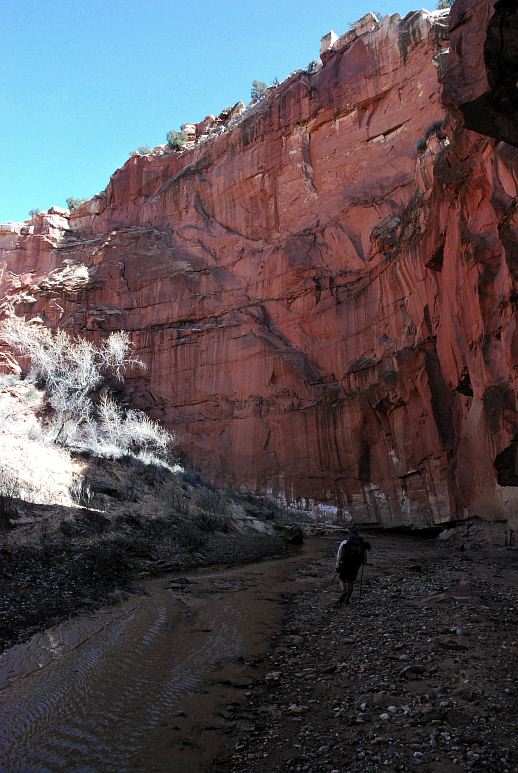
Hackberry Canyon to Paria Canyon
March 24, 2009
It wasn't hard to pick out Mags in the parking lot. Small, functional pick up truck with a camper shell on the back. Bumper stickers plastered on the bumper, truck, shell. Mismatching clothes. Five days of beard growth. Propane stove heating water for coffee. I stumbled down from my juniper tree and found Mags smiling and happy, a recent beneficiary of the economic downturn. Beneficiary? Depends on what you want out of life. I had known Mags for a few years through common interest groups on the internet and from hiker trash parties, but this was the first time we'd hiked together. After getting laid off from his job, Mags took the opportunity to go for a 300 mile hike on the new Benton Mackaye Trail, then swung out to Utah to meet me for a hike (with a hut ski trip in Colorado in between), and would finish with a 100 mile section hike on the Arizona Trail. All of this made possible by the downturn. Of course, Mags would eventually have to find a job, but in characteristic hiker trash fashion, this would work itself out when the time came. This is the benefit of having a low impact life style: It doesn't take much to live on and savings are easy to accumulate.
We talked over tea and coffee for a while in the parking lot and helped some lost college kids before drivin down the rough road to the trailhead for lower Hackberry Canyon. Our plan was, as always, simple. We'd hike up Hackberry Canyon to where the water ended and camp for a night. Then, a long day up the remainder of Hackberry Canyon, climb out via Round Valley Draw, then cross country and jeep roads to, well, that is where the plan broke down a bit. After getting through this blank spot, we'd magically appear in upper Pariah Canyon and camp for the night at water. The last full day would see us hiking down Paria and camping somewhere near the Old Paria townsite. A few more hours the last day would get us back to the Hackberry and a bit of cross country hiking would get us to the truck once again. A simple plan for simple minds.
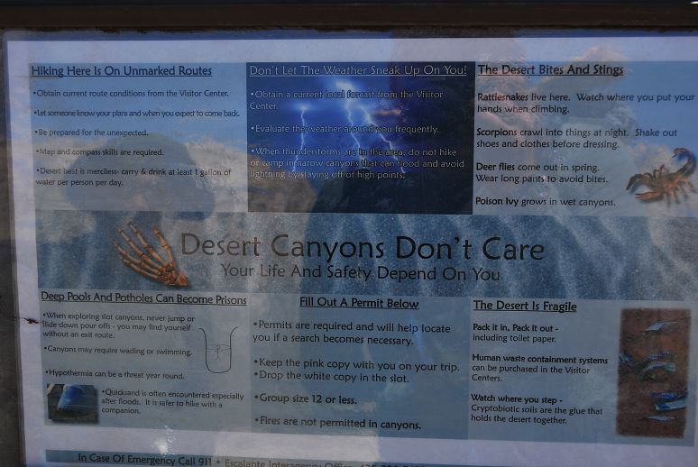
A sign at the trailhead had many warnings for us and it seemed like we were about to enter one of the world's most dangerous places instead of going for a little walk.
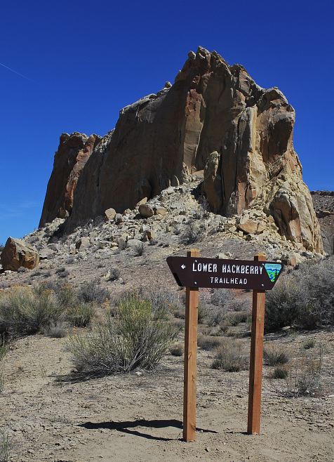
After making sure that our respective liquor bottles were stowed properly, we located a post in the ground that marked the start of the trail to Hackberry Canyon. In reality, there was no trail, just a bit of tramped down sand that led in the general direction that we wanted to go.

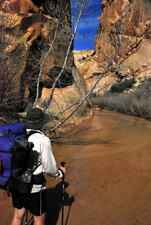
The Hackberry was flowing nicely: Clear and cold. Water, or really the lack thereof, is the defining characteristic of most of the West. Settlements, towns, cities, these were all founded where there was a reliable, year-round source of water.

Without reliable water, crops would not grow, cattle could not survive, and man had to look elsewhere for a place to build a city. The advent of large scale, industrial reclamation changed this. Agriculture became possible on a very large scale and cities sprung up where before there was only sage brush and cacti. There are two excellent books on water and the West: Wallace Stegner's Beyond the 100th Meridian and Marc Reisner's Cadillac Desert.
The Hackberry and Paria rivers provide a natural, reliable water source and it isn't surprising that settlements used to exist in the area. The area is still ranched, but few people live anywhere close by as more accessible, less temperamental sources flow through. Also, few people live in the area anyways due to the harsh, variable climate.

It wasn't long before Mags and I found our first barbed wire fence, designed to keep cattle in certain portions of the canyon and to prevent them from straying too far. Their handler's need to be able to locate them in order to turn them into hamburger.

After an initial stretch of narrowness, the Hackberry opened up into a wide, broad plane where people had lived before. Cottonwood trees littered the landscape along with willows and sage and the every present sand. If you didn't mind 100 degree summers, scorching heat, frigid, snowy winters, and generally living in a hostile land, this would have made for a fine homestead, assuming you could find enough good soil to plant something. It was beautiful to visit, but would be a hard place to live.

It wasn't long before we encountered the hooved locust itself instead of just its tracks and turds. The Hackberry cattle were of the long horn variety and despite knowing that cattle have been bred for docility and stupidity for thousands of years, the notion that an irate cow might decided to revenge itself and its kind on me for all the cheeseburgers I've eaten in the past crossed my mind.

Mags and I stopped for a rest and some food in the sun where it was warm. Hackberry was a fine canyon and not nearly so oppressive as Buckskin was last March. Whereas Buckskin was tight, dank, and wet, Hackberry was open and pleasant and I could see the sky. Salami and dried cantalope, with a Snickers bar for dessert, seemed superior fare for lunch.
Mags and I had been doing more talking than paying attention and neither of us were entirely sure where we were on the map. It didn't really matter as it would have been hard to get lost in the canyon: Just follow the canyon upstream. Then again, the college students we met this morning managed to get lost in tighter canyon. Hmm. There was supposed to be a cool cabin somewhere. And the maps says that there was an arch also. Hmm, didn't see that. Must pay more attention.
Shortly after lunch we encountered another small herd of long horns who slowly and pathetically made their way upstream, walking the way we were going in an attempt to escape from us. Tails raised, the cattle defecated directly into the Hackberry. Mags and I just shook our heads and took comfort that we'd be camping above the cattle.

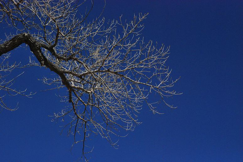
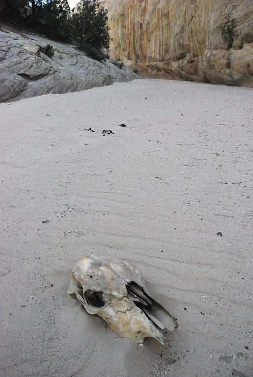
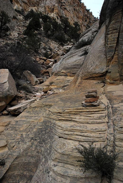
Can you guess what this is a picture of?

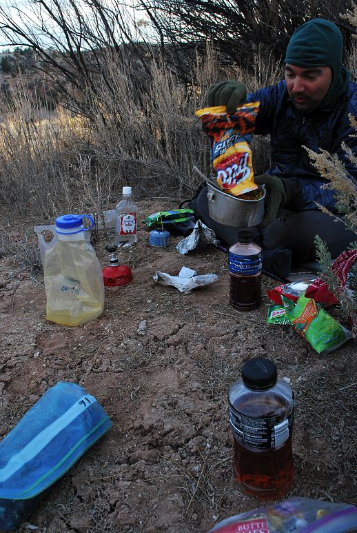
The Hackberry began to falter and slow and eventually took up a distinct oozing character. We were running out of water, which meant that our day was nearly done. Still, there were major land marks that we had not seen, like Stone Donkey Canyon. How do you miss a huge canyon coming in? But the water was definitely starting to trickle and we needed to camp at water tonight, for tomorrow would be waterless until the end, maybe 25 miles from where we were. I say maybe because neither of us knew where we were. A large, sandy bench equipped with a cooler and a tub beckoned us. It was dry and had a pleasant view of the sky. It was home. We set up a hobo camp and mixed pre-dinner cocktails.
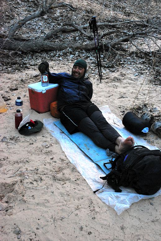
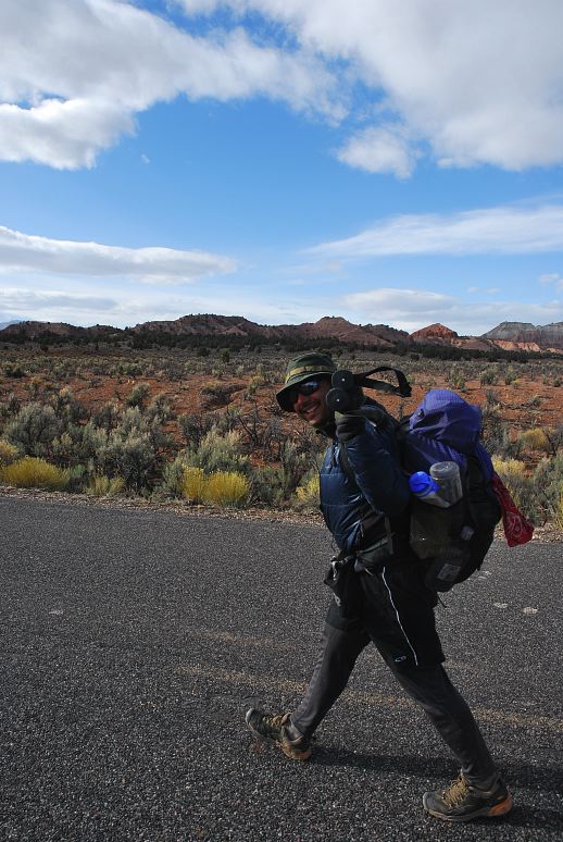
I like to look stylish and fashionable when I go into the outofdoors. Only the latest gear will do for me and I peruse the pages of Backpacker and Outside to see what all the hipsters and celebrities are wearing this season. Mags on the other hand is pure hiker trash. As Buddha (the hiker, not the sitter) said, "You make hiker trash more trashy, Mags!" His hiking shirt came from a Goodwill in Helena, Montana. He hiked 2000 miles on the CDT with it and it was still going strong. Some space age fabric from GoLite? Nope. A cotton-poly white dress shirt with a line-stripe pattern that would be right at home in Saturday Night Fever. His sleeping pad cost $7 when he bought it a few thousand miles ago. And his cook pot? Well...

Over cocktails and dinner we swapped stories from various trails. Talking with another long distance hiker is satisfying: You have so many common reference points and the experiences are so vivid, so forceful, even many years later that there is never a lack of talk. The sun was completely out of sight, but it gave us a little show high on the canyon wall. We were camped on thin foam pads on a sandy bench without a shelter over us other than the sky, drinking cheap alcohol cut with silty water. I wouldn't have traded it for any hotel room in the world, no matter how gilded, soft, or luxurious. Those places didn't have the basic price of admission. They were non-starters. Simply put, they were cages where you did time. There was time for that some other day. Tonight was about the open sky and the freedom that comes by having only what you need.

My nose was cold. I hate it when my nose it cold. I stuffed my head further down into the sleeping bag and let it warm up a bit before braving the bracing air outside my cozy cocoon. I opened the hood a bit and reached a hand outside to light the stove for morning tea, then huddled inside the bag once more. I'm a fair weather hiker for sure. My shoes, wet from the day before, were frozen solid and getting them on and walking around was a little painful at the start of the day. It was cold in the shade of the canyon and moving was the only way they would thaw out. As the first trick of the morning, we figured out on the map where we were. We had missed a lot of obvious landmarks yesterday as we told stories on the hike.
We left the last of the water of the Hackberry quickly. Our next water would be twenty or so miles in the Paria gorge, which we wouldn't reach until the early evening. It was nice not to have to worry about Mags and whether or not he was carrying enough water, or if he would drink it at the right time, or, well, or whatever. Hiking with experienced people is fun.
The floor of the canyon was covered in cow tracks, though occasionally we could make out a old foot print or two. The prom queens of the area are Buckskin Gulch and lower Paria canyon, last spring's destinations, and that meant few visitors to the more obscure canyons, which was fine with us. Even last Spring, however, we only encountered a handful of hikers in Buckskin and Paria, and none at the Coyote Buttes, home of a famous rock formation called the Wave. There is a strict quota for these areas, yet it was clear that the quota was massively underfilled. If so, why have the quota and force people to jump through a hoop to visit their land? Maybe it only gets busy in the summer when the temperature hits 100. Tourons are stupid like that.
It was with great happiness that we finally, after an hour of hiking, made it out of the cold shade and into the warmth of the sunshine. At some point we were going to have to leave Hackberry Canyon, but it wasn't entirely clear when. Ideally we were going to turn into Round Valley Draw and squeeze our way through the narrow slots and scramble up boulders. This sounded like a lot of fun, but we had a long day in front of us to get to the next water source at the Paria and fun would probably play second fiddle to speed. That meant finding the scramble route out of the lower end of Round Valley, which meant that we'd need to keep our eyes open for it. So far we hadn't done that very well.
Yesterday we had missed a cabin, a stone arch, and several large side canyon's during our hike on the lower Hackberry. I swore to myself that I'd pay more attention to the landscape and remember all the little features, and then promptly dropped back into conversation with Mags about the relative merits of marinating a 10 pound pork loin in garlic and olive oil before humping it up to a snowy cabin in the Colorado Rockies to celebrate a friend's birthday.

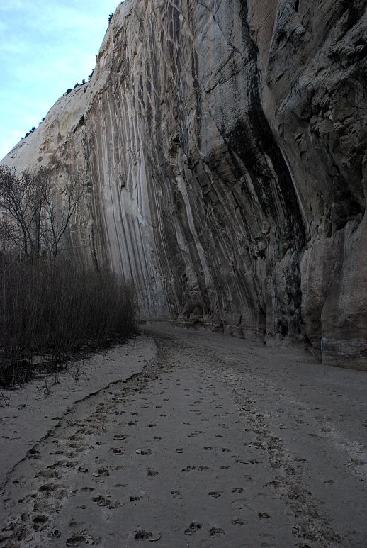
The canyon began to narrow somewhat after a few side canyons split off. The walls were getting bigger and the forms more and more interesting. Instead of the classic red rock of southern Utah, we had been traversing through light tan and white rock, with the usual caves, cliffs, and un-fallen arches. Right, stay on target. Always know where you are. Look at the map. Study the land. What was that about the Benton MacKeye? Really pretty, isolated, and pristine? In the southern Appalachians? Really, tell me more...
After jabbering away with Mags about hiking, Italian cuisine, and the relative merits and deficiencies of Catholic school education, we found ourselves in a much tighter than normal canyon. Almost Buckskin like, I thought. A sequence of cairns led up a rocky gully toward the rim. Hmm. I sat down with the map and after a short scouting trip realized that somehow we had turned out of Hackberry Canyon and into Round Valley. This must be the scramble route up. How we managed to miss the turn (indeed, I couldn't even remember seeing another prominent canyon) neither of us could fathom. But, we were in the right place, which was good enough.
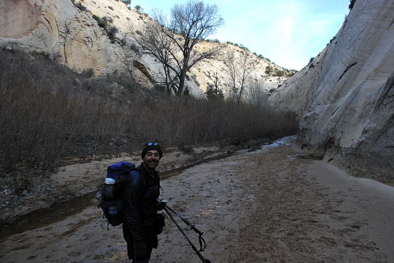
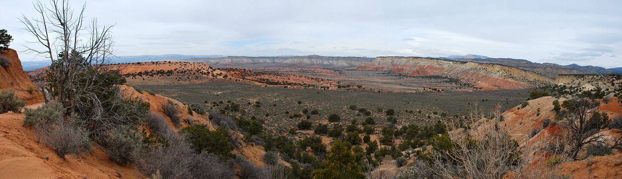
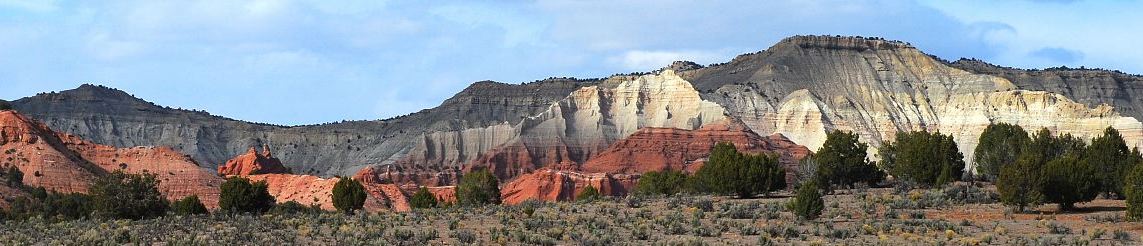
After a short lunch we scrambled easily up the gully, following an obvious use trail, and eventually found ourselves on the rim looking at a storm coming at use over the extensive plateau. Below you can see a sub-par picture of Round Valley. I say that it is sub-par because of what is happening on the right side. That tree could have been a super cool book-end to the picture. Spooky, spindly, ominous. Instead I cut it in half and it is just distracting.

At the rim we followed a faint foot path through the red clay that pretends to be soil in Utah and came to a jeep track through the sage and juniper that seemed to be the only plants capable of growing here. "Whoa," said Mags," this is total New Mexico flashback." Back in 2006 Mags hiked the Continental Divide Trail from the Canadian border at Glacier National Park in Montana to the Mexican border at Antelope Wells, New Mexico, a distance of 2,500 miles, give or take a few hundred.
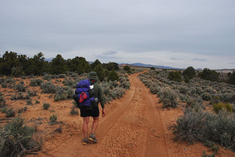
That same year two hikers, Disco and Princess of Darkness, made a documentary about their hike called the Walkumentary. You can download it for free and it makes for good watching, especially in the off season. The jeep track, the open plateau, the sage and juniper, these things all reminded Mags of the end of his CDT hike when it was hard to stay motivated, hard to keep going. Between the two of us we have probably hiked around 15,000 miles in long distance trails, not counting day hikes and weekend backpacking trips. With all that experience you'd think it was possible for us not to get lost.

When we ended up at a four way intersection with a large, graded, gravel road, it was clear that simply logging miles does not guarantee knowing where you are. But after consulting the map we found that, in characteristic fashion, we were exactly where we needed to be, even though we thought we were somewhere else.
It was cold and blustery up on the plateau and we both took the opportunity to put on warmer clothes. I belted back a few swigs of 150 proof rum to ward off any chills that I might get and we set off down Cottonwood Wash road, heading into the less-clear part of the trip. We needed to link up with Paria Canyon and there seemed to be a few different ways of doing this. Originally I had intended to try going down Rock Springs Canyon, but the day was getting long, we were getting tired, and I was in much less of a mood to go exploring than when I was warm and cozy at home.
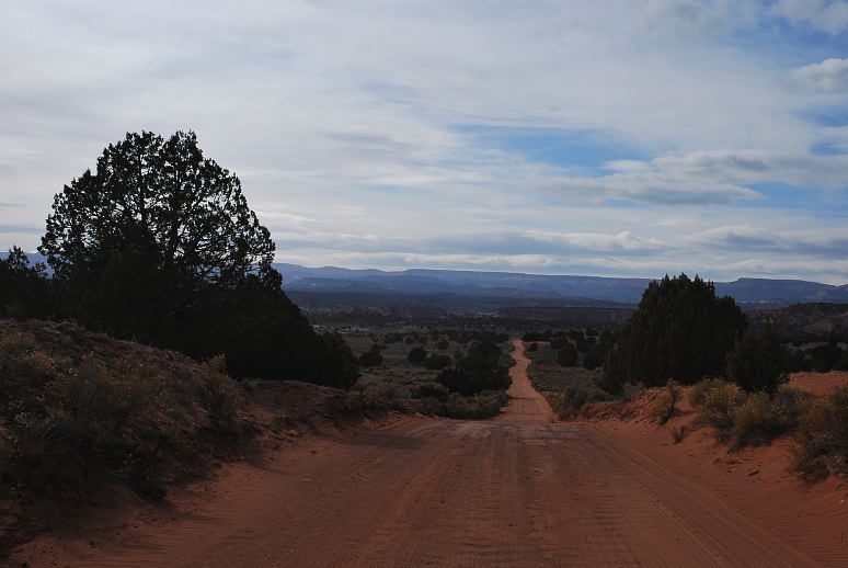
The other alternative was to walk all the way along Cottonwood Wash road to where it actually hit the Paria. This was much longer, but might be faster in the end. The correct way to do this unfortunately slipped past: Hit Little Dry Valley and follow it into Paria. Well, we crossed Little Dry Valley wash and kept going.

Our next-to-worthless guidebook mentioned several possible places to get down to the Paria, but the names he used didn't correspond to anything with a sign or marked or obvious enough to figure out. One might have been a closed-for-revegetation section that we passed just before the hard packed clay road turned to pavement. At least the mountains of nearby Kodachrome Basin State Park were pretty.
Mags and I were strolling along on opposite sides of the road when a minivan with Florida license plates pulled up along side and started a conversation with Mags. I could only hear bits and pieces of it, such as Mags responding to a question with "Fine physically, maybe a little bent mentally." The Floridians seemed loathe to let him go, as if they had come across some fabulous tourist find that they could write about for their local neighborhood association back. They could go back and tell stories of the freaks they met walking along the side of a perfectly good road and impress their friends with their bravery. They didn't bother to ask if we wanted a ride and I looked too scary for the driver to roll her window down.
It was with some relief that we rounded a point of land and spotted the Paria down below. We cut cross country on some cattle trails and finally reached the Paria, perhaps twenty two miles from where we started, and with plenty of blisters from the road and hard pack. Now it was simply a matter of finding an appropriately trashy place to camp along the river where we might have some shelter from the powerful with and the storm that would probably hit us overnight.

We strolled about a half mile from the road down the river and located a place near some cottonwoods and with enough space to pitch my tarp. Mags didn't care if it rained or not and just tossed out his sleeping pad and ground cloth and called it good. Cocktails were mixed quickly and efficiently. By efficient I mean that I just drank the 150 proof rum straight from the plastic bottle I was carrying it in. Mags was a little more dignified and put a healthy dose of cherry-pomegranate Crystal Lite into his Kamchatka vodka.

Dinner was a feast. I boiled up enough water to mix creamy chicken Ramen noodles with a packet of Idahoan Buttery Potatoes, with a healthy dose of olive oil. Not to be outdone, Mags cooked two packets of Lipton's and dumped the crumbs of his bag of Fritos in. It was even colder than last night and once the sun started to go we both nestled into our respective sleeping bags for warmth. I stayed awake for some time reading Abbey and sipping on the rum. Camped on a patch of dry ground surrounded by cottonwoods and willows and sage, drinking cheap, strong liquor and reading essays by a cantankerous old man, this was pure pleasure. I had an entire day of hiking down the Paria to look forward to tomorrow and even another half day before I had to put on the jersey of respectability once again. But for now I could indulge my Huck Finn side, and that was something to be happy about.