Bailey Range Traverse, Olympic National Park
September 8-12, 2007
School is starting and I have a big project to write up about my climbing trip into Northern British Columbia in August. Life isn't all coke and hookers, as my friend Daris would say, and not all writing is interesting. Rather than trying to weave a narrative together about the five days Wayne and I spent on the Bailey Traverse, I'm instead just going to give a photographic narrative with some comments, some of which might be amusing or interesting. I doubt I'll ever re-write this into something that someone might want to read from end to end, without the aid of pictures, as time is limited now that I have to work again, and do things like wearing shoes with laces, iron clothes, and shave regularly. See the logistics section at the bottom for some information on what the Bailey Traverse is.
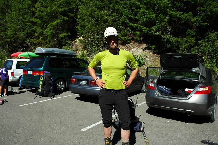
Wayne and I dropped a car at the North Fork of the Quinault trailhead and then drove around to Sol Duc, in the north, where we found a packed parking lot and many day hikers. We were a little embarrassed at our helmets, harnesses, and technical gear, so we decided to leave it behind and hope for the best.
We began on the Sol Duc trail, heading through the flat, pleasant forest lands that make up a large portion of the Olympics. Being September, mushrooms were starting to bloom and over the next few days we would see many excellent specimens. Here is a close up of the beautiful skin of a Fly Agaric mushroom. I wouldn't eat one of these if I were you.

We hiked for three hours and a half through the forest, slowly gaining elevation, until we finally broke out into the semi-open lands of Sol Duc Park. We were aiming for Heart Lake, which is located at the far end of the park, just below High Divide. It took us another thirty minutes to reach our camp, which was composed of rock hard gravel, the Park Service's favorite mattress material. The weather looked fine, so neither of us bothered with a tarp. Sleeping out under the stars is the best way to do it: At night, when you wake up, you have the stars overhead, and you can gaze upon the Milky Way at your leisure. There is nothing to separate you from your environment. Although frightening at first, you become immersed in your environment and a tent seems confining and artificial after your second or third night out in the open.

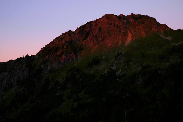
Another benefit is, of course, being able to snap photos from your bed when the light gets just right.
In the morning we got rolling at 8 am and immediately saw a black bear foraging on the slopes above our camp. Black bears are fairly common in the park at elevation, though they don't grow to especially large sizes and are pretty well behaved. The nominal reason for our carrying bear canisters was to prevent bears from getting at our food. However, most black bears are opportunists, not predators. That is, they might steal your food if it is out and you are not around. In the front country sections of some parks (Yosemite, Kings Canyon, etc) bears have gotten used to getting food out of humans and so can be a pest, just like a mosquito. In the backcountry, such bears are rare and, in my opinion, the need for bear canisters is not as great as the Park Service makes it out to be. In the below photo you can see Heart Lake and our camp, just above it, to the right, by a clump of trees. The bear is off to the left of the photo, doing what bears do: Eating plants and flowers.

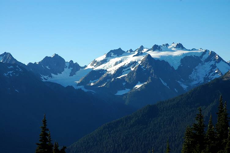
We crested High Divide and set out along an established trail leading off toward Cat Peak. Shortly we arrived at an overlook where we got our first clean look at the Olympus massif, which we would be circling for the next few days. The main Olympus peak is the furthest back tooth-like thing on the right and the valley below is formed by the Hoh River.
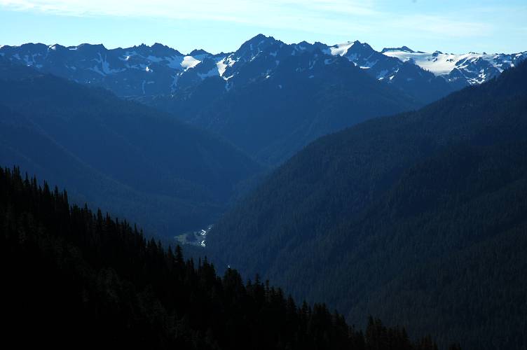
Here is the Hoh valley west of the turn off for the main climbing route up Olympus. The mountains you're seeing here form the Bailey Range and we would be moving along them the next day.
Looking the other way down the Hoh valley you can just see the Pacific Ocean in the distance.

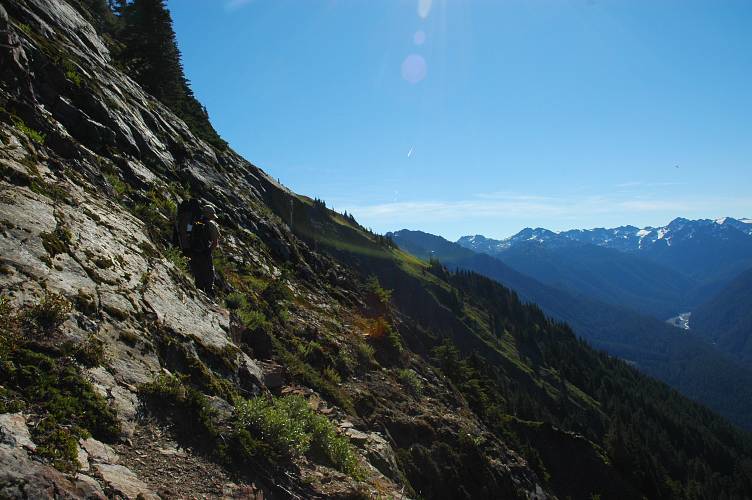
The maintained trail came to an end and we began the sidehilling that would make up almost all of the rest of the day. There is a beaten track to follow and footing is good, so progress was rapid. Rapid enough that we entirely missed a key track leading up. A couple was resting by it and we got distracted enough that we didn't see it. The track we had been following continued on and then ended at some rocks, which we assumed was the start of a feature called the Catwalk. Rather than backtracking and looking for an easier way, we continued along, scrambling down and then along the rocks, following signs of others' passage. The scrambling wasn't difficult, but there was enough air under our feet to make it interesting. We eventually scrambled up high enough to gain the ridge and found the track along it.
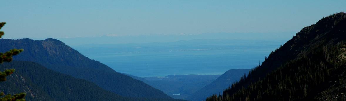
When we eventually popped up onto the ridgeline, we were treated to views of Vancouver Island, the city of Victoria, and Mount Garibaldi, which is the slightly white thing in the distance of this picture.
The rest of the Catwalk proved to be fun and easy, though the stout trees in places made progress annoying at times.

The Catwalk ends at a slightly flat spot with a stagnant pool of water called Boston Charlie's Camp. We rested here for a while and I drank liberally from the stagnant pool, for I was rather thirsty and was starting to feel a bit dehydrated. In the below photo you can see the track leading out from the camp and up onto the slopes of Mount Carrie, a 6995 foot peak.

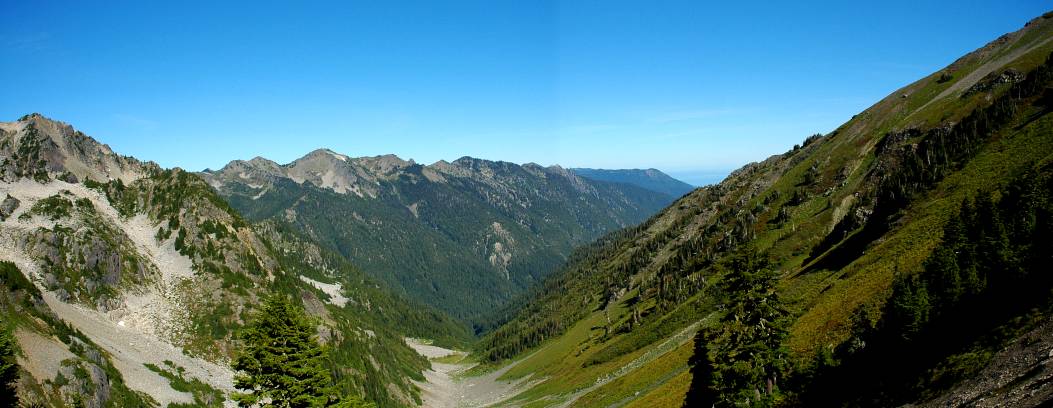
Here is a panorama of the valley below Boston Charlie's, running out toward the ocean and Vancouver Island.
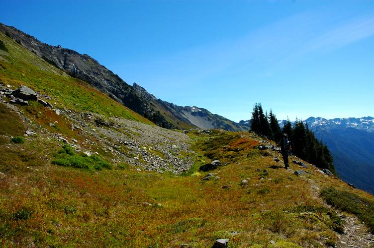
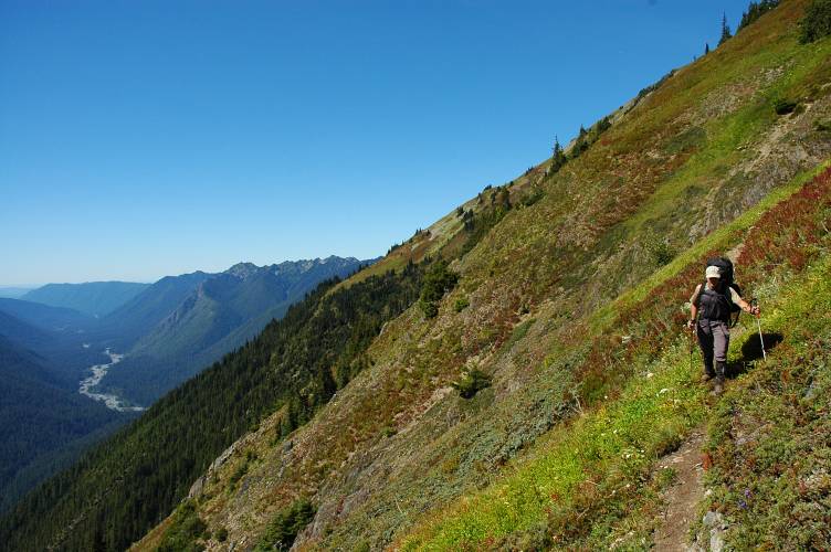
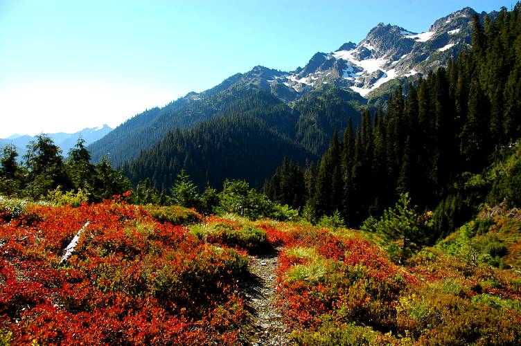
After a brief climb out from the camp, the track begins yet more sidehilling along the flanks of Mount Carrie. This is one of the few flat sections of trail. As you can see, fall is coming to the high country as the grasses and shrubs begin to turn gold and red.
The flat stuff didn't last very long and soon we were back on a contour. Sidehilling really tires your lower foot, in this case our right foot, especially when the track gets thin and the slope steep.
Here is a view of the summit of Mount Carrie, which we declined to go to as it was 2000 feet above where we were. This picture is taken from the start of Eleven Bull Basin, where water is plentiful and campsites abound. Indeed, this would have made for an excellent place to spend the night, but it was only 1:30 and we figured we should probably press on.

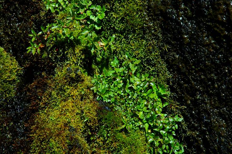
Taking pictures in the outdoors is pretty easy: Point your camera and at a mountain and press the button. No reason to get fancy or artistic: The mountains are already beautiful and you don't have to work very hard. However, there is a lot of other stuff that gets missed if all you do is point and shoot. One thing that gets overlooked is texture. All I'm doing is pointing my camera at some wet moss by a waterfall, but I rather like this photo. To paraphrase someone, taking an interesting picture isn't so much about going to new places as it is about having new eyes.
After a lot of hot and sweaty sidehilling, Wayne and finally emerged near our objective for the day: Cream Lake. The lake below is the lower version of the lake. The established track ran for a bit further and then plunged 700 feet to some meadows, where we met a solo hiker named Bruce. Bruce went his own way as we rested for twenty minutes and debated where to go. We finally decided on heading up and bushwhacked for a half hour to reach Cream Lake, which should really have been called something like "Pitiful Mud Pond." We rounded it and camped in meadows along its inlet. Bruce showed up nearly an hour later wondering where the lake was, while we wondered where he had been all this time. He took a look at the lake and then wandered further into the forest to camp.

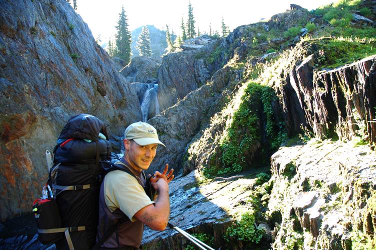
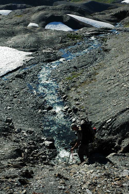
We were moving by 8 am again the following morning, a little unsure of how to gain the basin above us. After stumbling through the woods for a few minutes, we picked up a dry gravel bed that ran us to a flow coming down from the basin, where we met up with Bruce again. To our right was a canyon holding the flow and Wayne and I both liked the idea of trying to see if it would lead us to the top, though such an idea wasn't mentioned in either of route descriptions. Still, the water level was low and it looked like it might go.
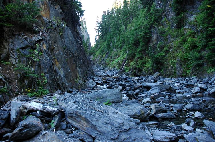
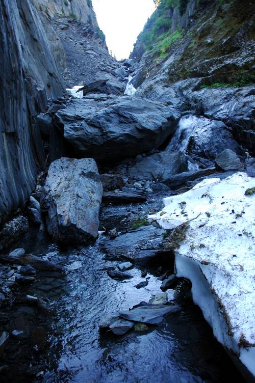
We moved up it easily, scrambling around a few boulders and taking advantage of the low water. We were nearly blocked by a large chunk of remnant snow, but it was easily passed on one side where it had melted out.

Shortly past the snow chunk, we found our easy way blocked by a moderate boulder problem. In the below photo, we chose to climb up the left side of the blockage. Wayne spotted me, but it was simple enough to gain the top of it and might rate a V0 rating in a gym.
A little shale-dirt scrambling later on gave way to the upper part of the canyon and we emerged into sunlight, rather pleased with our route finding decision.
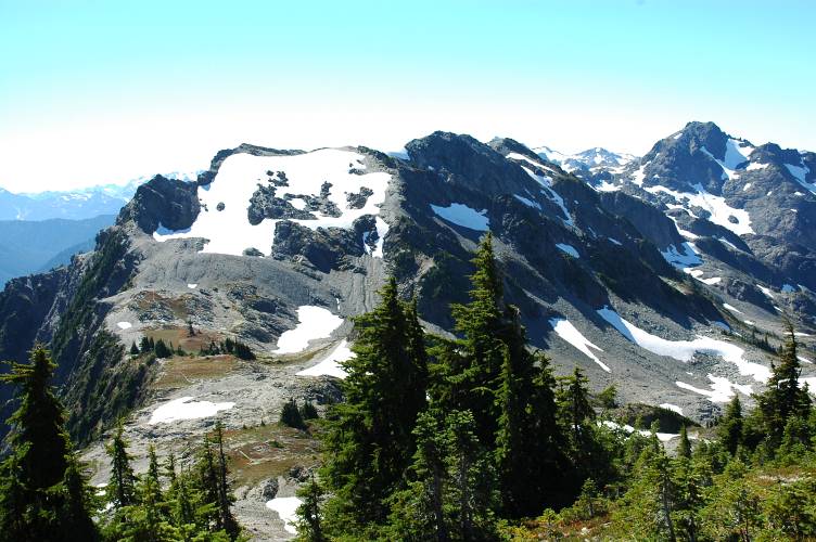
When we climbed out of the canyon, a little over an hour after leaving camp, we were treated to the open meadowlands of Ferry Basin.
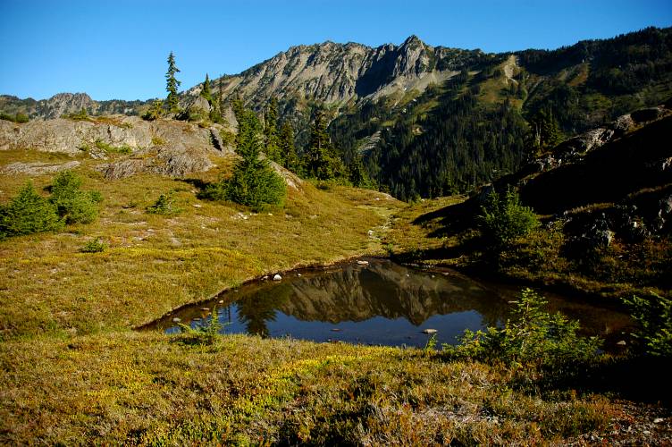
Ferry Basin sits below Mount Ferry and slopes gently up to a broad pass between it and Mount Pulitzer. Along the way we passed many stunning lakes, none of which had a name on our maps.
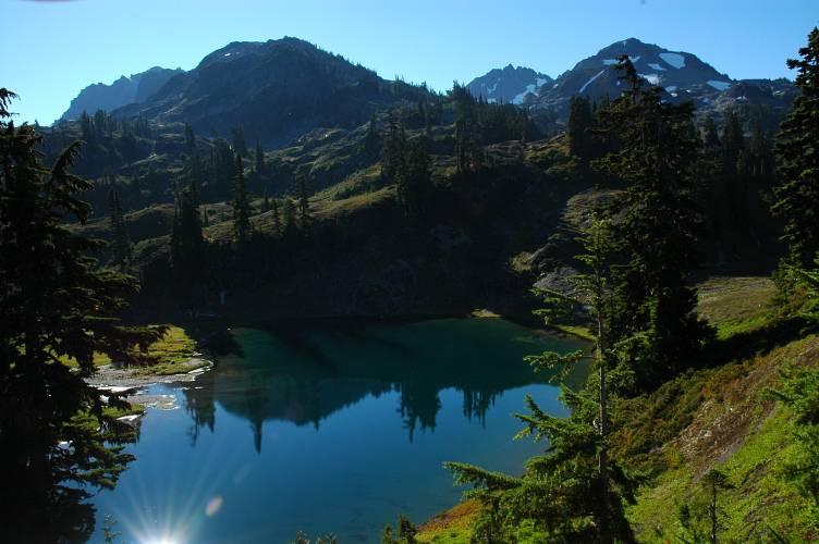
We climbed slowly toward the pass, mostly out of our sight, and occasionally came across a track to follow. The basin is broad enough and the route finding easy enough that not enough traffic forms along a single path to form a track. We climbed, sweating heavily, to a plateau from which we could see the pass and chose a fine lake to rest by and hydrate. Both of were feeling rather poor from a lack of water. Below is one of my favorite photographs from the trip. The bunch of yellow flowers stands out nicely against the rock and the water. My lens is about two feet from the flowers, which exaggerates their size and makes the lake seem longer than it actually is. The wider your lens, the more the effect.

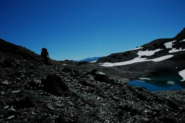
Below, Wayne is scouting our the route to the top of the saddle. Our route description and our maps showed us climbing a permanent snow field or a glacier, but we could see neither of these.
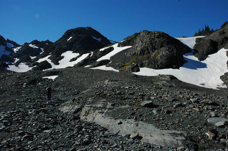
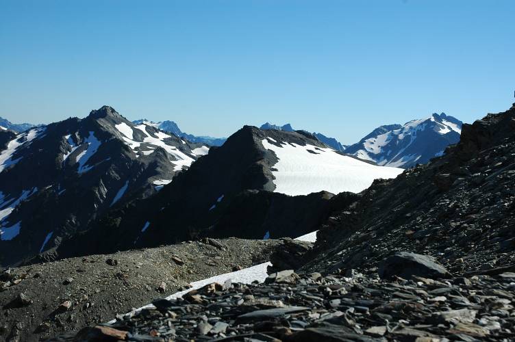
After gaining a little elevation, we found no glacier, only a massive lake with a huge iceberg in it. But, the location of the saddle was obvious and the route up, along broken shale, was easy enough.
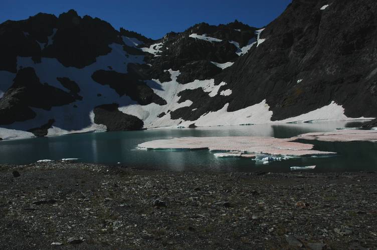
Below you can see this lake and the iceberg, the photo being taken from near the saddle. Later we realized that the lake used to be the snowfield/glacier: We were looking at the effects of global warming. If you want to see glaciers in the Pacific Northwest, you better go soon.

Here Wayne is approaching the middle of the saddle between the two peaks. We would later go up the right sky line to near the top of Mount Pulitzer.
Here we are from near the summit of Pulitzer, looking down on Mount Scott, which we both agreed was a fine peak that probably didn't see a lot of traffic.
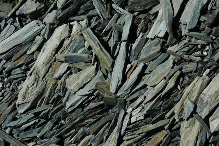
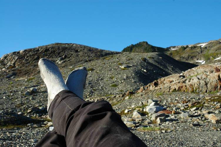
Remember the earlier diatribe about texture? Well, here is another example of it. The picture is easy to take once you decide to take it. Just point your camera at your feet! The hard part is deciding to take it instead of yet another picture of a majestic mountain.
From the high flanks of Pulitzer, our route for the next few hours was clear enough. Drop down to the pass below us (Lone Tree pass). Then, climb up to the middle section of the mountain that you can see on the other side of it. Traverse (go horizontal) across the snow band to the right side of it and climb up to the ridge crest. Then, run the ridge crest to Mount Childs, which is the prominent peak on the right of this photo.
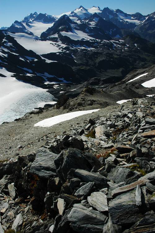
Mount Olympus was, of course, still in view. Here you can see the Hoh Glacier. There is a lot of blue ice on it and you probably wouldn't want to spend a lot of time on the lower sections of it.

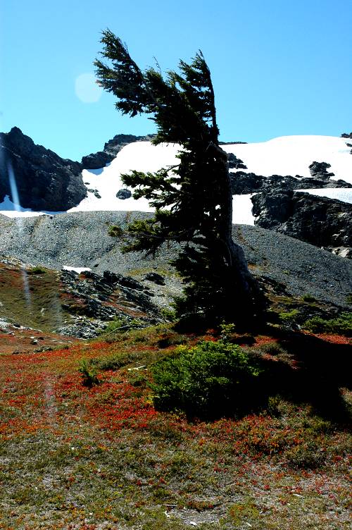
Here is the tree that the pass is named for. Apparently the winds come up exclusively from one from side of the pass, thus accounting for all the branches being on one side only.
We climbed up the other side of the pass, did our snow traverse, and got back on the crest. Very thirsty and very dehydrated, we stumbled along and dropped down to where snow was melting into streams for us to drink, just at the base of Mount Childs. The water was much appreciated and we both drank two liters while sitting there.

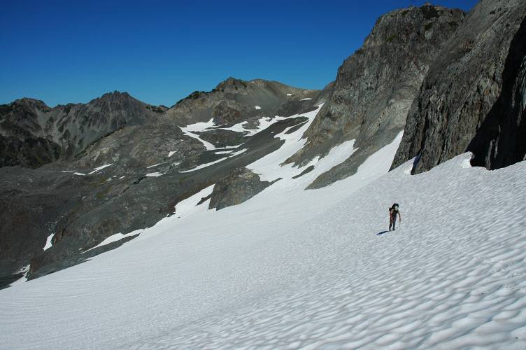
Feeling slightly better after a long rest, we got back onto the snow and climbed up along the flanks of Mount Childs. Our resting spot is in the middle-left of this photo, though you probably can't make it out. The angle of the snow was moderate, barely 25 degrees, and climbing up was easy. However, the sun was direct and the reflected light made the climb a sweaty, tiring affair.
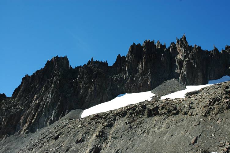
We crested out and continued along through a slightly inclined canyon filled with snow. On our right was an impressively spikey ridgeline coming off of Childs. Those pinnacles might be tempting to climb if they were made out of something more durable than the ratty shale we were walking on. The shale is so rotten than you can easily break sections of it apart along even the thinnest of fault lines.
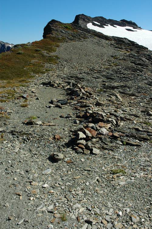
In the below photo you can see just about the end of our canyon and the beginning of the end of our day. We are heading for the top of the snow on the left side of the ridge. This is about as easy as mountain travel gets.

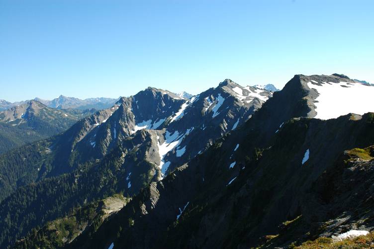
When we finally made it we were treated to views of many of the interior peaks of the Olympics that had been previously been cut off from us. We rested and broke out the map to identify some of them, but mostly just to rest.

We finally got going once again and headed toward Bear Pass, which is visible in the below photo: It is the low spot on the big snow hump.
Although we were walking on flat, easy terrain, the land dropped off spectacularly on our left side, giving our route a very airy, though secure, feel to it.
Yet another view of the Olympus massif. If you're getting bored of looking at it in these photos, imagine how we felt.

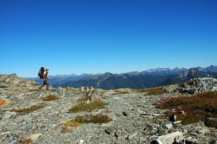
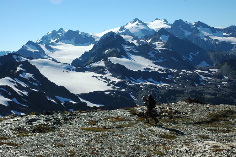
This shows you how easy the terrain really is. In contrast to the previous day of constant side hilling, the walking from Ferry Basin on was very pleasant, if tiring at times.
Hmm, what massif could this possibly be? The blue ice in the middle left is from the Bear Glacier, which we crossed to get to the pass. However, we were on the upper slopes, far above this, and far from crevasse danger.
More shale, more easy walking, more Wayne.

I think I took this picture at least forty times during the day.
Near Bear Pass we found evidence of old tent walls, where people had built up walls of shale to protect against the wind. Not too many people climb Mount Olympus from this side and we suspected that these walls were pretty old.
The Bear Glacier proved to be easy, pleasant walking on a moderate slope, though it was still rather hot and we sweated buckets moving up it.

From the pass we were treated to an excellent view down the Queets valley, which runs out to the ocean, exiting south of the Hoh. Unlike the Hoh, there isn't a massive trail up it and it is supposed to be one of the wilder places in the Olympics.

We could also spy a most excellent alpine lake along the flanks of, I think, Mount Meany. Or Maybe Mount Barnes. It didn't matter because we were tired and were not going to go anywhere except to Dodwell-Rixon pass.

Below you can see the pass, which we would go down the following day.

Before we could, we had to drop 600 feet to the plateau below, crossing over several streams feeding into the Queets.
When we finally reached camp we both agreed that today had been the heart of the Bailey and made up for our aching feet. The views had been superb, the terrain pleasant, and the technical difficulties minimal.
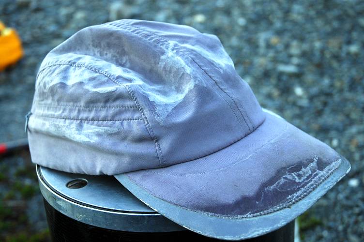
My hat showed evidence of the work we had put in over the last three days.
Ok, this is yet another shot of the Olympus massif, though one taken from my sleeping bag. But, it conveys a much different message than the other ones, all of which show the mountain in standard form.
Sure, this could be taken almost anywhere in the world, but I like the effect anyways.

In the morning we dropped down Dodwell-Rixon pass and gained the start of the Elwha snowfinger, a permanent snow field that leads down a gully toward the Elwha River.

We had read dire warnings about the dangers of the snow finger, but the angle of snow was very moderate (twenty degrees) and the snow very solid. Where it melted out was obvious, and as long as you were not complacent nothing bad was going to happen to you.

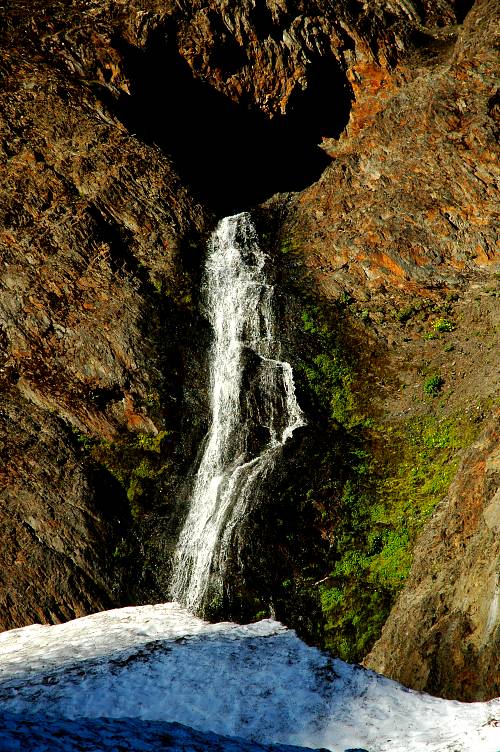
Here is a rather interesting waterfall spilling out of a cave in the wall of the canyon. Water was running underneath the snow and had cut out interesting caves, which we had to be careful not to break through.
90 minutes of easy plodding got us down to where the route on the snow ends and work begins again. Due to a gorge lower down, the route scrambles steeply up the wall of the canyon and climbs over a ridge to gain easier land on the other side. Though sweaty and strenuous, the nastiness didn't last that long and there were ripe blueberries to eat along the way. Once on the other side, the terrain evened out and opened up and we had fun times once again.

This photo could simply be titled, "Fall is Coming." A lack of leafy trees means that fall in Washington is marked by shrubs and smaller plants. I think the effect is particularly fine.
Thankfully we didn't have to deal with this snow, which was rotten through and through.

We reached the Elwha once again and rock hopped to the other side. We were now back on semi-official trail, and an hour later we'd be on maintained trail, deep in the forest. The only photos I took of the rest of the trip were from Low Divide, the only time the trail broke through the forest for a few views.

Though we still had a long way to go to reach the Durango, and another night to camp, the Bailey was over at this point. The cross country hiking was done, the Olympus massif put to rest. We were ready to be done and our purpose was no longer to glory in the high country of the Olympics, but rather to get to a certain spot on the map by the fastest, least painful means possible. Again, as Daris would say, life isn't all coke and hookers.
Logistics
The Bailey Range is a crescent shaped range of mountains that flanks the northern and eastern regions of the Olympus massif. It is entirely within Olympic National Park, which means you have to get a permit and pretend to follow some of their rules. This means carrying a bear canister, which you can rent at various ranger stations for $3. We were able to get nice, light kevlar ones, which seemed like they might be able to resist a bear for about four minutes. You can start and end the traverse at a variety of places. Having two cars at our disposal, we chose to start at Sol Duc in the north and end at Lake Quinault in the south. Here is a brief itinerary.
- Day 1: Car shuttle, permits. Hike from Sol Duc trailhead to Heart Lake camp, roughly 4 hours.
- Day 2: Heart Lake to Cream Lake. About 10.5 rather trying hours.
- Day 3: Cream Lake to Dodwell-Rixon Pass. About 9.5 most excellent, tiring hours.
- Day 4: Dodwell-Rixon Pass to Twelvemile camp. Roughly 9 hours.
- Day 5: Twelve Mile camp to North Fork Quinault trailhead. Exactly 5 hours.
The off trail portion of the hiking runs from near Cat Peak (about 3 miles from Heart Lake) to the Elwha River (about 3 hours from Dodwell-Rixon). Off trail does not mean no trail. There is a fairly well established, beaten track the whole way and route finding is not challenging, at least in good weather. The best part of the traverse is between Ferry Basin (just above Cream Lake) to Dodwell-Rixon. There were three places where we got a little confused. After the maintained trail ends, there is a short section of exposed, though easy trail that leads to the start of the Catwalk. We ran into a hiking couple and missed a critical turn off, leading up to the start of the Catwalk. We continued on the beat trail until it ended about forty yards ahead. At this point we should have turned around, but instead scrambled down, along, and then up to the Catwalk. We were clearly not the first ones to do so. The scrambling is easy class 4 stuff. Class 4 means that you are actually working, and that if you fall you will probably die. Easy means that the chances of falling were slim. The next place we got confused as courtest of the OMG (see below), which describes a way down to Cream Lake that seemed to make little sense. We took the trail down (which they advise against) and found some minor bushwhacking, but nothing too difficult. However, it put us below Cream Lake, which meant we then had to bushwhack up (about 20 minutes). The second place was just below the Ferry-Pulitzer saddle, where the map (and OMG) shows a permanent snowfield/glacier. However, we only found a big lake with massive icebergs. We finally realized that we were in the right spot and we were just looking at the effects of global warming.
The scrambling involved is mostly trivial and the snow travel laughably easy, at least from a climber's perspective. Hikers and backpackers may find it significantly more challenging. We met three other parties that seemed to be having a much more difficult time with the terrain. Additionally, a solo hiker had fallen on a steep section (actually, he was off track) and broken an ankle shortly before we rolled through.
Both Wayne and I were in heavy mountaineering boots and agree that there are a few sections where these are nice to have. I might try trail runners if I were to hike it again, though it would make some scrambling and the few snow slopes more difficult. An ice axe and crampons are recommended, though snow pros could probably dispense with the crampons. Rope and harness and snow protection isn't necessary, at least when there isn't much snow (we were there in September). Water, or lack thereof, can be a problem and both Wayne and I got rather dehydrated in the hot sun from lack of water in places. There isn't a whole lot of water between Eleven Bull Basin and Cream Lake, and from the lake below the Ferry-Pulitzer saddle to just below Mount Childs.
There are a few guidebooks out there with route descriptions. We had two descriptions, one from the the Olympic Mountains Climbing guide (OMG) and the other from Peggy Goldman's 75 Scrambles in Washington (POS). The OMG was accurate, for the most part, and pretty direct. POS was truly awful and shouldn't be relied on in any circumstances. It is unlikely that Mrs. Goldman has actually hiked the Bailey via her description and the publisher would be wise to remove it from future printings.