Burroughs Mountain, Mount Rainier National Park
September 4, 2010
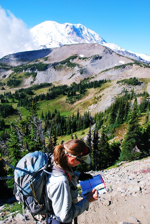
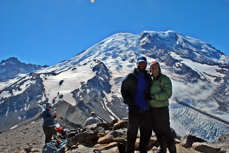
Mount Rainier looms over everything in the Pacific Northwest, an overlord who, even when shrouded in clouds, is always felt. With the deep evergreen forests and the salmon, it defines the region. You can't live in the area and not visit the mountain from time to time. Shauna had hiked past it on the PCT, but this was to be her first visit to see it up close.
Our planned climb of Goat Island Mountain would have to wait for another time as deep, dense clouds and fog hugged the lower regions of the mountain. Up the road we went to the rainshadow of the mountain, to Sunrise. Located on the northern side of the mountain, it receives less precipitation than the southern side. The vegetation is different, the distribution of plants is different, and the entire feel is different.
We hiked up the ridge to Frozen Lake and split off from the Wonderland toward Burroughs Mountain. I had never been to the peak, but it headed directly toward the mountain and went up to nearly 8000 feet. It had to be beautiful.
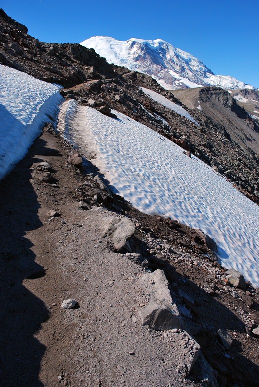
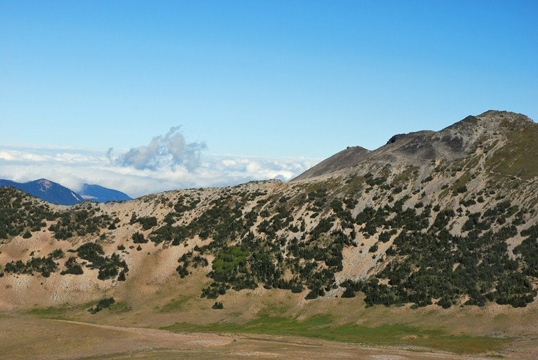
Burroughs Mountain is not a peak proper, but rather a long, extended ridge with three humps on it, each successively larger than the last. The trail was well built, well maintained, and well graded. Despite the obvious popularity, there was no trash flying around. I had just come back from five weeks spent trekking in the Himalaya. It was rare there to go more than fifty feet without finding candy wrappers or coke bottles or noodle packets. The locals kindly put rocks on top of the trash they left. I appreciated the cleanliness of the American tourist more than I thought I ever would.
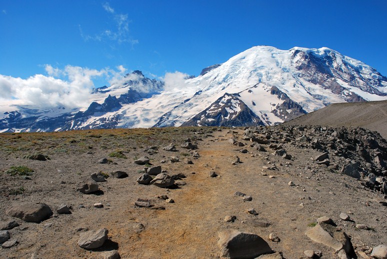
On top of Second Burroughs we found a few people lounging amongst the rocks, all under the spell of the mountain. It was hard not to be. After all, the top looked like a short jaunt, if only a path existed through the maze of crevasses and icefalls. In reality, the summit was nearly 7000 vertical feet above us. Little Tahoma, the state's third highest peak, looked like a dustmite next to the massive bulk of Rainier.
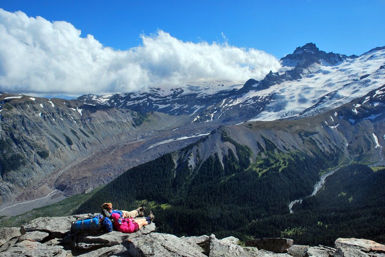
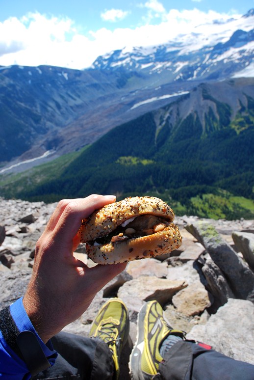
We found a spot out of the wind with a nice view and settled in for an early lunch before moving on to the third hump. Shauna had made two eclectic sandwiches out of what we had sitting around in the fridge. Works bagels, garden vegetable cream cheese, garlic infused olive oil, roasted mushrooms, soy baked tofu, parsely, tomatoes. Surprisingly tasty.
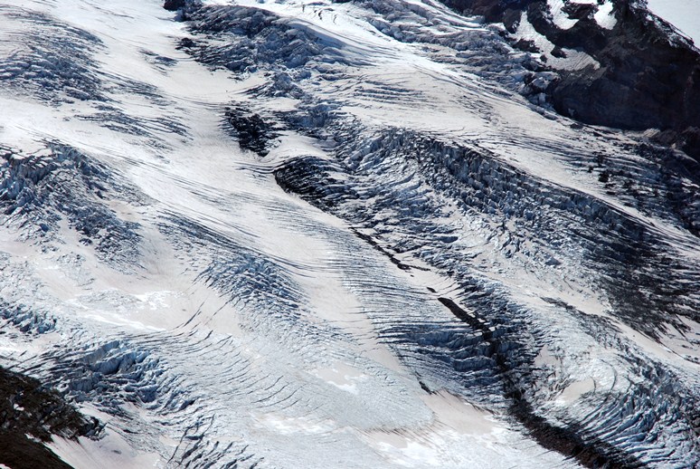
Shauna busied herself with her plant book, working on identifying and cataloging the wildflowers and shrubs we had found along the way. I stuck my nose in the map and worked on identifying the land features and subpeaks in front of me. Mount Rainier has many climbing routes and several the most difficult were here on the north side, including the Willis Wall, a sheer expanse of icy rock that seems more fit for the suicidal than the mountaineer.
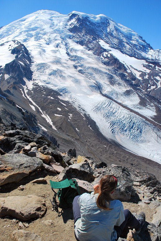
The ultra classic Liberty Ridge was just in view and the standard Emmons Glacier route spread out in the foreground. The Winthrop Glacier flowed down the mountain like a river. In the distance were Echo and Observation Rocks, objectives for another day. After the bite we dropped down to another low point and scampered up to Third Burroughs, which held the best views yet.
We were not alone on top, but this didn't matter at all. The mountain was out and the sun was shining. It was hard not to smile. Hard not to be happy. Better to be happy than not. I cracked open a 24 ounce can of Steel Reserve.
I moved from Indiana to Washington for a reason, a reason that I always keep in mind. But every time I'm close to Rainier, or deep in an Olympic forest, or sitting by the crashing Pacific, or high on Cascade ridge, I'm cheered by my decision. The decision is reinforced. We spent more than an hour on top, talking with ourselves and the other hikers. Reading maps and talking about the future. Being quiet. It was a bit of perfection in my backyard. In our backyard. I was happy to be home again.
Logistics
From Lakewood, take SR 512 east, following the signs for the Sunrise area of Mount Rainier, passing through Puyallup. Hop on SR 410 and take this through the towns of Buckley and Enumclaw, all the way to the White River entrance to the park. Continue on the park road and follow the signs to Sunrise, which is at the end of the road, way up from the valley floor. Park as far down in the parking lot as you can, as the trail starts from that end of things. Climb up to the ridge above you on any one of several trails, then tend toward the left, heading to Frozen Lake. Reach a five trail junction. Follow the middle path signed for Burroughs Mountain. Third Burroughs Mountain has the best view and the trail is fine to there.
The total elevation gain is about 2000 feet and the round trip distance is on the order of 6 miles.