Colchuck Peak, Alpine Lakes Wilderness
May 16, 2009
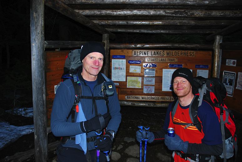
There is no good excuse for getting up at 4 am on a Saturday, especially if after getting up you have to climb a vertical mile of snow, ice, and rock. But sometimes you just have to be bad. With an extended stretch of nice weather settling in over the Cascades, there was no reason not to climb, even if it meant missing my beauty sleep, which I desperately need. The objective was big, but easy from a technical viewpoint. Colchuck is one of the major peaks in the area and at 8700 feet is one of the biggest non-volcanic mountains in the state. And so I found myself at the Stuart Lake Trailhead with four friends at the beginning of a long day. Here are Geoff and Rob, who are smiling a bit too much for good taste at 5:30 am.
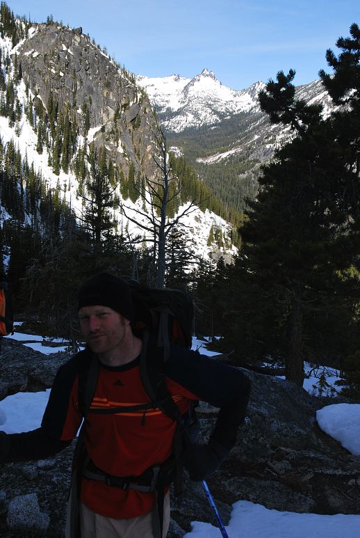
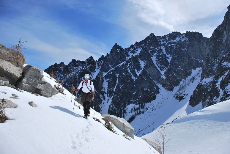
The snow began low down on the trail, with significant patches below 4000 feet and more or less continual snow beyond that. After a short break at a trail junction we started the climb toward Colchuck Lake, the first major marker on the approach. Here Rob is still smiling. Down below is the valley leading to Stuart Lake. The mountain in the distance looks like Mount Stuart, but I'm not entirely sure that it is, as Stuart is a lot bigger.
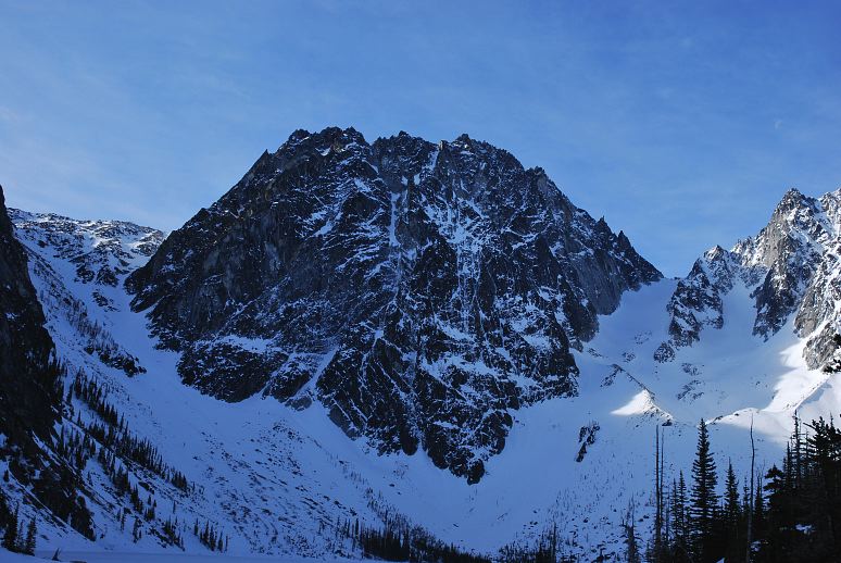
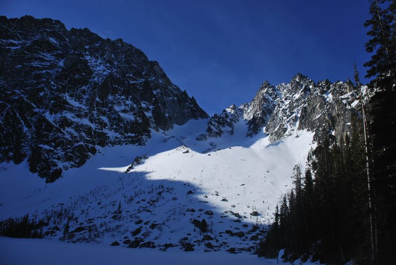
The sweat was flowing nicely when we arrived at Colchuck Lake at 5700 feet, 2300 feet above where we left the car. The scene was dominated by Dragontail, which is one of the more massive mountains in the state. It is in the center of the below picture, with Aasgard Pass on the left and Colchuck Col on the right. Many of the state's best alpine rock routes are on Dragontail.
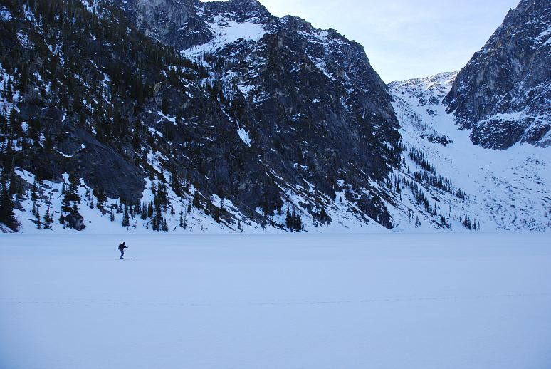
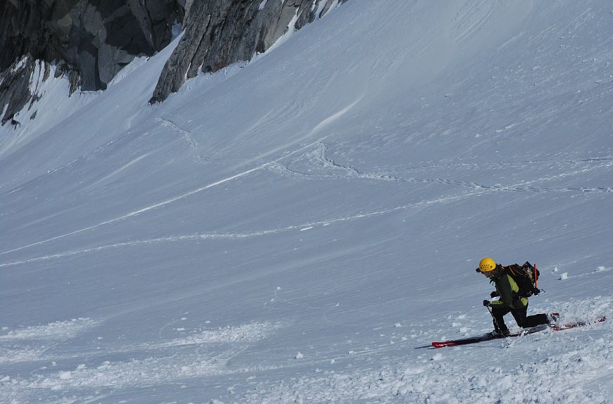
We me a group of three skiers who had spent the night at the lake and were getting ready to ascend Colchuck. The lake was frozen enough for them to ski across it, which I thought was pretty cool.
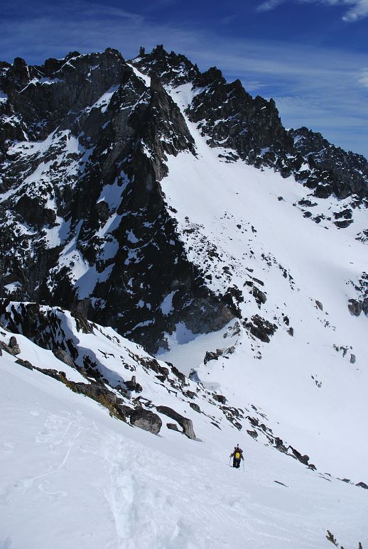
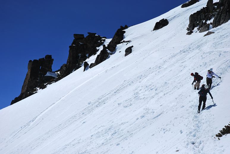
We crossed the lake by skirting the shore and then walking over brief section of it. On the far end we rested in the sun and geared up for the climb. This means we put on sun block, glasses, and crampons. We could have skipped the crampons. There was no route finding issue at all this weekend: Head directly for the col, which is 2300 feet above the lake. It doesn't look like it, but the way up to the col is steep and tiring. Colchuck is the mountain to the right of the col and looks like a midget next to Dragontail, despite being only 150 feet or so lower in elevation.
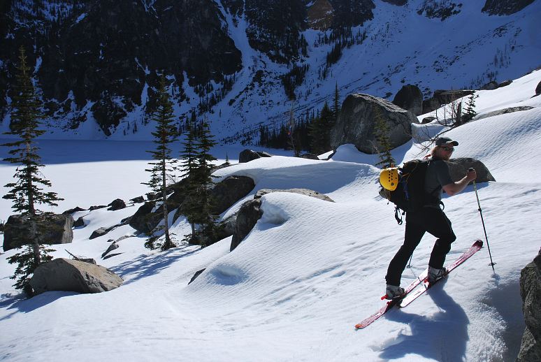
Peter was on skis and set out to skin up via a long sequence of switchbacks, while the rest of us booted up directly.
The route was tiring as the snow was soft and sloppy on the way up and I found myself postholing with every step. Fortunately, Rob went in front and kicked steps for most of the way. He only swapped out when he was told by Peter that it wasn't true that on your first climb you had to kick steps the whole way. Here is Ben traversing a slope about halfway up to the col.
I don't know what mountain this is, but it is well to the right of Colchuck. You can see Rob down below kicking steps for us to follow in. Geoff, Ben, and I are still staying in back and letting Rob do all the work.
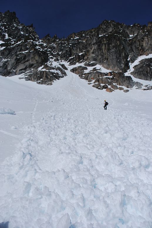
There is very real avalanche danger on the route. Here you can see Peter crossing a slide that occurred a week or so earlier. It wasn't a huge avalanche, but it still could have been lethal for anyone in the wrong place at the wrong time.
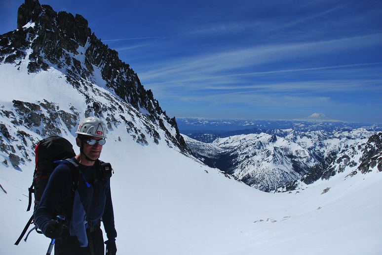
Geoff, Ben, and I eventually swapped out with Rob for kicking steps up the last eight hundred vertical feet to the col, which we reached in a somewhat exhausted state. I was really burned up at the col, but a fifteen minute break breathed a little life in to me. Here is Geoff at the col looking over the far side of it. I don't know what the mountain to the left, above Geoff's head is, but it sure looks cool. In the distance you can see Mount Rainier.
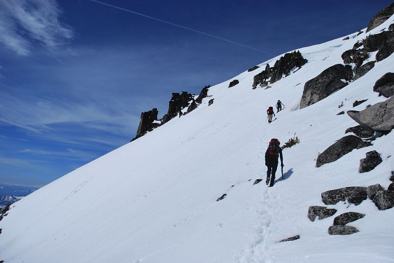
The three skiers left as we reached the col and we were able to follow their boot tracks on the last bit of climbing to the summit. The route up was steep for a section, and then leveled off toward the summit.
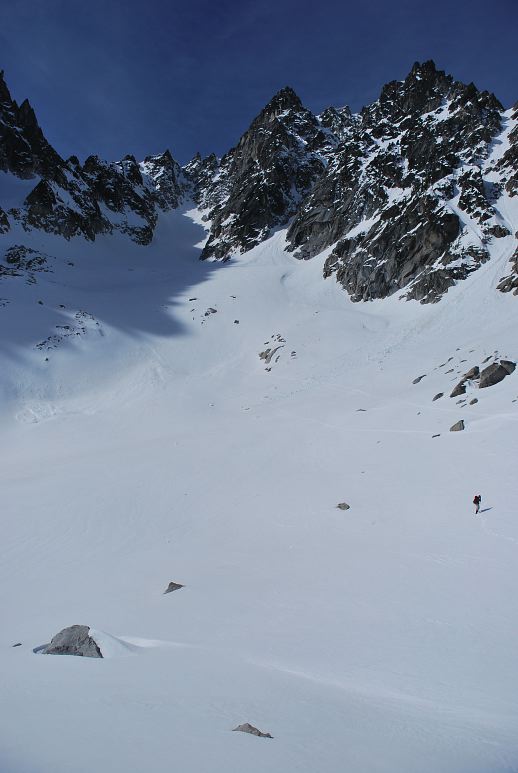
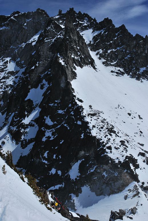
The below photo gives you an idea of how steep some of the sections are. The col is down below in the lower right corner of the photo, with the summit of Dragontail in the upper right. In the lower left you can see Peter's yellow helmet and his skis. Looks pretty scary, eh? Well, it really isn't as steep as it looks and I'm using a cheap photography trick to to this. If I zoomed out a bit you'd see that it wasn't as bad as it looks, but this sure makes us look like stud climbers.
Here is a picture just a hundred feet or so from the last one. You can see that the terrain isn't as bad as the previous photo looks, but is still pretty real.
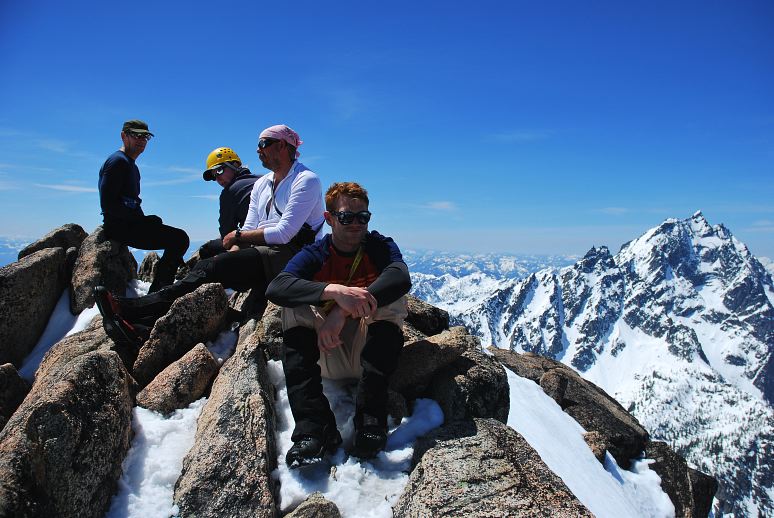
It took us about thirty or forty minutes to reach the summit and a well deserved rest in the sun. From left to right you can see Geoff, Peter, Ben, and Rob. Mount Stuart is the large mountain to the right. The views on top were pretty amazing, with everything from Mount Rainier to Ellensburg to the deserts of Eastern Washington and the icy peaks of the north Cascades.
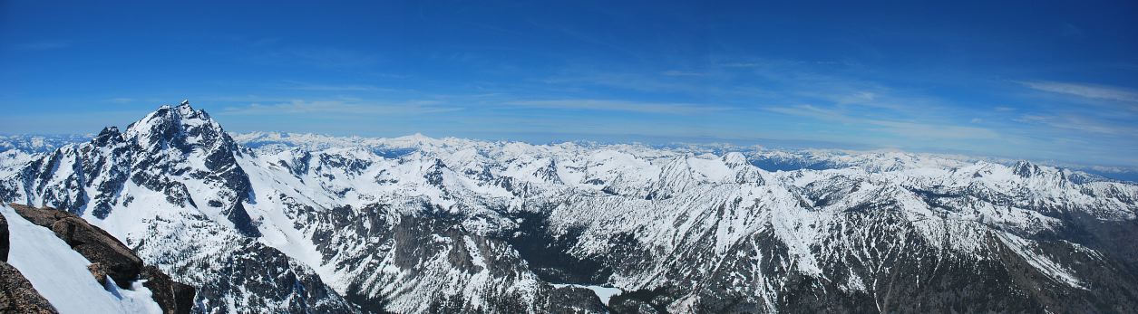
Here is a panorama of the Cascades. Although it is the middle of May there is still a lot of snow on the mountains and it won't be easy hiking for another month or two.
After an hour on the summit it was time to go down, which meant that Peter now got his reward for hauling skis up. Peter began his descent on skis, but opted to downclimb the steep section toward the col rather than risk a potentially catastrophic crash.
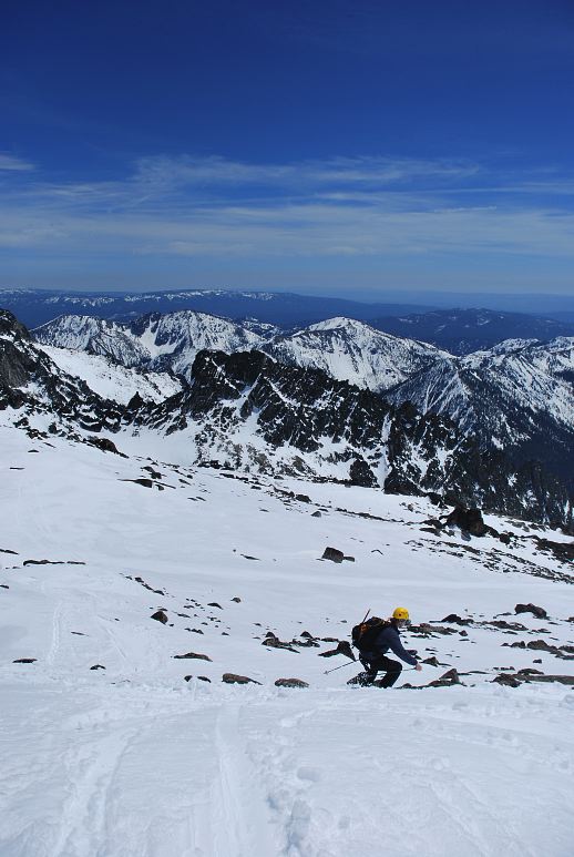
The rest of us had to manage on foot, which was a challenge due to truly rotten snow. Even with care, steps would collapse unless each of us re-kicked them. Even worse was the unpredictability of the snow. Just often it would be good enough to lull you into being complacent. It took us significantly more time to come down than it took to go up.
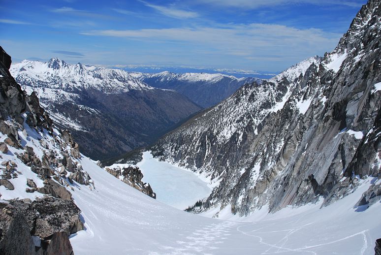
Back at the col we collected gear and I took a photo that I should have at the very start: Colchuck Lake in at the bottom, with the valley we hiked up below that. The far valley is Icicle Canyon, where some great rock climbing is found.
Peter started down and I was able to shoot a few reasonable photos of his descent.
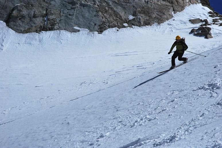
I'm hampered by the equipment that I have and missed a couple of nice shots, but this one ended up pretty good.
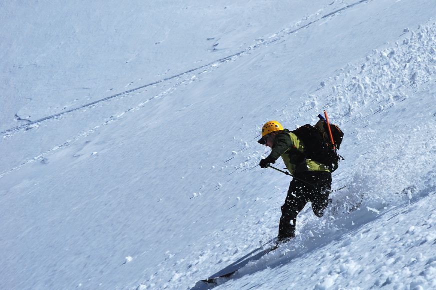
And one more shot of the Peter Show.
It was a long and tiring haul out to the cars, and then down to town for food and pitchers at Gustav's. How's that for a thrilling conclusion!
Logistics
From Lakewood drive I-5 north to SR18 and take that east over Tiger Mountain to I-90. Drive I-90 east the town of Cle Elum, where you hop on SR970. Follow this to US 97, which you follow over Blewett Pass to US2. Drive west on US 2 into Leavenworth. Drive through town and gawk at the funny tourists enjoying the faux Bavarian townsite. Make a left into Icicle Canyon at the far end of town. Drive about 9 miles, passing Eightmile Campsite and make a left on the gravel road heading up toward the Stuart Lake trailhead. Drive the road to the end. It is unpaved, but easy for passenger cars. You'll need a NW Forest Pass or equivalent to park. The trailhead is a popular one in the summer.
From the parking lot hike 2.4 miles up the trail to a junction. Make a left and head to Colchuck Lake. Gain some more elevation and reach the lake in 2.1 miles or so from the junction. At the lakeshore, you'll be able to spot Dragontail on the left and Colchuck on the right. The pass in between them is 2300 feet above you and is your destination. Hike along the lakeshore or across the lake if it's safe. Ascend directly to the notch. Wear a helmet as rockfall is a real possibility. Try not to get swept away in an avalanche. From the notch, rest your weary bones for a while, then hike the remaining 700 vertical feet to the summit. Route finding is super easy. It is about 7 miles to the summit from the parking lot and about 5300 vertical feet up. We had super sloppy snow conditions and it took us 12 hours car to car, with a nice rest on top. With better conditions it would be more like 9-10 hours.