Coldwater Peak, Mount St. Helens National Volcanic Monument
February 11-12, 2006
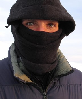
Sunshine and blueskies. Sunshine and blueskies. I stood in the parking lot bathed in the early morning light of a cloudless February sky wondering where the Pacific Northwest winter had gone. We just haven't had such days during this winter season. I wandered about the deserted visitors center at Coldwater Ridge waiting for Jonathan and the rangers. Although the place didn't officially open for another ninety minutes, there was supposed to be someone here to write a permit for us so that we could visit our land. The wind was howling as I snapped off a few pictures of the area surrounding Mount Saint Helens, but the air was already warm from the sun and the blue overhead didn't seem to be going anywhere.
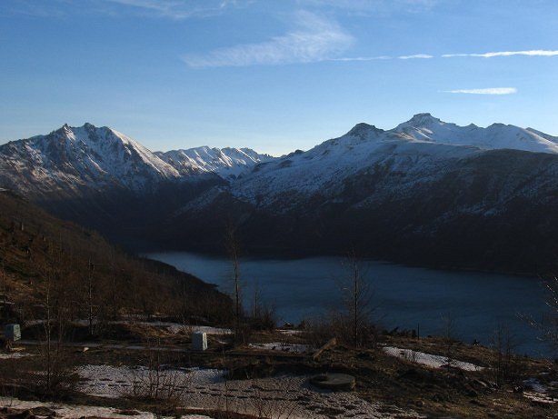
Jonathan and I, permit in hand, drove down to the Hummocks trailhead and parked after the drawn out process of form filling-in. "Warning: No snowplay permitted!" had brought forth chuckles. The fact that the last permit for overnight use had been issued in mid-October was just sad in comparison. The last time we had gone on a trip together had been in early May in the Mount Stuart area. Stunning weather then, stunning weather now. After a requisite roadwalk, we began the climb up the South Coldwater trail, heading for the prominent ridge that runs along the south side of the lake.

We quickly encountered snow, though not of the form that either of us were expecting. Instead of the loose, fluffy powder that I had been playing in since getting back from Thailand, we instead had crusty, icy hardpack to deal with. Initially just patches, as we progressed the snow became thicker and eventually the trail disappeared altogether. Climbing higher, clouds from the south rolled in, ending the bluesky day. The clouds didn't come by themselves, unfortunately. On the open ridge we were pummeled by sustained thirty and forty mile per hour winds that made Jonathan's nylon pants hum like an industrial fan.

The trail took us to the crest of the ridge where some old logging equipment had been left after the eruption. The trail had been littered with signs warning us to stay on trail or face a minimum $100 fine. Before the eruption the land in the area was being clear cut, as evidenced both by the machinery and also by the numerous tree stumps with no corresponding tree bodies. The government only cared about the land once it had been devastated, not before. Neither of us took the warning signs especially seriously, though we did make an effort to stay on the trail or at least on snow.

For some time before the eruption occurred, the mountain had cracking under the pressured of building lava. A small earthquake happened and the mountain broke open, releasing the massive pressure that had been stored up. Ash spewed forth and ice melted into massive water flows that dammed old creeks creating new lakes, and scoured the countryside for miles around. Scientists now had an open air laboratory in which they could observe a land as it recovered from volcanic devastation. Naturally enough, they didn't want people tromping through their lab. Hence the signs.
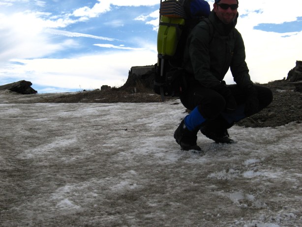
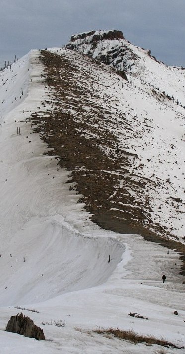
The trail became an old logging road that cut along the side of the ridge, but we couldn't follow it for long. The snow had become very icy and Jonathan and I had to be very careful with our feet as a slip would result in a rather long fall down to the lake, several hundred feet below us. Kicking steps as we went, we tried to stay on the traversing road, but eventually had to put on our snowshoes and climb to the crest of the ridge, where we would be on more level terrain. The snow would keep the lab insulated from our presence. On top of the ridge, we found the wrecked heap of what used to be Saint Helens.

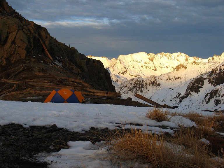
Staying on the ridge crest, we ambled up the crusty snow heading for a gap on the right side of a prominent heap of rocks. Climbing directly against an icy slope proved to be much easier than the sidehilling of before, and the only consequence of a slip would be laughter from Jonathan. Just before the gap we came to a large bowl against that looked like it would provide an excellent, if illegal camp for the night. We pushed on and climbed up another thirty feet to the gap to find an even better camp next to the rock heap, complete with views of Saint Helens, Mount Hood, Coldwater Peak, and the surrounding land. With lots of snow to camp on, we had our water source and our presence, after a day or two, would never be known.

We quickly set up my tent and stored our gear before setting out for an excursion to the gap to the right of Coldwater Peak. Kicking steps into the icy snow at times, using the cleats of our snow shoes at others, we slowly made our way around the slopes of a finger of Coldwater Peak and climbed directly up to the gap at 5300 feet.

On top I almost wept. Mount Hood stood up, as expected, but so did Mount Adams, whose presence surprised me until I remembered how far south I was. I wanted to weap not at the beauty of the scene, but rather at the thought of all the people who would never get to see such a place. It wasn't the abstract thought of a vague, general, undefined "people" that stirred me.

Rather, I thought of specific friends of mine who would never make the slight effort needed to get here, to get somewhere other than a concrete suburban jungle. It wasn't that they were lazy, but rather than they didn't see any value in coming out to such a place. Snow was cold and they could see pictures of such places in books, couldn't they? My eyes became misty and moist behind my sunglasses, but as Jonathan came up to the gap I pulled myself together, hoping they were doing something, anything, worthwhile back in settled life.

we climbed another hundred feet to a small peak on the other side of the gap where Spirit Lake could be seen, as well as a more dramatic version of Saint Helens and the flood plain that the melting glaciers had caused back in 1980.

Standing on the peak, we could see the end of the clouds that had blotted out the blueskies of the morning. The west was orange and pink as the sun began its descent, free of clouds. In a few hours we would have the evening light show and later stars, the benefits of staying out overnight.

Reluctantly we turned back and slogged toward our campsite, for both of us were out of water and getting hungry and we knew that soon the temperature would start to drop.
Upon returning to camp I immediately fired up my stove to begin the process of converting snow to water, which mostly involves a lot of doing nothing. But it didn't matter how little I did, it would be impossible to get bored in such a place. The sun had dropped to that certain angle where the light could make anything beautiful, even a rubbish heap or a Wal-mart.
I made up a few liters of water and then some tea, trying to rehydrate myself as best as I could in between taking pictures. The light wouldn't last long, but at least once it passed the sunset would start and a different kind of wonder would begin.

The caffeine from the tea and the start of the sunset brought out a sense of euphoria, a sense that I was in the most perfect place in the world, a sense of infinite being. I bundled up with more clothes and set some soup on to boil in an effort to keep the euphoric sense from becoming a feeling of freezing in my body. It didn't seem to matter what was going on in some other part of the world, near or far. It didn't matter that seventy air miles away their lay a lair of suburban unpleasantness, where beauty was a quality to be shunned in favor of convenience and security.
I had finished my soup and was boiling up dinner when the show started in earnest, with the land turning blue-ish purple and the horizon exploding in pink. Mount Hood was draped in the light, a far off beacon of another state, another world. I had no doubt that someone was on the flanks of Mount Hood looking at me right now, wondering how the light was here. The smell of broccoli-cheddar rice with spicy salami almost drew me away from the scene of Hood and the pink. Almost, but not quite.

As the sun set lower the pink turned to orange, as it always does, and lit up the valley below that had been so devastated. Munching on the rice, watching the sunset, I couldn't imagine wanting to be anywhere else, doing anything else.
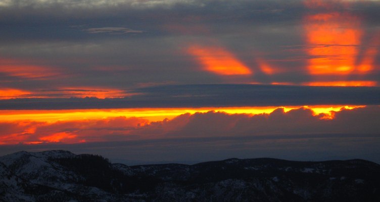
Jonathan was blazing away with his own camera after finishing his casserole dinner. As a professional photographer, Jonathan is used to taking pictures in places with outstanding scenic qualities. But more than technical proficiency does a photographer make. He notices things, sees things, that I miss or pass over. When he points them out to me, I can't understand how I could have missed them in the first place. That is the difference between the artist and the amateur. The horizon gave one last glow of orange, the sky turned midnight blue for a moment, and then the show was over.

We had stayed up until the late hour of nine thirty before the creeping cold drove us into the tent and our sleeping bags. Rain had fallen, briefly, overnight and a bit of fog was hanging around the mountains when I scrambled out of the tent to make tea. The fog slowly lifted as I drank my tea, revealing the a stunning framed picture of St. Helens and the cold land around it.

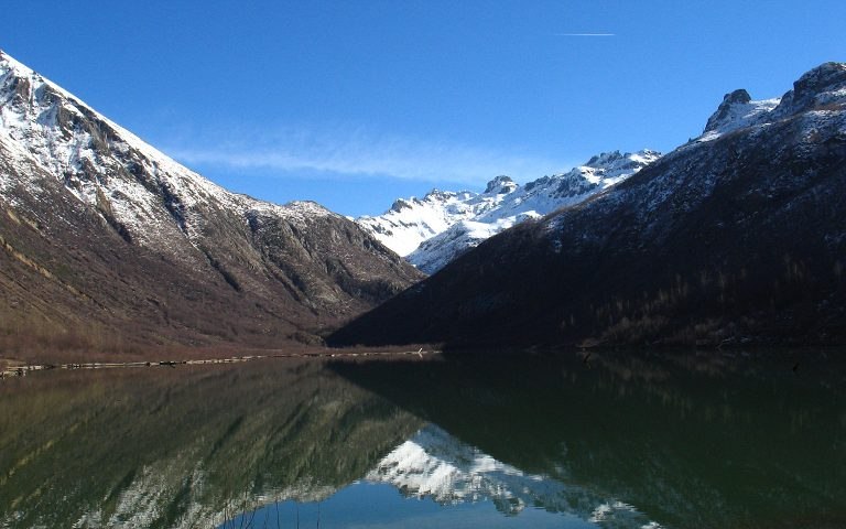
We quickly packed up our gear and set out to find the actual location of Ridge Camp, for we were most definitely not there. The park service never puts campgrounds in scenic places, apparently believing that where people go, destruction inevitably follows. We retraced our steps down the ridge line and dropped into a bowl where we found the camp: Viewless and soulless, as expected. We decided to take a trail along Coldwater Lake to get to the cars, but this meant battling through two miles of alder thickets to get there. Completely overgrown, the trail was difficult to follow as it was sparsely marked by flagging tape without an obvious corridor. However, a coyote had passed through recently and his line marked almost exactly the correct trail. Every time we would veer off in another direction, we invariably would become lost and have to fight back to find the trail, and the coyote tracks. After some suffering, we made it to the lake shore and started along the winding trail back to the road and the cars.
Jonathan and I split up as we each moved along the trail at our own paces, stopping where we wanted and hiking when we wanted. The sunny weather and warm temperatures were a welcome break from the rain and the cold that has characterized most of the fall and winter of this year. Being able to hike in just a shirt, not bundled up with vests and jackets, was a true pleasure, especially given the fact that it was February.
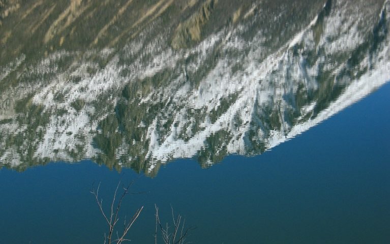
The lake was sprawling and stunning, with snowy mountains rimming it. The trail was easy: Flat, clear, stunning. So where were all the day hikers? The canoers? The families? The weather couldn't be any more perfect, the access to the trail was from a big road, and it was a weekend. Why wasn't the trail overrun? What could be so attractive that it could draw people away from this place? Shopping at the mall? Let chores rest for a while, put off meaningless activities for another time, clean out your shed on another day. I wouldn't have been quite as happy if the place was crowded with families out for a spree, but it would have made a lot more sense and I could have gotten in my car and driven away at least understanding something. As it was, I began driving home mystified by the lack of people, but thrilled at what I had been fortunate enough to experience, and at having a new playground that, it seemed, I could have all to myself in the winter.

Logistics
Drive I-5 south to SR504 (or, a bit further north, SR505) near Castle Rock. Take 504 east about 40 miles to the Coldwater Ridge visitors center. If you are planning on overnighting, stop off at the forest visitors center about 4 miles from Castle Rock to get a permit; otherwise, get one at the Coldwater Ridge visitors center.
You'll need a permit for overnight camping and have to stay in designated campsites. Reservations are recommended during the summer time and this is supposed to be a busy area, though we were the first people since October to have officially spent a night in the backcountry. You'll need a Northwest Forest Pass or Golden Eagle Pass or similar card, or pay $5 to visit the monument. To access the South Coldwater trail, drive down the Coldwater Lake access road and park either at the Hummocks trailhead if the gate is closed, or at the South Coldwater trailhead if the gate is open. Trail 230A ascends moderately, following at times an old road bed, for several miles, climbing up onto a lumpy ridge above the lake. Due to snow conditions, the trail was not safe after 4 miles and we climbed directly onto the top of the ridge and up to a prominent notch (5.4 miles). The descent down to Coldwater Lake via trail 230 is very overgrown with alders, but passable (not pleasant). Once on the lake, the route back to the road is quite nice and runs about 4.5 miles.
After hiking, stop in at the Toutle Diner, which is about ten miles east of I-5 on SR504. The food was quite good diner fare and hit the spot after a couple days of hiking.