Cub Peak, Olympic National Park
October 23, 2004
As the weather was supposed to be bad for the weekend, I had planned nothing. On Saturday morning, however, I saw a lot of blue in the sky, threw some stuff in a book bag, and headed out to the Staircase trailhead for a little exercise. I had planned to hike the stiff trail up to Wagonwheel lake and then come back down before the weather got foul. I parked, alone, in the lot and headed up the Wagonwheel Lake trail, which is billed as one of the steepest trails in the Olympics, gaining about 3,400 feet in a little under 2 miles. I was sweating, even in the cold air, by the time I got up to the highly unimpressive lake, but not particularly tired. A small beat path went around the micro lake and I followed it to see where it might head. Up, up, and up, it climbed directly and steeply into the alpine, rapidly leaving the cover of the trees behind. Although I was sweating rather too much for the amount of clothing I had with me given the cold wind that was blowing, I kept heading up the grassy slopes, now without a trail. Mount Lincoln came into view as I got up onto a ridgeline.
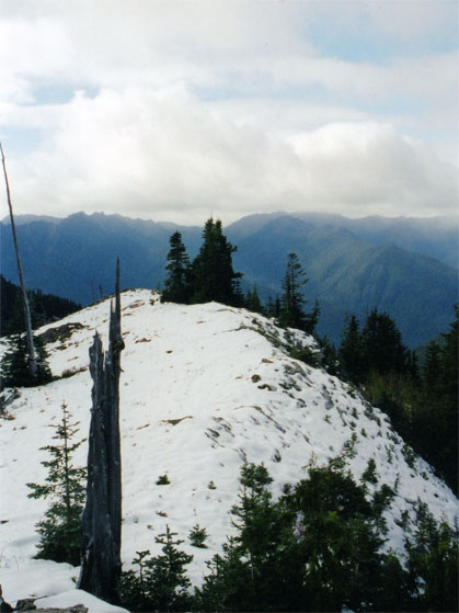
I followed the ridgeline across some early season snow to a prominent rock outcropping, which seemed to be the highest point in the area. Standing on top of it, I could almost imagine that I could see my car, except for the fact that the ridge I had just walked was inbetween me and it.
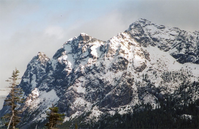
The cold, blowing wind brought some snow with it from the higher peaks, but I bundled up with all the clothes I had with me (a rain jacket). I probably should give up the idea that it is still summer and bring insulated clothes with me on my weekend rambles. I was warm enough to poke around a bit with my map and try to locate Mount Ellinor, which was the first scramble I did upon moving to the Pacific Northwest. I had gotten no reasonable photos from that trip as visibility was about ten feet. I set up my camera and took a timed photo of what I thought was Ellinor.
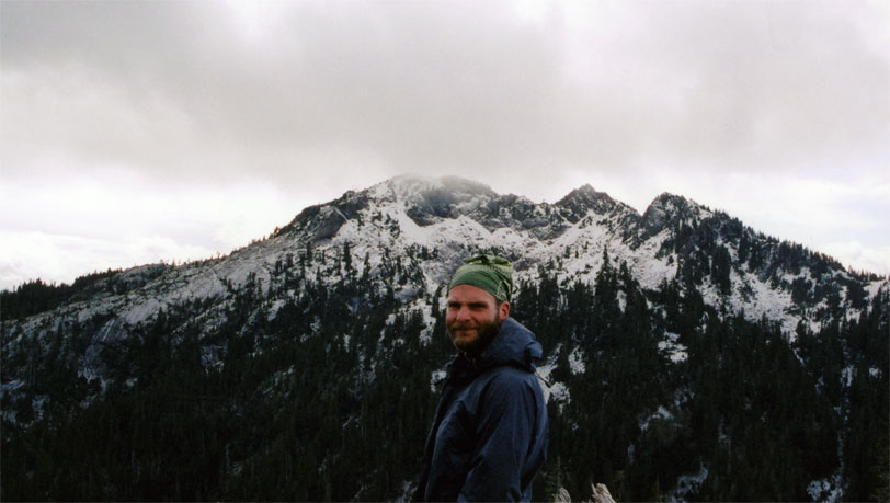
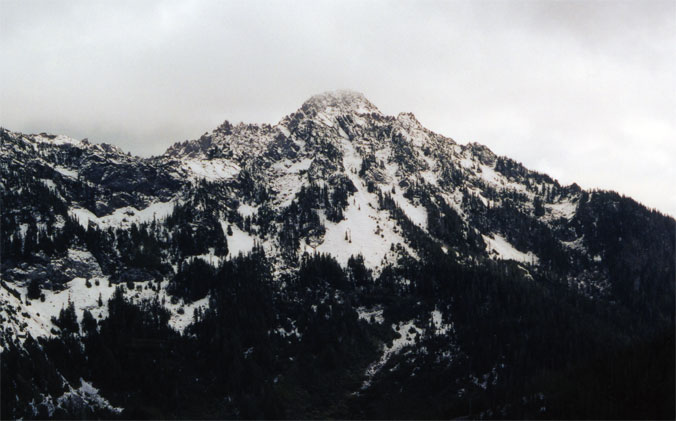
Rather cold, I set off down from the summit and back along the ridgeline, taking the time to get a snap shot of Copper Peak (my best guess), which loomed above Wagonwheel lake.
I made my way carefully down the slopes and picked up the beat track again, which led me back to the lake. I rumbled downhill, seeking some warmth, and passing several hikers on their way up. Back at the parking lot, I ran into a ranger who was turning off the water for some building and asked him if he knew the name of the mini summit on top, as my map told me nothing. "Cub peak," he told me. My belly replied, "Go home and get some pho."
Logistics
From Lakewood, drive I-5 south to US 101, and take it west and then north for about 30 miles to the small town of Hoodsport. In the middle of Hoodsport, make a left at the signed junction to Lake Cushman (SR 119). Drive SR 119 until it runs into a T-junction and make a left. The pavement ends after a mile or so, but the road is well graded and easy for my Camry. Drive to the road's end at the Staircase trailhead.
Take the Wagonwheel Lake trail and gain about 3,400 feet in less than 3 miles. The grade isn't so bad, but it is some work to get up to the lake, which is highly unimpressive. When you hit the lake, continue on the trail to the left and pick up an obvious climbers trail that leads up. The climbers trail occasionally fades out, but once you get above tree line it is pretty clear where to go. The slopes are mostly vegetated, but there are some bare rock sections. Take your time, as the slopes can be very steep in places. Once you gain the top, you'll spy a rock outcropping that is clearly the highest point in the area. This is Cub peak. There are nice views of all the big peaks in the area, including Lincoln, Ellinor, and Copper. I think Mount Cruiser is in view, but I didn't take a picture of it. Or, maybe my picture of Lincoln is Cruiser.