Mount Deception, Olympic National Park
June 23, 2007
The Eye of Doom was upon us. Or so said Wayne, in his usual Wayne way. For the third weekend in a row we were going to get smacked around by a low pressure system sitting off the coast of Washington. Kevin, the eternal optimist, was sure that the rain shadow of Sequim would protect us from the Eye and that all would be well. We countered with the fact that Mount Deception, being the second highest peak in the Olympics, would be well out of the rain shadow. Kevin raced his Outback up the gravel access road in the dark night and broke through the low lying clouds to find a single truck in the parking lot. John had taken the ferry across from Seattle earlier. Another John would be meeting us in the early morning. Despite the stars overhead, there wasn't a lot of optimism for the next day and we all made our trailhead bivies as secure as we could. Kevin and John in their vehicles. Wayne in a burrito made out of a tarp. Me in a more secure shelter located at every trailhead. Being early season, it didn't have much of a smell.
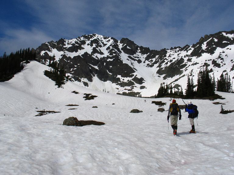
Four AM came around too early and I slept until 4:30 before waking the others. Although cold, the sky was clear when the second John arrived from Puyallup. Geared and girded, we set off up the trail at 5:20 AM hoping for the best. Mount Deception is big, but has a nice, mega-trail running for seven miles to near its base. Normally done in 2 days, we were going to push for a single day climb: Sunday's forecast looked far, far worse. The day dawned as a friend, rather than as a foe, and we were greeted at Royal Lake with blue skies and still wind.
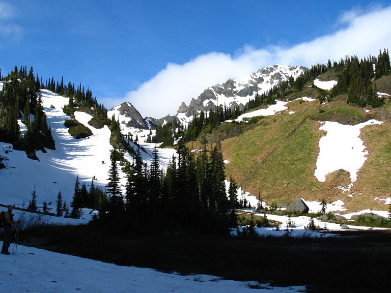
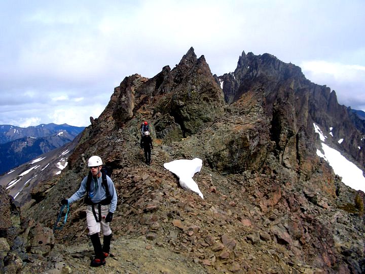
We worked around the lake and up to Shelter Rock, which marks the start of most climbs in the area: Bigger than a house, it would be a nice shelter in a storm. A good thing to remember with the Eye of Doom upon us. Above Shelter Rock we encountered hard, solid snow, causing those of us shod in trail runners to dance delicately upon its slick surface. We wound our way into the upper basin and were greeted with our first views of Mount Deception, though we could not spot our particular route. Clouds were beginning to gather.
Photos by K. Gallagher
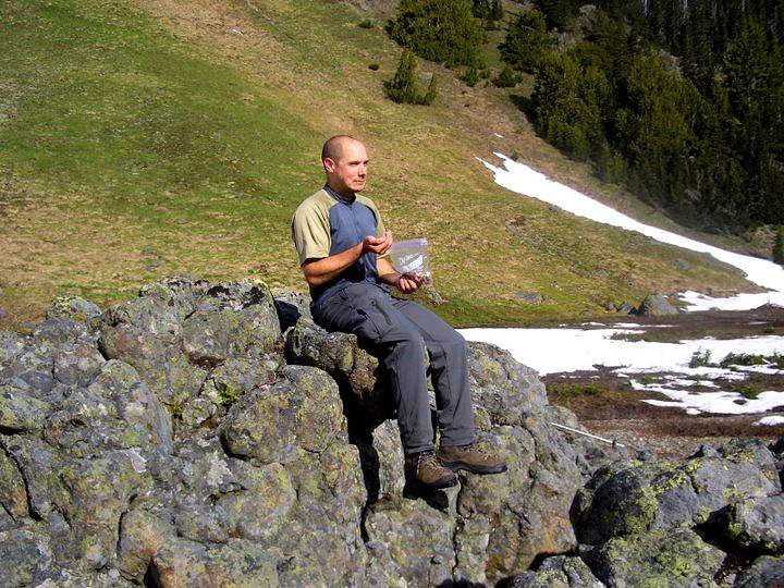
For now we simply relished the warmth that the sun brought us after slogging through the cold air of the shaded valley. It was hear, at a prominent rock, that we would leave our cushy shoes and trekking poles, and instead don boots, crampons, and ice axes. It was going to be a hard push from here.
From the big rock, we began the snow slog up a gentle gully that led to a few higher tarns. This is the point in every climb when moods are high, bodies strong, and it seems impossible that we could fail, or that something might go wrong. It is the time for optimism, when the sun in shining warm upon your face and a little breeze cools you gently. It is that time when alpine climbing seems easy, enjoyable, and makes perfect sense. It never lasts, and does not return until you've made it safely down the mountain.
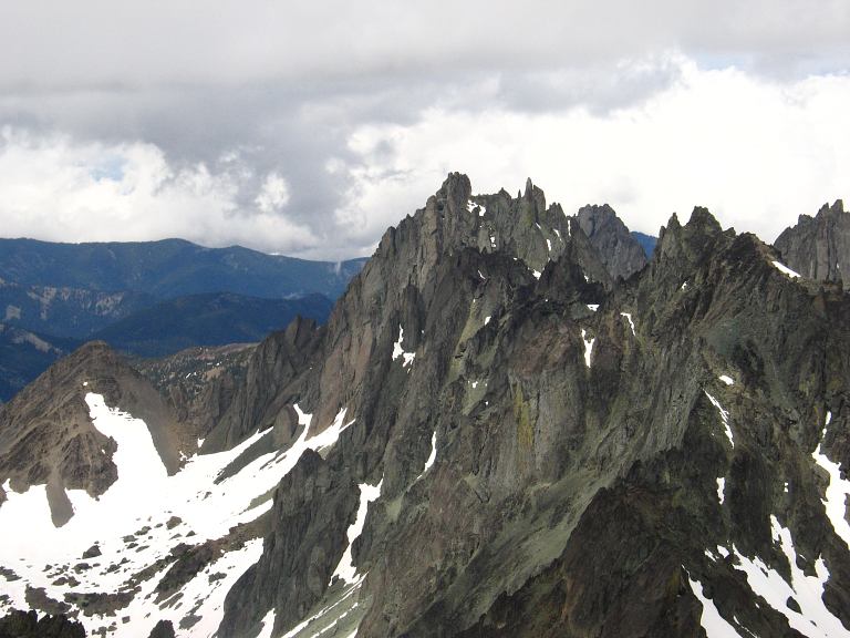
When we crested out of the first snow gully and reached the level of the tarns, we got our first complete look at our route and the mountain. The feeling left as it finally dawned on me what a serious endeavor we were on: Deception was big, steep, and loose. It looked like we would be able to stay on snow most of the way and avoid the choss that could cause a rapid descent (thanks to gravity) or a knock on the head.
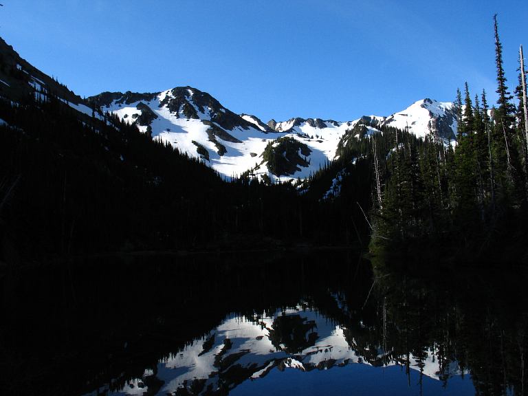
Royal Basin is one of the jewels in the park: A wide valley with soaring mountains above it. Deception stands at the head of it. Running off it to the right was Martin Peak and we planned to climb to the notch in between the two mountains to begin with. Past Martin Peak sat the Needles, Mounts Johnson and Clark, and a host of unnamed spires that begged to be explored. Most people came to the basin to camp and explore a bit and it was popular enough that the park service had tagged it with a quota system for overnight campers. It was calm, idyllic. A place where you could spend a few days wandering around and thinking for a while. For us, it was the last bit of secure land before the climb, and marked our return to safety at the end of it.
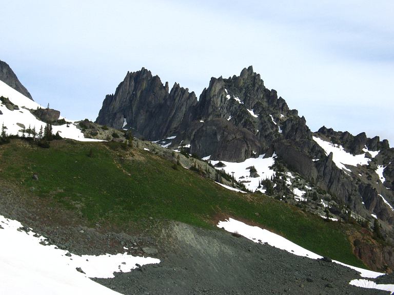
Photo by K. Gallagher
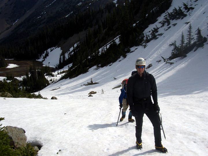
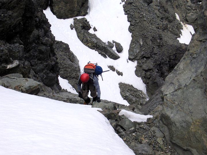
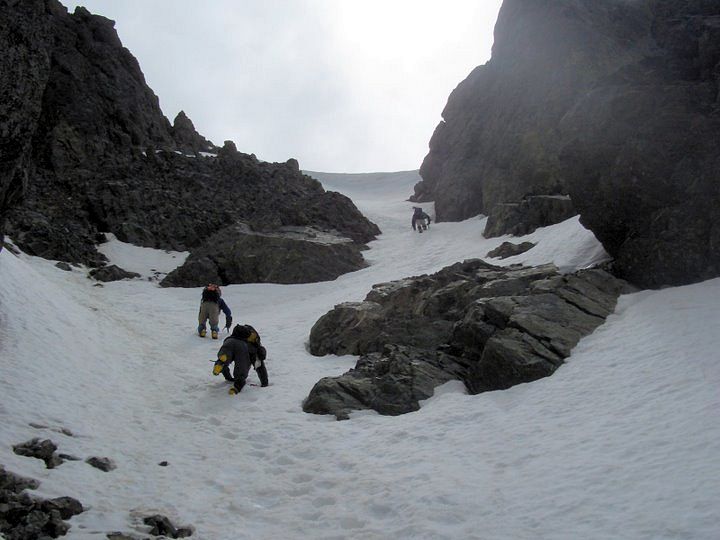
We left the upper basin and begin slogging up the firm, but rapidly softening, snow onto the lower reaches of the mountain. Our pace slowed as we kicked bucket steps up the rapidly steepening slope. From a gentle 30 degrees, it stiffened to 40. We crossed a bit of rock to gain access to the snow fields underneath the notch between Martin and Deception, then resumed our climb. The slope steepened to 45 degrees. At this grade, a slip means a very rapid descent and arresting a fall with an axe becomes nearly impossible after the first second or two. The rocks jutting out from the snow below us, that we had climbed past, made serious injury likely. The entire mountain was a no-fall zone. Wayne, Kevin, and I took turns leading on the snow, higher and higher, and eventually on to the ridge.
The optimism at the lake was fairly well gone, but a deep drink and a Milky Way bar brought much of it back as we stared at the high flanks of the mountain. We had two options here. The standard route would descend the other side of the ridge to a small glacier below, traverse around the upper portion of it, then climb very steeply to the summit ridge. However, there was a rather massive cornice on the ridge and climbing around it was questionable. We stuck with our original plan, choosing to stay on our side of the ridge, dropping down a bit to access the gully that formed the Honeymoon route. The snow looked like it was starting to thin our on portions of it, but it was impossible to tell the conditions from our vantage point: We'd have to try it to find out.
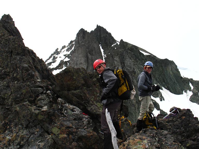
Photo by K. Gallagher
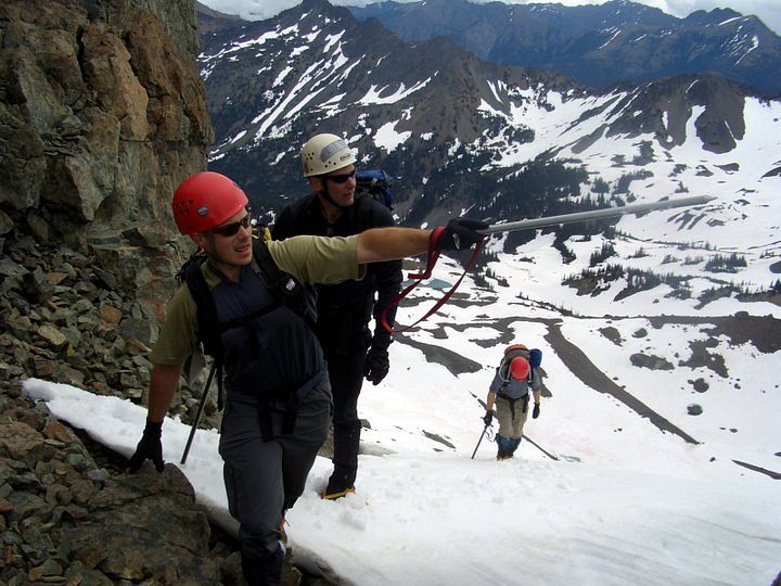
We worked our way down along the loose choss of the ridge and traversed toward the peak. Several unpleasant scrambles were passed, complicated mostly by the loose rock and uncertain footing. Indeed, we were in a range were you had to test every foot and hand hold before weighting it, making scrambling time consuming.
We reached the end of our traverse and re-donned crampons for the last snow. The gully looked better from here, but we could not see into the upper portion of it. If the snow ran out, or became too thin, climbing would become very unpleasant, though not un-doable. We down climbed for a bit to get below some jutting rocks and then took a direct line into it.

The traversing and climbing took some time, as Kevin and Wayne kicked out huge steps for those to follow. I was happy to leave them to it and play sweeper. Our pleasant sunshine was gone, lost as the Eye of Doom spotted us making progress toward the top of the peak. We had a window, but no idea how long it would last. The other side of the valley looked miserable, completely unfriendly, utterly depressing. As long as the weather was there, it wasn't here, and we had our chance.

Photos by K. Gallagher
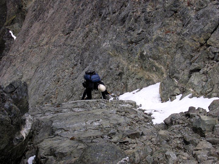
The forty five degree slope held mostly good snow, but occasionally it became too icy or too thin to support an ice axe belay. We negotiated a rock step in our crampons, and then moved around a problematic coating of icy rock, our confidence growing with each step. Near the top, when success seemed assured, we had a choice of two gullies to follow. Kevin led into the left hand one, climbing up to where a block of icy rock required some deft crampon climbing moves overcome it. Wayne and I, being the last climbers up, did not have the advantage of a slab of ice, since broken off, and had to chimney up the bit of rock. With metal spikes on your feet, this isn't especially easy or confidence inspiring.
However, we made it through and joined the others at the top. I saw Kevin scouting for something and my spirits dropped. We were not at the top, but rather at a false summit about a hundred or so vertical feet from the actual summit. We would not be able to get there from where we were. We had to retreat. Climbing up is always easier than climbing down, which we now had to do. One by one we worked back down the rock step and into the middle of the gully we had just expended so much energy to come up. I was very happy that all of got down below and back onto snow with out a fall.
We downclimbed our steps as quickly as we could, for a storm was coming at us from the mountains to the northwest. It had been hung up on them for sometime now and had finally broken free. We quickly kicked steps up the very steep gully and gained the ridge at the top. The true summit was insight and in our reach: Traverse a low angle scree field and make one last steep snow climb to the top.
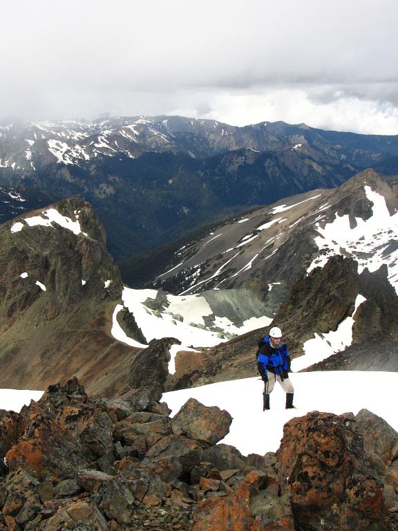
It was 2 PM when we topped out and celebrated, though our cheers were muted by the oncoming storm and the technical work to be done to get off the mountain and back to the safety of the tarns.
Mount Mystery, one of the more stunning peaks in the area and the covergirl of the current Olympic Mountains climbing guide, sat a mile off, beckoning us for a future trip.

Being the highest peak in the park next to Mount Olympus, we should have been able to see everything. Instead, we had to settle for the merely spectacular views of the local mountains. Everywhere it was storming. The Eye had not yet found us, but we didn't have much time left.
In what was, perhaps, the shortest ever stay on a summit, we quickly snapped off photos, ate a snack for the descent, and geared ourselves for the storm. I managed a smile, despite my worries over how the various rock steps would be if we were in the middle of a snow and wind storm.

Photos by K. Gallagher
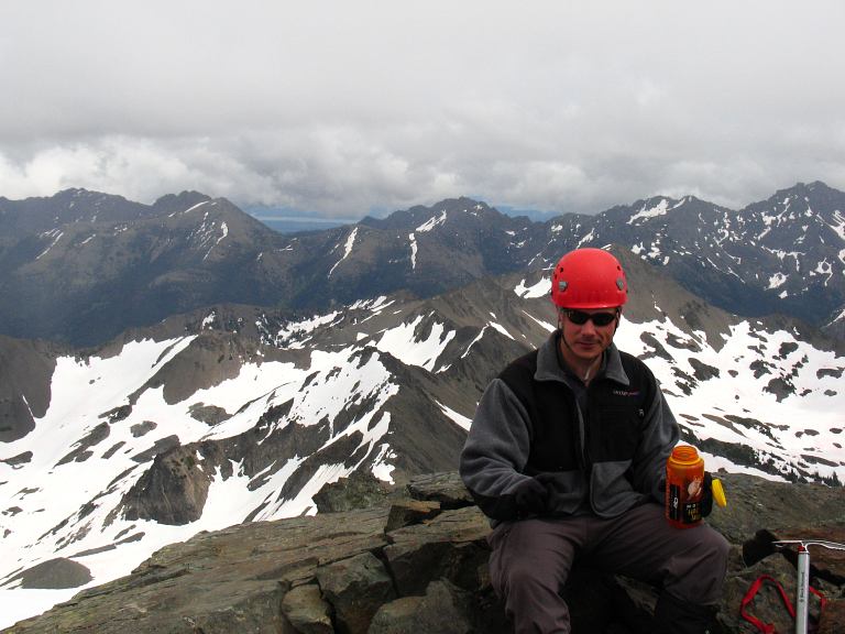
Here is our full party. In front, from left to right, are me, Kevin, and Wayne. In the back are John from Puyallup and John from Seattle.

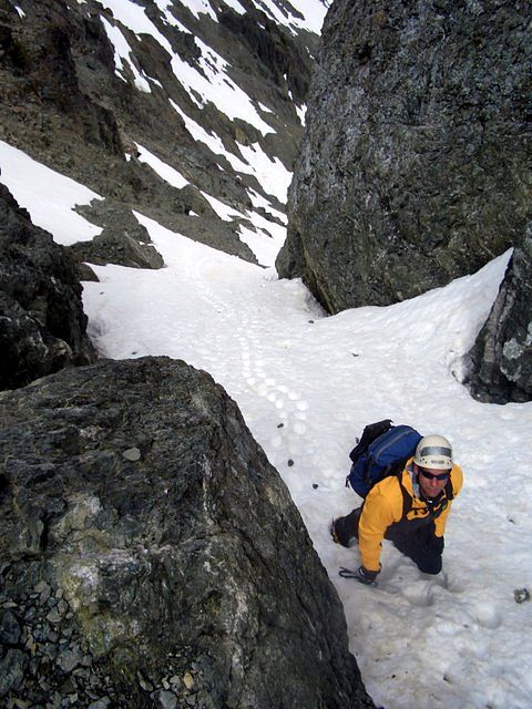
With the group photo, our time on top was over and we started to hustle off the top of the mountain. Below you can see John (red pack) and me, beginning to down climb a bit of steep snow.
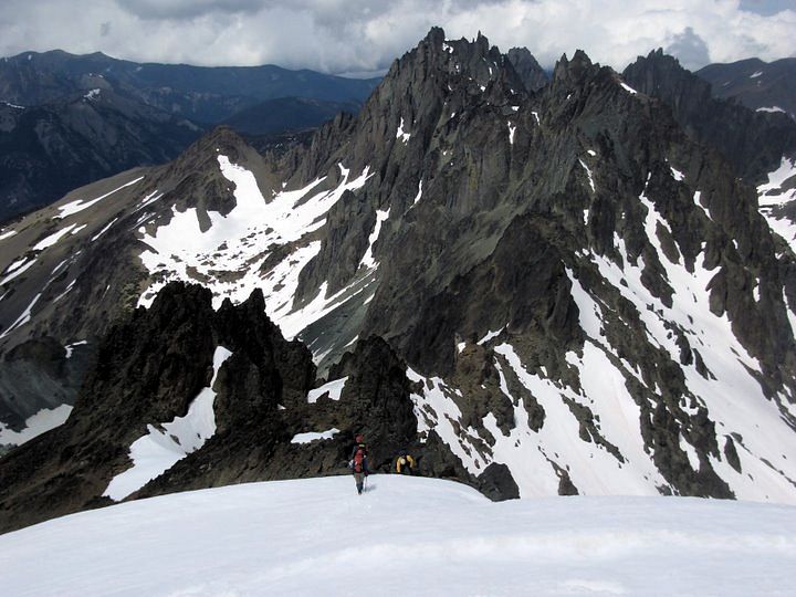
We retraced our steps to start of our ascent route and pondered taking the glacier route back. It had much safer run out and, once across it, we could simply follow our steps back down. However, it was just as steep as what we had come up and, moreover, was unknown. After a few minutes of debate, we settled on our ascent route and I led down over the vertical lip of the ridge, dodging a few pieces of rock that came down. The mountain is loose and rockfall is inevitable. However, we tried to stay close together so that when rock came down, it wouldn't hit with as much velocity.
Photos by K. Gallagher
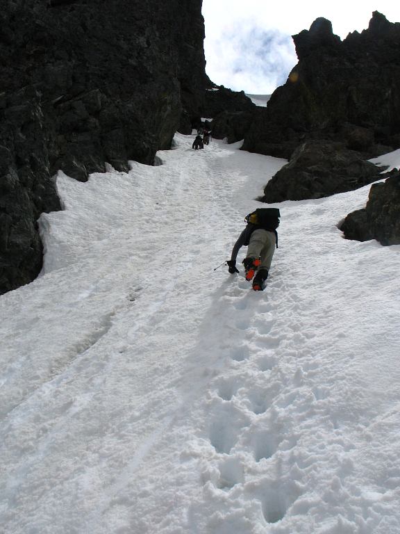
Here is another photo of the down climb that we did that Kevin took of Wayne and the two Johns coming down. The top of the gully is the ridgecrest that leads to the summit.
Here is more of the work yet to be done. Our steps helped in downclimbing, but I frequently had to re-kick steps so that the distance between them was shorter.
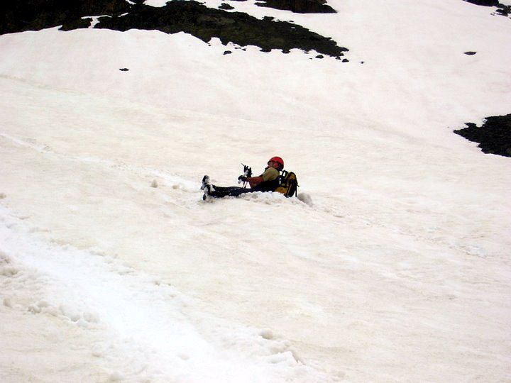
The storm hit just as I passed the icy rock that had proved difficult on the ascent. Then the storm went away. The ice was worse descending it and I had to put a lot of faith in the front points of my crampons and the strength of thin ice. Then the storm came back. I finished down climbing to the rock step and rested, waiting for the others to converge. The storm ended. The group re-assembled and snacked at the ledge above the rock step, with Wayne eventually finding a nice butt-scooting, short gully that allowed us to bypass the step completely. The storm returned, this time in full fury, as we downclimbed through the snow. Kevin put more faith in plunge stepping and got below the last of the rocks ahead of us downclimbers. I looked between my legs and saw him glissading down in a hoot. The storm had abated when I reached the same spot and stripped my crampons in preparation for an 800 foot butt slide. One by one the others arrived at the bottom end of the slope, with Wayne showing off a sweep 180 finishing move.
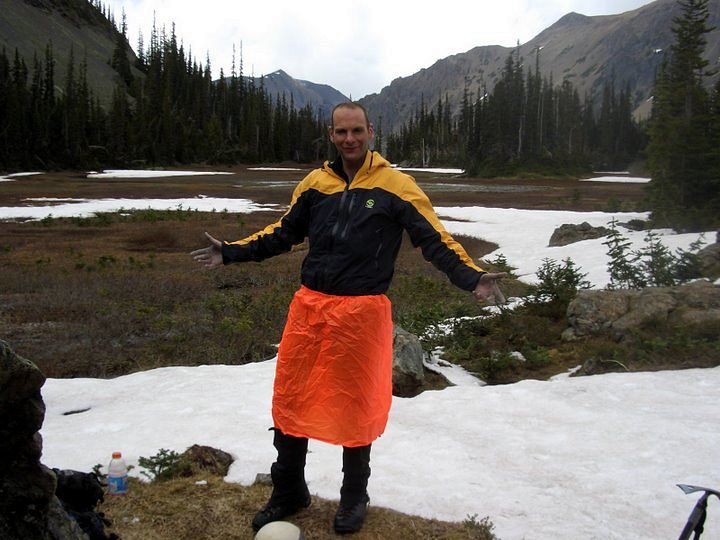
The spirit came back now that we knew we were safe. It didn't matter what the storm did, for we could just walk out on the non-technical terrain. We would be off of snow within an hour and then back on trail. Laughs and taunts echoed through the upper basin as we descended to our cache, snow and rain falling on us occasionally. Plans were already being made for Mount Mystery. Talk of beer came up from time to time. Kevin broke out some tele turns on the remaining slope. Our stash was unmolested by the resident deer and marmots, for which those of us expecting to walk out in trail runners were especially thankful. We quickly stripped off our technical gear and replaced it with more comfortable stuff, eating the last of our food and drinking the last of our water for the walk out. Deception was a big climb, but now that we were done with it we could again laugh and smile and make jokes. The time for being serious was over. The time was optimism was back.
Logistics
Drive I-5 North to SR16, and take SR 16 across the Tacoma Narrows bridge. Join with HWY 3 and roll through Bremerton all the way to the Hood Canal Bridge. Cross the water and join up with US101, heading toward Sequim. Just at Sequim Bay State Park, turn left onto Louella road . Drive about a mile up hill until you T into Palo Alto road. Make a left and follow this paved road past trophy homes for about 7 miles. After a big bend around a working ranch, you'll find a fork (marked) in the road. Make a right, folllowing the sign for Dungeness trail. The narrow, unpaved road drops you down for a mile to the Dungeness Forks campground. Keep going on the road (which is now 2880) and you'll make it to the trail head for Royal Basin in about 10 miles. You will need a NW Forest Pass or equivalent to park there. You'll need special reservations to camp in Royal Basin.
Mount Deception is big and dangerous! Do not bother climbing it after snow has melted from it, as it would become one giant choss heap and you would most certainly die. From the trail head, hike 7 easy miles, gaining about 2000 feet in elevation, to Shelter Rock in Royal Basin. This rock is massive and you can't miss it. Continue on the trail to the upper basin until you can spot Mount Deception: It is the big, hulking mountain at the end of the valley. If you can't see it due to weather, turn around. If you can, continue up snow slopes past several tarns and begin the steep, nearly continual 45 degree snow climb. We took the Honeymoon Basin route, which is really just the most direct route to the top. Spy the prominent snow gully that looks like the most direct one. Go straight at it. Do not bother climbing to the ridgeline as in the Olympic Mountain guide: You'll just end up traversing on crappy rock. If the gully isn't filled with snow, turn around. Near the top of the gully there is a branching, with the right branch being the correct one. The left one will leave you 100 feet short of the summit with no way to traverse to it. We did this in 14.5 hours, car-to-car. If we hadn't of climbed to the ridge or gotten lost in the left hand gully, the time would have been about 2 hours less. Still, the climb is very strenuous and many people might prefer to camp overnight.