Mount Gladys
November 20, 2004
The weather for the weekend looked good for the first time in several weeks and so I packed up my kit and headed out to the Olympics for a short overnight trip to the Olympics. I was planning to hike up the North Fork of the Skokomish trail and then up to Flapjack Lakes, where another trail would take me to the Gladys Divide. Some easy cross country hiking would bring me to the top of Mount Gladys and then a bit more to the Murdock Lakes, which are the source of the Hamma Hamma river. Being outside of the park, you don't have to pay to stay there, which I thought nice.
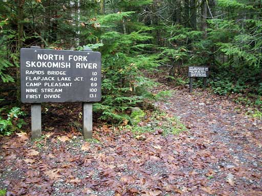
I left the Staircase trailhead, which is the same as for Wagonwheel lake and Cub Peak, around 10 in the morning after driving up from Lakewood. Like most of the trails I have experienced in the Olympics, this one starts in the rain forest, but unlike most others, it climbs very slowly and gently, following the Skokomish upstream.
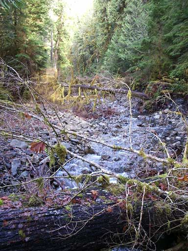
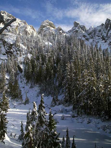
At the junction with the Flapjack lakes trail, the trail stiffened, but soon leveled off and began a contour through the forest, with occasional views of the snowy mountains on the other side of the valley coming out every now and then. After bending around and into a valley holding Madeline creek, the trail began to climb in seriousness and I started to sweat, despite the rapidly cooling air. As I crossed above 3000 feet I began to run into snow, and more of it than I expected. A few weeks ago I had met with some snow on the way up to Mount Rose, but not the kind that you might sink into. By the time I reached Flapjack lakes, at 3900 ft, I was in a winter wonderland with six inches of snow covering the trail and more falling from the trees above me.
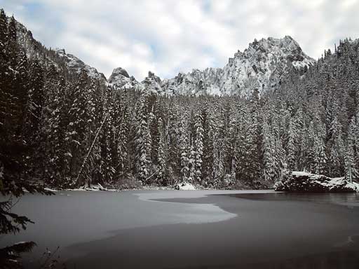
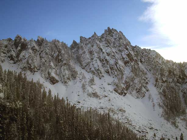
A big mountain, presumably Mount Cruiser, stood directly above the lake and marked the Sawtooth ridge quite distinctly. Because everything was snow covered, I had to hunt around a bit to find the trail up to Gladys Divide. As I climbed, the snow began to get deeper and my trail runners became soaked through.
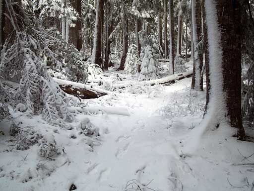
Snow fell heavily from the trees, sometimes dropping onto my head and sending cold flakes down into my jacket. As I approached Gladys Divide, the trail entered onto an open slope than was completely buried in snow. I took out my ice axe and sunglasses and set off through the sometimes knee deep snow. After perhaps 80 yards of traversing, I reached the other side but could not find where the trail picked its way through the forest on the other side. On the other side of the valley stood the Sawtooth Ridge.
Perhaps 300 vertical feet above me was what I presumed to be the summit of Mount Gladys. The slope was open and, if the snow was as deep on all the way up as it was here, it should be an easy, if steep (perhaps a 50% maximum grade, with some 30-40% stretches), snow climb to the top. The snow was fresh and not firm, which meant that I should be able to use without needing crampons (which I didn't have anyways). I abandoned the idea of reaching the divide and going up from there, and instead headed up the slope, switchbacking occasionally to make life easier. Unfortunately, there were many places where the snow was thin and I had trouble gaining enough traction to move uphill. To make matters worse, my ice axe frequently bounced off of rock that only had an inch or two of snow covering: No belay was possible. I gained elevation, but my safety margin was slipping to a rather thing edge as the snow got thinner and thinner near the top. Finally, with the valley several hundred feet below me, and the top only about 20 vertical feet above, I decided to call it quits. There just wasn't enough snow on the rock gain traction or to plant my axe: I kept breaking through the inch or two and slipping down the rock. I sat in the snow on a relatively flat part and stared at the top, tantilizingly close. Even if I didn't get to see what was on the other side, the views from here of the Sawtooth ridge and Mount Cruiser were good enough.
I glissaded part of the way down, then walked down a bit taking care on the rocks, then more glissading, more walking, more glissading, until I reached the trail once again and began the return trek to Flapjack lakes. Although I could certainly camp there with my tarp, it occurred to me that, as it was only a little after 2 pm, I could probably make my car not too long after dark and get back to Lakewood in time for a bowl of Pho. I hadn't put in a long hike for quite a while, and the idea of an almost 20 mile day hike sounded good. I reached the Skokomish trail around 4, as light began to fade, and hustled down the trail to my ride. I ran out of light about a mile from the end, but neglected to take out my headlamp, choosing to walk in the dark of the deep valley instead. I got back to my car at 5:15, feeling satisified that I could still put in a long day when I wanted to and began racing back to Lakewood for that big bowl of steaming Pho that had driven down from the frigid confines of Flapjack lakes.
Logistics
From Lakewood, drive I-5 south to Olympia and exit onto US 101 (exit 104).Take 101 north from Olympia to Hoodsport, about 30 miles away, and turn left at the sign for Lake Cushman (SR 119). Drive 10 miles to where SR 119 T-junctions. Go to the left. The pavement ends after a couple of miles but the gravel road beyond it is in good shape. It is about 5 miles to Olympic National Park and the Staircase trailhead at roadsend.
The trail head is at 800 feet and Flapjack lakes are at 3900 feet. But, the first 4 miles gain you only 700 feet. At 4 miles, you'll junction with the Flapjack lake trail, which you take uphill. After a short climb, it levels out until you reach the bridge across Madeline creek, after which you have to put some work it. Near the sign at Flapjack Lakes, there is a trail off to the left, away from the lakes. This is the trail to Gladys Divide, which is about 1.5 miles away and a few hundred feet vertical feet up. Near the divide I got lost and tried to directly climb Mount Gladys. When the snow is deeper, the climb should be a lot easier, but avalanche danger will also be higher, as the slope is moderate and very open (it looks like slides are frequent). Be careful!