Kendall Peak, Alpine Lakes Wilderness
November 15, 2008
I was feeling rather nostalgic late in the week and decided to pay a visit to the closest stretch of the PCT that I could find. This also happened to be one of the most important for me when I hiked in 2003. Besides scratching my itch, I also had a new camera to try out before heading to Argentina in December. There were two other groups of hikers in the parking lot when I arrived and I set out in between the two of them.
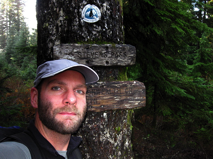
The new camera is a Canon SD790IS and is small enough to easily fit inside a chest pocket on my climbing jacket on in a zipper pants pocket. Although I really like shooting pictures on a dSLR, it is just a little much to haul up to the top of a 23,000 foot mountain. The small size is really nice, but as you can see in the below photo, chromatic aberrations are really awful! Look in the upper left of the photo and spot the purple fringing on edge of the tree.

I passed the first group quickly and then had the whole trail to myself. The climb out of Snoqualmie Pass was quite enjoyable, with an en easy grade and the fragrance of fall in the air. The alpine zone has a much different smell than the valley floor and as I lifted off the ground I found the change to be rather intoxicating. Rotting leaves, crisp pine needles, cool air. A nice view of Commonwealth Basin presented itself, with Red Mountain on the right and Lundin Peak on the left. I've tried to climb Lundin several times, but each time failed due to weather or general cowardice. The avalanche gully to the right of the main peak is a freeway to the top in the winter when snow covers it and avalanche danger is low.

The PCT went back into the woods for a while and I was able to hike lost in thought and nostalgia instead of ogling the scenery. In 2003 I realized once leaving Snoqualmie Pass that I was going to finish the whole PCT. I knew several hundred miles earlier that if I continued hiking they way that I had I would be able to make it to Canada. But here, about 240 miles from Canada, it finally dawned on me in a very concrete, hammer-over-the-head way, that I would be finishing the PCT in a little over a week. And this was a bad thing, I thought, back then. I was right. The PCT emerged from the woods and broke out into the rocky alpine zone that fills much of the remaining distance of the PCT to Canada. Snoqualmie Mountain hulked in the distance, covered in a thin mantle of the white stuff, with Lundin a midget at its side.

When I hiked through, every step I took was bringing me closer to the end. I was tired of hiking and beginning to get weary. I had covered a great distance and had grown in leaps and bounds during the short summer. I was ready to be done hiking, but I didn't want to go home. At home the only things waiting for me were my job and my stuff, neither of which I particularly wanted anymore. Across the valley, Chair Peak rose up and actually looked worthy of climbing. I knew better, though.

I made my way across the open talus field, went through a couple of switchbacks, and arrived at the spot. More than five years out, I can still remember taking a rest here where there was a nice view of the mountains and, more importantly, down to the interstate and the ski resort. That day in August I sat up here and looked down upon the little grey coffins making their way to, well, where ever they happened to be going to. Birdie was still down in the hotel room doing laundry and, unknown to me at the time, mailing me a chocolate bar to Stehekin in case she couldn't catch me before I made the border. She ran me down the next day and we finished the PCT together. Soon, I thought back then, I'll have to get into my own little coffin, put on the uniform, and go back to work. Be respectable. Orderly.

I turned the corner and trudged through some light snow and ice that was on the trail. Mount Thompson loomed in the distance and I was surprised that I had actually managed to climb it. In the below photo, it is the black pyramid sticking up on the left through a ridge of mountains in the foreground. I climbed the West Ridge, which is the left skyline, back in 2007. The "Snoqulamie Picketts" showed up more prominently, comprised of mountains such as Lemah, Chimney Rock, Burnt Boot, Overcoat. They don't see a lot of traffic due to difficulty of access and rock of questionable character. People prefer to drive to the real Pickett range in the North Cascades if they want to suffer on the approach.

I had originally intended on scrambling up to the to of Kendall Peak, but decided instead to sit at its base and drink tea, The view from here was just as grand and, besides, I actually don't like to summit. I found some dry rock to lounge on and ate a sandwich and Snickers bar while the water for tea boiled away. Below me was deep gulf with big mountains in the distance. I sat and reminisced about 2003 and all that I had done since then, which was exactly the purpose of coming up here. I knew back then that changes had taken place and that I was going to have to spend time trying to understand them. I was still trying to do just that, though I felt that I had finally turned the corner on the problem. That I had, if nothing else, traction.

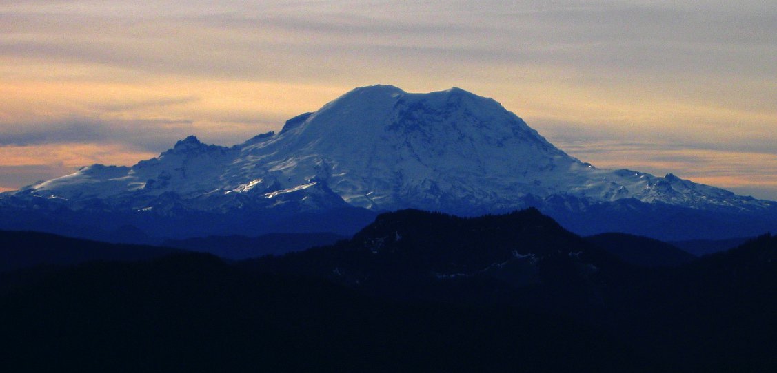
A few scramblers came up and started picking their way slowly up the rocky slope of Kendall, perhaps 100 or 150 feet higher than I was. They gave a whoop on top and then I saw them no more. Just before I left to return to the parking lot I heard a large amount of rockfall, but no screams and I encountered no bodies on my walk out. I went back out to my resting place from 2003 and admired Rainier (aka, the Big Fatty) from a safe distance. I needed to go back there this spring, I thought. The life list just grows. But for now I felt like I had been able to make a decision on the problem, or rather opportunity, that was vexing me and was the reason for coming up here. I looked at Rainier and the trail. It ran to Mexico in one direction and to Canada in another. All you needed to enjoy it was time and desire. I set off for the parking lot, pleased with myself and my future.
Logistics
From Lakewood, drive I-5 north to State Highway 18 and follow this to I-90. Head east on I-90 to exit 52 (marked as "West Summit") and get off the interstate. Make a left from the off ramp and drive a hundred feet or so to the entrance for the PCT trailhead (first right. The sign is currently missing). You'll need a Northwest Forest Pass to park legally, or something equivalent Hop on the PCT and hike up to where the trees end and your at a large boulder field, about 6 miles or so. Continue along making two switchbacks. When the trail makes a dive to the right, you're at the base of Kendall. You can scramble up here or continue on the PCT to the backside of Kendall and scramble up there. Or, sit at the base and drink tea knowing that you're only 100 feet from the top and the view isn't any better up there. It is about 7 miles to the backside of Kendall with a total elevation gain of little under 3000 feet.