Mount Margaret, Mount Baker - Snoqualmie National Forest
January 21, 2006
For the third Saturday in a row, I was heading up to Snoqualmie Pass in beating rain. The rain stopped as I neared the pass and turned in to lightly falling snow. Having gotten a later start than normal, I found the Gold Creek Sno Park completely full, with cars lining the roadway for almost its entire length. Fortunately, there were two slots at the very end. Even more fortunately, I was hiking off from the far end of the road. I geared up and set off down the forest service road, which had a nice thick layer of well compacted snow, courtesy of the local snow machines.

For a mile I pushed along the flat road, wondering when the climbing would start and amazed at the lack of people on the track. Given the number of cars, I was expecting a zoo. Instead, after rounding a switchback and starting to climb, I left the sounds of the interstate behind and found myself in the lucid serenity the snowy woods. I climbed for thirty minutes in the peaceful forest, neither happy nor sad. I wasn't numb: I simply did not feel any separation between myself and my environment. Some snowmobilers came blazing up the trail while I was resting, their two stroke engines wailing. Most definitely different from their environment.
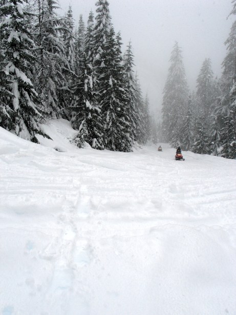
I passed a trailhead and kept moving up the road, passing through a few clearcuts, and enjoyed the serenity of the woods. Small things became beautiful, like a bit of a bush sticking out of the snow. Or the way that the snow formed under the wind into rolling dunes. I found a side track heading off to the left and, as the road started to descend after the junction, I took it and began plowing up hill, following a snowmobilers track. The machine had come through a few days before, judging by the snow, and I had no worries about being run over by someone with a Git-R-Dun sticker.

The sun began to come out as I switchbacked up the slope, though it was still cloudy and misty. The valley below, holding I-5 and Keechelus Lake, could barely be seen. Better than before, I thought.

As I approached the top the wind began to blow, causing my sweat soaked face, the only bit of skin exposed to the air, to chill quickly. The top of Mount Margaret was rounded and smooth and I suspected that the true summit was somewhere in the mist above me. Keechelus and the valley below, rime covered trees in front of me.
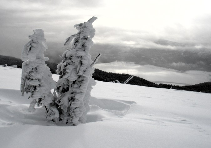
Margaret was a real stunner, I thought. Margaret would be hideous in summer, I thought. The snow and mist and cold made it attractive. When summer came, the ground would be bare and the stumps of the trees visible and no one would come here, especially when sexier options in the Alpine Lakes could be had just a few miles north. I stayed for a few minutes admiring the land while I could, but I was rapidly chilling. I turned around and headed down toward some thicker stands of trees where I could make some tea in the sun before heading back down to the snowmobilers and my own car.

Logistics
Drive I-5 north to SR 18 and head east on that fine road until you hit I-90, which you take to the east as well. Drive to the summit and turn off at Exit 54. Make a left turn and drive a few hundred yards, crossing under the freeway, to the access road, which is plowed. Make a right turn. Drive about a mile down it to the end of the plowed road and park along side it. This is the Sno-Park.The trailhead is marked with a sign, but little else.. You'll need a Sno Park pass, which will run you $21 for the full season. Snow machines are frequently met with on the road, so be careful.
Snow shoe up the road about a mile to the crossing of Wolfe Creek (marked), just past which the road makes a swing to the left. Moving uphill now, the next marker you'll find looks like a trailhead for Lillian Lake. Ignore this trailhead and keep going uphill, quickly passing a sign telling you there is a trailhead in a half mile. When you get to that trailhead (marked), ignore it as well. About 100 feet further on is an unmarked, quite wide "trail" heading up and to the left (the road you were on starts to descend). Follow the trail to the left and snowshoe up, switchbacking frequently, for about forty minutes to an hour to reach the top of what might or might not be Mount Margaret. It took me two hours and 10 minutes to get up, which includes a 15 minute break and time spent figuring out which way to go. My guidebook lists the top as being 4.5 miles away and about 2400 feet above the trailhead. I don't think I actually stood on top of the peak itself, and doubt that it is more than about 3.5 miles and 2000 feet of gain.