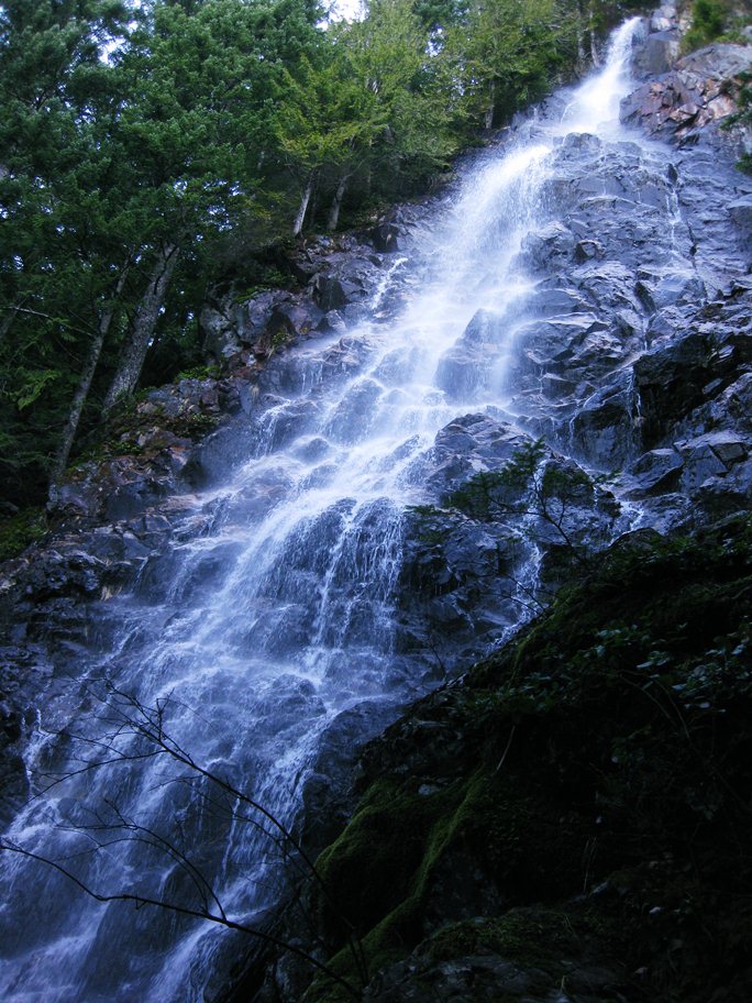
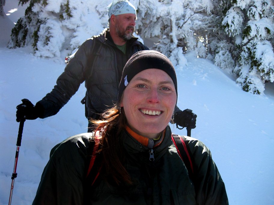
It had been a long winter for us, with very little backcountry activity, save for a few days of skiing, since our climb up Mount Adams last October on final good weather weekend of the year. We had been working on the house and the garden and I had ridden a few brevets, but the smell of mountain air wasn't something we had indulged in for some time. Spring had finally arrived in the Pacific Northwest and May Day promised to be the best day of the year yet. The sky was glowing pink and orange over Puget Sound when we got out of bed at a time far too early for a Sunday in order to drink coffee and be ready by the time Geoff and Ben picked us up at 6 am. We were going to scramble up Nicad Peak, a local mountain near Puget Sound whose summit had completely escaped my attention for the nearly seven years that I had been living in Washington. After a stop for bagels we unloaded in a parking lot with eight other cars and started up the well graded trail. My cycling fitness was increasing rapidly, but I was worried about the steepness of the hike. The worries were misplaced and I found my body reacting well to the grade up to the falls, which I thought to be the equal, or better, than the better known samples throughout the regions.
The falls marked the end of the well constructed and
graded trail and signaled the beginning of the steep sections, with
rocks and roots and mud forming much of the pathway. The steepness
actually felt good as we ascended rapidly above the falls and to a
ridgeline. This was no Mount Si, with its perfectly manicured and
loved trail and even grade. And hoards of hikers. The trail was more
or less empty, with only four other hikers being spotted. Snow
covered the path shortly after we passed 3000 feet, a fact that we
all found humorous given the late spring date.
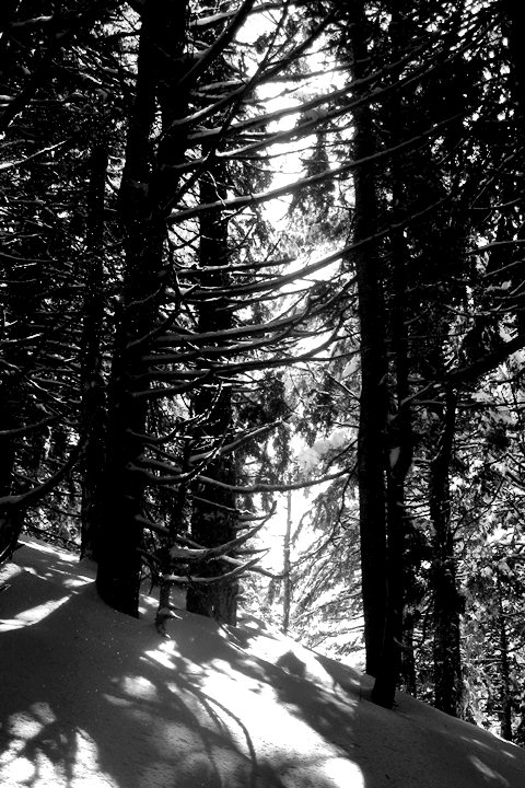
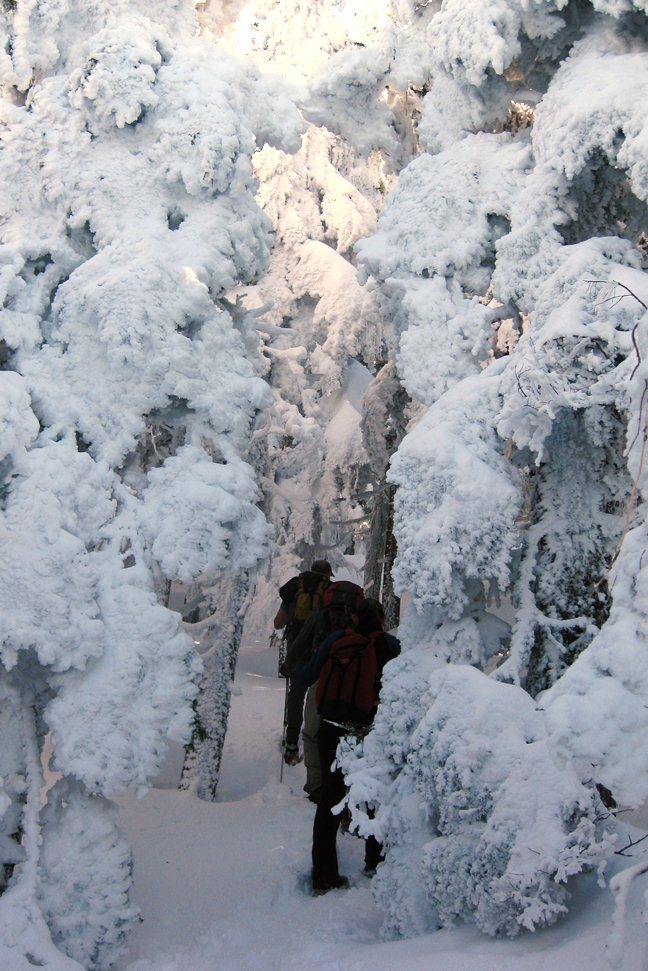
For some reason I had thought Nicad was lower than it actually was and as such Shauna and I were clad only in trail runners, without traction devices such as those that Ben and Geoff donned. We skated behind them as best we could as the trail left the ridgeline and took a direct and steep route through the woods. Snow covered the trees and several inches of fresh powder coated the land, evidence of the last storm, just a few days ago, that dropped enough snow to close US2 over Stevens Pass for avalanche control. La Nina still had a firm grasp on us, and perhaps would continue her grip for another month. But it was a beautiful land and it was well worth the cold, wet toes.
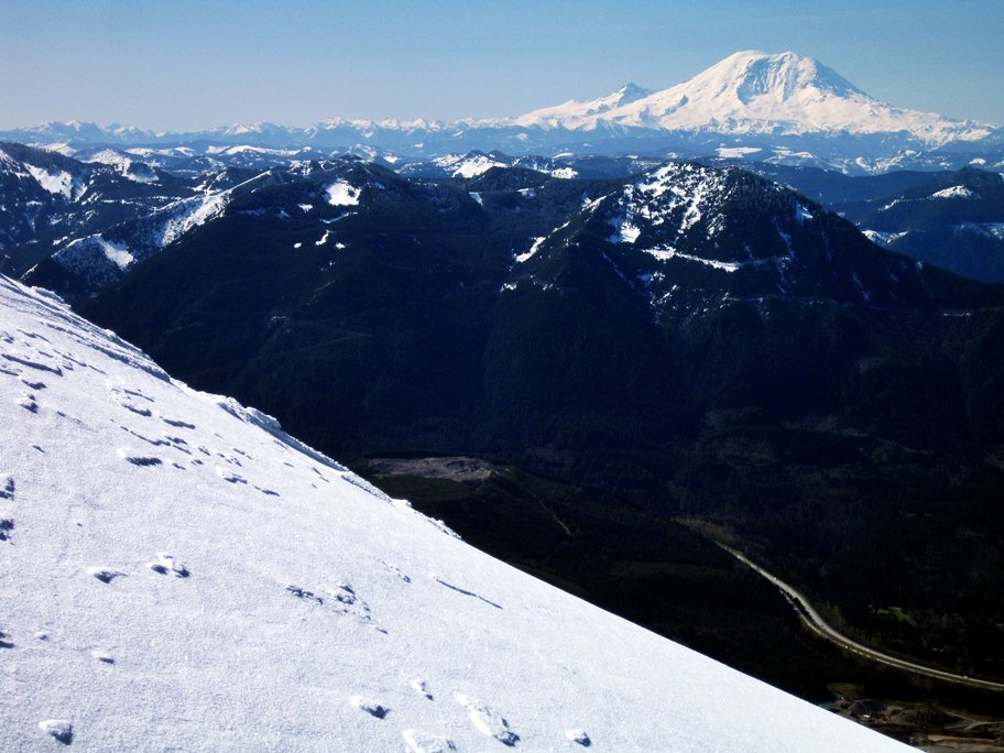
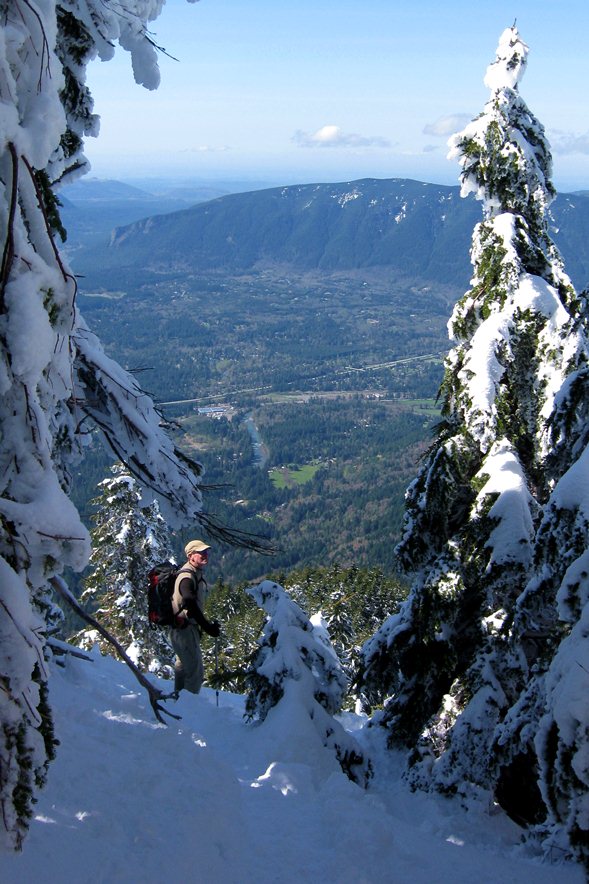
We broke through the trees and emerged onto an open
slope from which we could see Rainier and Little Tahoma, along with
the Norse Peak Wilderness and the entire Snoqualmie Valley, with I-90
snaking through it. Rattlesnake Mountain sat on the other side of the
valley, the location of another nice, if easier, hike. We had gained
nearly 3500 feet from the trailhead and the relief was pleasing to
the eye.
It was hard not to smile and be happy on a day like today. This is the reason that the backcountry gives so much joy to so many people. There is no artificiality in the natural world. Everything is as it should be. It represents a simple, absolute truth, rather than a more nuanced, relativistic one. There is comfort here, even on a snowy, steep mountain side. The comfort of knowing one's place in the world. It is a place that is without the fake distractions of the world down below, a place of home, a place where there isn't a division. I had been gone for too long.
We had another ten minutes to go until the summit, which was covered in snow and held a dangerous cornice overhanging a sheer cliff. Tracks in the snow indicated that others before us hadn't seen the cornice. They had been standing on top of a snow bank with nothing but a thousand feet of air underneath. We put on layers and ate a simple lunch of dried sausage and cookies. The sun warmed us and the slight breeze felt good against my sweaty skin. Rainier sat across the valley. Geoff and Ben would be climbing on it in two weeks, following the Tahoma Glacier to the top. We didn't linger for too long on the top, remaining only twenty minutes, but it was enough. The view north to Mount Baker, close to the Canadian border, and west to the Olympics, provided depth, while the interior Alpine Lakes gave depth. The skyscrapers of downtown Seattle sat in the distance. This summer I was going to spend in Washington, with only a month spent in the Rockies. I would spend time here. And here. And there. And that other place.
There is no place called Nicad Peak. On this beautiful spring
day the parking area for Nicad held only a few cars. The other
trailheads in the area were overflowing, with people parking more
than a mile away from some and walking on pavement to get to the
start. As such, I have no desire to increase the popularlity of
Nicad. It is on the map, in the guidebooks, and known on internet
bulletin boards. It is state land and open to all. There is a good
trail up to the waterfall (about 2 miles and 1500 vertical feet) and
after that there is a steep, rocky path to the summit (another 2
miles and about 2500 vertical feet). It took us about 2.5 hours to
summit with liberal breaks for photos and gear changes, and about 3
hours to come down. The hike is one of the most beautiful that I've
done and the general location can be fixed from one of the photos.
Nicad is a wonderful gem close to Seattle that, hopefully, will
remain just a little wilder than its well loved, tame cousins.