Potholes State Wildlife Refuge
February 5-6, 2005
With nothing but rain forecast for the Puget Sound area and the Cascades, I decided to make the trek across the mountains to the "desert" of central Washington. While there is very little federal land in this area, there is some state lands and a Seattle-PI outdoor article pointed me to a large wildlife refuge near Moses Lake called Potholes. I drove to Potholes State Park, where I left my car, shouldered my pack, and set out into the distance with no particular plan in mind. I set off from the Potholes reservoir, which includes many mini island that, I suppose, gave the area its name.

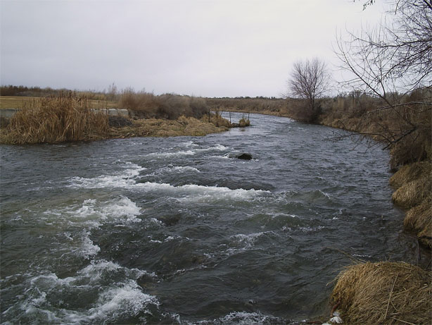
I walked west for a while, following the Frenchman Hills Wasteway, which seems to be Washingtonian for irrigation ditch, and quickly left the state park for unclassified lands. Presumably I was in the wildlife refuge now. While there are no official trails, there were enough hunters and game trails to follow when I wanted to, but the area is so open that mostly I just went where I wanted.
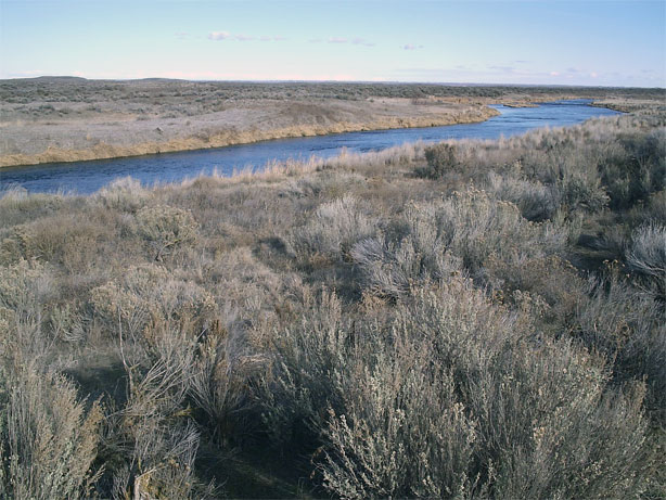
The Columbia basin area is supposed to be a very important habitat for waterfowl and I saw many, many birds, including several that I had never seen before. There were flocks of normal looking geese and ducks, but also several goose-duck looking creatures with entirely different colors (red and orange highlights). Many smaller birds and a few very large ones about the size of an eagle. Perhaps they are cranes. Regardless, the area should have been overrun with birders, especially on such a nice day, but I saw no one else.
After wandering west for three or four miles, I came to a dirt road with a bridge over the wasteway. I crossed and then headed north to some low sand dunes in the far distance. I rambled up the dunes and looked around, enjoying the wide open space that the refuge had in spades. There is something liberating about these open spaces, especially after dwelling in the city for too many weekends.
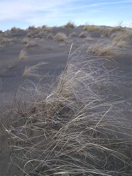
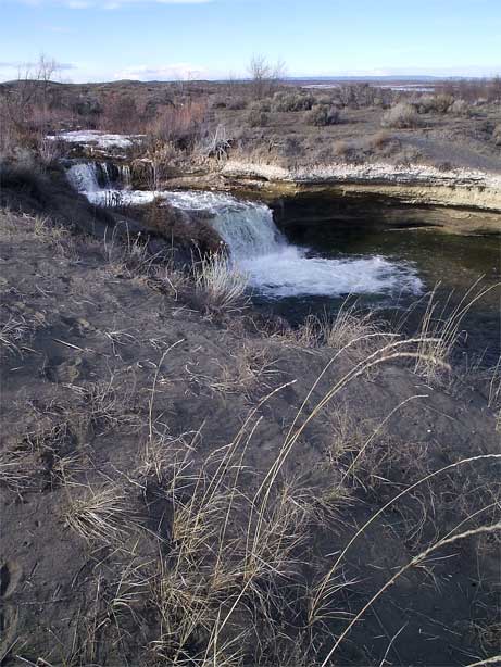
The wind whipped about at a high speed and quickly began erasing my tracks in the sand dunes. I walked from one dune to another with no particular plan, just enjoying the space. After dropping down from one dune, I ran into the Winchester Wasteway, which blocked my path. However, I followed it downstream for a while to a really nice set of falls. Off to one side of the falls, away from the tumbling water, was a really nice looking swimming hole. But, it was barely 40 degrees out and I didn't feel much like a bath at the moment.
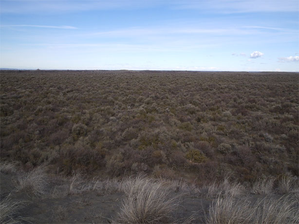
I ran a sequence of ridges formed by the sand dunes, taking the most indirect route possible, before dropping into a basin of sage and starting to make my way back to the reservoir.

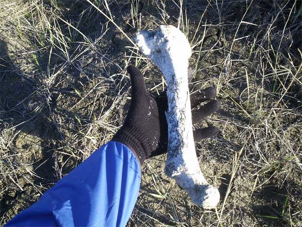
Inside the basin I spotted several deer and various bleached out bones. This area must be a paradise for hunters, for I saw more deer pellets in the basin that I had in any area I had ever been in.
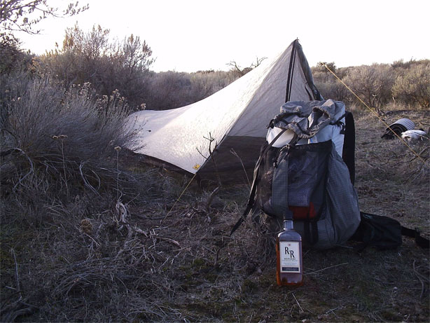
The sun began to dip toward the distance horizon and I thought I should probably find some place to spend the night. I hopped a couple of barbed wire fences and followed a straight line to the Frenchman wasteway once again. A small clearing in the sage was found next to a hill that provided some shelter for the wind and was only forty feet from the wasteway. Perfect. Up went my tarp and in went my gear. Out came a bottle of cheap Canadian whiskey.
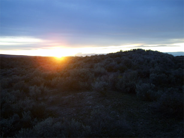
I made up a potent brew of instant coffee, hot chocolate, and whiskey and then walked about on the sand dunes watching the sun set. While not a Death Valley blockbuster, it was respectable and gave me something to do while I worked on the 22 oz mug I had in my hands.
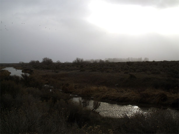
Dinner, whiskey, a copy of On the Nature of the Universe by Lucretius, and the solitary howls of a few local coyotes, filled up the hours before bed time, although I did find time in my busy evening schedule to take a little walk in the sage under the stars. I slept until 8:30 and then stuck my head out of the tarp to find a cloudy, wintry looking day. A storm of some sort was on its way, but I wasn't very far from my car so I didn't hurry. I made coffee mixed with cocoa, sans whiskey, and then packed up and headed out with my mug in my hand. I should have forded the irrigation ditch immediately, as the water was low and slow here, but held out hope that the state park might have a bridge across it. Snow began to pelt me rather hard as the storm came down upon me. A mile later I was relieved of my delusion of a bridge and found the wasteway to be too much to ford, necessitating a retreat to my campsite and a ford there. The snow continued to fall on me, but had lessened in strength.
My map had told me that the wasteway forked into two sections, and I had just forded the northern fork. Across the sage steppe to the southern fork, which was a little more formidable. I actually had to do a little searching before I found a place that looked shallow enough. A little fast and broken up, but it was either this, an actual swim, or retreating all the way to the bridge in the west.
I waded across, up to my knees at times in the freezing water, and emmerged on the other side, to the amusement of a local family out fishing, with rather numb feet. However, my car was close and I had dry socks and shoes in my trunk.
Logistics
Potholes State Wildlife Refuge is a large, but broken up, area in central Washington that is managed by the Washington State Fish and Game people along with the Federal Bureau of Reclamation. It is a haven for waterfowl and I would highly recommend bringing a pair of binoculars, as the closest I got to any birds was about 40 yards. I did manage to walk almost on top of a few, but didn't know it until they flew off, startled and disturbed. Hunters frequent the area, as the large number of shot gun shells and empty cans of Budweiser were probably not left by birders and hikers don't, I suspect, spend much time here. There are no established trails, but none are needed. I wouldn't bother much with a map, but taking a look at one before you go will give you some idea of the relative locations of things.
To get there, take I-90 across Snoqualmie Pass to the Columbia river, and then jump on Highway 26 heading east toward Royal City. Just past this hamlet, make a left turn on Dodson Road and drive it for about 5 miles to Frenchman Hills road (also marked as 7th). Make a right and drive about 6 miles to Potholes State Park. It will cost you $5 to get in and park. If you want to camp, you'll have to pony up $15. Alternatively, take I-90 all the way to exit #164, before Moses Lake. This is Dodson Road also. Head south until you get to Frenchman hills road and make a left turn. Or, you can park in a variety of parking lots for hunters, but you'll need a parking pass (about $10 where hunting licenses are sold).