Mount Pugh
September 2, 2004
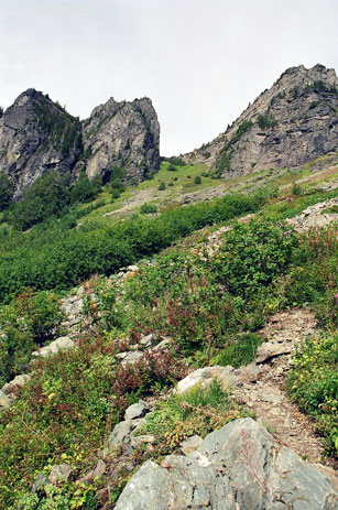
Mount Pugh is a pleasant hike near Glacier Peak. I got up early on Labor Day of 2004 and made the drive to the trail head under highly pleasant skies. The road to the trailhead became rough, and I scraped many bushes on the drive up. Although my guidebook told me that this was not a popular hike, I found quite a few cars at the trailhead. The trail made no pretense with an approach and began from the first to climb steeply up hill. After gaining a few thousand feet and running past a minor pond, where I found some tents, the trail broke into the alpine and headed steeply up the flank of a mountain toward a small notch.
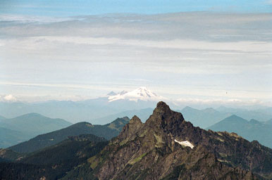
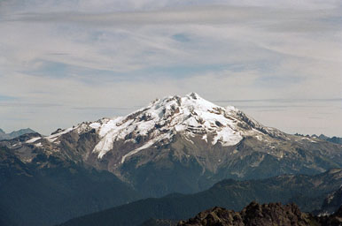
At the notch I entered the Glacier Peak wilderness, one of my favorite places on the entire Pacific Crest Trail. I scampered along the sometimes thin ridgeline with increasing incredible views of the surrounding mountains. Mount Baker, that behemoth of snow and ice, reared its perfectly symmetrical head. Springtime, I thought, just give me springtime and I will be there.
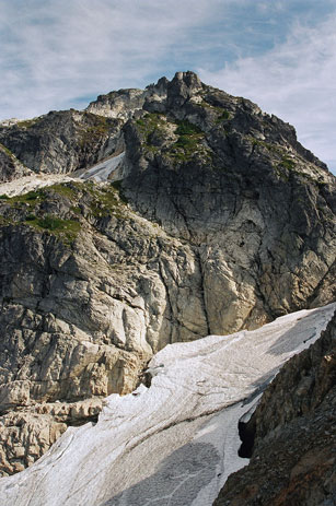
I passed one set of laboring hikers on the way along the ridge, and then a second set just before reaching a very exposed rock rib that ran around the head of a minor glacier, with Mount Pugh directly in front of me.
I was beginning to tire just as the trail became more scramble than hike. Up one bounder, along a short path, scramble some, hike some. I passed two more hikers who were resting before beginning another short climb through a chute. My lungs and legs were hurting as I passed another laboring hiker, but I was close enough to the top that I did not want to stop for a break. A few last scrambles and the trail dumped me out onto the final hill, which I walked up trying to compose myself as much as possible and feeling very pleased with my effort. As I neared the top I looked up and saw an 8 year old boy grinning at me. He welcomed me to the top and I suddenly felt deflated. Or, rather, my ego came back under control.
The only big mountain I could see on the way up was Baker (and a lovely one at that), but when I crested out an entire new world stood before me. Massive Rainier, far to the south, loomed large, another springtime project. Glacier Peak seemed right next door (as indeed it was).
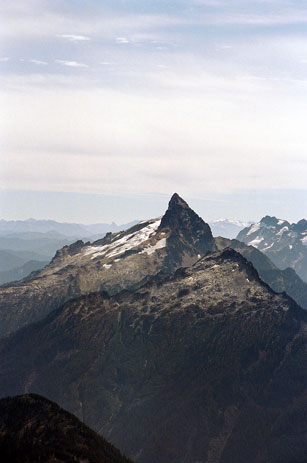
Mount Sloan, a wicked looking dagger of rock, was across the valley.
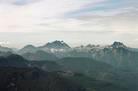
In the opposite direction sat some of the minor peaks that made up the Monte Cristo range. One of them is called Three Fingers, and the other is Whitehorse.
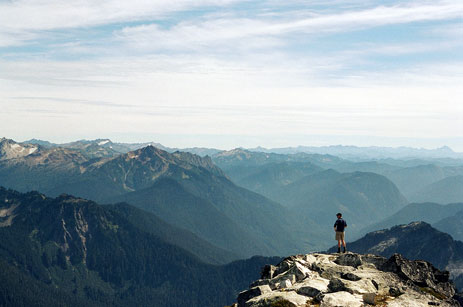
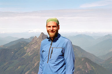
In addition to the 8 year old, there was a 7 year old (his brother) and their father. They had left the trailhead early in the morning and had gotten up here only a little before I had made it up. Two hikers, of my age, were sitting bare chested in the sun, making comments about hikers in running shoes (I was in runners). The last person I passed on the way up came huffing up the trail and moved over to the two snide hikers, nearly collapsing. For some unknown reason, all three had carried large looking packs up to the top. I spent a good hour on the top, enjoying the sun and the views, despite the relative crowds. The hikers that I passed on the way up eventually made it, along with a man in his 50s and wearing running shoes, who was barely sweating. After identifying some peaks in the distance with the help of some of the other hikers, I made a long hit list of mountains for May and June. Mount Pugh was good for conditioning, but even better for inspiration. El Dorado and Shuksan stood out prominent, and one could even see over far to the west to the Olympics. I posed for a picture, and then began the trek back down the mountain to my car and the long drive back to Lakewood.
Logistics
To get to the trailhead, drive north on I-5 to Exit 208, north of Everett, and head along SR 530 for about 30 miles to the hamlet of Darrington. In the middle of town, you will need to take a right on the Mountain Loop Highway. A few miles out of town, the road becomes gravel, but is fairly easy to navigate even in an older sedan (my 1991 Camry was fine on it). There is no sign for the trailhead, but there is a small spur road off to the left which is marked as FS 2095. There is an area here for you to park, or you can drive about a mile up the road to reach a higher parking lot. My Camry just made it, although I did scrap the underside of the car on some bushes.
From the upper trailhead, the Mount Pugh trail runs for about 5 miles and gains a hefty vertical mile of elevation. From bottom to top, without a break, the hike took me about 2 hours and 45 minutes and I was tired when I got to the top. For most of its length the hike is on good, solid trail. Once you gain the main ridgeline, however, there are some class 2 scrambles, with a little class 3 thrown in for good measure. There are a few exposed and narrow sections which might be worrisome if snow is down. However, I see no reason why those with a little care and skill could not climb Pugh during the winter time.