Rattlesnake Mountain Traverse
October 29, 2005
The trailhead parking lot was jammed with Mountaineers. A few spits of rain fell down as the various members strapped on gaiters or fiddled the hoses of their hydration system, putting everything right before starting the walk up to the top of Rattlesnake Mountain. I was the twelfth, and final, member of the group that was going to traverse the mountain and end at a different trailhead, where we had stashed a shuttle car. The other group, perhaps eight strong, was heading toward a lake in the area. We all looked toward the sky and hoped that it might not rain too hard on us today.
This was my second hike with The Mountaineers, a Washington outdoor and advocacy club that I had resisted joining during the first year I had lived in Washington. Needing to break out of my isolation in Lakewood, I joined recently and am glad that I did. I never would have come out to Rattlesnake Mountain by myself, and certainly never with such threatening skies overhead. A well built trail began from the parking lot led to some outhouses, where the actual vertical gain began. On a moderate grade, we switchbacked our way slowly up into the mist, occasionally with views down to the valley floor and lake.
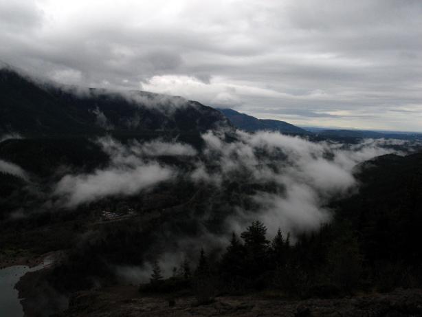
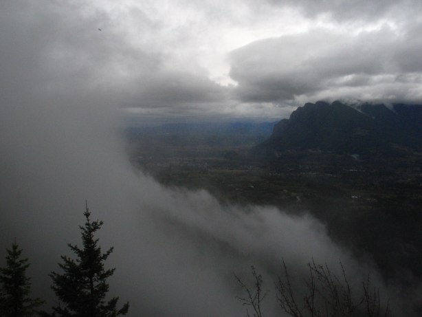
After a few miles of gaining elevation, we reached a prominent rock outcrop called Rattlesnake Ledge, from which one could see, predictably enough, mostly clouds. However, there were enough holes in the clouds to see Mount Si on the otherside of the interstate and bits of the foothills of the Cascades, slowly flattening out in a plunge toward Puget Sound and the east-side of the Seattle megaplex.
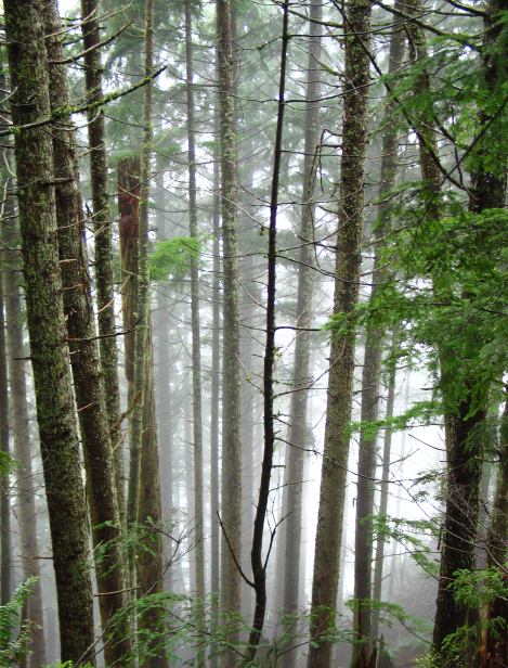
This is the point at which most people turn around and walk back down to the cars. But not us. Continuing on a much more narrow trail, we ascended once again though dense, dark, spooky forest. One of the group quipped that this would be the perfect haunted house for Halloween: Bring an unsuspecting non-hiker up here at night and let them fret in the dark canopy.
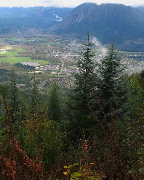
Eventually the track crested out near an antenna and began the traverse proper, rarely gaining or losing more than a few feet of elevation. For the most part, we remained in the woods with few views, but the atmosphere created by the mist and damp air was rather intoxicating at times. We reached a final cleared area just before leaving the protected area, from which the growing once-hamlet of North Bend could be seen sitting at the foot of Mount Si. It was interesting to see the land use patterns from this vantage point, as North Bend sat in the midst of largely undeveloped land: A city, a few outlying fields and cleared areas, and then forest. Who made the decision to develop or not develop? It wasn't clear who owned the land or what they intended to do with it. Given the rate of growth of the Seattle area and the great location, it was only a matter of time before the fingers of development reached the North Bend area and fully grasped it tight: Downtown Seattle is only 25ish miles away.
After a brief hail storm, the sun broke through the clouds as we began walking through some logged areas on our way down to the shuttle car. The drivers broke away at a faster pace, while most of the rest walked along at a slow pace. I split the difference, arriving at the shuttle car just as it was leaving and just in time to score the best brownie of my life: Dense with chocolate, the nugget was spiked with walnuts and chocolate chips on the inside. It seemed to me a master stroke to be able to bake the chips inside the treat yet have them remain whole and intact. I found a tree to shelter myself from the rain and threw out my sleeping pad, on which I scored another treat: A thirty minute nap. Alas, this came to an end too quickly as the shuttle car returned and the other group finished the trail, forcing an end to the nap and a drive back to Lakewood.
Logistics
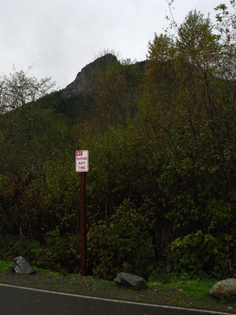
I carpooled from Issaquah, so I don't have the best idea of how to get to the various trailheads. The westerly one is located off of Exit 27 on Interstate 90 and the easterly one is off of, I believe Exit 32. The trail should be described in a book called something like Hiking the Mountains to Sound Greenway. The trail is approximately 12 miles long and gains something like 2600 feet of vertical. I would classify this as a mostly-easy hike, although the first four miles have some significant (but not steep) climbing. It is slightly unclear who manages the land, but it appears to be Seattle Public Utilities.