Alpine Lakes Wilderness: Waptus and Pete Lakes
May 28-30, 2005
With only two weeks or so to go before I left for my summer ramblings, two friends, Rich and Sandy, flew out to Washington for some hiking over the long Memorial Day weekend. Although it had been rainy and cold for several weeks before they arrived, the weekend was forecast to be clear, with record highs. Perfect weather for two new hikers. We drove out to the Salmon la Sac trailhead on Saturday morning and set out on the Waptus River trail under perfect perfect conditions. There were nothing but smiles on the faces.
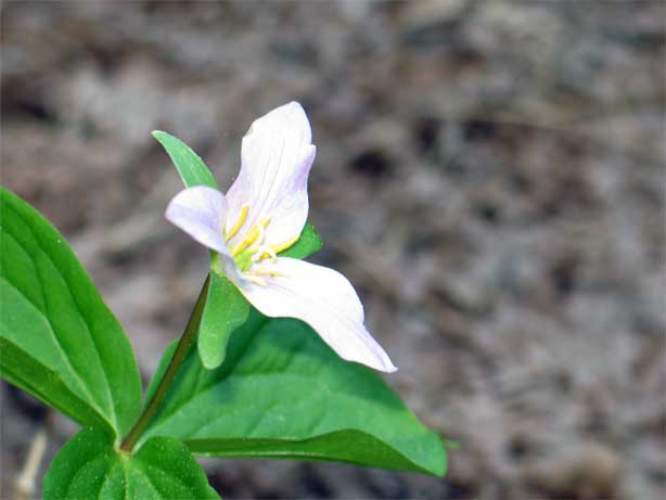
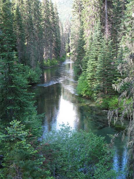
We branched over to the Waptus River Trail, running along its namesake body of water, which I had tried to snowshoe along in January. On that particular trip it was cold, with iron skies, and plenty of snow in which to get lost. I had been turned back by a creek crossing that I couldn't get across without getting my feet wet, but on this trip there was nothing but warm weather and lots of flowers.
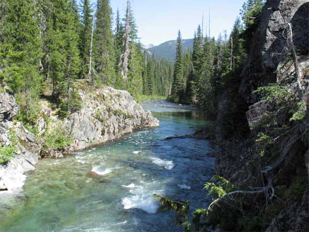
For several hours we walked along the river, fording occasional brooks and creeklets, and leapfrogging with several other hikers who were also heading for Waptus Lake. During rest breaks by the river, sitting underneath pleasant trees, I contrasted the pleasantness of the onset of summer with the more demanding conditions of January, when breaks meant sitting in the snow for only a few minutes before chills came on.
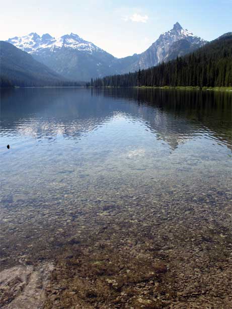
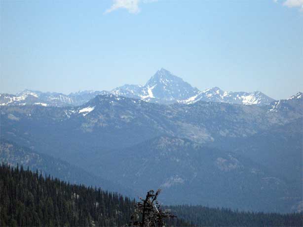
As my friends began to tire, I noticed the woods beginning thin and could spot, through the trees, where the unusually large Waptus lake had to sit. I thought about warning Rich and Sandy, but decided to keep quiet and let the lake be a surprise. As we burst through the last of the trees and came upon the outflow of the lake, Sandy and Rich were stunned by bulk of the mountains on the other side of the clear blue lake. Summit Chief and Bear's Breast were thrust up high and still held some snow, even with the light winter we had experienced in the Pacific Northwest.
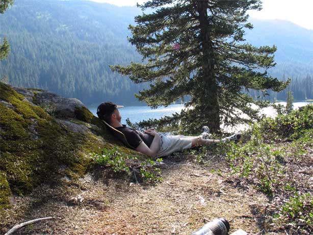
The campsite near the lake was full (one tent), so we began to head along the shore line, passing a few tents as we went, until we reached the Spade Lake trail and a reasonable, if viewless campsite, near by. It was watered and sheltered, but I really wanted something a bit more dramatic for our first night out, so on we went. Not far up the trail, I dodged off on a use trail as Sandy and Rich picked up water. Scrambling up a slight hill, I topped out at a great site over looking the lake, and then climbed up another hill to an even better site. One of the best sites, in fact, that I had even camped at. Even a blind man could have read the expressions on their faces when they saw where we'd be spending the night. Rich was happy enough to slouch on a rock and take a nap in the sun.
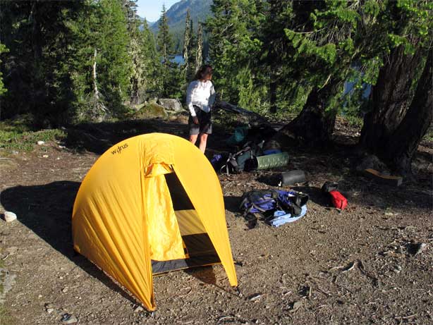
We lazed about for a while and then woke Rich up so that I could show them how to put up the tent they would be sleeping in during the night. I had no plans to put up my tarp and instead picked out a nice tree to sleep under, with only a few branches and the stars as my roof. Dinner went quickly, although Rich and Sandy had difficulty finishing their raw onion with couscous dinner.
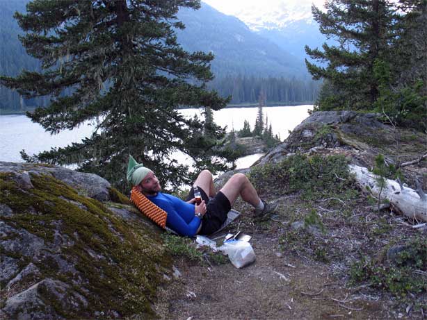
With dinner complete, I retired to a nice perch above the lake and wrote for a while and indulged in reading Steppenwolf, accompanied by cheap Canadian whiskey and Double Stuft Peanut Butter Oreos. The sun lingered and lingered near Summit Chief and the warm day folded into warm dusk, and eventually into a mild evening.
It would be hard to imagine a more pleasant way to spend a Saturday, but I had a few thoughts on the subject as the stars began to come out and night enforced its rule. I was a bit worried about our route for the next day, as I could spot patches of snow on the ridge that we'd have to traverse. Today had been flat, tomorrow we'd climb. With snow, it might prove a bit much for Rich and Sandy. Nothing was to be done about it, however, and we'd have to make it through.
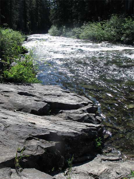
I awoke with the sun around 5:30, but dozed for a while as I didn't really want Rich and Sandy up that early. I finally woke them at 6:30 and we were hiking under blue skies by 7:30, which wasn't a bad turn around time for new hikers. We finished the walk along Waptus before crossing a few creeks (on log bridges) and hit a junction with the Pacific Crest Trail.
When I thruhiked in 2003, I had particularly good memories of the stretch we were about to traverse. I had hiked out from Snoqualmie Pass and made it about 25 miles to near the Escondido lake area before camping for the night. The scenery and the weather had been amazing, particularly as the land to the south of Snoqualmie Pass had been logged heavily. I had known, even then, that from Snoqualmie Pass north to Canada was supposed to be a special place and it had not disappointed. As we began to climb, I took the lead to guarantee a slow, steady pace up the mountain side. We had, roughly 2400 vertical feet to gain and I didn't want my friends tackling the mountain side with too much initial vigor; it was going to be a long day.
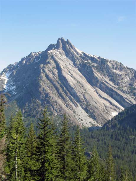
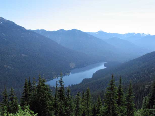
The PCT was moderately overgrown, but still very easy to follow as it snaked its way up the mountainside. Bear's Breast, one of the most recognizable mountains in the area, came in to view high above Waptus. It looked like a scary climb to me. Waptus lake, and our campsite, were in constant view as we moved back and forth, back and forth, slowly gaining elevation.
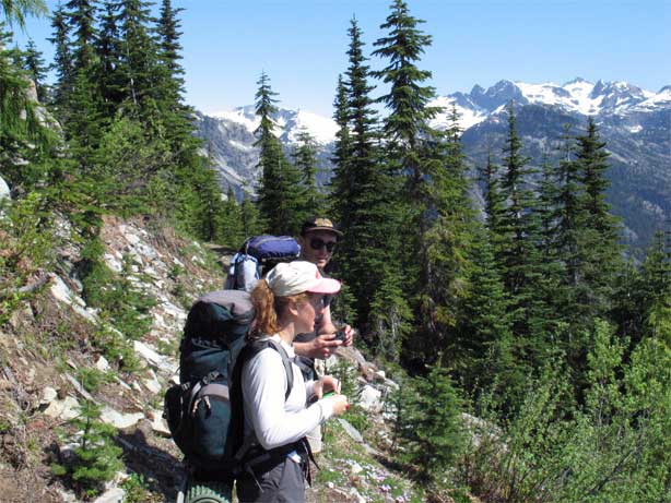
The higher we went, the better the views got. With our deliberately slow pace it took quite a while, but we were indeed going up and Sandy and Rich were constantly surprised by how high we were for such little effort. Needless to say, many pictures were taken by all.
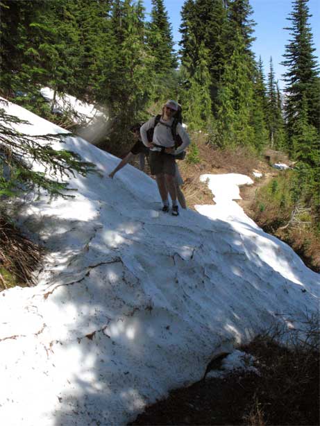
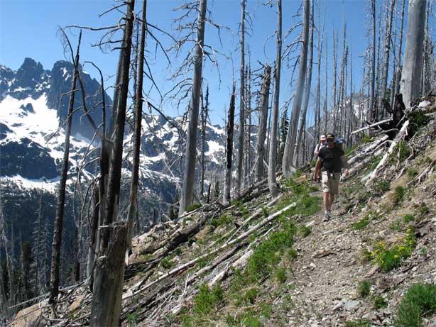
And then the snow showed up. From my experience several weeks earlier on Weasel Butt Peak, I had expected there to be little snow below 5000 feet, if any. However, this proved not to be the case and we quickly got our feet wet scrambling up snow banks that covered the trail, post holing across them, and then jumping down the other side.
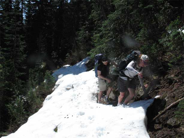
The higher we went, the thicker the snow became, until it was necessary for me to kick steps into the sides of the snow banks in order to get the footholds necessary for scrambling up them. While nothing especially difficult for me, it was challenging for Sandy and Rich. I thought, for just a moment, about sending them in front to see what leading through it might be like, but decided against it as we would almost certainly get lost.
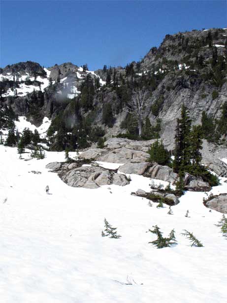
We topped out on a ridge, then swung back around through some particuarly bad snow areas, where I post holed down to my hips repeatedly. My friends were beginning to tire and we began to walk for only 20 or 30 minutes in between breaks. Finally my camping area from two years ago came into view and I knew that we were almost to the descent into the Lemah Valley.
Before that, however, the trail ran through a snow bowl where there was no sign of the path or the correct direction. Not worrying much, as there was only one way to really go, I had Rich and Sandy stop as I plowed along the snow looking for the trail. Three minutes later, I found it and called out to my friends, watching them slowly make there way across the bowl to me.
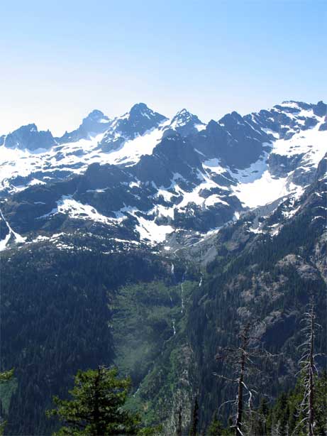
With, presumably, the last of the bad snow behind us, we wound our way up along the rocky trail with constant views of Escondido lake below us and occasional sightings of the Lemah Valley, into which we had to descend.
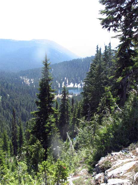
Near what I thought was the top, we found a nicely watered lunch spot with distant views off to mountains whose names I did not know, and plopped down for an hour's rest. After eating a bit, we all took naps after our fun in the snow.
Everyone was feeling better as we set out once again, although we quickly came to another snow bowl where I couldn't as easily find the trail. I went in one direction to look as Sandy and Rich went in another. Postholing into my hip, once again, I tried a different direction and found the trail. Rich and Sandy, who hadn't gone far for fear of being separated, quickly came down to me and we set out on the south facing aspect, the snow done for good.
The mountain side had burned some time ago, which gave good views off to the rugged mountains on the other side of the valley. I had stomped up this climb in 2003, racing the waning daylight, and was amazed at how long it took to get down. I remembered the climb as taking an hour or perhaps a little more. We took two hours, with some breaks, just to go down into the valley.
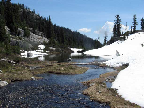
As we dropped down, I felt like being alone for a while and so set off at my normal pace, leaving my tired friends behind for a while. I did wait at an important trail junction for them, but set off once again as I wanted to think for a while and couldn't do this while other minds were present. A mile later I rested at a stream, waiting for them. When they arrived, we got to witness a rather short, but violent dog fight between three dogs who were off leash at the time. Our fun done, we made the short stroll to Pete Lake, our camp for the night.
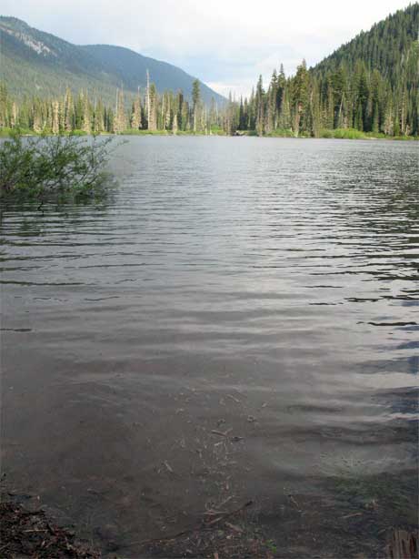
We rejected one site as entirely too buggy, but found a pleasant lakeside camp a bit further down where the bugs were not too bad. The sky had clouded and there was enough of a chance of rain to warrant my tarp going up. My next camp under the stars would have to wait for Montana. Sandy and Rich were tired, although they rallied after eating a bit of mashed potatoes and we spent a pleasantly warm evening by Pete lake doing what everyone does after a day of hiking: Sitting around.
I wanted to get up and go early, but still couldn't bring myself to wake up Sandy and Rich much before 6:15. In twenty minutes, I had gotten down the bear bag, eaten, packed, and was ready to go. Almost an hour later, we set out hiking. I handed off the map to Sandy, expecting to pull out in front quickly, but to my surprise they kept at my heels and we romped along the flat trail at a good 3 miles per hour. The clouds gave way to bright sun and the forest to the Cooper River.
After a rest near Cooper Lake, I walked along at my normal pace, while Sandy and Rich dropped back due to some lingering foot problems that were now bad enough to slow their pace. It didn't especially matter, as we were only about 3 miles from the car at this point. Sandy had given me back the map, not wanting to look at it, and so they didn't know how far we had to go. I smiled, inside, when I thought about how surprised they'd be when we popped out at the car.
After bouncing around some on the Cooper River trail, the trail finally began to hug the river and the voices of youngins playing floated upstream to me. I had a long sit waiting for Sandy and Rich and almost chuckled when, thirty minutes later, they arrived thinking it was another two miles to the car. I packed my stuff and downhill we went.
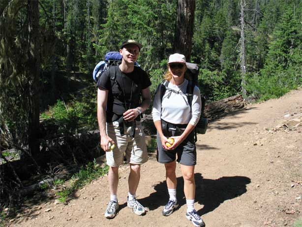
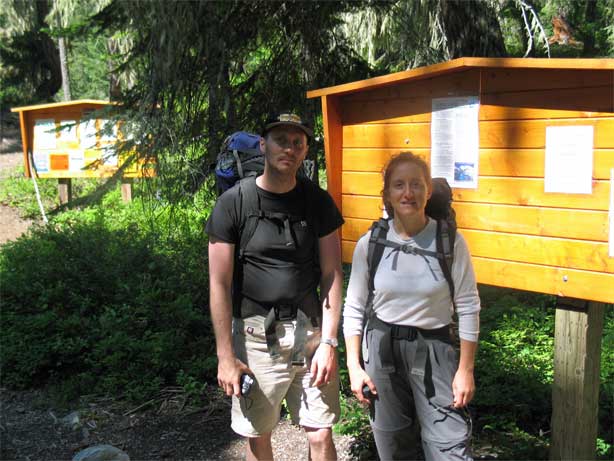
We ran into the trail junction that led off to the Waptus River trail and I said nothing, waiting for them to recognize some of the features: It is difficult when you are seeing things in reverse. Teenagers were playing in the river where we had seen them two days before and this clicked in Rich's head. Sandy noticed a familiar trail sign. Everything fell into place just as the car came into view and my friends rejoiced. Near the trailhead, I snapped a photo of them, capturing the tired looks on their faces. They had done well, but were plenty glad to be back at the car and a more relaxed mode of transportation.
Logistics
The Waptus River trail begins from the Salmon La Sac Sno Park in Wenatchee National Forest, east of Snoqualmie Pass. It is about 11 miles from the trailhead to Waptus Lake. The trail to the lake has a few hills and fords, but is an easy walk and there is ample camping along it. A Northwest Forest Pass (or Golden Eagle Passport) is required to park at the trailhead itself.
From Lakewood, drive I-5 north to SR18 and take this to I-90. Drive I-90 up and over Snoqualmie Pass and then down to exit 80, which has a sign for Salmon La Sac. This is the Bullfrog Cutoff road. Drive the Bullfrog to the hamlet of Roslyn and continue on SR903 to where it ends at the Salmon La Sac campground, about 17 miles from the Bullfrog. Drive over the bridge then on a dirt road for about a mile to the trailhead. Note that in the winter, you have to park alongside the roadway, before the bridge, and walk in to the trailhead.