Mount Washington, Olympic National Forest
January 20-21, 2007
After so much warm air sport climbing in Thailand, it was time to hit the Olympics and play in the snow for a little while. The forecast looked good enough for a run at Washington, though I wasn't quite sure what I might find in the way of avalanche danger. I teamed up with Lauren, Rhys, and Jake for the climb up to the top via a proposed Route 4 - Route 2 hybrid, leaving Tacoma REI parking lot at the stupidly early hour of 4:30 am. The road up toward Ellinor was a little frozen for a while, then the snow started piling up. Rhys got his 4-Runner high, perhaps a mile or two below the lower trail head, and out we spilled, starting the hike up at 7:30 am.
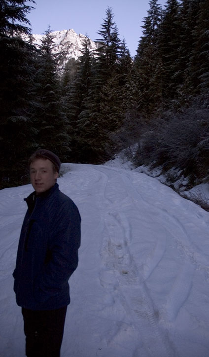
We hiked up the hard snow for about two minutes and then cut right into the woods on a barely marked (some yellow flagging tape) use trail that ran up and around over awkward ground (heavy overnight packs!) before dumping us out into a clear slide area with good snow. We kicked steps up for 15 minutes as the sun got really nice on the Ellinor - Washington ridge, finally emerging back onto the road, but well past the Route 1 trailhead.
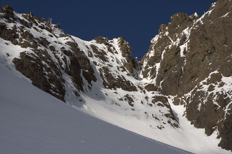
As we had been climbing the cut the sun had risen and lit up Mounts Washington and Ellinor, the first lumpy and taller, the other spinier and shorter, in an ethereal yellow light. I'd have paid someone five dollars had they been able to come up with a better sight. We hung out on the road for a while inspecting potential routes up. Route 1 ran a narrow ridge toward the end and we didn't especially want to deal with that with the snow. A prominent avalanche chute ran up toward the headwall and we figured that if the snow looked nice, we'd try to take that up. Then traverse left below the headwall
to gain a snow gully and run that straight up.

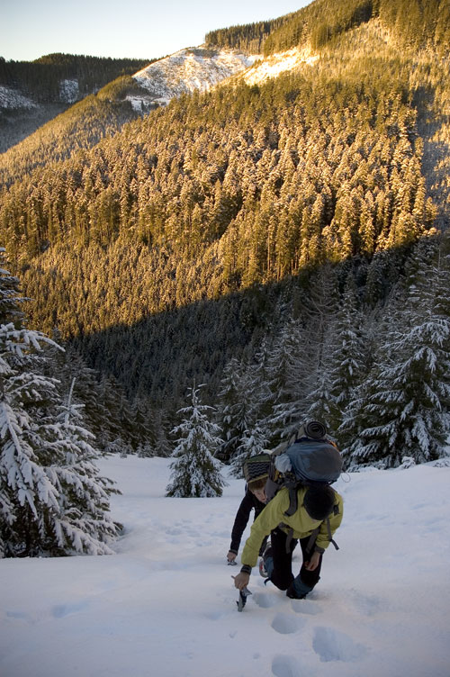
We meandered down the snowy road to just past the trailhead sign and then cut up past a creek, making our way through the woods as best as we could, heading the general direction of the chute. The grade began increasing, but the snow got better and better, and the trees less and less. We took turns leading, gaining elevation at the expense of rather a lot of sweat. Not a bad price to pay considering the perfect weather.

We walked down the road and began cross country work just pass the Jefferson Pass trail sign, following a prominent creek up. The snow initially was pretty good, but as we began to clear the trees we frequently hit spots with rocks, or very fluffy powder that made climbing very hard. Much sweat lost, but the sun was shining and everyone was happy at the progress we were making. However, as we gained elevation the work became seriously tough, with very steep sections that paradoxically held deep, dry snow that wasn't solid enough to take the weight of a climber.
Underneath was hard ice/compact snow that you couldn't do much with. Now, the clever person would have put crampons on and tried switchbacking a bit, but no one ever accused the four of us of being clever. Well, maybe Lauren is clever, but certainly not the rest of us. We eventually got up to near the base of the headwall (actually, behind some cliffs) and thought about traversing right.

We wouldn't be able to traverse, which meant we had to drop down lower and then move up once again. Once again, of course, our crampons stayed on our backs and some nifty (ok, thuggish) work was needed to get down off hard ice covered by 3 inches of fluff. But once down everything seemed grand.

The fun continued as we gained more elevation, lost more sweat, and climbed high into a gully that turned worse and worse as we came up. We were trying to stay close to the ridge and the gully we were taking turned out not to be the right one. It led up to a narrow pass and dropped off into a large basin on the other side.
Time was rolling on and we contemplated our options during a laughable session with the drawn map of the routes on Washington. We concluded that we were looking down on Route 5 and that we probably wanted to retrace our steps down the gully. So, back down we went, cutting into the main basin and heading up on increasingly challenging terrain, with hard, nasty ice underneath fluff. The challenge would have been, er, not so challenging had we bothered to put our crampons on. At least we looked cool (not like anyone was watching).

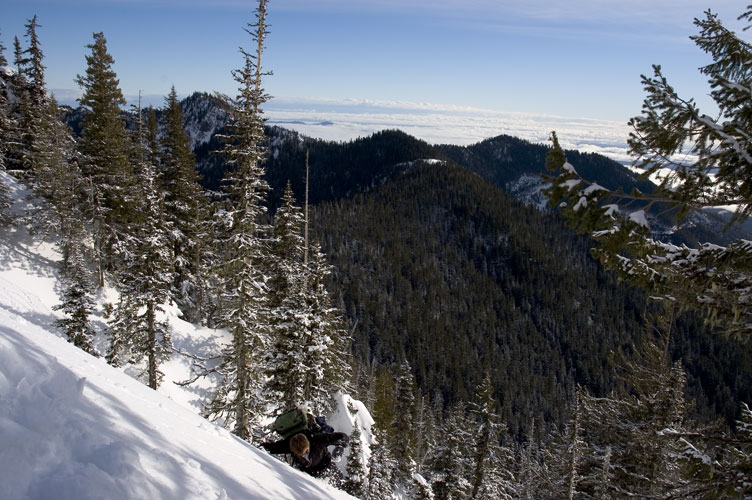
We climbed up for another half hour and decided we should probably dig in for a camp and spend a little more time with the map to determine where to go. We were looking up at an icy gully that we thought might go to the summit. Not very far!
The slope was at about 20-25 degrees, which meant we had to spend some time with shovels digging and slashing at the fluff and ice to get two platforms built. Task 1 accomplished. We never looked at the map, being too concerned with telling jokes about our respective mothers. Ok, only about Jake's mom. With only a little work, we had ourselves a not-so-spacious, rather precariously clung, icy cold home for the evening.

Our work done, we had plenty of time to sit about in the sun, which made everyone happy after climbing on steep terrain for almost seven straight hours.

From our camp site high on Washington we were treated to a spectacular view down to Lake Cushman, Hood Canal, and in the distance, Tacoma and, somewhere, my apartment.

It didn't take much effort to move my eyeballs a little and glance at the Big Fatty, which in a few hours would be coated in the most wonderful alpinglow.

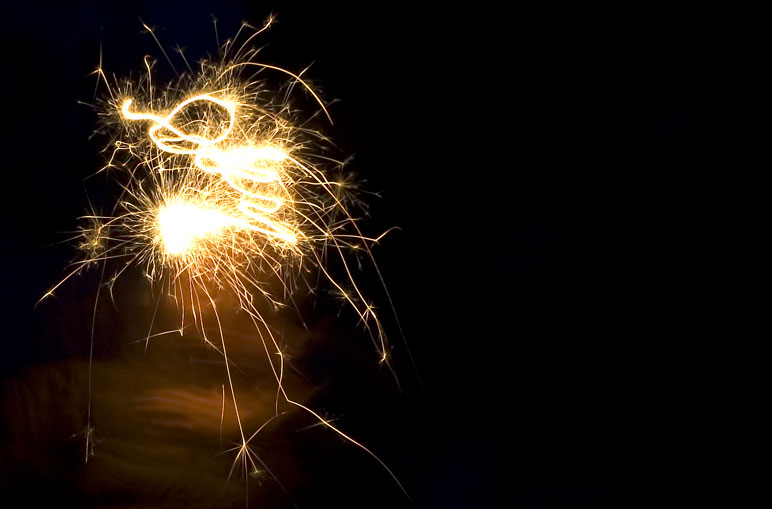
We were all pretty spent and decided to try the gully and the summit tomorrow. Even if it didn't work, we didn't have a whole lot more options. The temperature surprised us by dropping precipitously when the sun went down, driving us into our bags at the early hour of 6 pm. But the South Sound lit up all aglow, and Jake's sparklers seemed somehow appropriate.
I awoke to a distuburbing sound. After 13 hours in my sleeping bag, one might think that I was ready to wake up. But it was with some reluctance that I finally stuck my head out of the tent to see what that howling sound was.

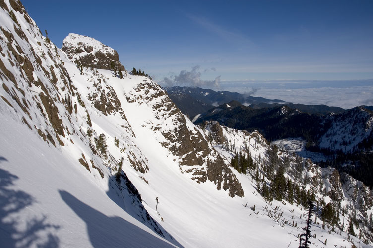
I put my head back inside and curled up into my bag, happy with where I was. Rhys and Jake decided to give the gully a run any way. I had a shot of Canadian whiskey and went back to sleep after watching them for a few minutes.

I dozed for a bit before finally wanting some tea, which meant that I had to go outside to fetch the stove. The wind was still blowing, but it wasn't especially cold as I melted snow for water. The two had been gone for an hour before I saw them slowly down climbing the gully and make their way back to the camp.

They had reached the top of the gully and then climbed a thin, narrow one to a notch. From the notch led steep, technical rock with plentiful patches of ice. Then decided not to try it and came back. Despite the weather, they were happy with the bit of climbing they got to do. Due to a genetic disorder, Rhys has this permanent look on his face, no matter what he is doing.

We packed up and headed back down (wearing crampons!) the slopes, sticking to the open areas for as long as we could. As we broke through tree line, our progress became more and more difficult. 50 feet above the road, we got stuck by a system of waterfalls and had to work seriously hard for 45 minutes to finally get down. We walked back down the road, picked up our old tracks, and retraced our steps back to the truck, plenty happy.
Logistics
From Lakewood, drive I-5 south to HWY 101 and take this through Shelton to the town of Hoodsport. In the middle of town, make a left onto SR 119 at the signed junction and head toward Lake Cushman - Staircase. Drive about 11 miles to where SR 119 hits a T-junction. To the left is Staircase. Make a right and drive about 1.5 miles on a good gravel road (many potholes!) and then make a left turn on yet another gravel road, heading up hill. There isn't much of a sign, but the road is hard to miss and there is a sign (in the other direction) just past it. Drive as high as the snow line will permit and park some place not blocking the road. Unless you know where the use trail is, it would be more advisable to walk or ski up the road, passing the lower Ellinor trailhead, the turn off for the upper trailhead, and continue on past the Route 1 trailhead until you see the sign for the Jefferson Pass trail. Turn up slope here. You are now on your own.
Don't try this unless you know how to climb hard and soft snow. Bring crampons, ice axe, and a helmet an be prepared for cold temperatures. A shovel will be needed for digging out platforms and you'll want a solid white gas stove for melting snow into water. If you can contain your hunger after you're done, and are headed that way, drive into Belfair and eat at a rather run down looking place called Crazy Eric's. The burgers are huge and very cheap: A 2/3 pound burger with cheese, Canadian bacon, and all the fixings (including fries and a drink) will run you about $5. If you just want the burger, you're looking at $3.50. Big vanilla ice cream cones are 69 cents.