Little Kendall Peak, Alpine Lakes Wilderness
August 21, 2006
Knowing in advance that you are going to get lost is reassuring in a way: It takes all the anxiety out of the start of a trip. When scrambling alone, I always seem to end up on the wrong peak. I know it will happen and just accept it as the price of getting some exercise. But, surely, I couldn't miss Kendall Peak?
Although the PCT parking lot at Snoqualmie Pass had many cars in it, I had the trail, this Monday, mostly to myself, with only a few day hikers out. The sounds of the freeway slowly decreased in volume until only a slight hum could be heard through the woods, and even this faded as I rapidly gained elevation on the big, superhighway-like track of the PCT.
I had a description from a local (and crappy) guidebook to get me to the proper route up Kendall, but I wasn't expecting very much to come of it. When the main direction is to leave the trail at 5200 feet, and you don't have an altimeter, getting lost is fairly probable. I should have ignored the description completely and just used my eyes and my brain, but I didn't have the wisdom to do so.
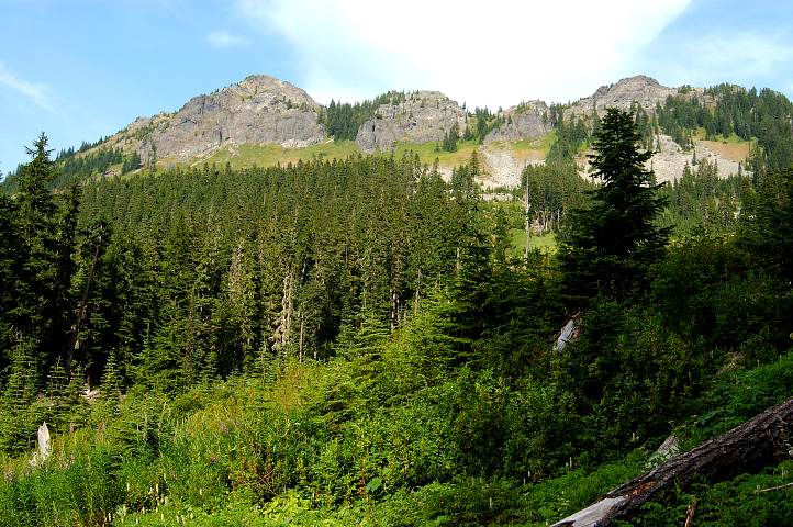
I finally broke through the trees and begin to skirt along a prominent boulder field, below which sat Kendall and its satellite peaks. I had a seat in the sun and looked at the description again. Hmmm, leave the trail at a boulder field. Must be it, I thought. The problem was, above me were three peaks, each of which looked nothing like I remembered Kendall. I probably should have looked at the photos in my camera to come up with the obvious fact that Kendall was out of view and to the far left, but I didn't do this. Instead, I declared that the rightmost rubble heap was the tallest of the three and set off cross country for it.
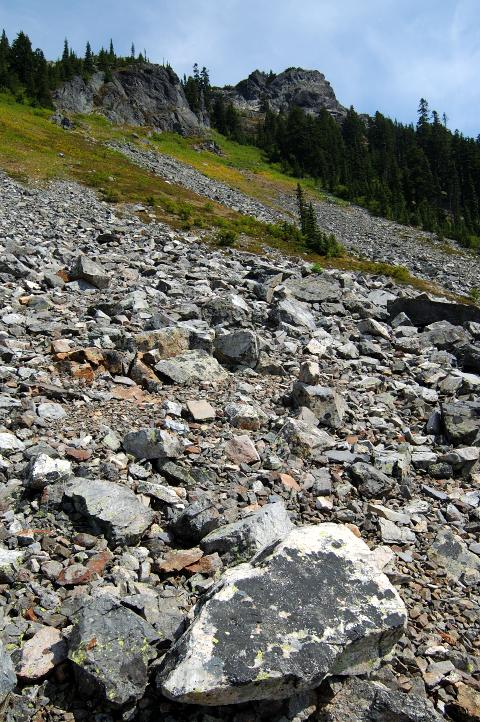
Scrambling up the talus and heather slopes toward the peak proved fairly easy, though slow, as I constantly stopped to make sure I was going in the right direction. I tried one gully, hoping that it might get me to a ridge to run to the peak, but found myself on terrain that it was wisest to leave alone. I retreated and tried the gully closest to the peak, filled with trees, and found an easy scramble up to ridge just below the peak. Of course, by this time I was high enough to be able to see something of the land and realized that Kendall was far to my left and that it couldn't be seen from below.
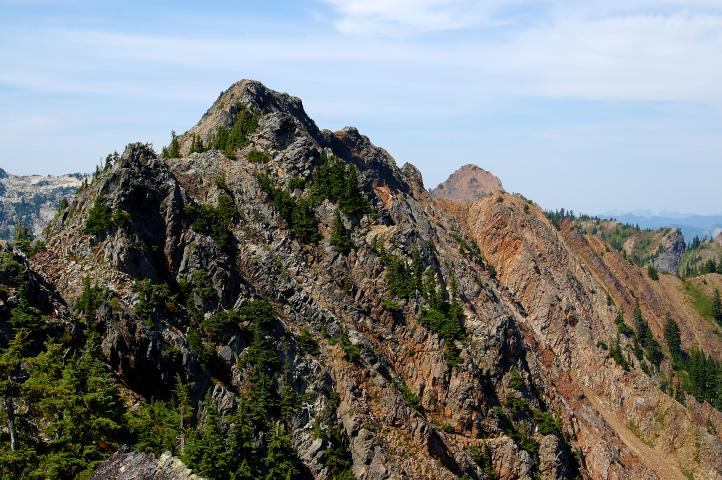
Not especially caring very much, I scrambled up easy rock to reach the top of the rubble heap, satisfied with where I was. After all, the view to Gold Creek Valley on the other side was just as spectacular, even in the hazy air of August, as it was from the top of Kendall. I had a seat and traced out the route of the PCT across the Kendall Katwalk. I remembered the route well from 2003, memorable for its exposure and views.
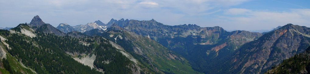
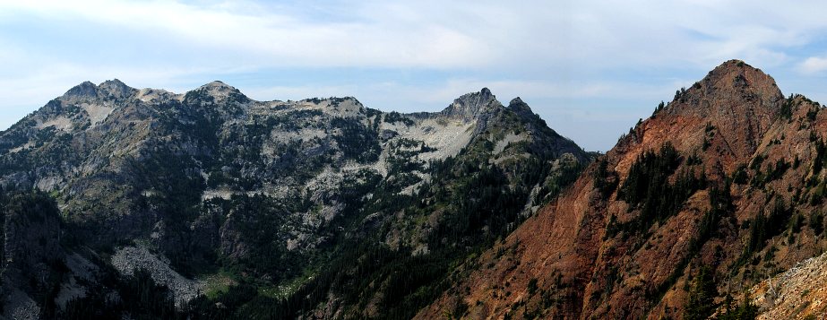
A few of the big mountains of the Alpine Lakes could be see, though they were heavily obscured by the thick air. I suspected one in the far distance of being Bears Breast and, with no one around to contradict me, settled on calling it such. From the other side of the peak the prominent mountains of the pass area could be seen to advantage, including hulking Snoqualmie, jagged Lundin (which has turned me back twice), and pyramidal Red (on which I got lost and ended up on the false summit of Lundin). The gully that I had climbed up to 30 feet below the summit of Lundin seemed far steeper that it had back in May. But, things always look worse from afar, and it had been covered in snow then.
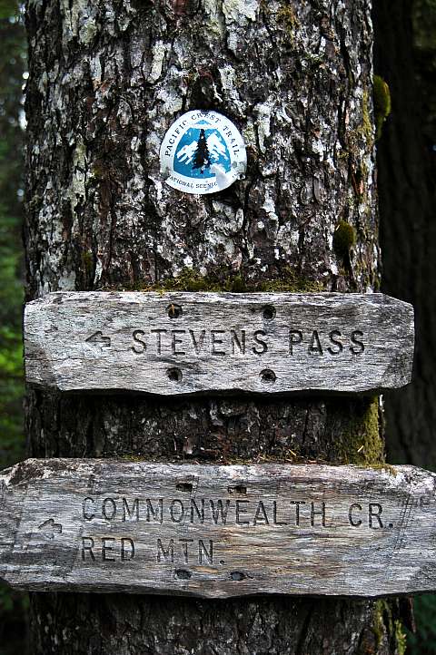
I sat on Little Kendall, as I had taken to calling it, for nearly an hour before deciding that it was time to descend and find the correct route to Kendall. Not that I had any interest in scrambling up it, but I thought that the information might be of use sometime in the future. I was very careful picking my way down the steep slope, but still managed to kick a few rocks down the slope. No one was below me, but I wanted to be perfect anyways. I reached the trail in thirty minutes and hiked quickly up the PCT, following a few switchbacks, to a spot where the PCT makes a big right turn before descending, and at which I had rested in 2003. It seemed that this was the 5200 foot mark and it was from here that one was supposed to scramble up to Kendall, still unseen from this point. I had a seat where I had three years ago and gazed down to the interstate and ski resort far below me. Beyond this point, PCT hikers would see little of the hand of man, other than a trail and a few signs, until they reached Stevens Pass, seventy miles from here. Between here and there lay one of the finest stretches of the PCT, one of the best long trail segments anywhere in the US. I felt a twinge of jealously toward those bearded, stinking, filthy hikers who would soon be coming along, having walked more than 2400 miles to get here.
Logistics
From Lakewood, drive I-5 north to State Highway 18 and follow this to I-90. Head east on I-90 to exit 52 (marked as "West Summit") and get off the interstate. Make a left from the off ramp and drive a hundred feet or so to the entrance for the PCT trailhead. You'll need a Northwest Forest Pass to park legally, or something like the Golden Eagle Passport, which is what I have. Hop on the PCT and hike up to where the trees end and your at a large boulder field. Above you, you'll see three minor heaps of rubble. To get to the rightmost one, just scramble up, staying to the right of the other rock, until you breach of gully with some trees in it, just to the left of the peak. Scramble up top. If you want to go to the real Kendall Peak, keep on the PCT as it switchbacks a few times, hiking maybe 10-15 minutes past the boulder field. Reach a prominent right bend in the PCT, past which it starts to descend slightly. Scramble up from here. You can't see Kendall from here or from the boulder field, which complicates matters, but you can from lower down.