Camp Muir, Mount Rainier National Park
November 23, 2008
A clear November Sunday? In Washington? Yeah, we're getting out for sure. I wasn't especially happy about not being able to spend two hours laying in bed drinking tea and reading Solzhenitsyn, but I agreed to sacrifice my normal Sunday routine for some exercise on our local mountain. I met Jeff and Kevin and the 512 Park and Ride and together we sped up to Paradise to join the rest of Puget Sound on the mountain.

Camp Muir is the high camp for several climbing routes on Mount Rainier, including the Disappointment Cleaver route, which Kevin, Wayne, and I climbed back in 2007. The route up to Camp Muir is one of the better conditioners in the state, gaining nearly a vertical mile of elevation in about five miles of travel. Unlike the other usual suspects, this conditioner has views the entire way up.
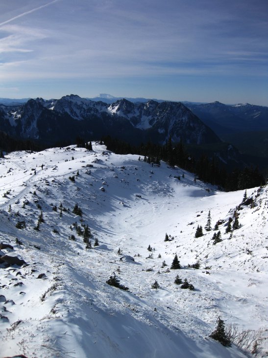
Starting down low you climb slowly, with views only of the local Tatoosh range. Down low these look brutal and intimidating, especially when a thick mantle of snow is plastered on them. But as you pass Alta Vista and begin the grind up to Panorama Point, the Tatoosh fall away and you start to get distant views to the southerly volcanoes of Adams, St. Helens, and Hood.
The hike up to Muir is non-technical only in the sense that you don't have to worry about scrambling up rocks or falling into crevasses on a glacier. From Paradise you travel mostly on snow at this time of the year and never have to cross a glacier on route. The main dangers on the climb are from altitude and weather. If you get off route, however, you can get in serious trouble.
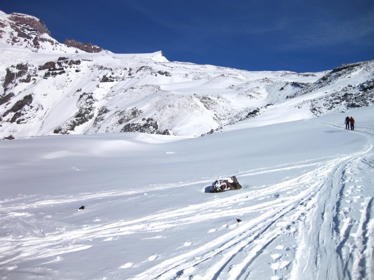
The Muir snowfield is flanked by the Nisqually and Paradise glaciers and these can for very real dangers. Hikers have died when a white out descended on the mountain and they lost their way on the Muir snowfield. Hikers have died of exposure when a storm came that they were not prepared for. More hikers, I believe, have died in the park than climbers on the mountain itself.
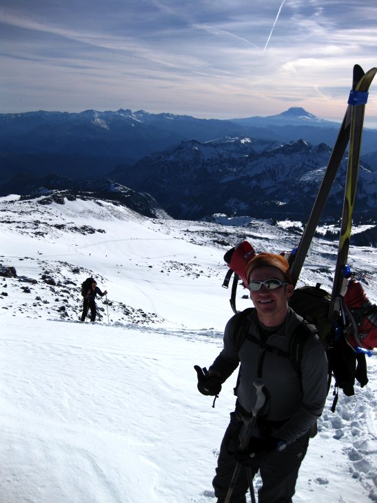
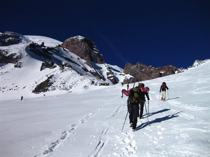
We climbed above Pebble Creek, passing a lot of skiers and a few hikers, and started up the snowfield itself. The Great Destroyer, who is now also known as MFW, had spent the night on the snowfield so that he could ski virgin snow in the morning. He came racing down on his skies and intercepted us at about 8,800 feet. He, Kevin, and I are heading to the Andes in a little under a month to try to climb Aconcagua, the highest point outside of Asia.

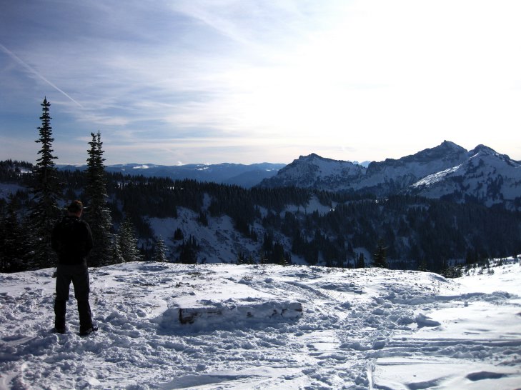
We continued to plod up toward Camp Muir, which slowly came into sight as we rounded 9,300 feet or so. Objectively, I knew that we still had 900 feet to gain and about 1/2 mile to do it in. I knew this, but it looked like the huts were so close that we'd be there in five minutes. This is how people get into trouble up here. They keep pushing when time or altitude or weather tells them to go down. "Look! Its so close. Let's keep on going!" And then they die or epic. Last spring a hiker died within sight of Muir from exposure. You can see one of the guide huts in the center of the below photo. The DC route goes around to the far side of the main rock formations you see, then climbs to the summit. Yes, that is the summit of Rainier in the photo. It looks so close, but from where I took the picture it is a vertical mile above me. Distances are deceiving on glaciers and snowfields!
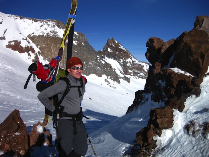
I began to feel the altitude at the very end, with a slightly off stomach, but my heart rate was fine and I wasn't breathing especially hard. Of course, I wasn't moving very fast either. I joined Kevin at the top, 3 hours, 45 minutes after setting out. Not a fast time by any stretch of the imagination, but not slow either. The view over to Cathedral Gap was impressive!
We hung out at Muir for a while, but my fingers were getting cold and I wanted to descend to where it was warmer. Kevin was going to ski down and Jeff had enough experience to make his way down on his own, so I strapped on my crampons and began descending as quickly as I could. There were many skiers out on the snow field and there were tracks everywhere. I stayed out of the virgin powder as much as possible to keep it nice for them.
It takes about an hour and a half to descend on foot to Paradise from Muir. I took my time once I got down to 9000 feet and started to warm up more. Many tired, strung out skiers and snowboarders kept asking me how much further it was, but few seemed to believe me when I told them it was a long ways still. If you get tired up here, it is better just to go down. It looked like we were going to get down with a lot of day light left and plenty of time to swill beer and eat cheeseburgers at the Copper Kettle.
But plans don't always go as planned. Around 8,500 feet I ran into a skier unable to move on his own and stopped to help. We ended up spending a lot more time on the mountain than planned and it was dark by the time we all got safely off and back to the parking lot. But, the light on the mountain at sunset was totally worth it and represented some of the best and strongest alpinglow that I'd ever come across.
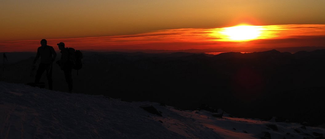
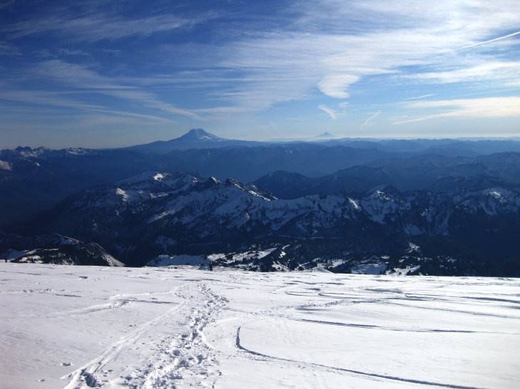
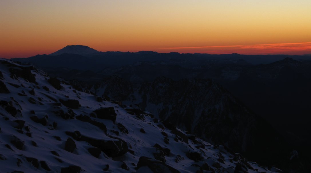
I only had my little point and shoot, but even with that the photos came out great. Having good conditions in which to work really helps: Just point the camera at the obvious, beautiful thing in front of you and fire away! The mountain below is St. Helens.
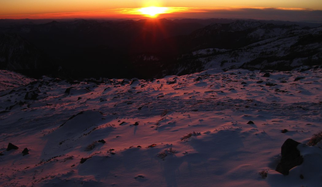
The snow really did look purple and I haven't tweaked the below photo at all on the computer.
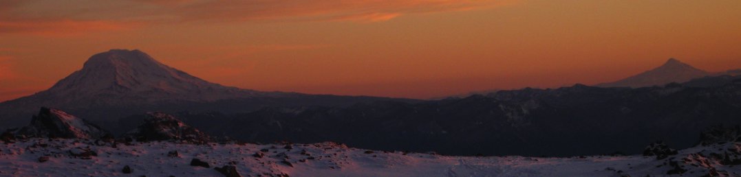
In the below photo, you can see Mount Adams and in the distance Mount Hood. If I had had my SLR with me, I'd now have three or four new 12 by 18 inch prints on my wall!
Logistics
From Lakewood, take SR512 west briefly and then exit onto SR7, heading south. Keep on 7 until you reach SR706 and make a left on it for Paradise (signed, you can't miss it). Drive 706 to the entrance to Mount Rainier National Park. You'll need to pay them some money to get in, or have a pass of some sort. Drive up to Paradise. You might need chains or four wheel drive in the winter. Also, if there has been any recent snowfall you may have to wait until late in the morning for them to open to the road above Longmire. Park in the lot next to the new lodge at Paradise and follow the Skyline Trail. If you're there when snow is on the ground, you'll probably want to go with someone who has been to Muir before. Or, just follow the tracks and hope for the best. The hike up is straightforward and has no technical difficulties. However, people die regularly on it due to bad weather, and occasionally avalanches. Do yourself a favor: If the weather is bad, go elsewhere!