Ohanapecosh Park Loop, Mount Rainier National Park
September 12-14, 2005
Sun was breaking through the clouds, though it was still noticeably cool, when I changed clothes and shouldered my pack for a final summer romp in the wilderness. I had originally planned to hike the entire Wonderland Trail this week, but a feeling of melancholy generated by the black day four years ago, combined with the suffering from the recent unpleasantness on the Gulf Coast, erased my desire for such an extended trip. Instead, I was going to take in the best of the Wonderland Trail and form a 34 mile loop on the east side of Mount Rainier National Park. Contrary to its fierce reputation, I found the gentle forest walking of the this part of the Wonderland Trail to be rather pleasant. The sun and the meandering body of Fryingpan Creek, coming down off of a g;acier high above, and the fragrance of the deep woods, gave the trail a welcoming aspect and I stopped frequently to drink the glacial milk and sniff at plants along the way.

As I gained elevation and began nearing Summerland, the forest melted away and the subalpine emerged. Fall was in the air and on the ground, the change in seasons distinctly marked by the birthing of golds and tans and reds by the local flora.

When I moved out to Washington a year ago, I assumed that the lack of hardwood trees would mean a boring autumn. That the pines and firs of the Pacific Northwest would render the season a meaningless blip on the march to winter. While the evergreens were indifferent to the change, other plants were not. I was shocked when I hiked the Northern Loop last September and saw the spectacle of fall in the northwest: Carpets of gaudy colors spread out over the land as all the small plants began their preparations for a deep sleep. Unlike the East and South, where the big trees are the stars, in Washington the little things were.

I bypassed the Summerland shelter, where two tired hikers were resting and lunching, and opted instead to push on through the subalpine land and head toward Panhandle Gap.

The local fauna knew that winter was coming as well: A fat, morbidly obese, rotund, portly, corpulent, tubby marmot was eating grass near the trail, showing of his new silverly coat.

As the trail steepened, the subalpine, with its scrub cover and occasional tree, was gradually fading away into the land of the true alpine. I was sweating now, which was not good as the air was growing colder and colder, laced, as it was, with the chill of the glaciers above me.

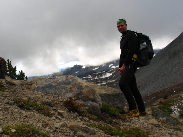
I was in a world of rock and snow, high above Summerland, and still climbing. The weather was closing in on me, spilling over Panhandle Gap, and would soon sweep away Rainier and Little Tahoma from visual existence.

The trail swung me around from what I thought was the gap, leading instead to a higher, broader notch in the mountain change. As I neared, I hoped the clouds and mist would not yet be complete, and that I would get something on the otherside other than pure grey.

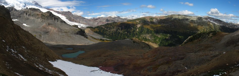
I was swept away on top. Breathless, though not from exertion; breathless from enchantment. My heart was beating hard in my chest as I surveyed the other side. Blue skies would have been inappropriate up here, I thought. Somehow the land would have looked like any other pass, any other place in the Cascades. But with the mist and low clouds, green valleys and oddly blue mountains in the distance, the view from the gap was a magical one.

I was excited enough to climb up to a nearby peak to have an even better look, despite taking me higher in the wind that I knew would soon cool my body dangerously. I should have put on a jacket. I should have found a rock to huddle next to. I should have been thinking about hypothermia. I couldn't have cared less. Instead, I sat on a rock colored by that funny orange lichen that one finds in the alpine and had a good long sit.
From my rock I gazed upon the land that I had just passed through. I gazed upon the land that was to come. Throughout, I alternated through feelings of great happiness and contentment for myself, and compassion and pity for people who would never come to such a place as this.
A camera is never as good as the human eye and besides, it only records a moment in time when a photographer happened to be in a certain place. It can't record the way a place feels or moves through time. In order to experience a place fully, you have to go to it. It had taken me two hours from the road to get here. They were two hours well spent. Yet, many people would never take the two hours out of their lives to walk up here. It didn't require any special skills or a remarkable feat of endurance. Just putting one foot in front of the other, resting when tired, eating when hungry.

Many people simply would never think that it was worthwhile to spend two hours and a bit of sweat to come up here. It wasn't that they thought it a bad idea. It would just never occur to them that there was anything up here that mattered. My mother had once told me of a distressing interview she had seen one Christmas season on one of the local news channels. A man was in a store and thinking about buying a new high definition, plasma TV, or something like that. He was raving about the picture quality and said, "Man, it's better than real life!" That man would never come to a place like this. And he was not alone.

I had been sitting on my rock for forty minutes when I realized that I was rather cold and my hands were numb. It was time to leave. The trail lead me along, up and down, through the alpine land until it finally crested out and I could look down upon Indian Bar, my home for the night. A little dot in a rocky drainage, far below me, was the shelter that my permit said was my bedroom for today.

I rolled down the trail, my leg muscles whimpering as they absorbed the rapid loss in elevation, and I found myself an hour later talking with a ranger with a Sig-Sauer 9mm pistol on his hip, like some old time gunfighter. I wondered why the Park Service had armed him, as the gun would do little against a black bear. The only things he would shoot would have two legs. Things like me. Arming rangers in the front country with pistols is reasonable, given the confrontations they have with drunk campers. Arming rangers patrolling against poachers is a good idea, given that the people they are looking for are, by definition, armed themselves. I just couldn't see the wisdom of putting on handgun on his belt in a place like this, where the most dangerous person he might encounter would be a tired backpacker. He checked my permit, we chatted, and I retired to the stone shelter, for I was still a bit cold from my time at Panhandle Gap. I was chilled, but happy beyond belief at how I had spent the last few hours of my life, hours that would never come again but that would be with me forever. They were hours that mattered, that counted for something. I had not killed time, but had lived with a purpose, had lived directly, as a crotchety old man from Massachusetts once wrote. And as I sat and watched the mist and clouds fill the upper reaches of the valley, watched the hikers slowly stream in to their campsites (I was alone in the shelter), watched the water flow down from high above, I was content.
From my sleeping bag I could see a pale light bathing the valley of Indian Bar. I hopped out quickly and grabbed my camera before the light faded. The clouds and the mist of yesterday had vanished completely and had been replaced by blue skies and the golden light of early morning in the mountains.

I gawked at my surroundings and could think of no better place to be than here. There was no hotel or resort in the world that could possibly provide a waking slumberer with a more delicate, delectable welcome to the morning. I drank tea and had breakfast and set out as quickly as I could, for I wanted to climb up and out of Indian Bar before the light faded with the onset of the day.

I was sweating hard when I finally topped out on the tortuous climb that never seemed to want to go all the way up. Forty minutes had brought me to the top of what in the South would be called a bald. Here, it was just a little hill covered with grass. A little hill from which I could survey Rainier and Little Tahoma in their morning glory. Burly Mount Adams anchored the south, dominating the blue mountains around it, with pale Mount Hood far in the distance. The Goat Rocks, wearing a fresh mantle of snow, were jagged reminders of one of the most incredible feats of trail building that I ever encountered. I sat in the sun, on my hill, and was alone in the world. It is exceedingly rare to find a truly silent place, but that is what I found on the hill. No birds were singing, no insects chirped. The was no wind to rustle the grass, and any sound of man was far away. A silence like that of Death Valley. I sat in the dewy grass and simply appreciated the feel of the sun on my skin.

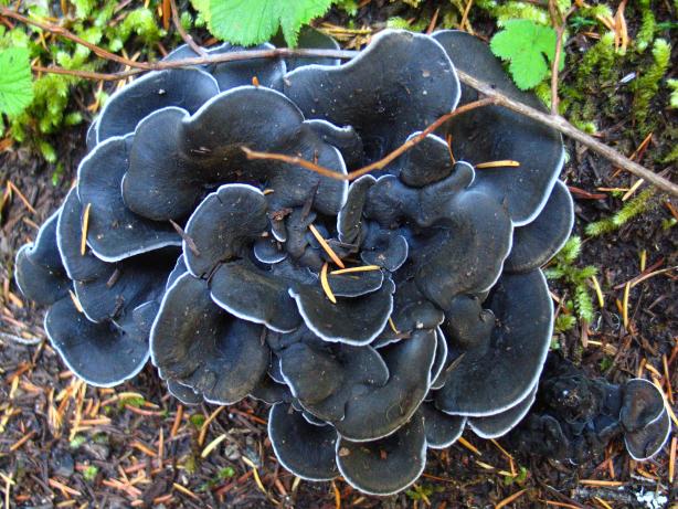
I sat until satiated and then set off down the trail, which dropped rapidly from my hill and quickly ran into the woods, where spectacular views of massive mountains and deep valleys could no longer be had. However, the deep woods have their own charms, not least of which is that Smell that reminds one that everything can be right at some time. That Smell that welcomes with its fecundity. One must keep one's eyes open when walking in the woods, for little treasures replace the huge spectacles of the alpine.
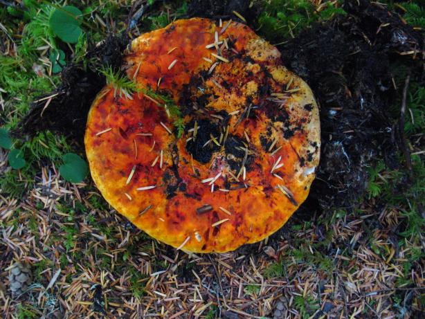
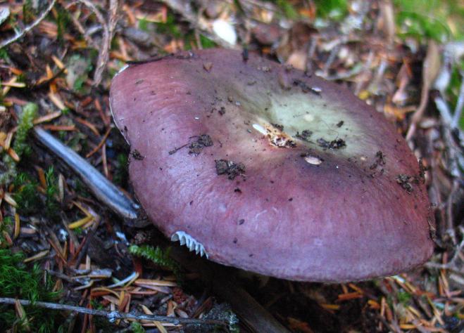
I dropped lower and lower and even passed two hikers laboring on their uphill trek to Indian Bar and all points north. I gave names to the plants and fungi that I found. Not knowing their proper names, I could only invent my own based on what I thought they looked like, or what they smelled like, or what they felt like. The Black Rose. Pizza mushroom. Stink bush. It was my own system, and no one else's.
I began meeting day trippers when I neared the Grove of the Patriarchs, a popular nature, interpretive trail which features the same large trees that I had been walking past for the last hour. Once the nature trail diverged from mine, I was alone once again, following the Chinook River upstream. It was not quiet, however. State Highway 123 runs parallel to the trail, but on the other side of the river and the sound of automobiles and trucks seemed out of place in the forest.

The Eastside Trail, which is what I was following, was nothing like the high alpine of the Wonderland. It had no views of Rainier, nor fat marmots to tease. It was mostly flat and mossy. It was sublime. A huge, two tiered water fall appeared where the Ohanapecosh meets the Chinook. On my map it was simply marked as "Falls", which seemed to guarantee that people would never come out to visit it. "Falls" just didn't sound particularly interesting, but this one was the largest one that I had seen in the park.
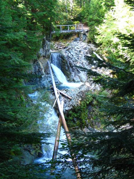
I sat on the bridge above the upper falls for a while, gazing at the water flowing underneath me and eating a Snickers bar. Because of camping restrictions, I had a short 16 mile day today and had done 13 of them already. Thanks to my eagerness for the magic of early morning, it wasn't even two in the afternoon yet. I had time to do nothing on the bridge. Better than doing nothing at camp, I reasoned. And so I lounged.

When I had lounged enough, I walked for thirty minutes and then lounged some more at Stafford Falls. The perfect swimming hole, during a warmer part of the year, was formed by the falls and the surrounding rock. An emerald pool, hemmed in by thirty foot cliffs and a narrow outlet, I couldn't believe that there weren't more tourists here, for it was maybe a mile and half from the road and of unquestionable scenic value. My lounging was becoming epic.

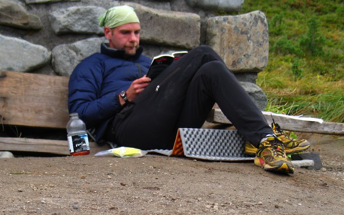
I felt like having cocktails and eventually persuaded myself to get up and walk the remaining mile to Deer Creek camp. Set off from the river, it was sheltered and my space had a nice, thick layer of duff to cushion me as I slept. It had no real view of the sky, however, and there were no interesting plants about, nor funny rocks to ponder. I had little to do but my normal routine of reading, writing, and cocktailing. And plenty of time to do it in.

I had no fire to start early this morning, given my location deep in the shade of the forest. The fact that I had a 2400 foot climb in about 4 miles didn't help me get out of my bag any faster. Nor did the thought that this was the final morning of my summer hiking. School was starting a week from today. A week from today I'd be in my office, ready to start teaching once again. I slept a bit longer.

When I finally did get going, the going was easier than expected. The Owyhigh lakes trail brought me through the woods and up to pleasant, golden meadows, where views of the Cowlitz Chimneys could be had. A few hundred yards further on brought me to Owyhigh lake, which was more of a puddle than a lake at this late season. I stopped to sit in the sun on a rock for a while and rest my mind for a bit, not really wanting to go home. I knew that once I got up from the rock, my next rest would be sitting in my car on the ride home. A rock in the sun, in the mountains, is a much more pleasant place to rest than in a car on a highway, and so I lingered. Lounged. Lazed. It was useless to put off the inevitable. But the mountains are not going anywhere. I can come back. I will come back.

Logistics
The Ohanapecosh Park loop starts at the Frying Pan Creek Trailhead on the east side of the park. Take the Wonderland Trail up and over Panhandle Gap and down to the junction with the Cowlitz Divide Trail. Take a left and hike down to Stevens Canyon, where you can pick up the East Side Trail. Take the East Side Trail north to the junction with the Owyhigh Lakes Trail. Take a left and hike up to Owyhigh Lakes and down to the road. Make a left and walk about 1/2 mile back to the Frying Pan trailhead. The total distance is about 34 miles, with some rather severe elevation changes, namely the big climb up to Panhandle Gap, the huge descent to Stevens Canyon, and the moderate climb to Owyhigh Lakes.
From Lakewood, take SR 512 east, following the signs for the Sunrise area of Mount Rainier, through Puyallup. Hop on SR 410 and take this through the towns of Buckley and Enumclaw, all the way to the park itself. You'll pass Crystal Mountain Ski Resort just before the turn off for Sunrise. A mile or two after you make the turn, there is a ranger station (White River) at which you can get a permit. Continue on the park road for another couple of miles until you reach Fryingpan Creek, where there is a trail head and parking. You'll need to pay $10 to get into the park (or have a parks pass), but the backcountry permit is free. Indian Bar and Summerland are extremely popular campsites and you may not be able to get a space during a summer weekend.