Ranger Creek, Mount Baker - Snoqualmie National Forest
November 5, 2005
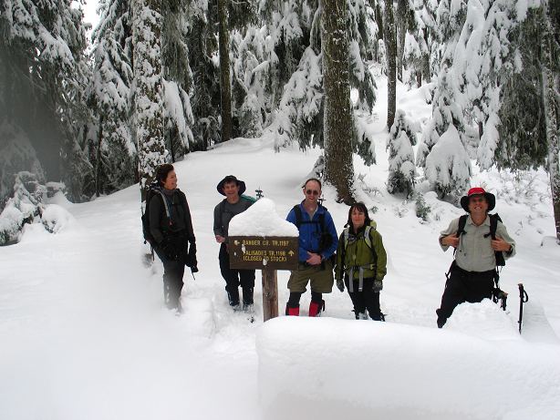
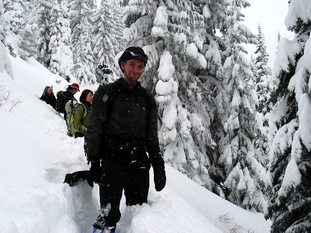
I stood under the awning of the Greenwater General Store finishing my coffee and watching the sleet fall down gently outside, pondering how much desire I really had in me to go for a hike in the hills around Mount Rainier. I was waiting for the rest of the The Mountaineers to show up and the wait gave me time to realize that I was only out here because I told other people I would be. I hate hiking in the rain. The original plan had been to do a loop connecting the PCT and a place called the Ravens Roost, but the access road was snowed in, prompting a change of plans, and lots of cancellations. A familiar mini-van pulled into the parking lot and out came Jay and Monica, whom I had met the previous week on a traverse Rattlesnake Mountain. Mike, the trip leader introduced himself and, after a bathroom break for the Seattle-ites, we sped off to a lower trailhead with the intention of hiking up Ranger Creek until satisfied, or until snow turned us back. The sleet had stopped and it was pleasant enough out when we started up the trail, though it quickly became apparent that we were going to be in snow very quickly.
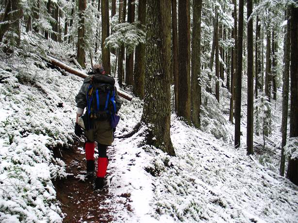
After climbing steadily for a mile, we found ourselves in the beginnings of snow: Light, powdery, and only half a foot deep. As we ascended, however, the snow started to increase in depth, but not enough to really slow us down. Someone else was out here, as we were following tracks, but they turned off at a trail junction to a view point and for most of the rest of the day we would have the pristine place to ourselves.
Mike, Wendell, and I took turns breaking trail through the increasingly deep snow as the ascent continued. I set out on my own for a bit and was struck by how beautiful the land was: Not because of vast mountain views or intricate rock formations, but because of the snow. During the summer this would be a simple sweat in the forest. But now, at this time of year, it was almost magical. The first snow of the season turned the woods into a sublime place.
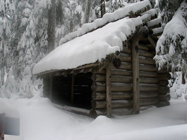
I found myself alone in the silent land standing next to a three sided, solidly built shelter that would have been quite at home in the hills of North Carolina on the Appalachian Trail. Except for the lack of bunks, that is. The others were somewhere down below me, but I could hear their cheery voices carrying up through the cold air.
When the others arrived, I knew that I was not the only one struck by the beauty of the place: Everyone wore a grin that vacillated from gaudy to contented. We were all happy. We stopped for lunch for twenty minutes, just long enough to get cold and to enjoy some double chocolate oatmeal cookies that Mike had baked up the night before. None of us wanted to turn around as it was still early and the setting too perfect to call the day done.
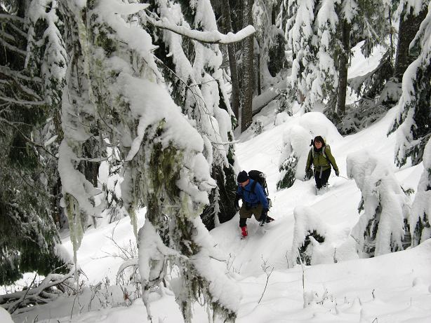
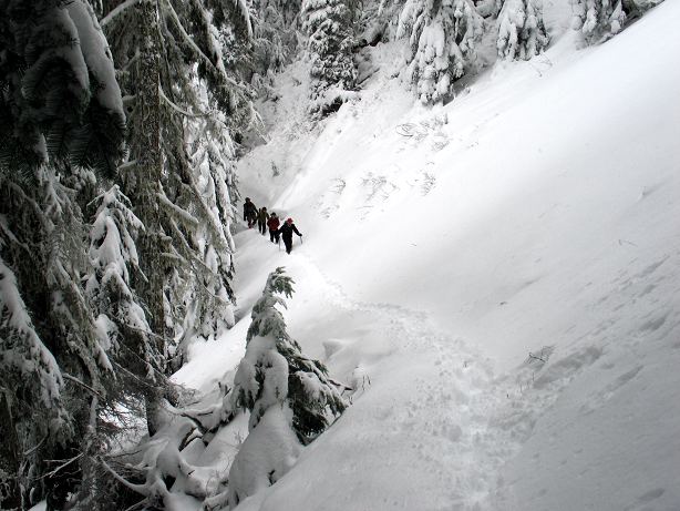
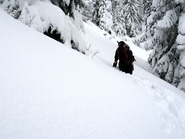
Setting off once again, we formed a line with each person taking a turn breaking trail through the two foot deep snow and then returning to the end of the line when their time was up. The snow began to accumulate more and more as we neared 6000 feet: As the slopes opened up out of the thick lower forest, the snow depth approached three feet. In some slide areas, even more.
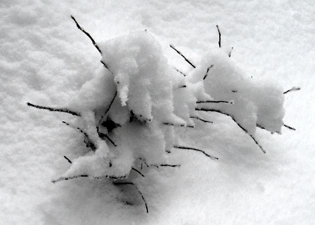
The snow was still light and powdery, but there was enough of it to make breaking trail a rather tiring experience for ones legs. Still, the increasing workload did little to staunch our enthusiasm. All around us was such magnificent beauty that it was hard not to be almost giddy. From the heavy phlumf that hung on the trees as abstract sculptures, or fell on us, to littte bits of vegetation sticking out of the snow, to snow covered moss dangling from trees. Monica made the best find in the underside of a large tree: Green moss, white snow, and orange lichen arranged in a pattern to suggest that nature was not without a sense of beauty and order.
Despite our general eagerness to push on and continue the loop, the snow on the traversing hillsides was becoming rather deep and the day was getting on. We had only been progressing at about a mile an hour and still had five miles to go to complete the loop. With only about three hours of solid day light left, we had to turn back. Naturally enough, we forged onward.
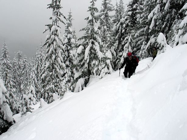
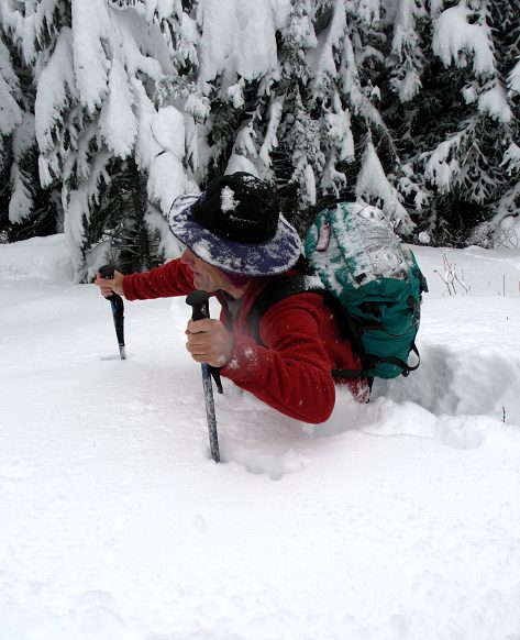
But not for long. I was plowing through snow that was approaching my hips, forcing me to spend a lot of energy and time, which we were running out of. Monica came forward to see for herself, making it about fifteen feet in front of me in five minutes.
Enough was enough and Mike's wise suggestion that we turn around and take the safe and sure route down was accepted. It had been a good day, a first day of the snow season, and there was no reason to turn it into a race against the cold and dark night.
We played on the snow slope for ten minutes before turning around and racing down our cleared path for the cars several thousand feet below us. The temperature had dropped to -5 centigrade and the wind was blowing steadily, as if the weather was confirming the wisdom of our decision to turn back when we did. The snow that had been falling on us turned to rain for the last mile of the trek and it was with great happiness that we reached the road and thus the warm, dry sanctuaries of the vehicles.
Logistics
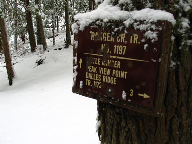
From Lakewood, drive I-5 north to SR 512 and follow that road east toward Puyallup. Take SR410 west through the towns of Sumner, Buckley, and Enumclaw to the hamlet of Greenwater. About 10 minutes past Greenwater you'll see a sign for the Buck Creek Recreation area. Take a right at the sign, cross the bridge over the White River, and make an immediate left into a parking lot. You'll need a Northwest Forest pass or something like the Golden Eagle Passport. To find the trail, walk back out to SR410,turn left, and walk about 20 yards to where you'll see a trail cutting up on the other side of the road. Walk up it about 10 yards and you'll see trail signs. Note that you could park on the road if you wanted to and avoid the parking pass issues.
If you hike up the trail (moderate grade) for about 6 miles you'll run into a nice three sided shelter. Beyond the shelter, the trail climbs and it is possible to complete an entire loop of about 12 miles. We turned back due to lateness of day and the snow. It is about 7.5 mile to our turn around point. The highway is at about 2600 feet and we topped out somewhere around 6000 feet.