The Timberline Trail, Mount Hood National Forest
September 4-6, 2006
Mike and Wounded Knee were so clearly thruhikers that only a blind man with sack over his head could miss them. Sitting at the breakfast buffet in Timberline Lodge, Brian and I had spotted them instantly, though gave them some time to chow before chatting with them a little bit. Both of us had hiked the PCT, though at different times, and could probably predict with perfect accuracy what was going through their heads at this moment, so close to the last state on the trail. 550 miles away from the end of a trip might seem like a long way, but for a PCT hiker the Columbia marks the start of the end. Canada seems close. Thoughts turn to life after the trail.
I hadn't expected to be here in Oregon. A surprise email from Brian Frankle on the last day of August brought me down for hiking instead of pottering about Lakewood, moaning about the end of my summer vacation. Brian is, perhaps, the first real thruhiker of the Hayduke Trail, one of the most original and daring routes that I had heard of in recent memory. The fall before he had hiked the Arizona Trail, another ambitious desert route. Oh, and in between he runs Ultralight Adventure Equipment. This summer he had set off for a multimonth trek across Nevada, the product of his own planning, but after a few days had called it off for lack of focus.
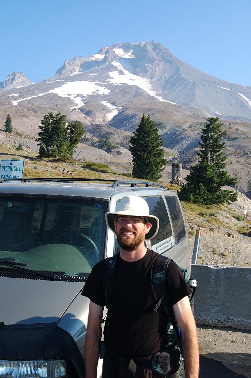
After my experience on the CDT last summer, I completely understood. Brian just had the good sense to come home after three days as opposed to waiting for a month. But, I was surprised anyways to get an email from him seeing if I was interested in a hike on the Timberline Trail. The Timberline provides hikers a possibility to circumambulate (that is a fancy word for walking around) Mount Hood, one of the finest of the Cascade Volcanoes. Like a shorter version of the famous Wonderland Trail around Mount Rainier, the Timberline promised plenty of elevation change and lots of stunning views of all sides of the mountain.
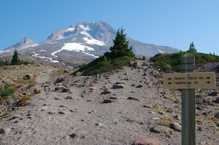
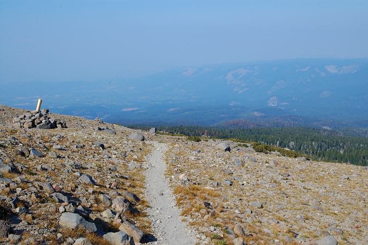
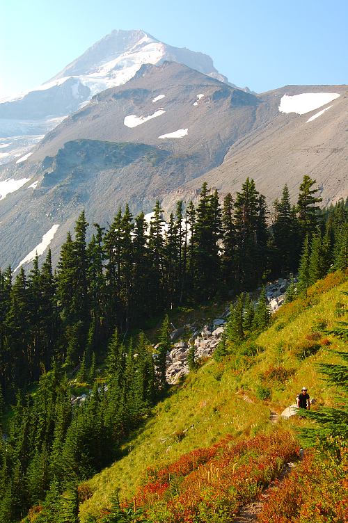
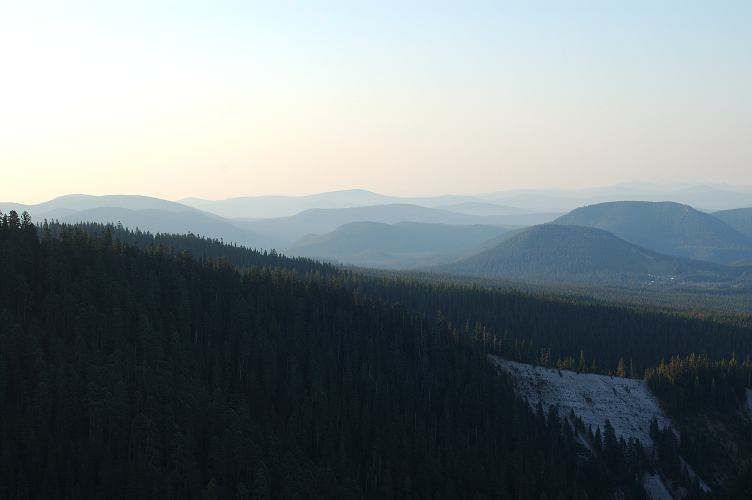
After breakfast we said our good byes to Mike and Wounded Knee and got our respective packs together, both of which Brian had sewn up at some point in the past. I promised him that I would do my best to embarrass him when we met hikers along the trail, and with that threat we set out in the pale light that was filtering around Mount Hood. The late summer haze and a few fires burning in the area meant that we couldn't see very far with accuracy, and the mountains looked more and more like those found in Appalachia, with row upon row of overlapping ridges.
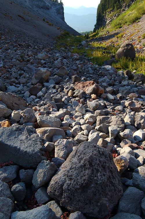
The trail ran along a ridge before dropping rapidly down toward a large, pumice filled drainage. This was the first of many such drainages, carved by the power of the volcano and old glaciers, that we have to traverse across on our route around the mountain.
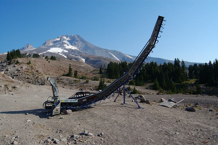
Brian rarely went on backpacking trips with others, just as I had done until last summer. But, we have a lot in common and were never without a topic of conversation. Although I had known him for several years, and we communicated regularly, this was our first hike together. But Brian and I are a lot a like and topics for conversation were never lacking. After a steep climb out of the pumice drainage, we emerged onto flower filled slopes scarred by the chair lifts and maintenance roads of the ski resort.
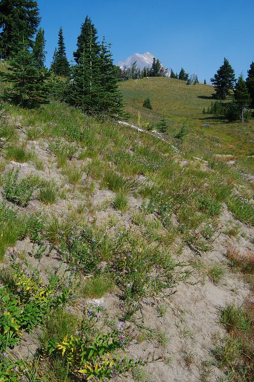
Unlike Rainier, Mount Hood is in a National Forest, rather than a National Park, and thus the ski resort. People wanting to ski or snowboard on Rainier have to haul up the mountainside under their own power. The pay off, of course, is quite high, but the effort is as well. For those looking to expend less energy, there are plenty of other opportunities, such as Mount Baker. Although the land was changing with the seasons, there were still plenty of beautiful wildflowers to gawk at, with purples and reds and whites dotting the green-changing-to-gold slopes.
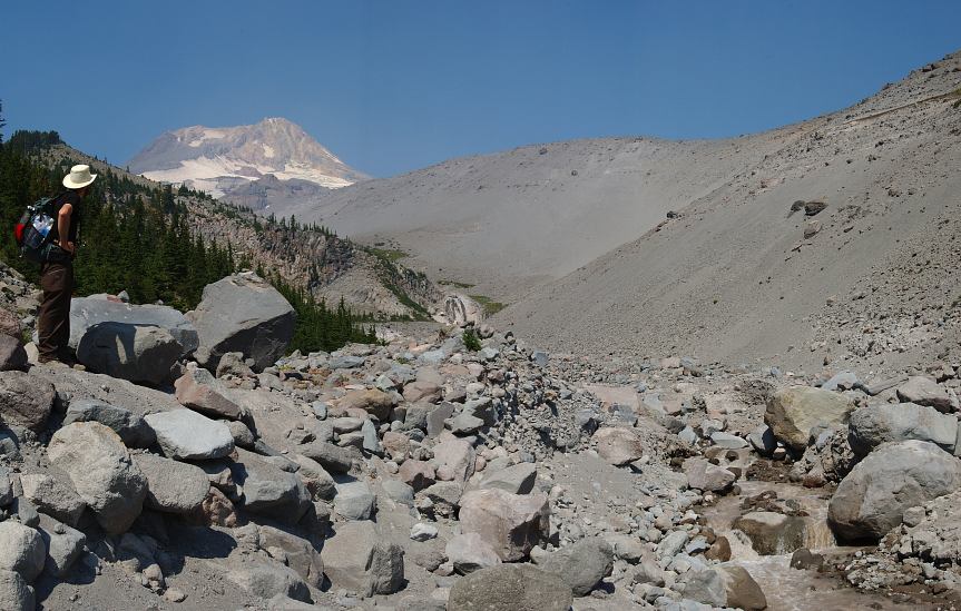
Brian and I dropped into our second drainage, moving carefully across the sliding, finely ground rock, and hopped across the river. A little unclear as to where the trail went, we followed some tracks and cairns downstream before becoming further lost. The trail clearly didn't continue to go down the drainage, so we scrambled up the moraine, sure that we would find the trail in the forest above us. When we didn't we finally looked at our maps, though they didn't especially help.
No matter, we thought, we'll just hike through the woods in the direction of the trail and hope to pick it up. An hour later, with bleeding shins and with pine needles down the back of my shirt, quite sweaty, we emerged from the woods and onto a trail. Not the best way to spend an hour, but at least we had trail again. It had been running above us the entire time. I had been fighting off a change-of-seasons cold for the last few days, and it made the two thousand foot climb up the mountainside somewhat taxing.
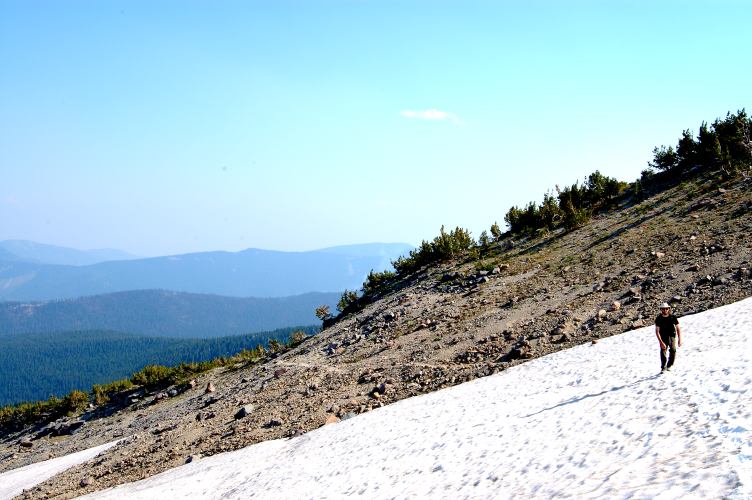
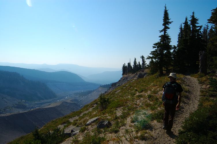
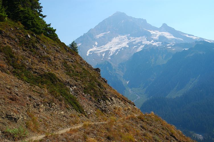
But the open, sweeping views of Hood and the deep, agricultural valleys running to the Columbia Gorge provided ample rewards. The land was barren, alpine, without trees. Without life. Without anything that one might grasp onto for moral support. This was a place that could be lethal in bad weather, but was stunningly beautiful, in that Death Valley sort of way, under the blue skies that we had.
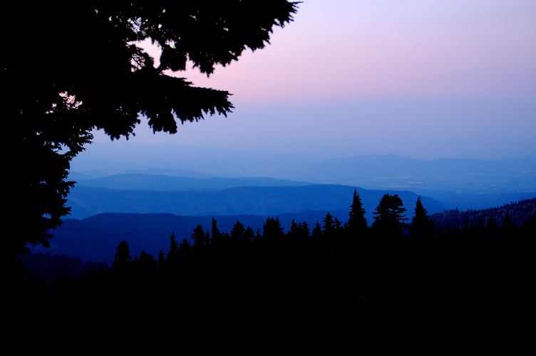
The high alpine couldn't last and we eventually descended to the friendlier, more mild, environs of the forest. After the climb I was pretty well whipped, but had enough energy to negotiate another drainage and make a few more miles before camping. We rounded a final waterfall and spotted a nice flat area a top a minor ridge, where we found a clearing and a great view of the valleys below us. The lights of various towns slowly came out as we cooked dinner and chatted about all things physical and metaphysical, sacred and profane. But the day had been hard for both of us and it was barely 8 pm when we got into our respective sleeping bags, no tarp or other barrier between us and the starry heavens, and quickly fell asleep under the stern gaze of Hood.
I almost never drink tea at home. But when in the out-of-doors, a half liter of steaming tea is almost a requirement for me. The hot liquid and the caffeine give me confidence to come out of my sleeping bag and start the day. We had covered about fifteen miles yesterday and were looking to put in twenty today so that we could finish early on Wednesday. After all, the next day I was leaving for a climb in the North Cascades. The summer was ending with a bang.
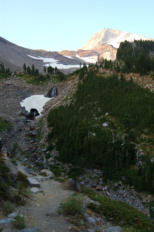
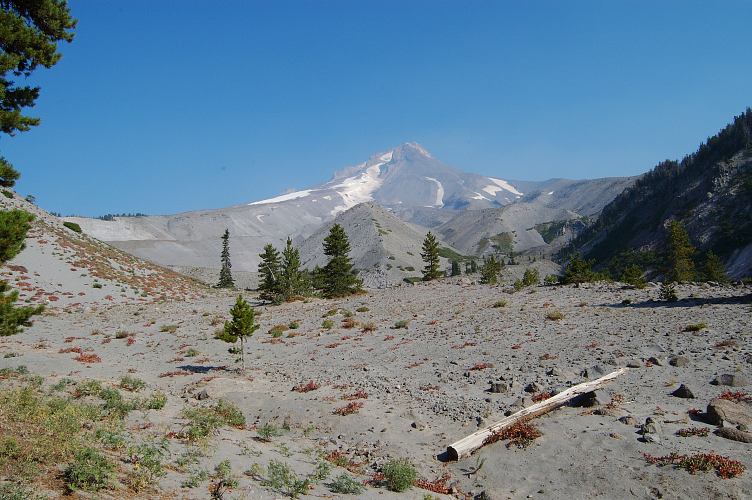
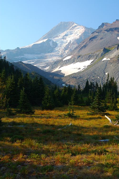
The elevation profile of the trail indicated that most of today would be downhill, with only a few minor climbs. But the end held a climb of more than 2500 feet, in about 3 miles. But that joy was for later. After an hour we came out into Elk Cove, an extensive system of meadows, glowing gold and red in the early sun, where camping was prohibited and where everyone would want to camp. The view of the north side of Hood was immense, with its many glaciers and icefalls, and only an idiot would not want to camp right there. There were some official campsites down in the woods, but they seemed a poor substitute for the meadows.
Brian and I talked about ULA and the independent gear business in general as we wound our way around the flanks of the mountain. It was a strange business, it seemed. His packs were in use by hundreds of hikers now, and almost standard issue on the PCT. Granite Gear might have a plurality on that trail, but he was not far behind. His packs come with a tag stating, "Sewn in my garage." That a one person operation could compete with a big corporation says a lot about the viability of small, specialized businesses these days. Walmart doesn't have to dominate.
Near 11 am we reached a junction with the Pacific Crest Trail and sat down for a bit of lunch. Brian was much more inventive than I. Where I ate down some cheese, a Snickers Bar, and a bit of trail mix, he had a ziplock bag full of mashed potatoes mixed with assorted goodies, such as Funyons and ramen noodles and dehydrated cheese. Early in the day he had poured a bit of water into the zip lock to rehydrate the bulk of it, and when he sat down to lunch he added the Funyons for crunch. Much better than my fare.
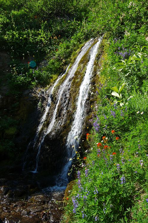
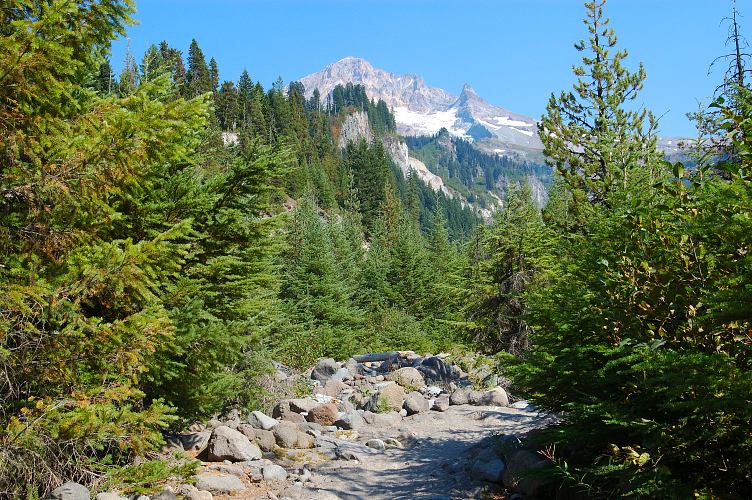
Rather than following the PCT, we stuck to the higher Timberline Trail, following it through shady forests as it continued its mostly level traverse around the flanks of the mountain. When the PCT got routed down to the lower areas was a bit of a mystery to us. Perhaps it was the fact that the Timberline ran right past Ramona Falls.
Ramona Falls are not obvious and garish like other popular water fall destinations, such as Eagle Creek Falls. Instead of exuding raw power, Ramona Falls are delicate, slender. The water flows down, rather than crashes. I tried taking a few pictures and then gave up, the lighting and my lack of a tripod making the quest foolish. The PCT is an equestrian trail as well as a hiker trail, and the forest service doesn't like horses moving so close to water falls, for some reason. Eagle Creek Falls are also avoided by the PCT, though almost every hiker leaves the PCT for them.
We dropped down from Ramona Falls and regained the PCT, where we encountered Wounded Knee as he made his way north to the Columbia. He had spent yesterday resting at Timberline and was now moving forward, contemplating the end of his hike. He didn't want it to end, and another 550 miles just didn't seem quite enough. We talked for a few minutes and then split, for he had a pleasant rumble to the Columbia to do, and Brian and I had our climb in front of us. Sweat rolled heavily off of me as we ascended the mountain side, meeting a few more PCT hikers along the way. Even though the trail was heavily switchbacked, it still tired me greatly and I was happy to reach the top of the climb, to have a steady uphill grade replaced with a friendly contour.
A little before 6 pm we found a pleasant open area near a stream where we could throw out our ground clothes and sleeping bags for the night. I fired up my stove for a dinner of cheddar and broccoli Liptons, mixed with dried vegetables, a package of salmon, and a healthy dose of olive oil. I was surprised when the sun went down, for time seemed to stand still as Brian and I chatted away the early evening. It is rare for people to sustain a conversation beyond the span of about ten minutes, and we had spent nearly two days talking non stop. Not gabbing. Conversing. But the light was done, bodies were tired, and it was easy to fall into a deep slumber under the stars and the mountain.
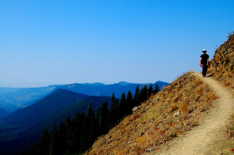
The light bathing the foothills on the south side of Hood reminded me again of the time I had spent in Appalachia. Row after row of overlapping, nondescript mountains, piling on top of each other for as far as the eye could see. They held a simplicity that the more austere Hood could never muster. They looked warm and inviting. Habitable. We had been sitting on a ridge above the Zigzag river chatting about climbing and leadership for some time. I didn't want to leave, and I suspect Brian would have been happy sitting there for another few hours watching the aspect change with the rising sun. But I had to go home to get ready for South Early Winters Spire, and Brian needed to return home as well to get ready for other adventures as well. We had to move on.
We traversed our last drainage and came out onto the slopes above Timberline Lodge, passing several groups of hikers who had wisely started the day early. Time had passed in a rather strange fashion on this trip, seemly meaningless beyond the rising and setting of the sun. Without a strict schedule and with more than enough days for the miles, the hike had been more of a frolic than a bit of exercise. 40.7 miles had brought us from parking lot to parking lot, with gorgeous scenery in between. But had I hiked the Timberline alone, it could not have possibly been as enjoyable or pleasant. It was the presence of Brian that made all the difference, that had turned a hike in stunning scenery to an excursion worthy of remembering beyond the surface level. The ghost of the CDT was gone.
Logistics
From Lakewood, drive I-5 south toward Portland and take I-205 heading south toward Salem. Pick up I-84 heading east. Turn off at exit 16, following the signs for Mount Hood and US 26. Once on US 26, follow it east to the town of Government Camp, just past which you'll find the road heading up to Timberline Lodge. Follow the road up and park in the massive ski complex parking area. You do not need a parking pass here during the summer.
We hiked in a counter-clock wise fashion, and I would do so again. Mostly the trail is well marked along its 40.7 mile course and it is fairly hard to get lost (we did). Elevation change can be severe, but there is also a lot of glorious contouring. Water availability is excellent and there are many places to camp. Make sure to pick up a permit at any of the stations at the wilderness boundary. Note that the parking lot is not in the wilderness, so you'll have to hike along the trail for a while before you can get a permit.