Mount Baring, Mount Baker - Snoqualmie National Forest
April 7, 2007
I looked up at the North Face of Mount Baring and felt some appreciable fear. The sheer face had claimed the lives of several of those who first tried to climb it, and would claim more in the future. It was steep, long, and committing. It was for climbers stronger, more skilled, and braver than I. Fortunately, I wasn't heading in that direction. Instead, I was off the West Ridge and South Face of the peak, an easy jaunt for my first alpine climb of the new spring season.
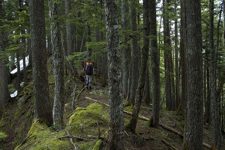
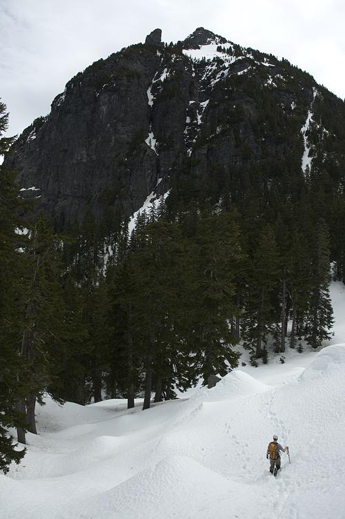
Steve, with whom I had climbed Mount Hinman and Lundin Peak last year, had emailed Peter (of Vantage infamy) and I to see if we were interested in a climb of Mount Baring with the Mountaineers. A basic alpine climb, it was going to have four basic climbing students and would be their first outing of the season. It seemed like a good excuse to get in an easy break-in climb before things got tough in the summer and I had been itching to get back out into the alpine after a three month hiatus. Besides, climbs with Steve were fun. We led out from the trailhead at 8:30 am after making the drive up from the Dirty South, with a rather large party of 8 people. Unlike a rock climb, this only slows things down, as opposed to slowing things down and annoying other people. We pushed our way through the steep brush to the top of the West Ridge, where we found a rather pleasant, flat, and easy ridge walk of about a mile.
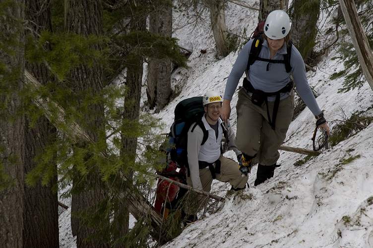
At the end of the easy part of the ridge, we dipped onto the south side, following a climbers trail and traversed along the face of the peak for a bit before donning crampons for upcoming hard snow, information we got courtesy of a group of eight from Seattle who were just in front of us.
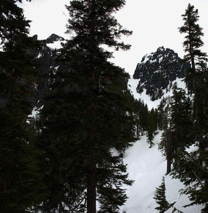
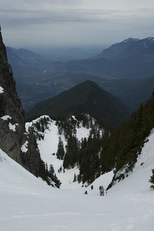
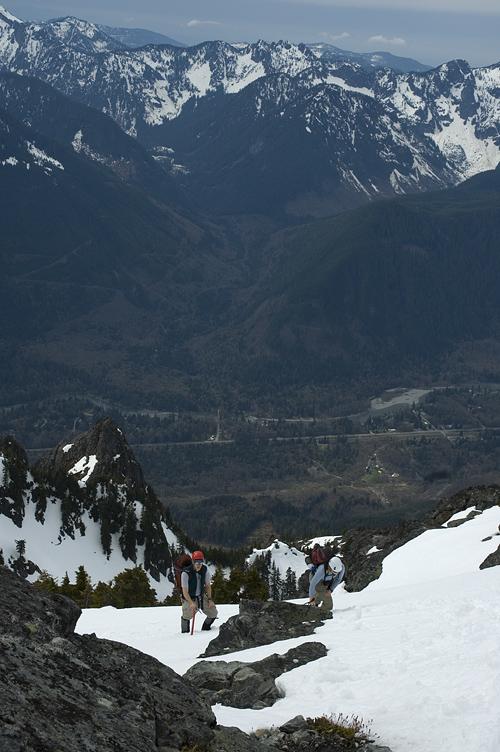
The traverse moved off of the easier terrain and began a sharp climb of about 30 degrees up to a distinctive notch where the mountain and the rest of the route were plainly visible: Cross the basin, climb the snow gully, make a left turn and reach the top.
After short break to put on sun glasses and get a bite to eat, we set out across the soft snow following the tracks of the other group. Unlike the shaded, forested snow on the flanks of the mountain, the snow in the basin was soft and easy to kick steps in. However, we didn't even have to do that as the group ahead of us had kicked big, bucket steps for us.
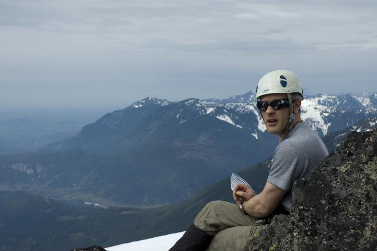
The gully proved to be easy walking, though it steepened to near 40 degrees at the top. Normally I'd be scared of this sort of thing, but the snow was so good that it was like climbing a ladder. Without snow in the gully, I don't think I would have headed up as talus walking at this angle isn't much fun. Steve, Rich, and I reached the top and luxuriated in the fabulous views from the notch between the two summits.
The distinctive pyramid of Mount Stuart dominated most of the scenery, and I made a mental note that I had made several mental notes in the past to climb it, but had not yet managed to do it. More interesting, for me, was lumpy Mount Hinman, completely covered in snow and looking more like a ridge than a peak. The attractiveness of Hinman wasn't in its physical beauty, but rather of its location: A rarely climbed wilderness peak. Unlike its close by neighbor, Mount Daniel, Hinman doesn't see much traffic, and the route up is fun, easy, and stunningly scenic.

The three of us rested for a while at the notch and were soon joined by Ryan. After Ryan caught his breath and had some food, I set out with him and Rich for the summit, with Steve waiting for the others. Following the well kicked steps of the party in front of us made life easy, and thirty minutes or so later, the three of us joined the other party on the summit.
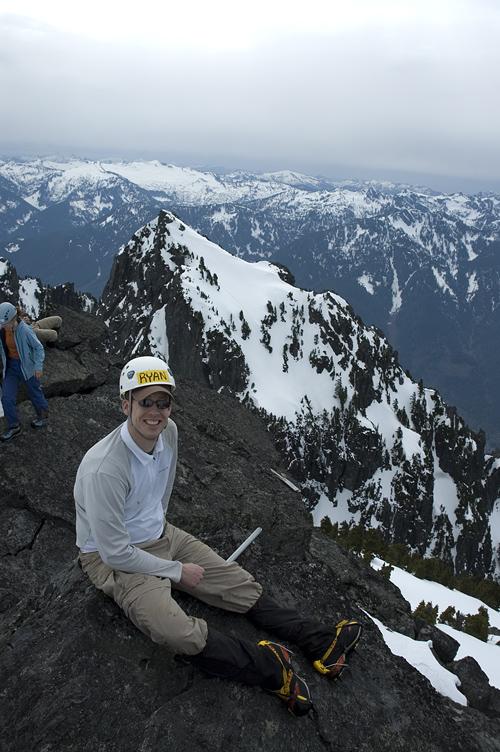
Unlike Hinman, it was very clear that Baring was still within the sphere of civilization. While one side held vast views of the Alpine Lakes, Henry M. Jackson, and Glacier Peak Wildernesses, another side held views of a logged, abused land. Or, rather, overused.
Gazing down from where we had come from, we could see the well inhabited valley holding US2 and running to Stevens Pass. A wilderness peak Baring is not. But, a very fun one nonetheless. The rest of the group joined us about twenty minutes later at 1:30.
The climb had been very fun and entertaining so far, partly because the stress level was very low. No technical difficulties, just a little sweat. However, in the back of my head was a rather annoying voice telling me that coming off the West Ridge and getting back to the cars wasn't going to be much fun. After thirty minutes of chatting and laughing, we headed back down the slopes to deal with the West Ridge.
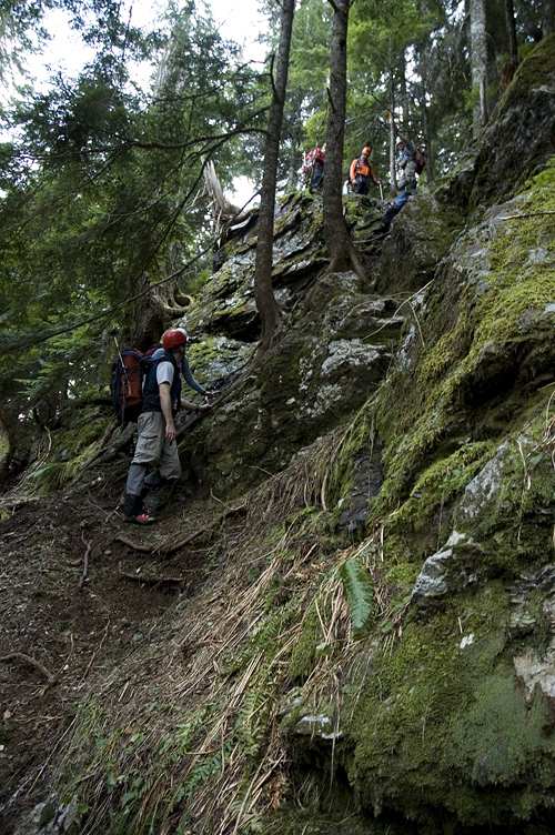
After retracing our steps to it, we began the steep descent, sticking to dirt rather than the bits of snow that dotted the upper slopes. Unlike going up, when you head down gravity is most definitely not your friend. It fights your balance and footwork every step of the way. I tracked the progress of the other party, following their route through the forest, stopping every now and then when there path faded out. Why I was following their track was unclear, but it seemed easier than finding a new way. On our way up we had scrambled up through various rock formations without much comment. However, down climbing them was bit more tenuous and a hand line came out at a judicious moment.
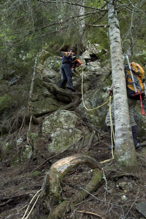
Using roots, rocks, and appropriate butt scooting, we made slow, sweaty progress down the slope, which seemed as if it would truly never end. We finally reached the creek, at whose base we knew lay the road, and forced our way, sans trail, down and out onto the road, four hours after leaving the summit.
Logistics
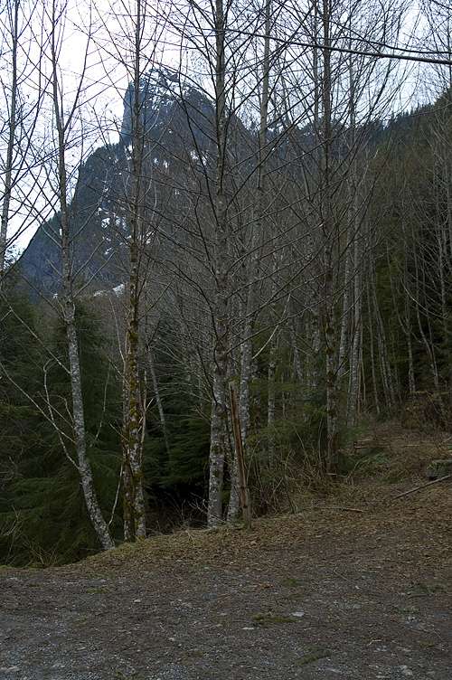
From Lakewood, drive I-5 north to I-405 and head north to SR522. Take SR522 east to its junction with US2. Take US2 east past a variety of small towns, such as Index, Sultan, and Gold Bar. At the near edge of the hamlet of Baring, make a left onto a USFS road signed for Barclay Creek. The road quickly turns to gravel, but it isn't too bad, except for some large potholes. Drive to the end of it at an elevation of 2200 ft. Do not take the Barclay Creek trail. Instead, just to the right of it (and by a big boulder) is an old road grade. Take that, pass by the boulder (and an old toilet) and walk for about 300 meters to a large cairn by a creek. Turn up the slope and head on an old (and decaying) climbers trail. Your goal is the top of the West Ridge of Baring Mountain, at about 4000 ft. The trail fades in and out and you'll lose it frequently. Just keep heading up through the brush, making your way as best you can. There are occasional pieces of flagging tape to help you.
At the top of the West Ridge, make a left turn and walk along the mostly flat, forested ridge. The trail continues, but you don't really need it here. The trail dips to the south and begins to traverse across the side of the mountain (still in trees) when flat progress ends on the ridge. Traverse along and then climb up a steep (30-35 degrees or so) that may have hard snow (take crampons). Climb to a notch (can't see it till you're close) at 4800 ft where you can see the rest of the route. Drop into the basin below the notch and head across the broad basin (snow covered in April) to a steep gully. Take the gully up (about 25-25 degrees) to a notch at around 5800 ft (unsure here). Make a left and head up the steep ridge (snow covered in April) toward the summit. You'll probably need to traverse a bit left, but the way is easy from here. Beware of cornices near the summit. The descent is easy until you have to drop off the West Ridge and return to the cars. Then life is pretty awful. 5 leisurely hours up, 4 down, 4000 feet of gain.
I don't think I would climb this route after snow melt. The ascent and descent of the West Ridge was pretty awful without snow, and the rest of the climb was easy with snow. Without snow on the upper portions, this would be a pretty miserable climb the whole way.