Royal Basin, Olympic National Park
May 24-25, 2009
K-Dizzle and I had big plans for the weekend. We were all set to climb the covergirl of the latest climbing guide to the Olympic Mountains: Mount Mystery. We had gotten a good, if quick, look at Mystery from the summit of Mount Deception two years earlier. Mount Mystery is a big, classical looking peak that is almost never climbed due to its remoteness. Ironically, we met a group of three skiers in the parking lot who were bent on the same destination. With excellent weather predicted for the region over the Memorial Day weekend, we only had sloppy snow conditions and spring slides to worry about. None of this mattered much down at the trailhead at 2500 feet, where it was warm, lush, and perfect.
The Olympic mountains are one of the most special places on earth. The Olympic Peninsula sits directly across from Seattle, yet was largely unknown until the start of the 20th century, and not fully explored until near World War II. As of the 1970s, there were still major unclimbed mountains in it. The peninsula juts out into the Pacific and the weather patterns are such that the mountains are the first things that storms hit when the roll off the water and onto land.
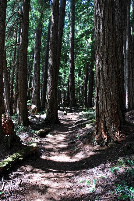
As a result, the west slopes of the mountains receive incredible amounts of snow and rain every year, leading to the formation of a vast temperate rainforest down low, followed by a brutal alpine zone starting around 4500 feet, much lower than the Cascades, Sierra Nevada, or Rockies. The mountains themselves are not one continuous chain. Rather, there are separate and distinct ridges that are separated by deep valleys. As a result, hikers will frequently find themselves walking through deep rainforest for miles before making a brutal 3000 foot climb over three or four miles to get into the alpine.
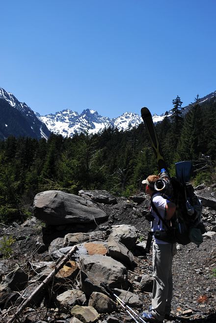
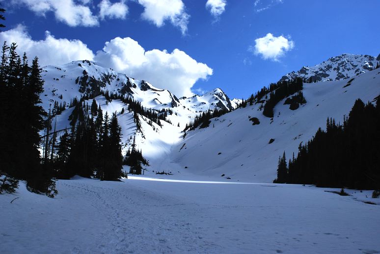
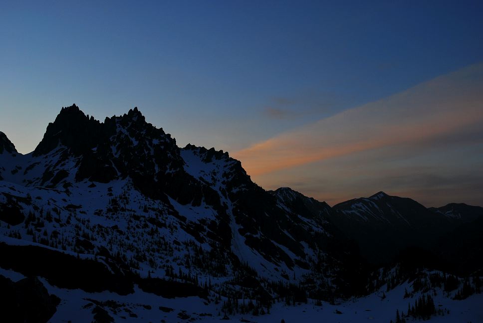
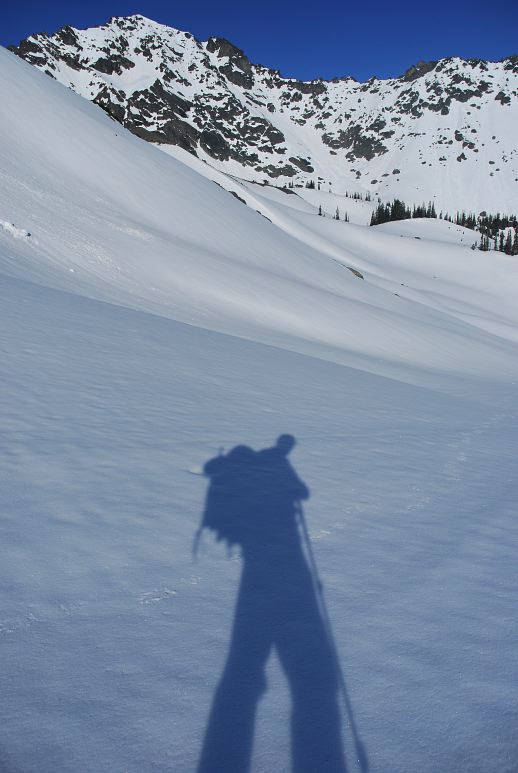
Kevin and I were hiking up toward the alpine through one of the most spectacular valleys: Royal Basin. We left the lush forest behind and climbed into the snow zone around 4500 feet, stopping to put on skis and snowshoes as we broke through the lower basin and started the climb into the upper. Royal Basin is oriented north-south and is bounded on the west by the massive Greywolf Ridge. The below is looking north down the valley, with Greywolf Ridge on the left.
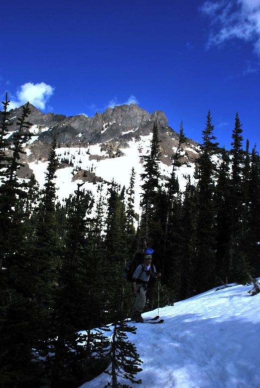
To the east is a lower ridge system that doesn't have a name. Here you can see Kevin skinning his way through the trees with an unnamed mountain on the eastern ridge system above him.
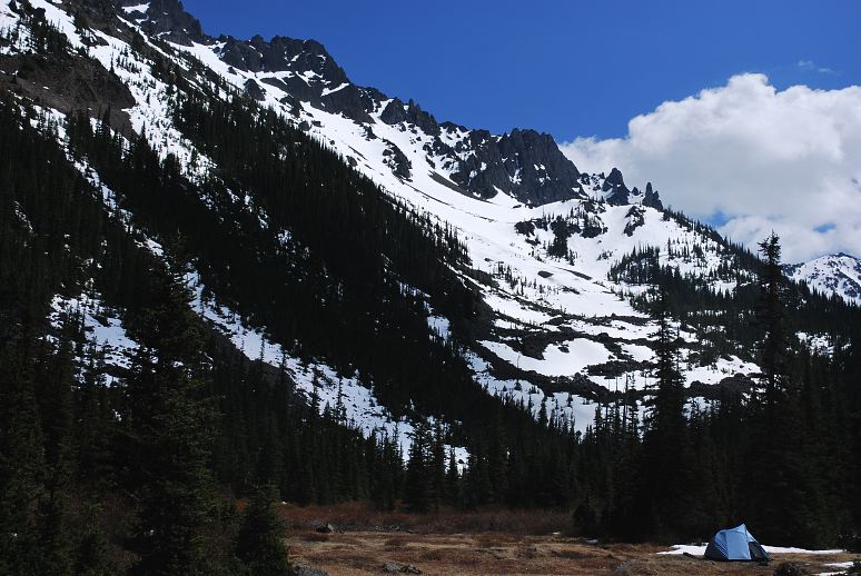
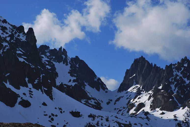
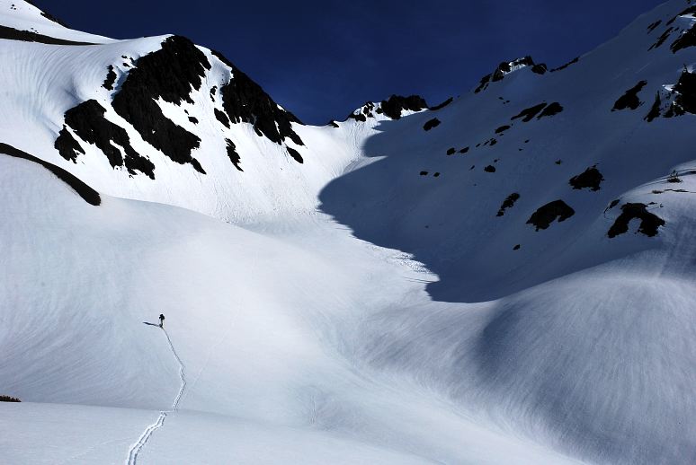
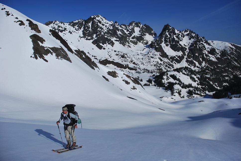
Our destination was a pass on the Mount Deception - Mount Fricaba ridge, which we took to calling Deception Pass. At nearly 6600 feet, it is higher than many of the summits in the park. The snow was getting worse as we went higher, and worse doesn't mean more. It means that it was getting softer and softer and was not holding body weight well. As a result, I was having to work harder and harder to gain elevation. The picture below is looking from the upper portion of Royal Basin into the head of it, with Deception pass just to the right of the prominent peak in the middle of the below photo. Mount Deception, the second highest mountain in the Olympics, is the big peak on the right.
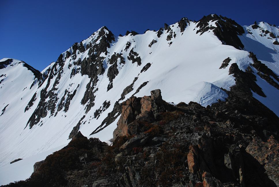
We climbed through the upper basin, making slow progress on our way to a large boulder at 6000 feet. The Greywolf Ridge holds many of the parks 7000+ foot mountains, which in the Olympics means big. Climbing Mount Clark (on the right) or Mount Johnson (left) or the Arrowhead (foreground, left) isn't easy like Mount Elbert or Whitney are. But because they aren't giants, they tend to get overlooked by Washington climbers and are completely unknown to people outside the state (and many inside).
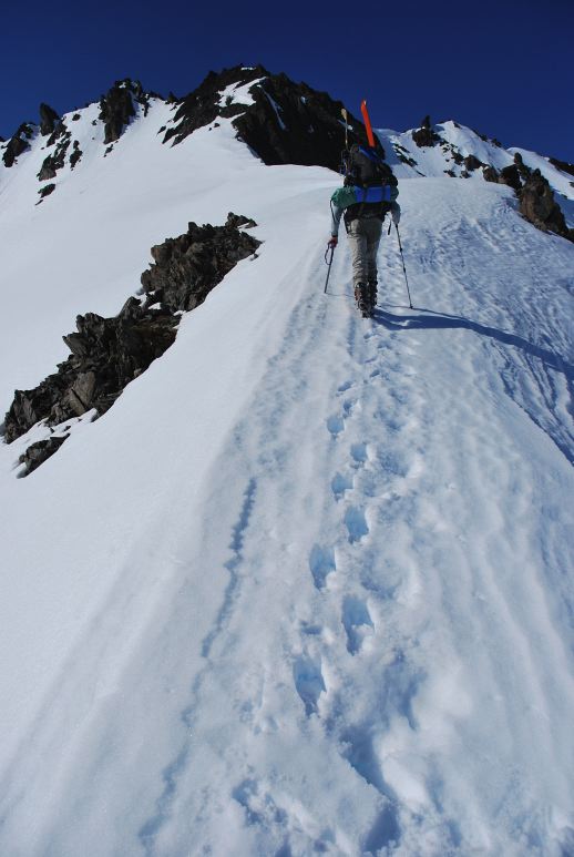
We were out of water and I was thirsty and a big nervous about the avalanche conditions on the route to Deception Pass. There were numerous small slides in the area, with some cornice breaking and pinwheels. If you don't know what these are, just imagine a thousand pounds or so of snow breaking off above you. We put our beacons on and Kevin started skinning up toward the pass, 600 feet above us, through the wet snow while I kept and eye on him and melted water for snow.
In the below photo you can see Kevin skinning up toward the pass. On the right, in the shade, you can see some avalanche rubble and at the head of the cirque you can see some streaks in the snow. That was from a cornice that released recently.
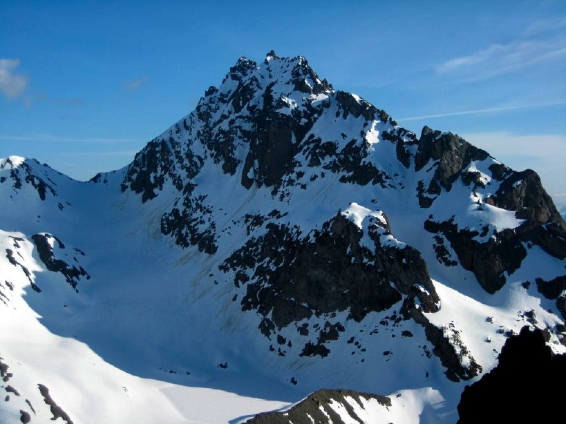
I watched Kevin slowly climb through the slushy snow, eventually stopping to take his skis off and boot up a steep section. After 50 minutes he was safely on top. Although I couldn't hear him, it was clear that he wanted me to come up. Below is a picture Kevin took of Mount Mystery. Our route was going to be to climb the big snow gully/glacier to the col, then make a right turn and ascend the ridgeline to the summit.
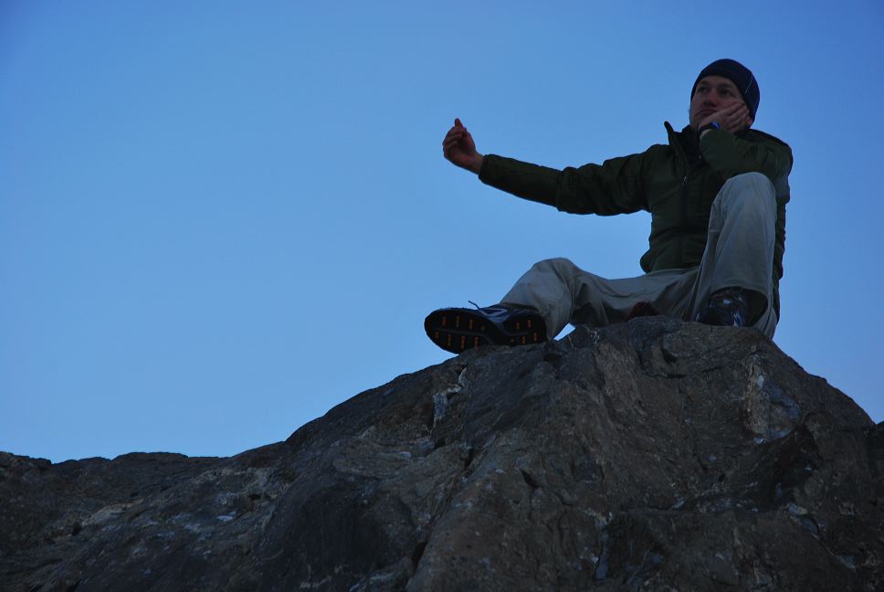
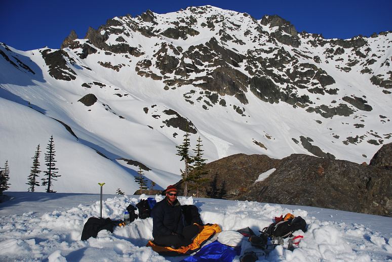
Unfortunately, the stove sputtered and stopped. We were out of fuel and hence out of water. I had grossly underestimated how much fuel was left in the canister and Kevin and forgotten his and as such our forward progress was halted. We had enough water to last the night and a little while in the morning, but not enough to make a serious attempt on Mystery. I waved my hands and tossed up snow and shouted. Eventually Kevin realized what had happened and skied down, taking a minute and a half to descend terrain that had taken nearly an hour to ascend. We didn't have a lot to do for the rest of the night as neither of us had packed up any whiskey or wine and we didn't have a stove to make dinner with, and neither of us had book. So, we spent a few hours climbing around on the local boulders and spelling out obscene words with rocks for others to find. Here, Kevin is playing charades. I guessed that he was wishing he had Winey to hug and grope, but the correct answer was that he missed Gremlin's Mom.
I should write some filler material here, something to transition between Gremlin's Mom and the night. But the photos stand for themselves without the artificial aid of words and sentences. John Longcore, a long distance cyclist I met in Bonners Ferry during my Pacific Northwest Trail hike in 2008, summarized this problem well. How can I capture, really capture, the feeling, the meaning, the intensity of existence, the power of the light and shadows and snow and rock and ice, the smells wafting up from the rainforest below, the way the streaks of cloud in the sky were turning pink, how could simply words capture this?
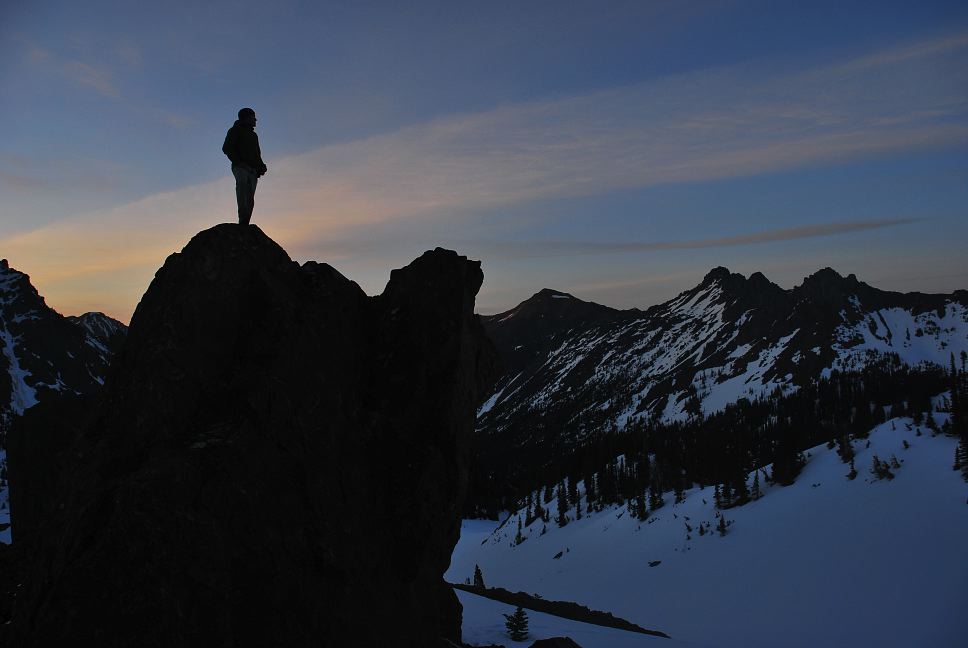
Words are for people who will never get out and experience it for themselves. They are fundamentally inferior to the actual thing. They can only give you part of it, sort of like a photograph of a grizzly bear can give you a small sense of what a grizzly bear is. Come face to face with one at a three meter range and you'll get the whole part. You'll understand the feeling of no longer being the alpha predator, of having your rational brain defeated by the immediacy of natural existence. Now, I meant not to write any filler, but there I've gone and done it.
At six AM it was painfully bright out and the first thing I had to do when I finally stuck my head out of the bivy sack was to find my sunglasses and slather myself with sunblock.
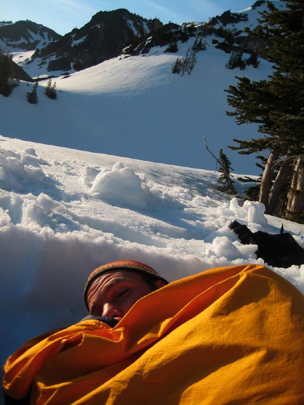
Kevin and I are both sissies and can't be bothered with the weight of a tent on our backs when the weather is fine. Hence our accommodations for the evening were basic: Dig out a platform, put out bivysacks and sleeping bags. Besides, why have a five by eight prison of nylon when the entire world as your sleeping quarters? The views of the stars along were worth it. Although it had dropped well below freezing overnight, I was mostly warm, and was completely warm once I fully zipped up my sleeping bag.
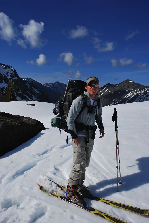
We had three liters of water between us, which meant that we couldn't go very far before returning to the trailhead, the car, and the return to the mundane. Based on our map, it looked like we might be able to sneak in a summit push on Fricaba, one of the larger mountains in the area, though currently out of sight behind a ridge. Kevin had a bit of a speed advantage on me on the way over.
The snow had frozen nicely overnight making the walking easy. My crampon-clad boots made a satisfying crunch as the points bit into the hard crust of the snow. After some initial undulations, we made a direct line toward a prominent ridgeline well above us, behind which we expected to find Fricaba.
We had our map, but no route description or even vague notion if Fricaba would be climbable from this side, or if we needed ropes and protection, or really anything. We'd have to find out, and that was part of the pleasure. Neither of us were particularly bent on reaching the top of anything. Rather, the process of getting up and doing the activity were the goal.
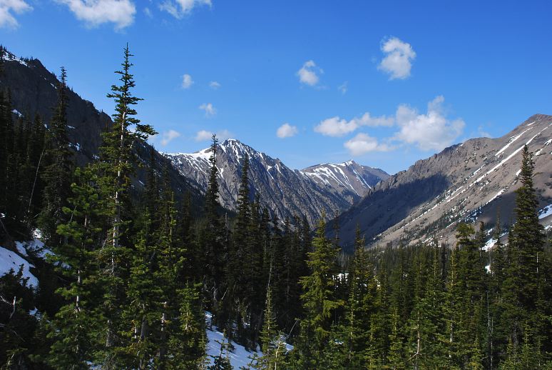
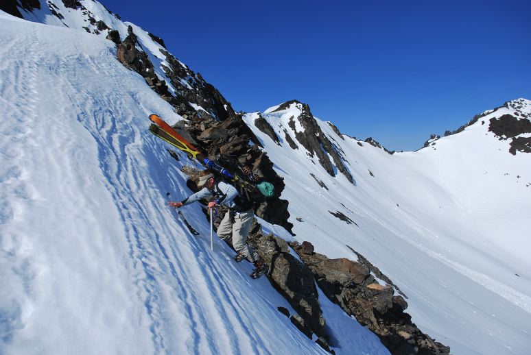
As the terrain steepened near the ridge Kevin stopped to take off his skis and put on crampons, giving me the opportunity to reach the ridgeline before him and luxuriate in the views. It became very clear right away that climbing Fricaba from this side was going to be problematic. In the below photo, Fricaba is the prominent peak in the center-left. The ridge I'm standing on runs toward it, then climbs a steep snow and rock face to gain another ridge, which might go to the summit block. Hal Foss is the peak left of Fricaba. I was happy to let Kevin try for it if he wanted.
Kevin eventually climbed to the ridgeline as well. You can get a sense of the steepness here. I didn't shoot the picture from some strange angle or do any funny photography. The upper lip is just a bit stiff.
It was thrilling to be where we were, especially given the mild wind, warm breeze, and expansive views.
Kevin decided to give Fricaba a shot and headed out along the ridge line for the rock face. This gave me an opportunity to sit on a rock and look out at the mountains. An opportunity to be still and quiet is not to be passed up. And silent it was, other than my own breathing and the occasional brush of wind. And so I sat on my rock and did nothing, thought nothing. I sat and was, even if only for a little while.
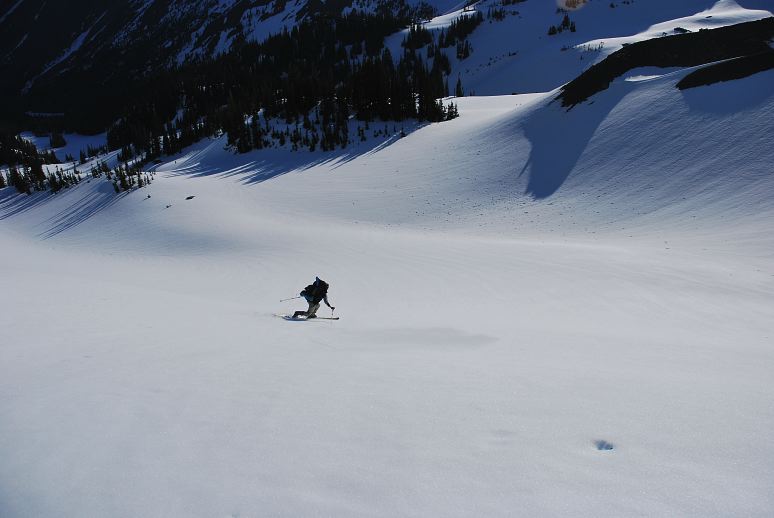
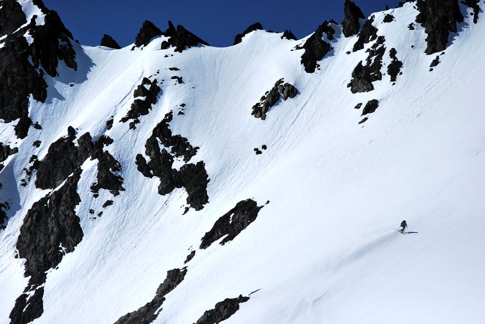
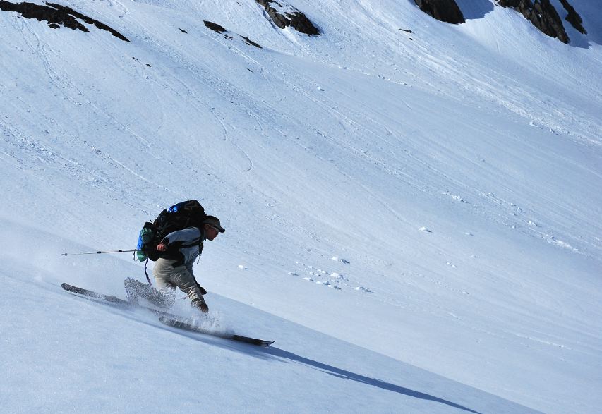
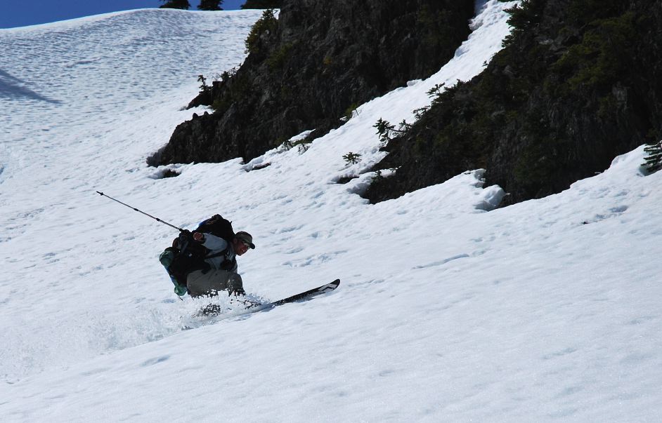
After gaining a few hundred feet Kevin reach unstable snow near the base of the rock face and decided to come down. Postholing to your waist is not a good sign of future progress. He put his skis back on and descended quickly from the rock face, carving nice telemark turns through the snow, including a 360 spin at the very end.
It was time to go. We had a long hike out to the car and a long drive through holiday traffic to get back to Tacoma. Even worse, I had to work tomorrow, as I suppose most people had to. Tomorrow I'd have to put on dress slacks and a nice shirt and speak in proper English. I'd breathe the treated air that gets pumped throughout the building I work in and drink the chlorinated water that comes out of the tap. I'd be mundane again.
The beauty of living in Washington is that I can come to special places like Royal Basin whenever I want to. People living in Indiana would have to make a serious effort to come out here, even if they knew about it, and could only do it rarely. It would be trip of a lifetime and would soak up their vacation time for the entire year. And it would be worth it. But I live in Washington precisely so I can come out and place in places like the Olympics whenever I like. Or, more precisely, whenever I need to escape the mundane for a while, if only for weekend.
Logistics
Drive I-5 North to SR16, and take SR 16 across the Tacoma Narrows bridge. Join with HWY 3 and roll through Bremerton all the way to the Hood Canal Bridge. Cross the water and join up with US101, heading toward Sequim. Just at Sequim Bay State Park, turn left onto Louella road . Drive about a mile up hill until you T into Palo Alto road. Make a left and follow this paved road past trophy homes for about 7 miles. After a big bend around a working ranch, you'll find a fork (marked) in the road. Make a right, folllowing the sign for Dungeness trail. The narrow, unpaved road drops you down for a mile to the Dungeness Forks campground. Keep going on the road (which is now 2880) and you'll make it to the trail head for Royal Basin in about 10 miles. You will need a NW Forest Pass or equivalent to park there. To camp overnight in Royal Basin you are required to have a bear canister and you need to make reservations with the park and you need to get and pay for a permit. We did none of these things out of moral objections. Also, they're really inconvenient and not needed, especially when it is still winter in Royal Basin with few visitors or bears. in the summer Smokey the Pig is in force and a volunteer rent-a-cop will probably try to write you a ticket. It might be a good idea to have a bear canister then anyways. You don't need to do any of this stupidity if you just day hike. If I sound hostile to the park service regulations, you're right!
The Royal Basin trail climbs for 7 miles and about 2600 feet to get to Shelter Rock, which is in between the upper and lower basins and is super obvious. The trail is really beautiful and gets better the higher you go. The head of the upper basin is around 6000 feet in elevation and is about a mile or so from Shelter Rock.