Some Day is Now
Waterton National Park, AB to Eureka, MT
July 12, 2008
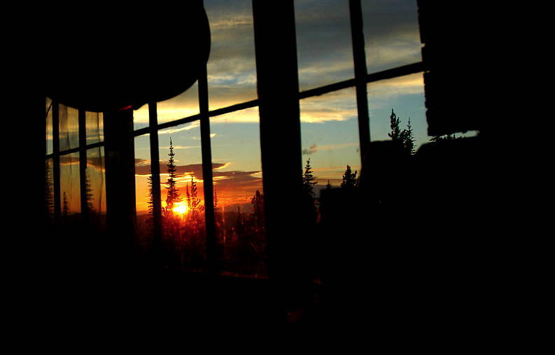
In the predawn hours my eyes should be closed and drool should be running out of the corner of my mouth. But my eyes were open, focused upward at the fading stars. My choice of a campsite was not a good one as the openness of the field and the proximity of the lake and the cold air combined to drop a massive condensation on my ultralight sleeping bag, collapsing the down in the process. I put on my down jacket and settled back into my bag for a few more hours of sleep. It wouldn't come easily, I knew. This was like waiting for Christmas morning when you were a little kid. But I wasn't going to leave Waterton at 3 am. And so I stayed on my back, looking up at the stars.
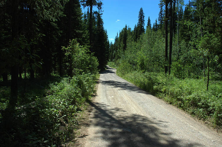
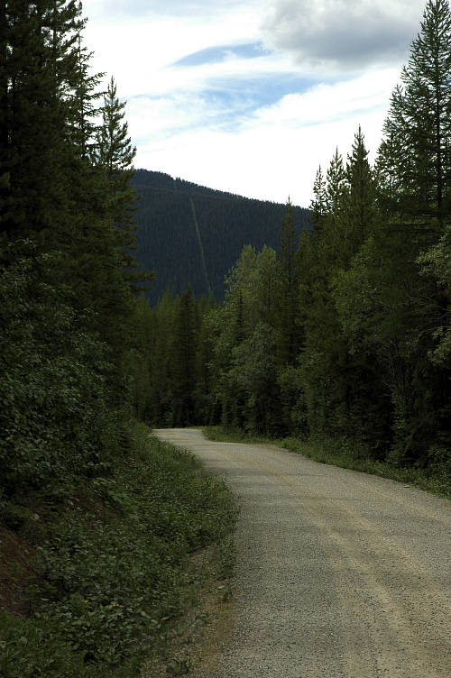
I had drifted off at some point because I awoke with the sun high on the flanks of the mountains. It hadn't made it to the valley yet, but I packed up my gear, surprising a few runners who were passing near on a trail but couldn't see me because of the tall grass. I discovered that I had lost one of the hipbelt straps from my pack, which meant that I was going to have to carry my rig as a pure rucksack for a hundred miles or so to Eureka. I strolled into town, the campsite finally quite, and found a cafe that happened to be open. It was the only one open. It was the same one that I had crappy dinner at the night before. The same waitress was working. I ordered an omelet with hashbrowns and toast. Rather than hashbrowns, I got tater tots. Waterton has to be the worst eating experience of any national park I've ever been to, Canadian or American. Even the food at the Grand Canyon is better. Sufficiently fattened, I walked back to the campground and to the trailhead that would take me to the border. I knew it well, having hiked the trail for the beginning of two long treks. A group of very green looking backpackers were there taking photos and hamming it up to avoid starting something that it was clear was going to be a challenge for them. I looked up at the sign, spat, and started walking.
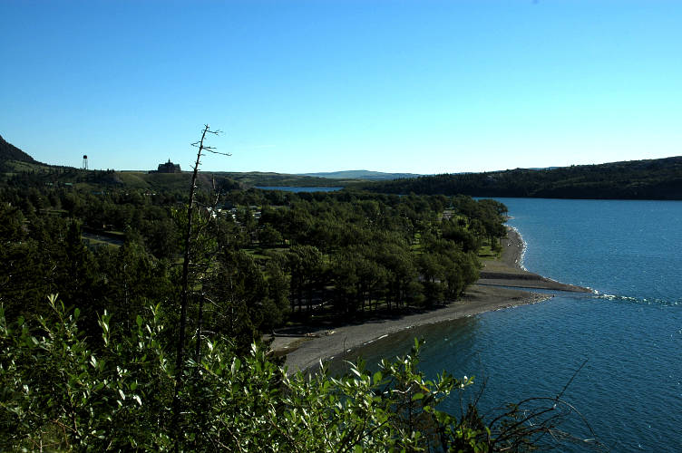
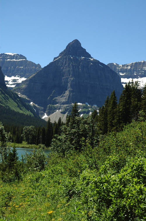
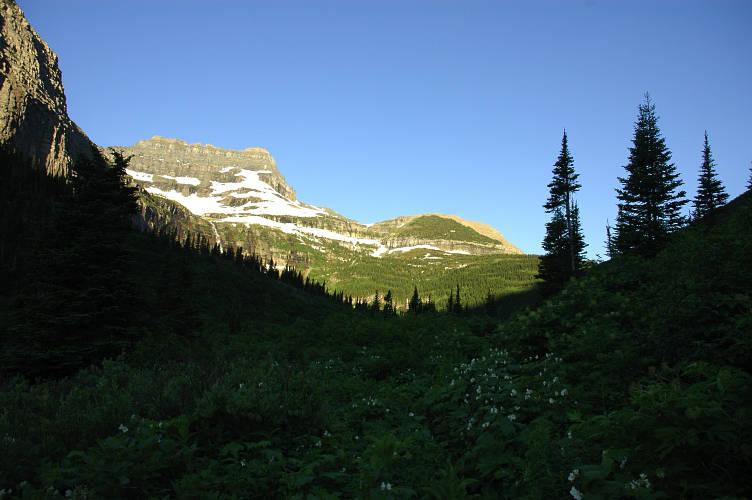
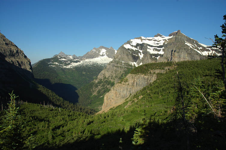
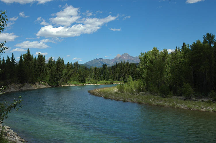
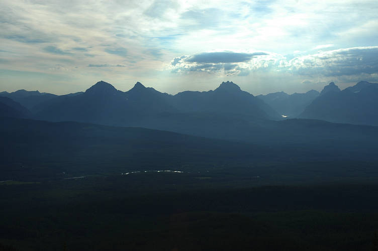
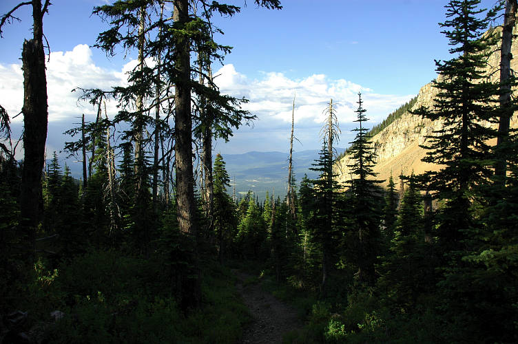
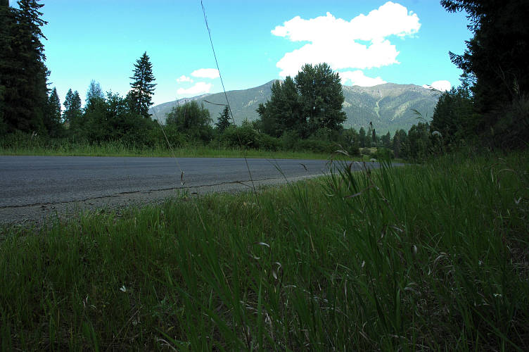
As I hiked along, I thought about how much different I felt than the last time in 2005. It wasn't just the weather, which was spectacularly sunny this time around. The weather reflected my mood. I was happy, joyful, brimming with the enthusiasm of a recent convert to fundamentalism. Three years ago I was dour, depressed. The weather then was cloudy and rainy. I climbed to the top of a small ridge and looked back to the Prince of Wales lodge and the outflow of Waterton Lake. My first campsite could be seen along the sandy shore of the lake and I paused for a while, now that it was quite and calm. Looking to the east all was flat and open, mile upon mile of expansiveness. Easy traveling. In the other direction, the West, was my future. The northern Rocky Mountains are Gothic, sharp, a tribute to the classical beauty of Nature. They are easy to love, to appreciate, at least as long as you can look at them from the comfort of a road or a visitors center. Waterton Lake had the color characteristic to most lakes in this area: Shimmering aquamarine. The silt from glaciers comes down into the lake and reflect light in a most exquisite manner, causing the color. You can see in this in lakes stretching from Glacier north to Jasper, and beyond. Any high place with plenty of moving ice will have lakes like this, but the northern Rockies are one of the best and easiest to get to.

I walked along the trail, exploding in happiness. At times I couldn't contain myself and so sung the few fragments of songs that I could remember. There are no songs that I can remember completely, but it is fun to mix and match, especially when others are not around to hear my poor singing. I fully conscious that this time would never come again. That I would never be able to re-capture it, to re-create it, to re-live it, to have it once more again in my blood and on my breath. This cognizance only fueled my enjoyment of the day. When I hiked the PCT in 2003, I was only partly aware, and only on special occasions, that it was a unique experience. I finished the hike knowing, though only subconsciously, that that Beautiful Thing was over, done, finished. The next summer I had forgotten that important fact and went after it again. I wanted The Beautiful Thing, part 2. What I got was a painful experience on the Appalachian Trail. I left that place for much the much greener pastures of the Great Divide. When I came back to the Rockies the following summer, I was still trying to get back to the place that I had left on August 21, 2003. It didn't work. It couldn't work. Between now and then I had learned to look at life and existence in a fundamentally different way.
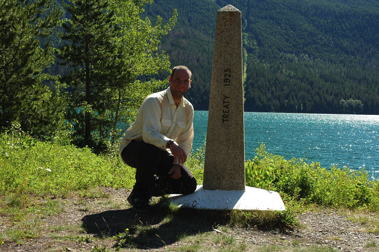
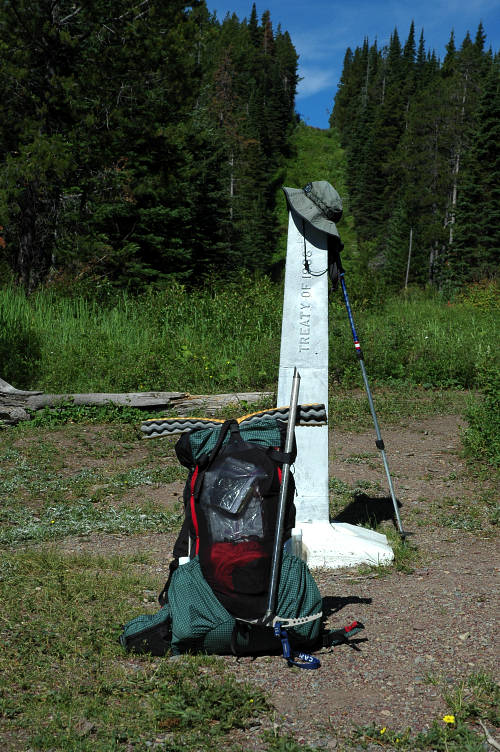
I didn't have to force myself to stop at the border. Although raging inside with a raw energy that poured out of my skin, I dropped my pack at the monument and danced a little jig in the sunshine. I'm not sure if it was an actual jig, or only a few twirls, but it helped. This was the third time I had been here, and I was convinced that I would be back at least one more time: The CDT sign was here. Someday, maybe.
The US-Canadian border is the longest undefended border in the world. The only marking, for most of the distance, is a long, mowed strip, like a corridor for power lines. The fact that we've never fought a border war is really amazing. But even more amazing is how porous the border truly is, at least for people on foot. Commoners seem to think that the government has cameras and sensors up everywhere and will respond rapidly, efficiently, and effectively to anything that comes across. Well, that just isn't the case. The border is too long, there are too many animals, and it would take the entire US military to provide enough staffing and logistical support. Knowing this, the gubmint focuses on the roads around, along, and across the border. The notion of border security is a silly one, but one that we put forth to make people feel secure and to catch lazy criminals. Why drive 40 lbs of grass across the border on I-5 and risk a dog or ICE agent finding it when you can walk it across through the woods? Don't want to bushwhack? Well, just take the Pacific Crest Trail from Manning Provincial Park across the border and south to Harts Pass, where there is a road. Pick up a DeLorme Gazetteer for Washington or Idaho or Montana or North Dakota and see how many small forest service roads run to the border, close to it, or across it. Then ponder the distances involved. Our border is open for business, and there isn't anything the gobermeant can do about it.
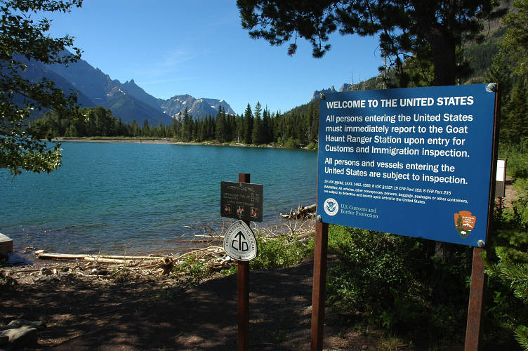
I sat in the sun for a good, long while, savoring the border experience. There was the rest of the continent for me to enjoy and it wasn't hard to push on. A sign reminded me that I had to check in with the rangers at the Goat Haunt Ranger Station. I had to. Or what? The trail didn't even run past it and I could very easily just walk right on by. I giggled, like a little girl, at the idea of walking home from here, for that is what I was doing. I didn't have a line on a map to follow, but rather had a general direction, an idea rather than a plan. I had a process, not a goal.

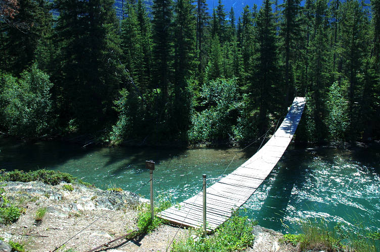
The hike south from the border to Goat Haunt took me across a swaying bridge over Waterton River and then through viewless woods to the a split in the trail. My course went to the right, up toward Brown Pass, but I was supposed to go left, to Goat Haunt, where I could clear immigration. Goat Haunt is a Class B Port of Call, which means US and Canadian citizens can go through immigration there. Another sign reminded me that I needed to go there. The insecurity of this arrangement was about normal for the border. If I was smuggling something, I could just cache it in the woods here, go and clear immigration, and then come back to pick it up later on. But, I was clean and so to the left I went.
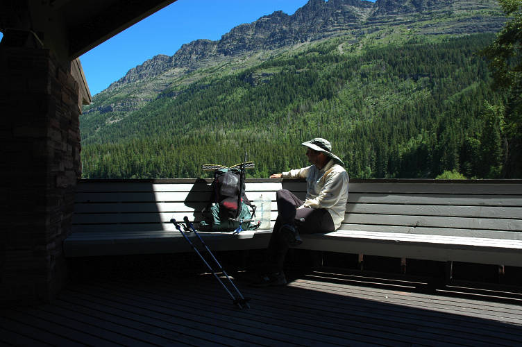
The trail to the left ran for a half mile to the ranger station. Along the way I met several groups of people heading back to Waterton along the trail, or maybe up to Brown Pass, where I was heading. Three years ago a storm was coming. Today, the sun was shining and it was pleasantly warm out. The ranger and the ICE agent were friendly and we chatted for a while as my passport was examined. The ranger started out with his grizzly speech, but had the good sense to ask if I had ever traveled in grizzly country. It is a rare ranger that will believe anyone, even when they are telling the truth, but this one was such a creature and when I rattled off some of the trips that I had done he shortened his oration to: "No problem bears where you're heading. Make sure to keep it that way."
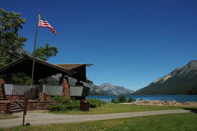
The ICE agent returned my passport and smiled. The border crossing process involves not much of anything here: Just make sure I have a passport that isn't vandalized (pages ripped out). She didn't even flinch at the visas from various "questionable" countries that I have. She could see that I was, in fact, a hiker and not a criminal and thus there was no reason to work me over. She went back to her desk, the ranger went to his cabin, and I spread my wet gear out on the lawn to dry in the sun. It was nice sitting on the observation deck looking back to Canada. The un-weighting that I felt when I got off the shuttle bus had not left me. Without any responsibilities or burdens, I could just live. I didn't have much to live on or to live with, but that paucity of Things was a blessing, not a curse. The fact that I did have much was one of the things contributing to my sense of freedom. Of free will. I had to eat, to drink, to keep warm, to stay alive, and, hopefully, to enjoy the time that I had. But nothing else. I had the time to learn from other people, to watch the world and see how it changed. I had the luxury of being able to get lost. The luxury of time, which is one of the rarest in the world. At least it is rare in my small corner of it.
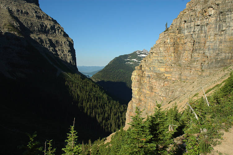
After an hour I packed up and headed back to my trail junction to start the climb to Brown Pass. The trail was mostly viewless, though in a few places the trees fell away, normally in an avalanche chute, and I got some grand views of the mountains through which I would pass. Someone who has read a lot of books or gone to a lot of lectures could say with some authority why the mountains look the way they look. But for me, a geological ignoramus, two things are very clear.
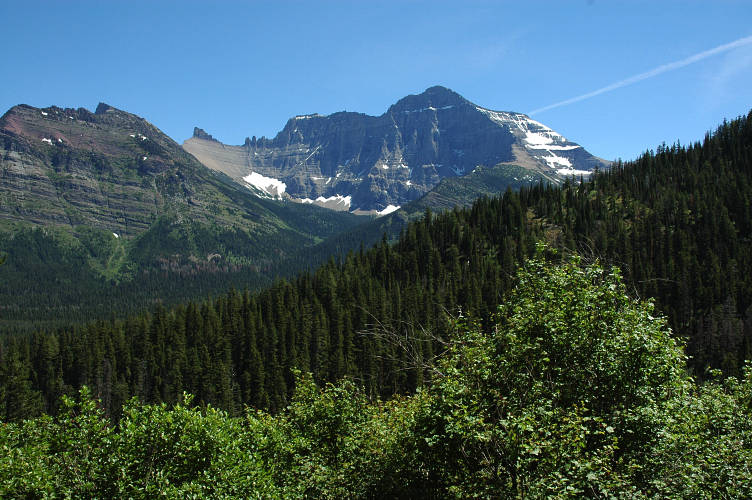
First, the mountains look completely different than the Cascades, which form the other side of a massive region called the Transmontane. That is probably a geographic term, and when I say that it is called something, what I mean is that I call it thus. But, back to the two clear things. The second thing is that the mountains look very similar to those in the Four Corners region, 1500 miles away. The coloring is different, and there is more snow here, but the basic shapes and striations are the same.
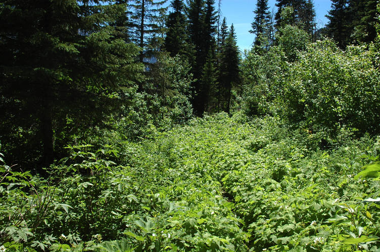
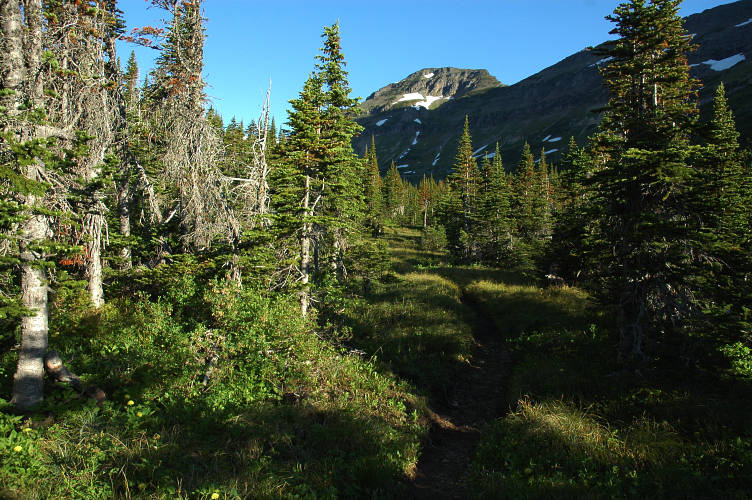
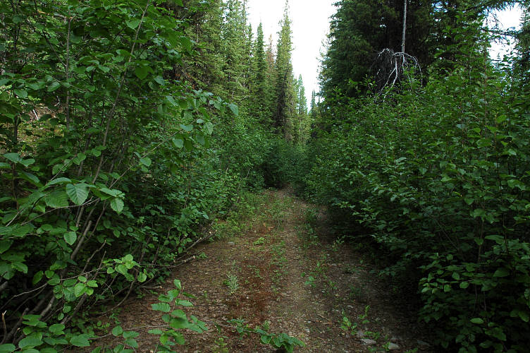
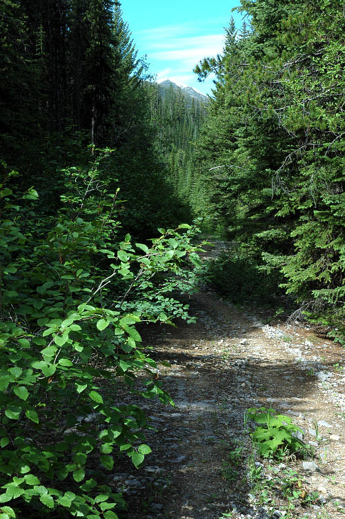
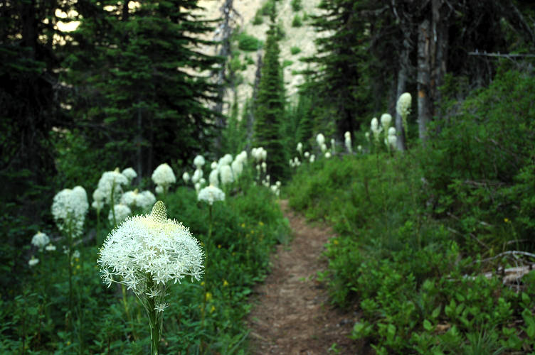
As I slowly crawled up toward the pass, the trail began to get brushier and brushier. One of the facts about hiking in places like the Rockies, with their long winters, is that it can often be late in the season before the park staff (actually, a lot of the maintenance is done by independent contractors) and volunteers get the trails completely cleared of the winter's deadfall. This last winter was near record setting in the Cascades and it was about the same in the Rockies. This meant that there were a lot of downed trees that had to be cut out, a laborious and painstaking work since much of it is done with cross cut saws. Chainsaws are not allowed in wilderness areas and most of Glacier National Park is protected with a wilderness designation.
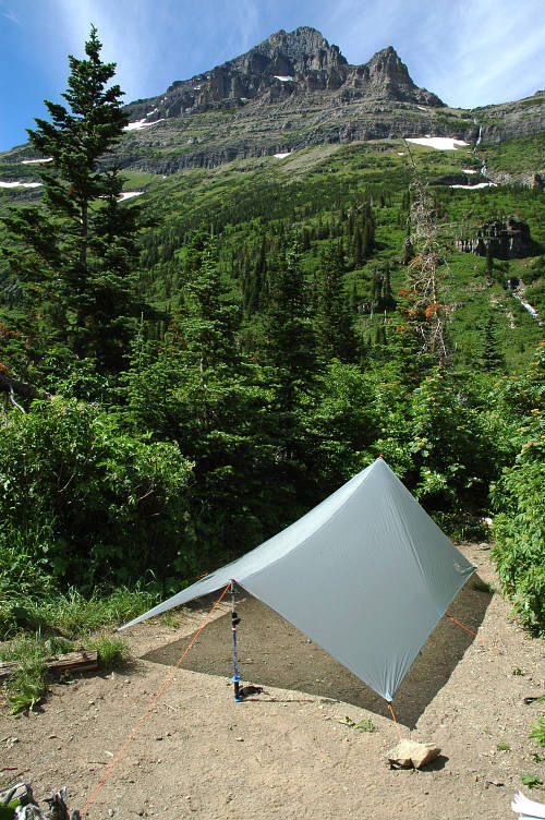
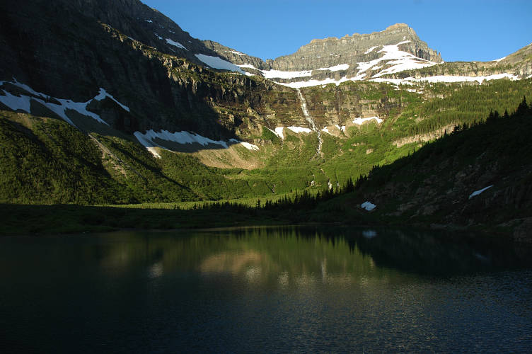
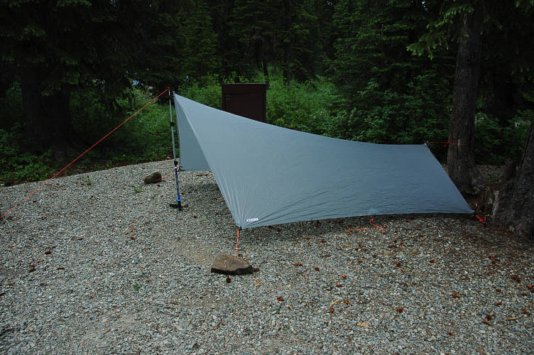
I broke into a large, open basin rimmed with mountains and shortly was at the Hawksbill campsite. There were two others here, a couple from Calgary whom I had seen as I was walking to Goat Haunt. They were out to enjoy Glacier for a few days, which they thought was much wilder, much more remote than Waterton. Although Waterton is stunning, the assessment is completely true. There were a few sites, all more or less the same: Hard, dusty, mostly flat. The sort of places where you would never choose to camp. But this is the Park Service, which meant that these were prototypical, desirable places, for them, for they were durable. That is, you couldn't make them any worse than they already were. I put up my tarp and fetched water from the creek. My chores were done.
On weekend backpacking trips, stopping early isn't a problem. You've got lots of stuff to do, like drink whiskey and swim in lakes. I had no whiskey and there wasn't a lake nearby that was above 50 degrees. I wrote and ate and then ate some more. Around 7 pm the Canadians awoke from their nap and started cooking dinner. They were hauling fresh vegetables and it looked like they were making a salad on top of their dinner of curried couscous. I turned in, writing extensively in my journal before returned to Huck and Jim. They had just come under the influence of two rascals and their idyllic river existence had changed to one of subservience. But I knew that they would win out in the end and that the rascals would meet with an unpleasant fate. Being far north, and close to the edge of a time zone change, the valley stay lit for long after I wanted to go to sleep. It was still too hot to get into my sleeping bag, but I had to be in it to protect myself from the buzzing mosquitoes. The ground was hard. I smiled at my aggravation. It was the process. In a few days I wouldn't notice any of this. My body and my mind would adjust to a life out of doors and in a few months, when I returned to settled life, my futon and pillows would seem just as foreign as the dusty ground felt now. Transitions, those are important. Moments of change. Maybe these were an illusion, something the mind invented so that it could try to understand, to give shape to something without form or shape. I put my earplugs in to escape the buzzing of the skeeters.
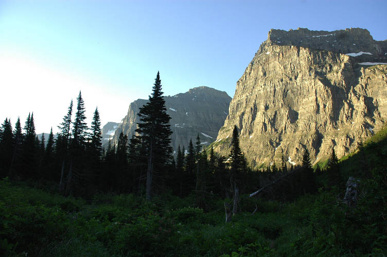
This is the time when all in the world is perfect, that time of the day when everything amplifies and resonates and hums in your very bones with a strength and power not found in normal life. The valley was still in the shade but a pure white light illuminated the mountainous walls on the edges. I took a sip of tea out of my cooking pot and just Felt, digging the complete sensory stimulation. The air was cool, but not cold, and my skin, after the sweatiness of the sleeping bag felt refreshed and relieved.
The air was scented with a mixture of dew, flowers, and raw, green vegetation, the wetness in the air providing something for my nose to grab onto. Not overpowering, not weak. But with each breath I took I inhaled a dose of something more delicate, more subtle, more alluring than any sort of perfume man has ever made. I drank some more tea, nodding my head and smiling as a doped up jazzman might while playing his favorite groove. This was just right.
It didn't take much to get me to pack up and start moving up the valley once I finished my tea. I was really looking forward the today. I didn't know what it would bring or who I would meet or what I would see. I was heading up to a pass through the Rocky Mountains and over to the western slope of the continental divide. Officially I was going to leave the PNT there and take an alternate route. For some inexplicable reason, the PNT was officially routed over another pass and down to a ford of the Flathead River. Fording the Flathead just isn't an option outside of drought years, on horseback, and in September. I didn't really care, since I wanted to go to Polebridge and see what it was like, this hamlet far from civilization, but possessing a bakery that was supposed to rival the one in Stehekin.
I climbed higher toward the pass without much sweat, for the air remained cool and the valley was still in the shade. The quiet of the valley, after so much time spent in the hum of electricity and human hustle and bustle, was a relief to me, one that I didn't know that I needed so much. Some time without the incessant demands on your attention that modern society makes. Yes, that is what I needed and that is exactly what I was getting. At home there is always some sound, a car or electrical lines or a barking dog or a yammering television. There is a billboard or a flashing traffic light or the garish clothes of the youth of today and the aged of yesterday. A woman going by in a skirt too short for her body or a man with his pants near his knees or a junker car or a Hummer to spit at. Even at night, the sound of electricity, of heaters, of compressors. There is never a moment when your senses can luxuriate in something pure and recover. And this morning, I had that.
My senses were fully immersed in the world around me, fully engaged, fully deployed. They were out and about and at work. It wasn't the lack of sensory stimulation that was hitting me over the head with a metaphysical hammer. Rather, it was the quality of the stimulation. Sort of like the difference between giving a thirty person a glass of pure spring water from the base of Mount Adams, filtered for years through volcanic soil, or giving them a warm glass of sugary sweet soda. I barely noticed that I was on top of the pass and only managed to do so when ran into a trail junction and a sign.
I stood and rested there, looking around me. I looked to the east and said good bye to the Gulf of Mexico. I couldn't see it, but from here all water would get to there eventually. It would flow down the eastern slopes of the Rockies and into a river system that would eventually dump into the Missouri, which in turn fed into the Mississippi, which in turn ran to New Orleans and the Gulf. In the direction I was going, water would eventually feed into the Columbia, where I would be in a few weeks, and eventually out to the Pacific.
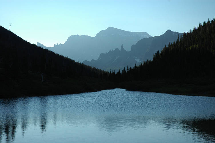
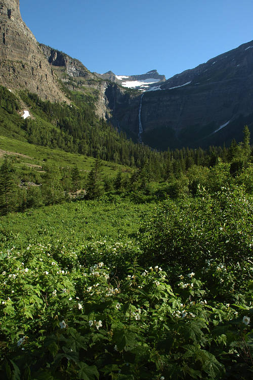
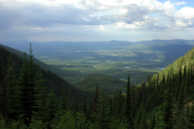
Brown Pass was broad and partly open and gave excellent views down the valley to Bowman Lake, barely visible in the distance. I didn't really want to leave the heights for the valley below, especially since it would take several days to get into the mountains in the distance. I couldn't even see them yet. But the descent had its own attractions, including many waterfalls, some big, some small. Some in my path and some on the far walls.

The path traversed and zig zagged and bent and twisted trying to get into place to make a good descent through the walls of the upper canyon. As I dropped, I spied Bowman Lake again and, in the far distance, the mountains that separate the North Fork Flathead valley from the Kootenai Valley. I was going to cross those mountains in a couple of days. The PNT was like that. It ran against the grain of the land rather than following it. Although it meant that I was going to have to work hard for my miles, it also meant that I would get to see the Land change in a way that was impossible on a trail that followed ridges.
Take the PCT for example. It runs for 2650 miles between Mexico and Canada. It starts in Sonoran desert and ends in high mountains surrounded by temperate rainforest. In between it gives you the polished granite of the Sierra Nevada, which gently yield to the volcanic lower Cascades. You get the glaciers of Mount Rainier in the north and yucca in the south. That's a lot of biological diversity. The biological diversity forces social and cultural diversity upon the residents of the land since, eventually, we must adapt ourselves to the environment we find ourselves in. However, the PCT takes a long, long, long time to do this. Most hikers will see the whole thing over the course of 5 months, which is far too long a time span to remember, to see, the change happening. Slowly, slowly, slowly things change until at some point you recognize the difference. But you never see the transition because of the slowness. I hiked it in three and half months and was only barely aware of it.
However, because the PNT goes against the grain, the transitions, I reasoned, should be much more obvious. Polebridge, in the North Fork Flathead Valley, was the first test. Could I see the transition from the eastern slopes of the Divide? Culturally? Biologically? Well, what is this? I scratched my head and then my rear as I looked at a plant after fording a river. I'd seen the plant many, many times. I've had its thorns rotting in my body. It couldn't be. I picked up a stick and beat the plant, lopping off the top and leaves. I knew I couldn't kill it like this, but I wanted to hurt it a bit. The Devils Club. The bane of coastal explorers, climbers, hunters. It is a plant that thrives at lower elevations with lots and lots of moisture. You normally find it below 1000 feet near the coast. But here it was, at 4000 feet above sea level, hundreds of miles from saltchuck, where it drops to -40 F in the winter. How in the world could it be here?
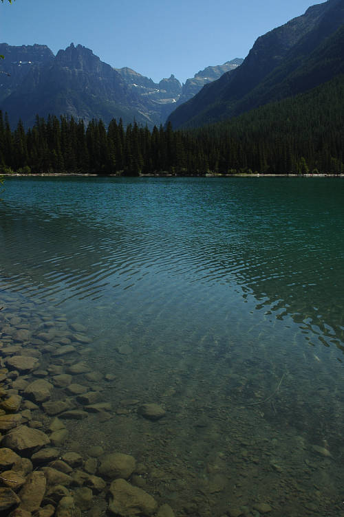
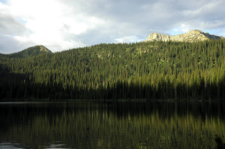
Bowman Lake was long. Seven miles long, with the preternatural aquamarine color of high alpine tarns. I dipped my hand in the water to see if it was swimmable, then continued the pleasant hike along its shore, still wondering about the Devils Club. The walking was easy and flat, but for some reason I found myself tired. I wasn't sore and I was barely sweating. I was just dull. Like I needed a nap. I found a nice spot with a view of the lake and decided to take a sit.
I ate some food and fiddled with the maps and drank a lot of water, but mostly I just sat and rested. Maybe my body was sensing what was in store for me, told by an unfaithful mind that knew I had eight miles of road walking coming up. My mind knew it and somehow my body found out. Since it had to do the work, it was staging a slow down of sorts and didn't want to leave the pleasantness of the lakeshore. I tried to re-assure it and hold out the carrot of the bakery in Polebridge, but I'm uncommonly stubborn and the body just wouldn't respond. "Alright lazybones! Up with you already." I began trudging again and reached the far end of the lake, and the dusty access road, after an hour and a half.
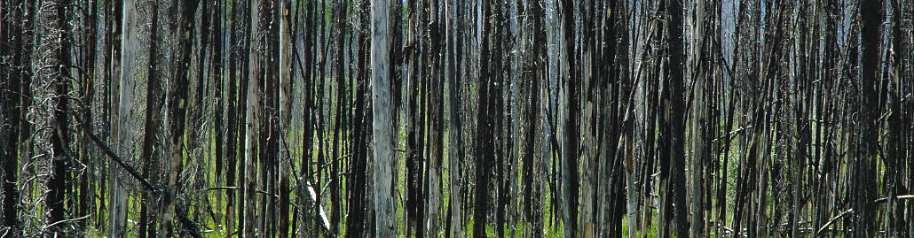
I rested for a while in the campground and then set out on the road. The air was hot and the sun was strong and shade was sometimes rare. Occasionally a car would drive by, usually slowing down enough to keep me from getting hit with a wall of dust. But sometimes not. I was hiking through an area that had burned hard a few years back and the signs of the fire were still evident. But the land was recovering. It was doing its thing. Humans think in scales of time appropriate for our lives. But forests work on a different scale and what looks to us like slow progress is just our insistence on observing things using ourselves as a reference point.
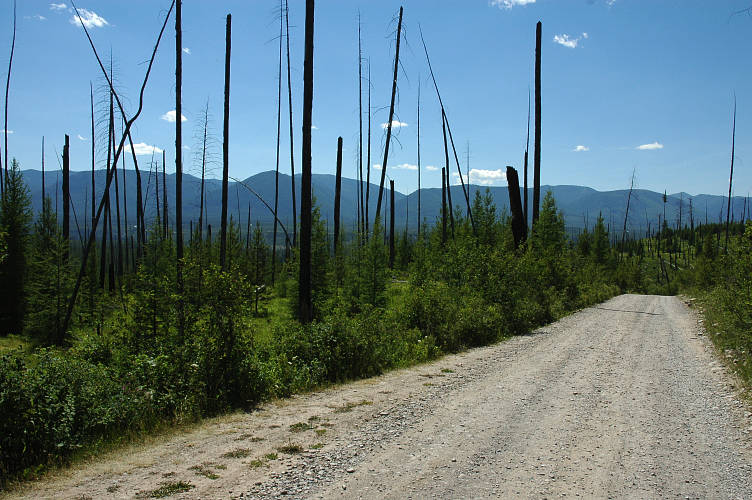
As I moved into the area most affected by the burn, I began to hear it. The Sound. But first a short digression. One of the things that makes Youth so interesting and Middle Age so boring is that when you are young there are lots and lots of new things, each of which seems more marvelous than those that came before. As you get older, you don't experience much that is truly new. Even worse, you get set in your ways, develop patterns, and create means for shutting life out. But there on the open, sun baked slopes I was hearing something completely new. The open slopes around me were dotted with the black remnants of the trees that had once lived here. In the distance were the mountains across the Flathead that I'd have to walk through tomorrow. The wind was blowing, but not with much force. The Sound. There it was. I stopped and turned my ear to it to hear it better. I was hearing a mournful wail, a distinctly audible song of sadness. I've heard the wind blowing through trees before. And I've heard it make a sound that sounds like a cry. But not like this. This was a full church choir singing a death chant in the saddest way possible, a plaintive wail that would make the Devil cry. It wasn't anything supernatural. It was the wind blowing over the land making a sound that couldn't be made elsewhere, in other conditions. If it could be, I would have heard it by now. I walked along, listening to the song. I was, almost, afraid. I kept telling myself that it was the wind. The crunch that my feet made on the gravel road couldn't distort it or block it or de-tune the sadness that the wind brought into my body. If it was night and I was camped up here, all alone with no one around to pretend to be brave to, I would have cowered in my sleeping bag, terrified.
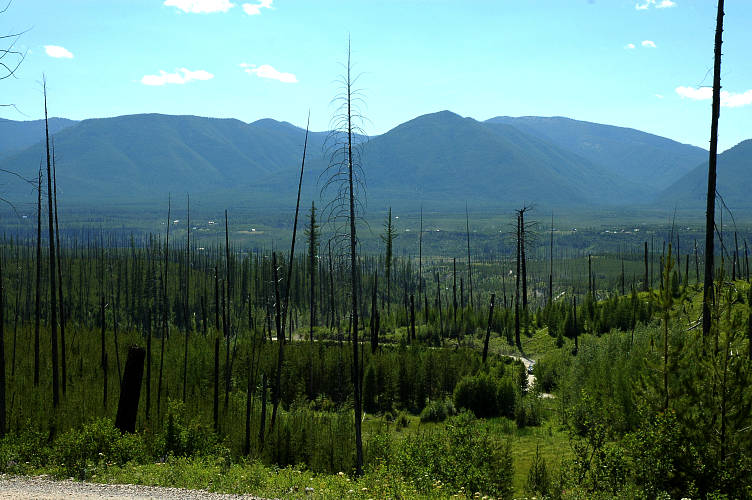
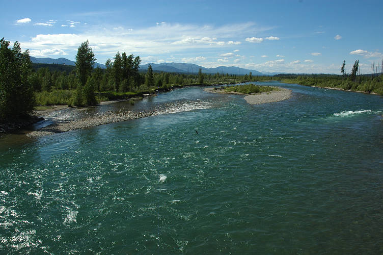
The Sound was left behind on the open slopes as I descended the road. I was fading rapidly in the sun and the heat and needed to get some rest and water, which fortunately were to be had at the ranger station down near the river. I found some shade and filled up my water bag from the bathroom and commenced a mighty rest. Back against pack against tree. Pad underneath the rump. Legs sprawled out, hat over eyes. Don't move. Not even an eyelid. My body wasn't used to all this walking stuff and it was clear that I needed some adjustment time before a 25 mile hike would seem like a short stroll. After a half hour I felt better and began the two mile jaunt to Polebridge. As I crossed the Flathead, I laughed at the fool who might try to ford it. The very idea that a guidebook would suggest such an obvious deathtrap was a little disturbing. Granted, it said that you could only do this in low water. But when was that?
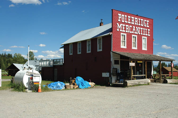
The road to Polebridge was good gravel, meaning it could be driven by a 1984 Colt. It wound through the open valley of the North Fork to Polebridge, and from there south another 35 miles to Columbia Falls. It was was a road into an isolated and remote part of a state that was far, far from anywhere. I wasn't sure what I would find in Polebridge, but the presence of a high standard bakery this far from anything was an encouraging sign.

I was very tired and coated in sweat when I dropped my pack and poles in the shade of the porch of the Polebridge Mercantile. Inside was the bakery with its smells and behind the counter was an woman in her mid sixties who greeted me with a genuine smile. Not the smile that servers in chain restaurants are trained to give in three hour seminars. Genuine. I wandered around, smelling and looking, before I settled on two pastries, one sweet and one savory. I settled into to chat with the woman about the bakery and Polebridge, for one of the things I wanted to do on my long walk this summer was find out about the people that lived along the route. What sort of people lived here? How does the land shape their lives and the role of community? Do people stay in the winter? Really? It gets that cold here? A few people came in and out and it quickly became clear that this was the social center of town. Flyers on the wall indicated what was happening and when. A "Freethinkers" night was happening in a week or so, beer provided by the host. A meeting against the paving of the North Fork road was going to take place soon. I got directions to the hostel and went outside to finish the spinach and feta savory. Two men were in the back yard practicing Tai Chi. This definitely wasn't the Montana of stereotypes.
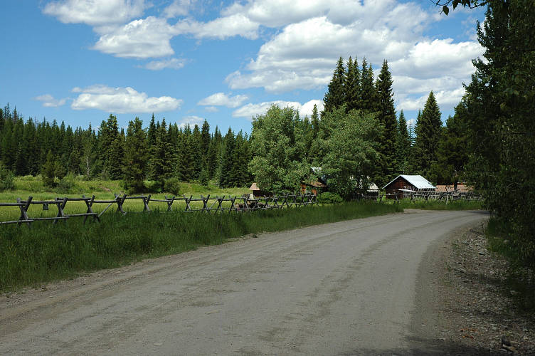
I wandered down the road and over to the North Fork Hostel, which had a sign saying that Oliver was out and that I should come in and make myself at home. Presumably Oliver was the man in charge. I dropped my pack and wandered inside. The house was cool and serene, with the smell of purity that comes from not using perfumed cleaners and solvents and instead just letting things smell like themselves. No potpurri or spring rain here, but plenty of oak and wool and wild flowers. A young man named Neal came out and greeted me. He working with wolf researchers in the area for the summer and was staying at the hostel. We talked for a while and he showed me the place and where I could stay before heading out on his own errands. I took a shower and rinsed clothes and then wandered around the outside in my draws. The warm sun felt good on my fish belly white, Washington winter skin. I read an extensive paper on why paving the North Fork Road was not a good idea and it seemed to make a lot of sense. The increased speed would mean more animal kills and more traffic would mean more disruption to those that survived. A way of life for the locals would change with the increasing ease of access, both for themselves and for the newcomers who would move to the valley and then hope they were the last ones. I sat on the steps out front and thought about Polebridge. I liked it here. A lot. I didn't really know why, for I had only been here for an hour or two and had talked with only two people. But the feeling was there. The feeling of being at home.
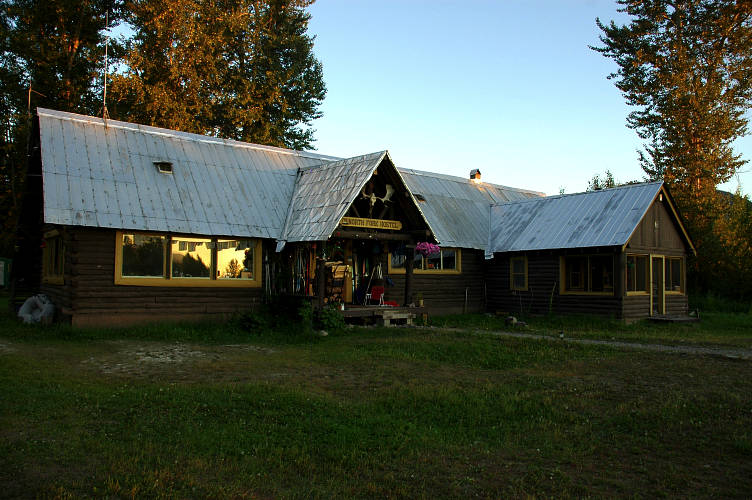
Three hours later I piled chunks of juicy, roasted pork onto a tortilla, squeezed a bit of lime juice, and topped it with the homemade pico de gallo that Neal had made an hour earlier while we chatted over beers. I stuffed as much as I could into my mouth and let the juices run down the hairs on my chin. The long table in the kitchen was full of the guests of the hostel and Oliver, a beared, muscular German sat at the end. Laughter filled the kitchen as the various conversations progressed. I had been invited to share in a meal that the residents had put together out of what each had. Neal made the carnitas. Others made some vegetables. Some supplied bread. Another made a salad. With the closest grocery store over an hours drive away, food was at something of a premium, especially fresh vegetables and fruit. For a moment I felt awkward because I had nothing to contribute, nothing to add to this stone-soup meal. The guests, a dozen of them, came from all over the world and the US. There was the pretty 19 year old girl from Florida who was driving around the country. She had no interest in hiking or rafting or climbing or Nature and I couldn't figure out how she had gotten this far away from civilization all on her own. But here she was. She was here to see what was here. One man was from Austria, who had decided that he needed more than a month off from his job at a time. And so his employer gave him six. A Swiss couple. Two women from some place, some where, who spent much time hiking in the area. Others I didn't know. The common link was the community meal that had been put together ad hoc, with minimal planning. When someone came in, Neal, making the pico de gallo, would ask them if they wanted to have some carnitas for dinner, for he had made a lot. Sure, they would say. They'd scratch there heads and think of something they had that they could make. And there was dinner. This wasn't a special occasion or an aberration. I got the distinct sense that this was how things were at the North Fork Hostel. It felt like a family, except one in which there was no paterfamilias, no hierarchy, no top-down structure. It was, in short, a community writ small.
After dinner Oliver and I sat down to talk about my route out of town. I showed him some alternates that I was planning on taking and he seemed to think they made a lot more sense than the PNT route. We talked about hiking for a bit as the world got dark outside, which was quite late at this latitude. Being off the electrical grid, the lights of the hostel were primarily powered by propane and, as such, no one used them very much. As it got dark people drifted off here and there, sitting outside under the stars for a chat, or playing cards or reading under an LED light. I crawled under the blanket of my bunk and thought about the place. The entire place. There was a quality here that I had found in few other places. Because of the land and the way it shaped the people here, the bonds of the community were strong. The desire to help others was a core value, one that descended directly from an environment that could be, for large portions of the year, extremely unforgiving. The North Fork Hostel was, I thought, a reflection of the community of Polebridge as a whole. It was a reflection that held a strong attraction for me. Plans began to ferment in my head as I drifted off to sleep. Plans for another life and another time.
I stepped out of the hostel and into the new sunshine of the beginning of the day. I was sad to be leaving, but it was too soon in my journey to stop in any one place for a while. The air was pleasantly cool, but the clear sky told me it was going to be a scorcher, at least for a Puget Sound dweller used to thinking of a 75 degree day as a warm one. I walked down the gravel road, past a few cabins with solar panels on top, and down to the main road. The Rockies of Glacier National Park loomed in the background and represented by past. I was moving forward, westerly, onward.
I stopped at the Mercantile for a cup of coffee and breakfast and was rewarded for my efforts. Not only was the breakfast sandwich cum pastry devastating, not only was the cinnamon roll extra sticky and gooey, not only was the coffee rich and dark, but everything was served up by a pair of stunning 20 somethings in pigtails and braids. A third beauty was sitting at the only table in the joint, reading a newspaper. She looked like a lot of the women I had seen since I got off the train in East Glacier: Athletic, healthy, and fit. I sat at the table and ate breakfast, occasionally looking up to see who was rumbling through the store and to gawk at the women. I got a refill on coffee and stepped outside into the rapidly warming air where I chatted about gear with one of the hostelers that I had had dinner with the night before. I knew that I was resisting starting, for I had 15 miles of road walking to do before I could get on trail again. But I had to do it sometime. I had to start walking. A huge black bear waddled across the road thirty yards in front of me when I finally motivated my lazy self enough to leave Polebridge.

I was walking up the North Fork Road even though I could have easily gotten a ride from the numerous locals who stopped and asked if I needed one or some water or any help. To the north, in my direction, the road ran all the way to Canada, where presumably you could keep going even though there was no ICE station. The road followed the North Fork of the Flathead, which was one of the numerous rivers of the West that don't respect national borders.
The Flathead was a major watershed and sat in between the Rockies and the Kootenai Mountains, my next destination. I was going to take a route through the mountains to the west and drop down to the Kootenai Valley, which had a rather serpentine topography. That wasn't for a few days, though, and for now I was more concerned with finishing the road walk and then a climb up to the top of Mount Thoma, where an old fire lookout was located.
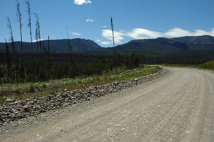
I stopped for lunch at a Forest Service cabin that was normally rented out to people unwilling to camp on their own. The rangers had taken the handle off of the water pump, presumably to discourage squatters from spending the night here. However, the location of a nice stream flowing twenty feet away from the cabin caused me to doubt the strategy that the rangers were employing. I fetched water and settled into the shade for some rest from the sun and dust of the road. The same fire that had scorched the east side of the river had burned large sections to the west of the river as well. But the burn was patchier, less uniform, and there were long stretches of green, healthy forest to mix with the black stumps.
The road seemed to run on forever, especially in the sections where the fire had removed all the shade. The sun beat down upon me. I tried to remind myself that it really wasn't all that hot. Maybe in the mid 80s. But it was 20 degrees hotter than what I was used to and it felt like I was hiking through the Mojave. I topped out on a low rise and saw some mountains in the distance. One of them was Mount Thoma. Rather than continue on the road to Canada, which went through the big gap in front of me, I was going to climb up to the top of the mountains to the left of the gap and spend the night in a room with a view, which would cost me nothing but some sweat and some time.
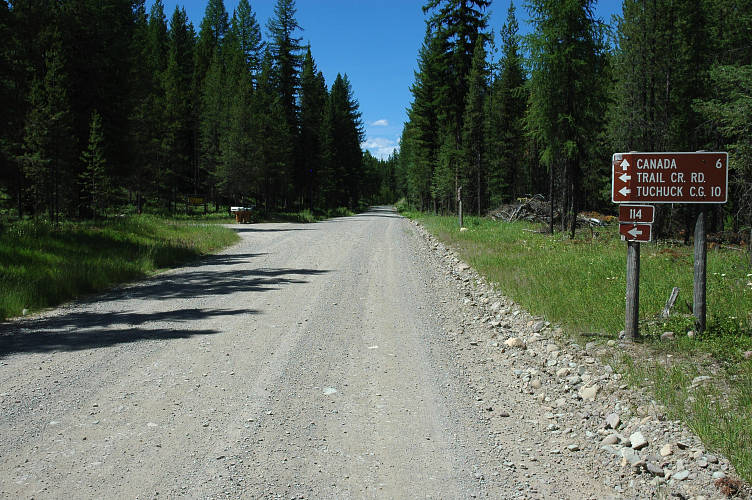
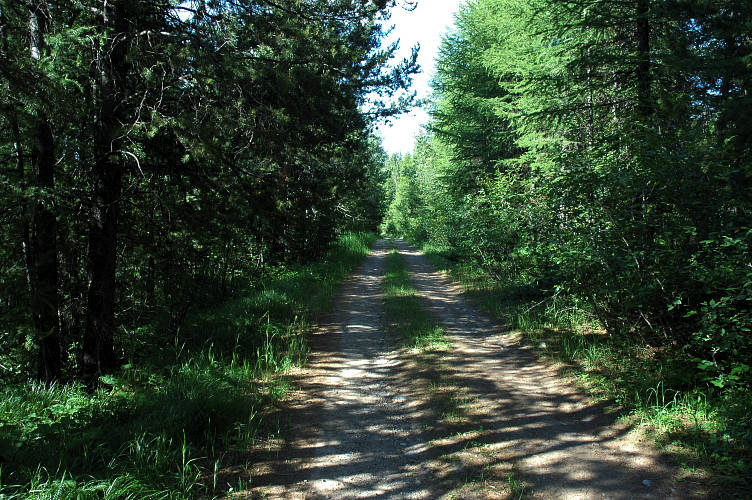
I wandered along on the road, shuffling my feet, and thought about how sweaty I was. About how thirsty I was. About how much my feet hurt. About how my shoulders were sore. But I wasn't unhappy and I didn't want to be anywhere else. It seemed strange to be suffering, yet not wanting to end that suffering. It was part of the process and it was the process that I was focused on. Finally, I reached the intersection with Forest Service Road #114 and left the North Fork Road to continue my wandering toward the Pacific.
#114 was narrower and shadier and the cool provided by the trees helped my physical state, which was beginning to verge on the decrepit. There were a few houses along the way, but I was mostly keeping my eyes peeled for a river that was supposed to come in. I needed to cook dinner and collect enough water to have a dry camp on top of Thoma. At mile 2 I passed a creek but kept going, thinking I would find Ketchikan Creek at the start of the trail up Thoma. At mile 3, where the trailhead was supposed to be, was the driveway to a house. I continued up the road for a half mile and found the trailhead. No creek. I started the hike up hoping to find water before the climb started. When I didn't find it, I returned down hill and spotted an old trail partially obscured by some branches put in place by a human. I followed the old trail back to the driveway at mile 3. It seemed that some one had simply re-located the trail to get off of private property.
One mystery solved, I still needed to get water. There was a house here, which meant there was a water source of some kind. I just needed to avoid getting shot or mauled by a dog. I walked up the drive way to get a look at the house and saw that the windows were boarded up: No one was home. I walked around the field bordering the house and found a stream running nearby. I fetched water and hauled it back to the road to make dinner where I wouldn't have to worry about anyone bothering me. After feasting on Cheddar Brocoli Rice, courtesy of Liptons, I fetched another 2.5 liters of water, saddled up, and started the hike up to the top of Thoma.

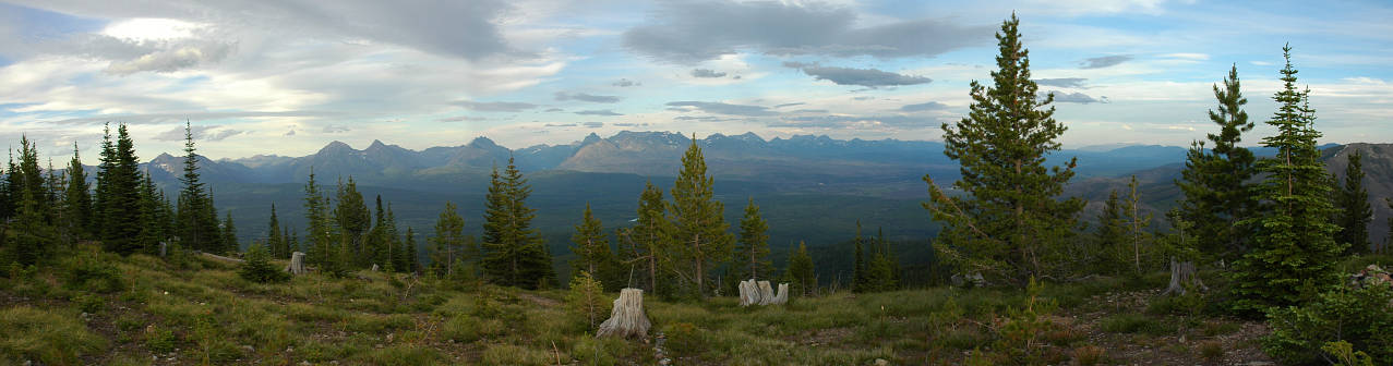
Rather than embarrass myself further, I'll simply skip ahead two hours, 3 miles, and 2800 feet. My entire shirt and most of my pants were soaked in sweat. I had wheezed and gasped and struggled to get up to this ridgeline with its wildflowers and its views of the rounded top of Mount Thoma. But I had found a sweet five inch knife on the trail and the views were of moderate compensation. I didn't know why I was so tired. The grade of the trail certainly wasn't excessive. Indeed, it was easier than most of the hikes and climbs I had done back in Washington before I left.
I staggered along the ridgeline and made the last, slow climb up to the top of Thoma, gaining 400 more feet over another mile. By the end, I was barely moving, even with a stiff tailwind. A cabin with peeling white paint greeted me on top and sat on the middle of the broad summit, which had been cleared of trees down to the bedrock. Back in the day this was one of a string of cabins where firewatchers kept their eyes peeled for signs of a forest fire. Using a sort of giant compass, they would determine the location of the fire and call it in via radio. Other cabins would correct the location of the fire and a fire crew would be dispatched. We have a much more efficient system today that eliminates the need for humans to spend extended periods of time on top of mountains with enormous views in cabins with stoves and plenty of food. It wasn't clear to me that the new system, without cabins, was actually better for us. It was cheaper, though, and money trumps quality, it seems.
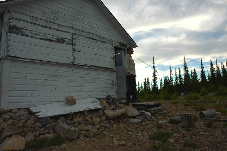
Inside the cabin was clean and pleasant, with enough space for me to put out my sleeping bag. The PNTA wanted the Forest Service to fix the cabin and rent it out to people willing to pay for it. I was horrified at the idea, for if it was in place I would be sleeping outside where the wind was howling. If it was raining, I would have simply kicked the door in to get out of the hypothermia potential. The cabin was fine the way it was. It was being maintained by locals who valued it and it was too much effort to come up here and intentionally vandalize it. It, and others of its kind, should remain in the public domain rather than going to someone willing to pay $40 to sleep in a padded bunk. Why should nice things always go to those with cash in their pocket? Why not keep public lands and facilities free, open to all? I liked it the way it was.
I stripped off my wet shirt and put on my thermal top and hat and down jacket. I suspected it would be a cold night at 7100 feet. I turned on my pocket radio and was rewarded with my choice of numerous stations, both Canadian and American. I wandered around outside in the wind enjoying a public station out of Calgary. At least, I'm assuming it was public because I can't imagine any commercial venture featuring a show called Baba's Grooves, hosted by a man with a thick East Indian accent who thumped hard, bluesy rock. When it got too cold, I retired to the cabin and changed stations, looking for something a bit more mellow to listen to as I watched the evening show.
The sun was nearing extinction when I found it. I had recovered from my hike up and was mainlining the scene on top of Thoma. Everything flowed into everything else, like something banned by the Feds was lurking in my blood. The song came on. Midnight Train to Georgia. Gladys reached out to me with her voice, making me want to cry, though I didn't know if it was because of sadness or pure joy. I could feel the words, the tone, the tune, the Feel, it was all reverberating in me. She was telling a story of love and failed dreams. Of going back to a place where everything made sense, where the hustle and bustle and plastic-ness of the big city was no more, where life was simple and, more important, so was time. Of leaving a world to be with another because existence wouldn't be the same on your own. I had never heard this particular song before, though I had listened to it many times in the past. I was hearing it now. When it was over and a commercial came on, I turned the radio off and sat in the dark cabin and knew. Just knew.
I stood at the doorway of the cabin drinking tea out of my cookpot and thought about the upcoming day. The exertion of the climb up to the cabin had been unusually difficult for me and I was a bit worried about the climb later up to Mount Wam, where another lookout cabin was located. The tea cooled rapidly in the pot and I drank it quickly, getting a fast hit of caffeine into my system. I didn't really need the boost it gave me this morning. It was gorgeous enough outside for that.
I set out a little after 8 am and enjoyed the ridge top views immensely. All 10 minutes of them. Then the trail dropped down back into the woods. I was glad that I had stayed on top, for otherwise it would not have been worth the climb. The views had been good, but the effort was nigh and the good stuff was short. The trail was mostly cleared of brush and I made short work of the descent, arriving at road #114A in good order. The PNT took an inexplicable route at this point. It went south and sort of west for a bit on the road, which was clearly abandoned, and then climbed up to the Tuckchuck Mountain, about the elevation of Thoma. But, there wasn't a trail off the top. So, it bushwhacked down the side to re-join the continuation of #114A. Rather than do this, I just decided to walk the abandoned road, which looked quite nice.
The walk was a delight. It was quite narrow and shady, but maintained just enough so that horses and ATVs could get through. Oliver believed that the border patrol maintained it just enough so that they could move along it without having to walk. I got occasional views of Canada and a few mountains, but mostly the walk was peaceful. Serene. There was no one around, nor would there be.
But all good things must end and eventually my lovely road got to a stretch where someone thought it was a good idea to maintain it to passenger car standards. Wider now, the sky was overcast enough that I didn't have to worry about the lack of shade. I walked and walked and walked some more on the gravel road. This wasn't what I had pictured back at home: Walking a gravel road instead of a trail. That is, intentionally seeking out the front country and avoiding the backcountry. At some point I passed the place where the PNT comes out of the woods and to the very road that I was on. I had meant to try to see where it was, but it went right past me.

When I reached road 319, I had to face the decision that I had been putting off all day: Go up to Mount Wam or hike around on a road, then climb up and over Stahl Pass to reach a road into Eureka? Yesterday's climb had left me a bit dispirited and I couldn't figure out why I had been so tired. I didn't want a repeat of it, but walking the road wasn't appealing. I would get some trail work in by going over Stahl Peak. I also only had a vague notion of what was there, for my detailed maps were for the PNT. That was enough. I continued on 319 past the Mount Wam trailhead. A few vans passed me along the way, and after an hour or so I passed the spot where the PNT again crossed 319 and climbed up the other side, going anywhere but to the setting sun. It was an odd route, stitched together by, it seems, the local day hiking community. A long, moved strip of land to my right reminded me that the border was only a few hundred yards away and I could walk across it at my leisure.
Although direct, the route was certainly boring, and a bored mind focuses on the physical discomforts of the body instead of what is beautiful around it. I was quite happy to reach a Forest Service campground where the trailhead over Stahl Pass was located. I wandered in to the main area and found a board with the regulations. They wanted $10. I wanted to pay nothing to camp on my own land. After all, there were thousands of acres of public land around me to camp on for free. But, I wanted to use the bear box. I walked over to the camp host and performed my routine.
Host: How 'yer dooing terday?
Me: I'm a bit tahrd. I walked here from Thoma and am all wahr out.
Host: Mount Thoma? With the cabin on top? That's a faar piece.
Me:'Bout 25 mahls. Headin' for Eureka. D'ya have spot for people on foot?
Host: Nope. Jess camp in #4. No charge.
Me: Thanks a bunch.

I wandered over to camp site #4 and found the usual thing: Hard packed slab covered with gravel. Next to impossible to drive a stake. Built for car campers and designed to last for ages. I set up my tarp and anchored the stakes with rocks as best I could. The contrast between today and yesterday was stark. Both had involved a lot of road walking, but one had ended on a high note at 7100 feet and Baba's Grooves. With Gladys. With a light show at the end. Today I was on a slab with no view. I wasn't sure I liked my decision to come here instead of heading up to Wam. If I had done that, I would have spent another night up high with a view and a sunset and could have listened to Baba again and seen the sunrise. But here I was and, in a way, I was happy being on the hard gravel. I was happy because I was here, in the present. I wasn't moping about the past or worried about the future. And that was a state of mind that didn't depend on where I happened to be in the world.
The gentle pitter-patter of rain falling on my tarp woke me during the night. A soft sound in the dark. I ducked deeper in my down bag and went back to sleep. A few hours later the rain had stopped and the world was grey,with unsettled clouds hanging over the mountains that I was going to be hiking through in a few hours. I drank my tea and packed up, including my camera. The Nikon D70 is not a small thing and it had been riding on the sternum strap of my pack. It had occurred to me that perhaps my difficulty on uphill hikes had been coming from the camera-strap combination compressing my chest too much. Normally the camera rides on the hipbelt, but as I had no hipbelt this was my only option. I put the camera in the pack to test the theory and set out around Therriault Lake, hiking quickly to generate some body heat.
My theory was right. Although I started to tire near the top of the climb, I felt strong on the way up and enjoyed myself. I crossed a few snow patches on the way up and reached the top of Stahl Pass after only a little more than an hour of hiking. My very vague, very big scale Delorme map showed trail #91
descending in the direction I wanted to go. Well, I wandered along the ridge trail looking for it and never found it. I found trail #87 running in the direction I wanted to go, but it wasn't on the map. No worries, I thought, it will certainly go somewhere, and I've got plenty of time to get lost.
As I began to descend off the pass views opened up of the valley of the Kootenai River and Eureka, with my next mountain range visible in the distance. The chill air of the pass slowly merged with the warm air blowing up from the valley. The rain clouds and unsettled weather on the Therriault Lake side were gone, replaced by clear skies and plenty of sun. A big change for such a small hike.
With nothing to be done in the way of route finding, for I didn't really know where I was and had no way of changing that, I lost myself in thought, mostly concerning what I would find in Eureka. I wanted to drink some beer and eat some salad, but had little else to do. I had finished with Huck and Jim, but my bounce bucket was waiting in Eureka and I could retrieve another book from it. I knew that on a trip like this, loneliness had the potential to be a source, maybe the greatest source, of discomfort. As such, I had taken steps, like the radio and the books, to combat it. But I hadn't been lonely so far and, quite honestly, couldn't see it becoming an issue.
Long distance hiking is, for the most part, a mental challenge rather than a physical one. It seems counterintuitive to suggest that hiking for, say, 2000 miles, is more mentally challenging than physically challenging. But all you're doing is going for a walk, just like you might in a city park back at home. Of course the load is more, but if you're lazy like me you tend to cut as much weight as possible from your back. There are uphills sections, but you can slow down or stop for as many breaks as you want. It isn't gym class: No one is timing you. Long duration injuries, like stress fractures or cysts can certainly end your hike, as can ferocious blisters, which long distance hikers seem to generate with some ease. In certain areas, like the High Sierra traverse on the PCT, can bring in altitude problems. But most of these can be dealt with: There is a reason why many people successfully hike the Appalachian Trail, all 2200 or so miles of it, with no physical training before hand.
I reached the end of the trail at a dirt road with no signs. I was on an unmarked road after finishing a trail that wasn't on my map. To the right it went slightly uphill through the woods. To the left it went slightly downhill through the woods. The Delorme map wouldn't be of much help, and without a sign I couldn't make an intelligent decision. This is one of the mental issues with long distance hiking that has to be overcome: Being comfortable with not knowing where you are. That is, not worrying about being misplaced, as my friend Yogi might say. Because the left direction went downhill, I chose that route. The road was shady and pleasant and a compass bearing told me it was roughly the right direction.
I picked up an intersection with a slightly larger road that had a sign telling me my small road was #7120. Well, that was great. But what was the big road, and where did it go. I continued to apply the principle of laziness and chose the downhill direction. The walking was easy and after an hour or so I reached pavement and a view into the valley below me. I spied a lake that had to be Glen. A powerline cut ran down to it and, after a bit more consulting with the map, decided just to walk directly down the powerline to the lake, find the road that ringed it, and foot that into town. Technically I wouldn't be trespassing on anyone's private property since the cut should be leased from the land owners by the power company. I'll trespass on corporate land anytime.
Just as I was getting ready to leave the road a woman in a small SUV rolled up and offered me a ride. I settled for directions instead and she was able to orient me to my map easily: She lived just up the hill. I was closer to town than I thought, which was a good thing since I was nearing the end of my water and it was getting hot out. I continued down the road, which I now knew was #756, and eventually reached its end at Glen Lake Road. At this point I was on the valley floor and the heat was approaching the blistering level. Again, my mind told me it was only about 85 degrees, but that is hot if you're used to 60 degrees! I wandered down the road and found a patch of shade under an old tree to relax under. A few trucks drove by and I wondered what they thought of me, sitting by the side of the road, under a tree. Perhaps nothing: There is a man taking a rest from the the road and the sun. Perhaps no fear at all.
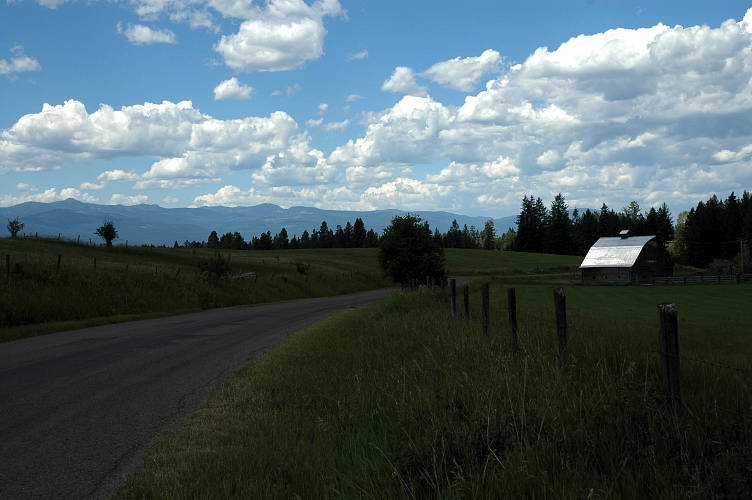
The sun beat furiously upon me, for there was no shade along the walk into Eureka. But the scenery was fine. The farms and homes and barns were spaced far apart and provided a pastoral view that museum dwellers love about "rural" Europe. I trudged along the road and tried not to think about being thirsty, but did so with little success. Many houses had for sale signs on them, but most of these shared a common trait: They appeared to be vacation homes rather than primary residences. The land they sat on was too large and the houses were too quaint. They had that look of underuse that screams irrelevance. I had seen the same sort of homes just before starting the climb up to Mount Thoma a few days ago. Only now the houses were for sale, deemed to be too much of an albatross by their owners.
I stumbled into town with a parched throat and sore feet and was in no mood to deal with tourists a-gawking at me. After passing through the farmland around it, I came through the residential section of town and hit Main Street, which was also the main street. It was 2 pm and tourist traffic was in full swing. US 93 ran through town on its way to Canada and brought car loads of tourists into town on their way to the next town. They were just like me, except I was coming through on foot and was thirsty and hungry and my feet hurt and my shoulders were sore and I had no place to sleep tonight and I smelled foul and wore dirty clothes and was actually happy. I went inside a gas station and picked up two liters of a sports drink I had never heard of and wandered out to the alley were there was shade and quiet and I could recuperate in peace.
I rested for a while before setting out for the post office, which a bank teller told me had moved down Main about three quarters of a mile. I walked out in the hot sun and felt weak. Not tired, but weak. I waited in line at the PO and felt like I was going to collapse. My bounce bucket was there and I was very happy to take it outside to a patch of shade where I could sit by myself, out of everyone's way, and sort through the maps and gear that I needed to make it to Metaline, probably ten days away by foot. Maps and relevant guidebook sections, a few new ziplock bags for food and trash, Narcissus and Goldmund replaced Huck and Jim. I sealed up the bucket and mailed it and my ice axe back to Tacoma. Town Chore one done.
Town experience is one of those things that long distance hikers both look forward to and dread. After spending much time in the out-of-doors, the events and attractions of a town stop are magnified greatly. Waiting in a line at a post office is a terrible nuisance. Not being able to go to the bathroom where ever and when ever the need arose seems the height of stupidity. Smelling laundry detergent and deodorant and perfume and cologne is just too much. But other things are grand, like Town Chore #2: The Feed. Just down the road from the PO was an empty pizza joint (who eats a large five topping pizza at 4 pm?) where I could gorge without worrying about offending other people's noses with my smell, not that they extended the same courtesy to me. And across from the pizza joint was a gear store where I could buy a simple buckle-strap combination ($2.25) that would fix the hipbelt problem that I had had since Waterton. And across from there was a supermarket, where Town Chore #3 could be done: Resupply. When you carry all of your food on your back, walking the aisles of a supermarket is fascinating: There is food everywhere, as much as you could possibly ever want. Enough for you to walk across the country, if you were so fortunate.
I loaded up with food for the five planned days to Bonners Ferry, Idaho, and bought some strong beer for evening as well. Clouds were massing in the sort of way that screams rain and I had not bothered to bring my rain jacket with me. I walked back along US 93 to Riverside Park, which is where intended to camp for the night. Right in the middle of town, it offered an expanse of verdant grass to lounge on and picnic tables to eat off of. There was one other tent set up, but its resident was elsewhere. I set up my tarp and sat on the table drinking beer. I wrote in my journal for a while and then felt confident enough to build a new hipbelt strap. I was working away when the resident of the tent came walking through the park with a plastic sack in his hand and a smile on his face.

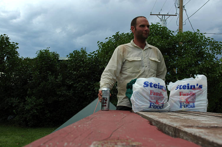
I didn't especially like Joe at first. He talked too much and was partly deaf, which meant that when I had the chance to speak I had to do so in a loud and over-ennunciated voice. Joe asked all the wrong questions about my trip: Gear, gear, and more gear. Food, where I got it, and how much of it I carried, and what kind it was. What was my tarp made out of. What happens if it rains. The questions that I always have to answer, but which are the least important. But Joe slowly grew on me. Joe looked like he was in his mid 40s, but the fact that he had served several tours in Vietnam made him older than that. He was fit, having just gotten back from his daily run at the high school track. His tanned skin and healthy vibe told me he spent a lot of time outside. Indeed, last year he had cycled 4000 miles around the US and Canada and at some point had come through Eureka. He liked it so much that he was back this summer, though this time on foot. He had been living in the park for the last three weeks. The park allowed camping for $5 per day, paid only if you went to get the key for the bathroom-shower room from the city hall-police department. There was supposed to be a two week limit, but Joe didn't seem to care, nor did the town. Our talk was cut short after an hour when the skies opened up and thunder flashed. Rain began to fall heavily and we scurried to our respective shelters to wait out the storm. I lay underneath the tarp and looked up at the sky, wondering what tomorrow would bring me. I was heading out into new mountains, new lands, a new perspective, hopefully. All I had to do was live through it, to engage in whatever the day brought me, to use the time I had to actually be. The fact that I was walking home, carrying my possessions on my back, could easily be mistaken for the goal, and this was where confusion, both on my part and on others, usually set in. The goal wasn't to walk home along some pre-defined route. The goal, rather, was the process itself. And the process was simply to live. My stomach growled and the rain had stopped. I went to look for something to eat.